
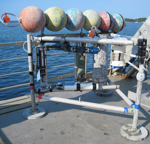
Deck shot of M/V Scarlett Isabella
Images
Images below come from a wide variety of USGS science activities in the Northeast Region. Science Center staff showcase what we do, who we are, and where we work conducting science that inform decision makers and addresses societal needs.
Filter Total Items: 2050

Deck of M/V Scarlett Isabella

Gulf of America
A GIS compilation of Updated Vector Shorelines and Associated Shoreline Change Data for the Gulf of America Coast
A GIS compilation of Updated Vector Shorelines and Associated Shoreline Change Data for the Gulf of America Coast

Estimated Agricultural Use of Azoxystrobin Fungicide - 1996 to 2014
Estimated Agricultural Use of Azoxystrobin Fungicide - 1996 to 2014Estimated Agricultural Use of Azoxystrobin Fungicide - 1996 to 2014
Estimated Agricultural Use of Azoxystrobin Fungicide - 1996 to 2014
Estimated Agricultural Use of Azoxystrobin Fungicide - 1996 to 2014Estimated Agricultural Use of Azoxystrobin Fungicide - 1996 to 2014

Map showing the change in modern sediment thickness Fire Island, NY
Map showing the change in modern sediment thickness Fire Island, NYMap showing the change in modern sediment thickness in meters between 1996-1997 and 2011 offshore of Fire Island. Green areas indicate accretion and red a
Map showing the change in modern sediment thickness Fire Island, NY
Map showing the change in modern sediment thickness Fire Island, NYMap showing the change in modern sediment thickness in meters between 1996-1997 and 2011 offshore of Fire Island. Green areas indicate accretion and red a

Relative seagrass biomass in West Falmouth Harbor, MA
Relative seagrass biomass in West Falmouth Harbor, MARelative seagrass biomass in West Falmouth Harbor, MA, under current and potential future nitrogen loading scenarios. Seagrass biomass increases in western (seaward) portions of the harbor while eastern (landward) areas see new colonization by seagrass.

Lights! Camera! Action!
Dr. Laura Brothers preparing to collect visual imagery aboard the RV Rafael as part of the launch of the MiniSEABOSS while doing work off of Nantucket. The MiniSEABOSS collects samples, photos and video of the seafloor.
Dr. Laura Brothers preparing to collect visual imagery aboard the RV Rafael as part of the launch of the MiniSEABOSS while doing work off of Nantucket. The MiniSEABOSS collects samples, photos and video of the seafloor.

Groundwater Staining in Pennsylvanian Sandstone, West Virginia
Groundwater Staining in Pennsylvanian Sandstone, West VirginiaFractures in bedrock transmit groundwater, and geologic mapping is conducted to provide the geologic framework for groundwater resource studies. This photo shows iron-oxide staining (Leisegang banding) from past groundwater flow along fractures formed prior to the rock having been blasted open during road construction.

Geophysical Surveying
Geophysical Surveying on city street in New York
Geophysical Surveying on city street in New York

South Atlantic Coast
Vector Shorelines and Associated Shoreline Change Data for the Southeast Atlantic Coast
Vector Shorelines and Associated Shoreline Change Data for the Southeast Atlantic Coast

North Atlantic Landscape Conservation Cooperative region
North Atlantic Landscape Conservation Cooperative regionCoastal area within the North Atlantic Landscape Conservation Cooperative region for which predictions have been generated.
North Atlantic Landscape Conservation Cooperative region
North Atlantic Landscape Conservation Cooperative regionCoastal area within the North Atlantic Landscape Conservation Cooperative region for which predictions have been generated.
Minipod style tripod for near bottom current and wave measurements
Minipod style tripod for near bottom current and wave measurementsMinipod style tripod for near bottom current and wave measurements ready for deployment.
Minipod style tripod for near bottom current and wave measurements
Minipod style tripod for near bottom current and wave measurementsMinipod style tripod for near bottom current and wave measurements ready for deployment.

Special Delivery
Sandy Brosnahan transporting a weather buoy into the Woods Hole Coastal and Marine Science Center’s operational facility in preparation for deployment. This buoy was one of 6 deployed to measure wind speed, direction, pressure, and temperature off the coast of Fire Island, NY.
Sandy Brosnahan transporting a weather buoy into the Woods Hole Coastal and Marine Science Center’s operational facility in preparation for deployment. This buoy was one of 6 deployed to measure wind speed, direction, pressure, and temperature off the coast of Fire Island, NY.

USGS scientist collects samples in a New Jersey salt marsh
USGS scientist collects samples in a New Jersey salt marshCaption: USGS scientist Zafer Defne measures water and sediment movement at Forsythe National Wildlife Refuge, New Jersey. Defne is co-author with USGS' Neil Ganju of a 2017 study on how to estimate coastal salt marshes' potential longevity, based on their sediment budgets and the ratio of open water to vegetation. Photo: Sandra Brosnahan, USGS

Gas Hydrate Crystals
Scanning electron microscope image of gas hydrate crystals in a sediment sample. The scale is 50 micrometers (µm) or approximately 0.002 inches
Scanning electron microscope image of gas hydrate crystals in a sediment sample. The scale is 50 micrometers (µm) or approximately 0.002 inches

Storm erosion at Chincoteague Bay, MD
Storm induced erosion of marsh shorelines can provide significant quantities of sediment to the bay altering the deposition patterns.
Storm induced erosion of marsh shorelines can provide significant quantities of sediment to the bay altering the deposition patterns.

Measuring seagrass!
Measuring seagrass biomass in Chincoteague Bay, Maryland to constrain numerical models.
Measuring seagrass biomass in Chincoteague Bay, Maryland to constrain numerical models.

Flood tidal shoal
Flood tidal shoal at Barnegat Inlet, New Jersey (courtesy USGS EROS NAIP orthophotography)
Flood tidal shoal at Barnegat Inlet, New Jersey (courtesy USGS EROS NAIP orthophotography)

Collecting Samples in Barnegat Bay
Box-cores provide a relatively undistributed look into the recent past to help better understand the processes contributing to sediment deposition and erosion.
Box-cores provide a relatively undistributed look into the recent past to help better understand the processes contributing to sediment deposition and erosion.

UAS Pilot Training
USGS pilot Sandy Brosnahan and Senate Pro Tempore Marc Pacheco discuss the use of Umanned Aerial Systems (UASs, also known as drones) to collect data in coastal environments. Photo credit: Dann Blackwood, USGS.
USGS pilot Sandy Brosnahan and Senate Pro Tempore Marc Pacheco discuss the use of Umanned Aerial Systems (UASs, also known as drones) to collect data in coastal environments. Photo credit: Dann Blackwood, USGS.

Conceptual diagram used to assess potential sea-level rise impacts
Conceptual diagram used to assess potential sea-level rise impactsConceptual diagram showing the structure of the Bayesian network used to assess potential sea-level rise impacts on the coastal landscape.
Conceptual diagram used to assess potential sea-level rise impacts
Conceptual diagram used to assess potential sea-level rise impactsConceptual diagram showing the structure of the Bayesian network used to assess potential sea-level rise impacts on the coastal landscape.

Decision Making Framework
Problem statement, objectives, and alternative actions defined by Department of Interior collaborators using structured decision making framework
Problem statement, objectives, and alternative actions defined by Department of Interior collaborators using structured decision making framework