
...to informing restoration efforts in the Florida Everglades
...to tracking storm-related flood conditions through the South Atlantic...
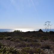
...to investigating coral health in the Florida Keys & Caribbean...
...to assessing environmental contaminants on aquatic life in the Mississippi River Basin...
...USGS science spans the South Atlantic, Gulf States and Caribbean
The Southeast Region includes 13 states and two U.S. territories, Puerto Rico and the U.S. Virgin Islands
The Southeast Region includes 13 states and two U.S. territories, Puerto Rico and the U.S. Virgin Islands
Southeast Region
We conduct impartial, multi- and interdisciplinary research and monitoring to address a broad range of natural-resource issues that affect the quality of life of citizens and landscapes in the Southeastern United States and the Caribbean region.
News
AquaDePTH: Merging Aquatic Disease Surveillance Data into One Useful Tool
AquaDePTH: Merging Aquatic Disease Surveillance Data into One Useful Tool
USGS Geologic Mapping Project Supports Critical Mineral Exploration, Enhances Public Safety in the Southeast
USGS Geologic Mapping Project Supports Critical Mineral Exploration, Enhances Public Safety in the Southeast
Ecological Thresholds, Abiotic Stress, and Climate Change: A Conceptual Framework
Ecological Thresholds, Abiotic Stress, and Climate Change: A Conceptual Framework
Publications
Shallow geologic framework of the Mississippi Sound and the potential for sediment resources Shallow geologic framework of the Mississippi Sound and the potential for sediment resources
The Mississippi Sound, an estuarine environment located between the mainland and barrier islands bordering the northern Gulf of America (formerly the Gulf of Mexico), serves as a vital ecosystem for the States of Mississippi and Alabama. Spanning approximately 100 kilometers from east to west and covering 1,400 square kilometers, the sound is home to marine industry and ports, and its...
Assessing streams in the Chesapeake Bay Watershed to guide conservation and restoration activities Assessing streams in the Chesapeake Bay Watershed to guide conservation and restoration activities
Freshwater streams in the Chesapeake Bay watershed are home to numerous aquatic organisms (like fish, amphibians, mussels, and insects) and provide drinking water and recreational opportunities to people living in or visiting the watershed. Land-use changes, such as urban development and increased activities in certain agricultural sectors, have degraded water quality and altered...
Biologging to identify nesting and non-nesting emergences for four species of imperiled sea turtles Biologging to identify nesting and non-nesting emergences for four species of imperiled sea turtles
Quantifying sea turtle nesting behavior is essential for recovery planning and evaluating management actions. Traditional monitoring approaches, based on nest counts from beach surveys, can misclassify non-nesting emergences, obscure true fecundity, and underestimate clutch frequency, metrics that directly influence population models and regulatory decisions. Here, we demonstrate that...
Science

Mobile River Basin Study
The Mobile River Basin in Alabama, Georgia, Mississippi, and Tennessee is one of the 59 study units that are part of the U.S. Geological Survey's National Water-Quality Assessment (NAWQA) Program. The long-term goals of this program are to describe the status and trends in the quality of a large, representative part of the Nation's surface- and ground-water resources, and to provide a sound...
Where land meets sea: USGS science for resilient coastal habitats
USGS coastal science plays a critical role in supporting the effective, science-based management of coastal ecosystems, where the biodiversity of land and sea meet. It provides managers with the information they need to make sound decisions. Through cutting-edge research, predictive modeling, and decision-support tools, USGS empowers resource managers to make informed, science-based choices. From...
By
Core Science Systems Mission Area, Ecosystems Mission Area, Water Resources Mission Area, Cooperative Research Units, Ecosystems Land Change Science Program, Land Management Research Program, Science and Decisions Center, Species Management Research Program, California Water Science Center, Eastern Ecological Science Center, Forest and Rangeland Ecosystem Science Center, Lower Mississippi-Gulf Water Science Center, Pacific Coastal and Marine Science Center, Western Ecological Research Center (WERC), Western Fisheries Research Center, Western Geographic Science Center, Wetland and Aquatic Research Center

Flood-inundation mapping in Tar River Basin, North Carolina
The U.S. Geological Survey (USGS) has created flood-inundation maps for selected streamgage sites in North Carolina. These maps depict the approximate area that would be inundated at selected water levels, ranging from approximately top-of-bank to the maximum observed water level. The inundated areas depicted on these maps are approximate, and accuracy of the maps is a function of the accuracy of...