U.S. flag

An official website of the United States government

Kīlauea

Find U.S. Volcano
Current Updates and Notifications
Kilauea Message 2026-10-01 18:55:01 HST
Kīlauea remains relatively quiet today. This Volcano Watch article explains activity related to the intrusion of a shallow dike last night. https://www.usgs.gov/observatories/hvo/news/volcano-watch-intrusion-during-eruption-summit-kilauea View All Messages.

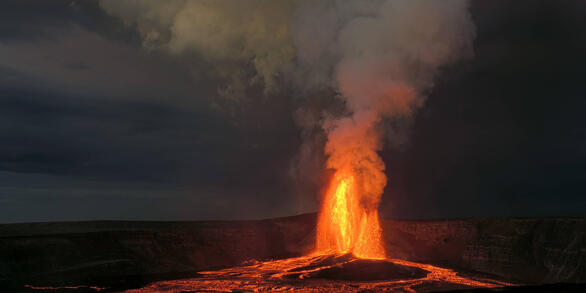
Kīlauea is one of the world's most active volcanoes; since December 23, 2024, it has been intermittently erupting within the summit caldera in Hawaiʻi Volcanoes National Park. 

Quick Facts

Location: Island of Hawai‘i
Latitude: 19.421° N
Longitude: 155.287° W
Elevation: 1,222 (m) 4,009 (f)
Volcano type: Shield
Composition: Basalt
Most recent eruption: June 2024
Nearby towns: Volcano, Pāhoa, Kalapana, Mountain View
Threat Potential: Very High*

*based on the National Volcano Early Warning System

Summary

Topographically Kīlauea appears as only a bulge on the southeastern flank of Mauna Loa, and so for many years Kīlauea was thought to be a mere satellite of its giant neighbor, not a separate volcano. However, research over the past few decades shows clearly that Kīlauea has its own magma-plumbing system, extending to the surface from more than 60 km deep in the earth.

In fact, the summit of Kīlauea lies on a curving line of volcanoes that includes Mauna Kea and Kohala and excludes Mauna Loa. In other words, Kīlauea is to Mauna Kea as Kama‘ehuakanaloa (formerly Lō‘ihi) is to Mauna Loa. 

Kaluapele is the summit caldera of Kīlauea volcano. Within Kaluapele, Halemaʻumaʻu (often a crater that hosts persistently active vents) is the home of Pelehonuamea (Pele of the red earth), the Hawaiian elemental force of creation that appears as red molten lava. Hawaiian chants and oral traditions record, in veiled forms, centuries of volcanic activity in Hawaii.  The first European, the missionary Rev. William Ellis, visited the summit in 1823 after which written documentation of eruptions begins. Kaluapele was the site of nearly continuous activity during the 19th century and the early part of the 20th century. Kīlauea ranks among the world's most active volcanoes.

Since 1952, Kīlauea has erupted dozens of times. From 1983 to 2018 eruptive activity was nearly continuous along the volcano's East Rift Zone, centered at Puʻuʻōʻō and Kupaianaha vents. At the summit, a vent within Halema‘uma‘u hosted an active lava pond and vigorous gas plume from 2008 to 2018. In 2018, the 35 years of continuous activity on the East Rift Zone ended. An intrusion into the lower East Rift Zone resulted in collapse and termination of the lava lake in Puʻuʻōʻō and draining of the summit lava lake in Halemaʻumaʻu. Those events caused a devastating eruption from the lower East Rift Zone and resulting collapse within Kaluapele, which enlarged and deepened Halemaʻumaʻu. Since December 2020, several summit eruptions within Halema‘uma‘u have been slowly filling the collapsed area. In 2024, activity migrated out of the caldera, with an intrusion and eruption in the Southwest Rift Zone, and several intrusions in the upper East Rift Zone as well as an eruption on the middle East Rift Zone. Since December 23, 2024, an eruption has been intermittently active within Halemaʻumaʻu crater at the summit.

News

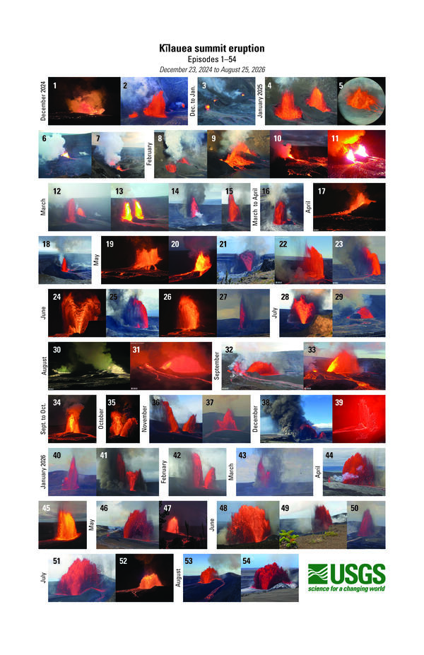
Photo compilation of Kīlauea summit fountaining episodes 1–54

Photo compilation of Kīlauea summit fountaining episodes 1–54

Photo & Video Chronology — Flaming vents at Kīlauea summit

Photo & Video Chronology — Flaming vents at Kīlauea summit

Kīlauea Status Report

Kīlauea Status Report

Publications

The 2018 eruption of Kīlauea: Insights, puzzles, and opportunities for volcano science The 2018 eruption of Kīlauea: Insights, puzzles, and opportunities for volcano science

The science of volcanology advances disproportionately during exceptionally large or well-observed eruptions. The 2018 eruption of Kīlauea Volcano (Hawai‘i) was its most impactful in centuries, involving an outpouring of more than one cubic kilometer of basalt, a magnitude 7 flank earthquake, and the volcano’s largest summit collapse since at least the nineteenth century. Eruptive...
Authors
Kyle R. Anderson, Tom Shea, Kendra J. Lynn, Emily K. Montgomery-Brown, Donald A. Swanson, Matthew R. Patrick, Brian Shiro, Christina A. Neal

Modeling the occurrence of M ∼ 5 caldera collapse-related earthquakes in Kīlauea volcano, Hawai'i Modeling the occurrence of M ∼ 5 caldera collapse-related earthquakes in Kīlauea volcano, Hawai'i

During the 2018 Kīlauea eruption and caldera collapse, M ∼ 5 caldera collapse earthquakes occurred almost daily from mid-May until the beginning of August. While caldera collapses happen infrequently, the collapse-related seismicity damaged nearby structures, and so these events should be included in a complete seismic hazard assessment. Here, we present an approach to forecast the...
Authors
Andrea L. Llenos, Andrew J. Michael

2018 update to the U.S. Geological Survey national volcanic threat assessment 2018 update to the U.S. Geological Survey national volcanic threat assessment

When erupting, all volcanoes pose a degree of risk to people and infrastructure, however, the risks are not equivalent from one volcano to another because of differences in eruptive style and geographic location. Assessing the relative threats posed by U.S. volcanoes identifies which volcanoes warrant the greatest risk-mitigation efforts by the U.S. Geological Survey and its partners...
Authors
John W. Ewert, Angela K. Diefenbach, David W. Ramsey

Science

Eruption Information

Eruptive activity at the summit of Kīlauea, within Hawaiʻi Volcanoes National Park, has been episodic since an eruption began on December 23, 2024.
Eruption Information

Eruption Information

Eruptive activity at the summit of Kīlauea, within Hawaiʻi Volcanoes National Park, has been episodic since an eruption began on December 23, 2024.
Learn More

September 2024 Nāpau Eruption

Kīlauea erupted in and near Nāpau Crater on the middle East Rift Zone of Kīlauea, within Hawai'i Volcanoes National Park, from September 15-20, 2024.
September 2024 Nāpau Eruption

September 2024 Nāpau Eruption
Kīlauea erupted in and near Nāpau Crater on the middle East Rift Zone of Kīlauea, within Hawai'i Volcanoes National Park, from September 15-20, 2024.
Learn More

Past Week Monitoring Data for Kīlauea

This page presents Kīlauea monitoring data collected over the past week, including summit crater floor elevation, earthquake rates, locations, and depths, and ground deformation data.
Past Week Monitoring Data for Kīlauea

Past Week Monitoring Data for Kīlauea

This page presents Kīlauea monitoring data collected over the past week, including summit crater floor elevation, earthquake rates, locations, and depths, and ground deformation data.
Learn More

Multimedia

Color compilation showing images from 54 lava fountains
Photo compilation of lava fountaining episodes 1–54 at the summit of Kīlauea
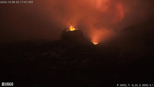
Color photograph of flames within volcanic vents at night Color photograph of flames within volcanic vents at night
October 8, 2026 — Video of flames in the volcanic vents at Kīlauea summit, captured by V1cam
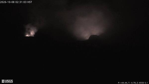
Color photograph of volcanic vents glowing at night Color photograph of volcanic vents glowing at night
October 8, 2026 — Video of flames in the volcanic vents at Kīlauea summit, captured by V3cam
Color photograph of volcanic vents glowing at night
October 8, 2026 — Flames in the volcanic vents at Kīlauea summit, captured by V3cam
Color photograph of flames within volcanic vents at night
October 8, 2026 — Flames in the volcanic vents at Kīlauea summit, captured by V1cam
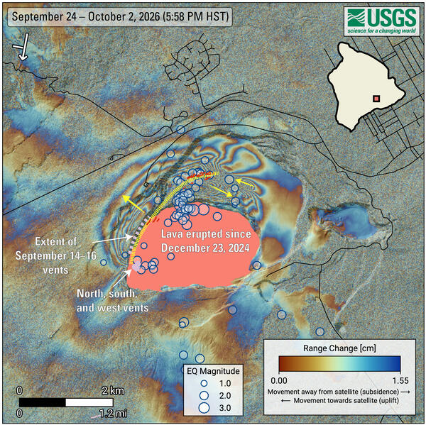
Color graphic showing ground deformation and earthquakes on a volcano
October 7, 2026—InSAR image showing Kīlauea summit deformation and earthquakes between September 24–October 2, 2026
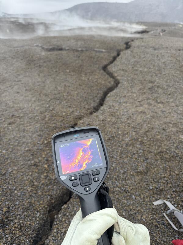
Color photograph of thermal camera showing temperature of ground crack
October 6, 2026 — Thermal camera shows temperature of new ground crack from recent intrusion at Kīlauea summit
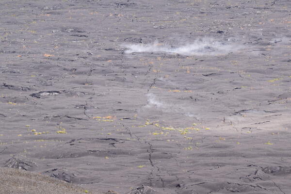
Color photograph of steaming ground crack
October 6, 2026 — View of new ground cracks in caldera floor, from Uēkahuna (Kīlauea summit)
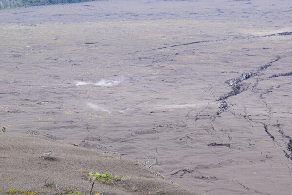
Color photograph of steaming ground cracks
October 6, 2026 — View of new ground cracks on caldera floor from Uēkahuna, Kīlauea summit
Was this page helpful?