
Data Science: Converting Data into Actionable Knowledge
Science Analytics and Synthesis (SAS)
USGS Library
Core Science Systems Mission Area
USGS CSS serves as the primary national civilian mapping agency, including topographic and geologic mapping for Federal and State requirements, national geospatial coordination, satellite operations and remote sensing. Our products and data are necessary to understand, monitor, and detect changes that affect the Nation’s natural and agricultural resources, the economy, public safety, and security.
National Geospatial Program

The National Geospatial Program is the Federal civilian mapping agency and provides the digital geospatial foundation for the Nation. It engages partners and communities of use to collaboratively produce consistent and accurate topographic map data.
Science Synthesis, Analysis and Research Program

The Science Synthesis Analysis, and Research (SSAR) Program provides analysis and synthesis of scientific data and information, interdisciplinary research to improve understanding of Earth system changes, and preservation of scientific data and samples and library collections.
News
The USGS Library Celebrates 250 Years of Discovery and Exploration
America at 250, Seen from Space
Annual NLCD Collection 1.2 Now Available
Publications
Seeing is believing: Livestream video monitoring of Hawaiian eruptions Seeing is believing: Livestream video monitoring of Hawaiian eruptions
Across-track tilt concept for sun glint mitigation in future Earth-observing missions Across-track tilt concept for sun glint mitigation in future Earth-observing missions
Science

2026 18th CEGIS Annual Research Meeting
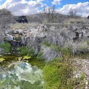
Las Moras Wash Restoration: Integrated Geomorphic Assessment, Modeling, Monitoring, and Adaptive Management
