
USGS Wildland Fire Science
USGS science helps understand the causes, consequences, and benefits of wildfire and helps prevent and manage larger, catastrophic events.
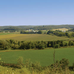
USGS Drought Science
Helping managers understand the interactions that determine the magnitude and impact of drought on water availability and ecosystems across the Nation
Ecosystems Science at USGS
Ecosystems Mission Area
The USGS Ecosystems Mission Area provides science that directly benefits the health, safety, and prosperity of the American people by providing trusted and timely information to help address the Nation’s toughest management and conservation issues impacting public lands and the surrounding communities that benefit from them.
USGS Science for Food & Water Security

USGS Ecosystems Mission Area science helps ensure safe and abundant domestic food and water supplies, ensuring all Americans access to livelihoods and traditions that connect generations with each other and the outdoors and strengthen America’s self-reliance
USGS Science for Public Safety & Security

Science within the USGS Ecosystems Mission Area provides a critical advantage in addressing public safety, infrastructure, and security issues surrounding natural disasters and changing landscapes, strengthening America’s ability to be a hazard ready Nation.
USGS Science for Economic Growth

Science provided by the USGS Ecosystems Mission Area helps boost America’s economy by providing practical tools to implement cost-effective management and development strategies that supports the Nation’s economic growth and protects our natural heritage.
News
Environmental DNA Monitoring Protects Fish Hatchery from Invasive Species
Voyage into the Past: Stories from the California Current
FORT Updates: From Plains to Peaks - Vol. 4 | Issue 2
Publications
Plant diversity shifts with drying and wetting cycles following removal of poplar plantations in Dongting Lake, China Plant diversity shifts with drying and wetting cycles following removal of poplar plantations in Dongting Lake, China
Resurvey of cross sections on the Green River in Browns Park, Colorado and Utah Resurvey of cross sections on the Green River in Browns Park, Colorado and Utah
A simplified two-station approach for modeling metabolism in dam tailwaters subject to diel flow variation A simplified two-station approach for modeling metabolism in dam tailwaters subject to diel flow variation
Science

Ecology and Distribution of the Endangered Hawaiian Hoary Bat
Land application of waste to US farmland: Understanding the scope and environmental implications to aid best practices
