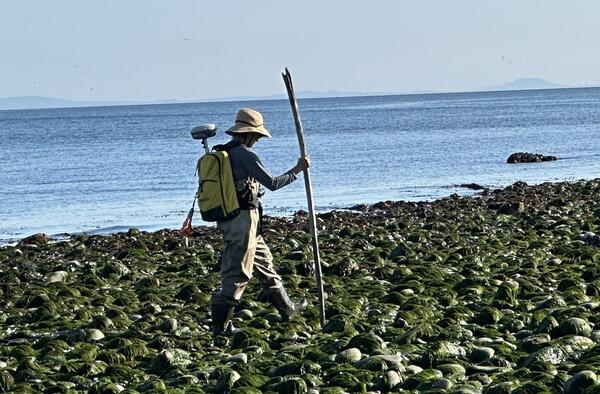
Picture of surveyor equipped with survey equipment during mapping mission
Picture of surveyor equipped with survey equipment during mapping missionPicture of surveyor equipped with survey equipment during mapping mission of the Elwha River mouth.

Official websites use .gov
A .gov website belongs to an official government organization in the United States.
Secure .gov websites use HTTPS
A lock () or https:// means you’ve safely connected to the .gov website. Share sensitive information only on official, secure websites.
Oceanographer with the USGS Pacific Coastal and Marine Science Center
Explore my published data sets on USGS ScienceBase, or choose the Data and Tools tab below.


Picture of surveyor equipped with survey equipment during mapping mission of the Elwha River mouth.
Picture of surveyor equipped with survey equipment during mapping mission of the Elwha River mouth.

Photo showing personal watercraft equipped with survey equipment used during the mapping mission at the Elwha River mouth.
Photo showing personal watercraft equipped with survey equipment used during the mapping mission at the Elwha River mouth.

Diana McCandless, an environmental specialist with the Washington State Department of Ecology, collecting topographic data on an all-terrain vehicle.
Diana McCandless, an environmental specialist with the Washington State Department of Ecology, collecting topographic data on an all-terrain vehicle.

USGS Oceanographer Andrew Stevens performing a topographic survey at the base of an eroding dune.
USGS Oceanographer Andrew Stevens performing a topographic survey at the base of an eroding dune.

Personnel from Oregon State University launch a personal water craft into the surf zone during bathymetric surveys along the Washington coast.
Personnel from Oregon State University launch a personal water craft into the surf zone during bathymetric surveys along the Washington coast.

Paige Hovenga, former Graduate Research Assistant at Oregon State University, participating in a dawn topographic survey.
Paige Hovenga, former Graduate Research Assistant at Oregon State University, participating in a dawn topographic survey.

Kai Parker, USGS Oceanographer, navigates the surf zone on a personal watercraft during a bathymetric survey.
Kai Parker, USGS Oceanographer, navigates the surf zone on a personal watercraft during a bathymetric survey.

PCMSC scientist measuring land-surface elevation near the bay-marsh edge of Whale's Tail South marsh in Eden Landing Ecological Reserve, Hayward, CA, with birds foraging on the South San Francisco Bay mudflats at low tide in the background.
PCMSC scientist measuring land-surface elevation near the bay-marsh edge of Whale's Tail South marsh in Eden Landing Ecological Reserve, Hayward, CA, with birds foraging on the South San Francisco Bay mudflats at low tide in the background.

A three-dimensional hydrodynamic model of the lower Columbia River (LCR) was constructed using the Delft3D Flexible Mesh (DFM) modeling suite to simulate water levels, flow, and seabed stresses between January 1, 2017, and April 20, 2020
A three-dimensional hydrodynamic model of the lower Columbia River (LCR) was constructed using the Delft3D Flexible Mesh (DFM) modeling suite to simulate water levels, flow, and seabed stresses between January 1, 2017, and April 20, 2020

Marine engineering technician Pete Dal Ferro sets up a newly acquired, portable, single-beam echo sounder on the San Lorenzo River in Santa Cruz, California. The new device, called CEESCOPE, collects bathymetric (depth) data and also records features of the subsurface.
Marine engineering technician Pete Dal Ferro sets up a newly acquired, portable, single-beam echo sounder on the San Lorenzo River in Santa Cruz, California. The new device, called CEESCOPE, collects bathymetric (depth) data and also records features of the subsurface.

You have to be able to have a little fun when in the field. A colleague from the Washington State Department of Ecology hams it up while prepping for a beach survey with scientists from the USGS Pacific Coastal and Marine Science Center.
You have to be able to have a little fun when in the field. A colleague from the Washington State Department of Ecology hams it up while prepping for a beach survey with scientists from the USGS Pacific Coastal and Marine Science Center.

Pete Dal Ferro and Andrew Stevens, both from the USGS Pacific Coastal and Marine Science Center (PCMSC) in Santa Cruz, California, install a Vaisala WXT weather station in Grizzly Bay, east of San Pablo Bay and northeast of San Francisco.
Pete Dal Ferro and Andrew Stevens, both from the USGS Pacific Coastal and Marine Science Center (PCMSC) in Santa Cruz, California, install a Vaisala WXT weather station in Grizzly Bay, east of San Pablo Bay and northeast of San Francisco.

From left to right, USGS scientists Sam McGill, Lucas WinklerPrins, David Hart, Selina Davila Olivera, and Pete Dal Ferro work on Grizzly Bay on the vessel Jewell, to collect sediment samples using the GOMEX box corer.
From left to right, USGS scientists Sam McGill, Lucas WinklerPrins, David Hart, Selina Davila Olivera, and Pete Dal Ferro work on Grizzly Bay on the vessel Jewell, to collect sediment samples using the GOMEX box corer.

Evolution of the shoreline around the Elwha River mouth, Washington, before, during and after dam removal, 2011–2017. Two large dams were removed from the Elwha River between 2011 and 2014 in the largest dam removal worldwide thus far, releasing more than 20 million tons of sediment downstream.
Evolution of the shoreline around the Elwha River mouth, Washington, before, during and after dam removal, 2011–2017. Two large dams were removed from the Elwha River between 2011 and 2014 in the largest dam removal worldwide thus far, releasing more than 20 million tons of sediment downstream.

Photographs showing equipment used during bathymetric and topographic surveys along the Columbia River littoral cell, Washington and Oregon.
Photographs showing equipment used during bathymetric and topographic surveys along the Columbia River littoral cell, Washington and Oregon.

Cordell Johnson uses a personal watercraft (PWC) equipped with GPS and sonar to measure seafloor depths near the beach.
Cordell Johnson uses a personal watercraft (PWC) equipped with GPS and sonar to measure seafloor depths near the beach.

Dan Nowacki measures dune elevations near the mouth of the Pajaro River with a precision GPS unit carried in his backpack.
Dan Nowacki measures dune elevations near the mouth of the Pajaro River with a precision GPS unit carried in his backpack.

USGS oceanographer Andrew Stevens, of the Pacific Coastal and Marine Science Center in Santa Cruz, California, sits on an all-terrain vehicle equipped with a precision GPS and other instruments. The GPS collects position data continuously, about 2 points per second, while an operator like Andrew drives the ATV over a beach.
USGS oceanographer Andrew Stevens, of the Pacific Coastal and Marine Science Center in Santa Cruz, California, sits on an all-terrain vehicle equipped with a precision GPS and other instruments. The GPS collects position data continuously, about 2 points per second, while an operator like Andrew drives the ATV over a beach.

Two personal watercraft operators from the USGS Pacific Coastal and Marine Science Center in Santa Cruz, California, navigate their personal watercraft (PWC) in the shallow nearshore region in Moss Landing near Elkhorn Slough. The PWCs are set up with precision GPS and echosounder systems in order to create detailed bathymetric maps (depth).
Two personal watercraft operators from the USGS Pacific Coastal and Marine Science Center in Santa Cruz, California, navigate their personal watercraft (PWC) in the shallow nearshore region in Moss Landing near Elkhorn Slough. The PWCs are set up with precision GPS and echosounder systems in order to create detailed bathymetric maps (depth).

Diana McCandless of the Washington State Department of Ecology pauses for a moment, on the beach around the point and to the east of the mouth of Elwha River. McCandless is part of a team of scientists from WA State and the USGS who are periodically mapping the delta and beach areas near the mouth of the Elwha River.
Diana McCandless of the Washington State Department of Ecology pauses for a moment, on the beach around the point and to the east of the mouth of Elwha River. McCandless is part of a team of scientists from WA State and the USGS who are periodically mapping the delta and beach areas near the mouth of the Elwha River.

USGS and Washington State Department of Ecology scientists are geared up and ready to start a topographic survey at the mouth of the Elwha River, using handheld computers and backpack-mounted GPS equipment. From left to right are Owen Warrick (USGS Volunteer), Jon Warrick (USGS), Andy Ritchie (USGS), Heather Weiner (WA State Dept.
USGS and Washington State Department of Ecology scientists are geared up and ready to start a topographic survey at the mouth of the Elwha River, using handheld computers and backpack-mounted GPS equipment. From left to right are Owen Warrick (USGS Volunteer), Jon Warrick (USGS), Andy Ritchie (USGS), Heather Weiner (WA State Dept.
Picture of surveyor equipped with survey equipment during mapping mission of the Elwha River mouth.
Picture of surveyor equipped with survey equipment during mapping mission of the Elwha River mouth.
Photo showing personal watercraft equipped with survey equipment used during the mapping mission at the Elwha River mouth.
Photo showing personal watercraft equipped with survey equipment used during the mapping mission at the Elwha River mouth.
Diana McCandless, an environmental specialist with the Washington State Department of Ecology, collecting topographic data on an all-terrain vehicle.
Diana McCandless, an environmental specialist with the Washington State Department of Ecology, collecting topographic data on an all-terrain vehicle.
USGS Oceanographer Andrew Stevens performing a topographic survey at the base of an eroding dune.
USGS Oceanographer Andrew Stevens performing a topographic survey at the base of an eroding dune.
Personnel from Oregon State University launch a personal water craft into the surf zone during bathymetric surveys along the Washington coast.
Personnel from Oregon State University launch a personal water craft into the surf zone during bathymetric surveys along the Washington coast.
Paige Hovenga, former Graduate Research Assistant at Oregon State University, participating in a dawn topographic survey.
Paige Hovenga, former Graduate Research Assistant at Oregon State University, participating in a dawn topographic survey.
Kai Parker, USGS Oceanographer, navigates the surf zone on a personal watercraft during a bathymetric survey.
Kai Parker, USGS Oceanographer, navigates the surf zone on a personal watercraft during a bathymetric survey.
PCMSC scientist measuring land-surface elevation near the bay-marsh edge of Whale's Tail South marsh in Eden Landing Ecological Reserve, Hayward, CA, with birds foraging on the South San Francisco Bay mudflats at low tide in the background.
PCMSC scientist measuring land-surface elevation near the bay-marsh edge of Whale's Tail South marsh in Eden Landing Ecological Reserve, Hayward, CA, with birds foraging on the South San Francisco Bay mudflats at low tide in the background.
A three-dimensional hydrodynamic model of the lower Columbia River (LCR) was constructed using the Delft3D Flexible Mesh (DFM) modeling suite to simulate water levels, flow, and seabed stresses between January 1, 2017, and April 20, 2020
A three-dimensional hydrodynamic model of the lower Columbia River (LCR) was constructed using the Delft3D Flexible Mesh (DFM) modeling suite to simulate water levels, flow, and seabed stresses between January 1, 2017, and April 20, 2020
Marine engineering technician Pete Dal Ferro sets up a newly acquired, portable, single-beam echo sounder on the San Lorenzo River in Santa Cruz, California. The new device, called CEESCOPE, collects bathymetric (depth) data and also records features of the subsurface.
Marine engineering technician Pete Dal Ferro sets up a newly acquired, portable, single-beam echo sounder on the San Lorenzo River in Santa Cruz, California. The new device, called CEESCOPE, collects bathymetric (depth) data and also records features of the subsurface.
You have to be able to have a little fun when in the field. A colleague from the Washington State Department of Ecology hams it up while prepping for a beach survey with scientists from the USGS Pacific Coastal and Marine Science Center.
You have to be able to have a little fun when in the field. A colleague from the Washington State Department of Ecology hams it up while prepping for a beach survey with scientists from the USGS Pacific Coastal and Marine Science Center.
Pete Dal Ferro and Andrew Stevens, both from the USGS Pacific Coastal and Marine Science Center (PCMSC) in Santa Cruz, California, install a Vaisala WXT weather station in Grizzly Bay, east of San Pablo Bay and northeast of San Francisco.
Pete Dal Ferro and Andrew Stevens, both from the USGS Pacific Coastal and Marine Science Center (PCMSC) in Santa Cruz, California, install a Vaisala WXT weather station in Grizzly Bay, east of San Pablo Bay and northeast of San Francisco.
From left to right, USGS scientists Sam McGill, Lucas WinklerPrins, David Hart, Selina Davila Olivera, and Pete Dal Ferro work on Grizzly Bay on the vessel Jewell, to collect sediment samples using the GOMEX box corer.
From left to right, USGS scientists Sam McGill, Lucas WinklerPrins, David Hart, Selina Davila Olivera, and Pete Dal Ferro work on Grizzly Bay on the vessel Jewell, to collect sediment samples using the GOMEX box corer.
Evolution of the shoreline around the Elwha River mouth, Washington, before, during and after dam removal, 2011–2017. Two large dams were removed from the Elwha River between 2011 and 2014 in the largest dam removal worldwide thus far, releasing more than 20 million tons of sediment downstream.
Evolution of the shoreline around the Elwha River mouth, Washington, before, during and after dam removal, 2011–2017. Two large dams were removed from the Elwha River between 2011 and 2014 in the largest dam removal worldwide thus far, releasing more than 20 million tons of sediment downstream.
Photographs showing equipment used during bathymetric and topographic surveys along the Columbia River littoral cell, Washington and Oregon.
Photographs showing equipment used during bathymetric and topographic surveys along the Columbia River littoral cell, Washington and Oregon.
Cordell Johnson uses a personal watercraft (PWC) equipped with GPS and sonar to measure seafloor depths near the beach.
Cordell Johnson uses a personal watercraft (PWC) equipped with GPS and sonar to measure seafloor depths near the beach.
Dan Nowacki measures dune elevations near the mouth of the Pajaro River with a precision GPS unit carried in his backpack.
Dan Nowacki measures dune elevations near the mouth of the Pajaro River with a precision GPS unit carried in his backpack.
USGS oceanographer Andrew Stevens, of the Pacific Coastal and Marine Science Center in Santa Cruz, California, sits on an all-terrain vehicle equipped with a precision GPS and other instruments. The GPS collects position data continuously, about 2 points per second, while an operator like Andrew drives the ATV over a beach.
USGS oceanographer Andrew Stevens, of the Pacific Coastal and Marine Science Center in Santa Cruz, California, sits on an all-terrain vehicle equipped with a precision GPS and other instruments. The GPS collects position data continuously, about 2 points per second, while an operator like Andrew drives the ATV over a beach.
Two personal watercraft operators from the USGS Pacific Coastal and Marine Science Center in Santa Cruz, California, navigate their personal watercraft (PWC) in the shallow nearshore region in Moss Landing near Elkhorn Slough. The PWCs are set up with precision GPS and echosounder systems in order to create detailed bathymetric maps (depth).
Two personal watercraft operators from the USGS Pacific Coastal and Marine Science Center in Santa Cruz, California, navigate their personal watercraft (PWC) in the shallow nearshore region in Moss Landing near Elkhorn Slough. The PWCs are set up with precision GPS and echosounder systems in order to create detailed bathymetric maps (depth).
Diana McCandless of the Washington State Department of Ecology pauses for a moment, on the beach around the point and to the east of the mouth of Elwha River. McCandless is part of a team of scientists from WA State and the USGS who are periodically mapping the delta and beach areas near the mouth of the Elwha River.
Diana McCandless of the Washington State Department of Ecology pauses for a moment, on the beach around the point and to the east of the mouth of Elwha River. McCandless is part of a team of scientists from WA State and the USGS who are periodically mapping the delta and beach areas near the mouth of the Elwha River.
USGS and Washington State Department of Ecology scientists are geared up and ready to start a topographic survey at the mouth of the Elwha River, using handheld computers and backpack-mounted GPS equipment. From left to right are Owen Warrick (USGS Volunteer), Jon Warrick (USGS), Andy Ritchie (USGS), Heather Weiner (WA State Dept.
USGS and Washington State Department of Ecology scientists are geared up and ready to start a topographic survey at the mouth of the Elwha River, using handheld computers and backpack-mounted GPS equipment. From left to right are Owen Warrick (USGS Volunteer), Jon Warrick (USGS), Andy Ritchie (USGS), Heather Weiner (WA State Dept.