Lisa has worked for the USGS since 1987, first as a Research Geophysicist and then as a Science Communicator and Web Content Manager for the USGS Earthquake Hazards Program, the Landslide Hazards Program, the Geomagnetism Program, and the Natural Hazards Mission Area. She is also a member of Natural Hazards Mission Science Communications Team.
Computer/Software Experience
- HTML, CSS, Adobe Creative Suite, Office 365, WordPress.
Relevant Experience in Science Communications and Graphic Design & Layout
- Created and coordinated an Education & Outreach Program for the USGS Earthquake Hazards Team office in Pasadena, CA with no budget; created USGS Public Lecture Series, created and lead Teacher Workshops to teach teachers how to teach classrooms about earthquakes with hands-on materials.
- Created classroom activities for K-6 to teach about various earthquake science.
- Forged a partnership with the KidSpace Museum in Pasadena, CA, and served as a scientific consultant for their new hands-on earthquake exhibit; worked with exhibit designers.
- Created and presented hands-on talks/presentations about earthquakes to K-6 classrooms and community organizations throughout the Los Angeles Metropolitan area.
- Coordinated several-year long project to completely redesign the USGS Earthquake Hazards Program website, which involved several 1000 webpages, and web developers spread in several offices throughout the US.
- Coordinated USGS “booths” at local, regional, and national meetings and answered questions.
- Author and co-author, and graphic design and layout of many USGS Fact Sheets, which are publications that communicate science to the general public; general 5000-10,000 copies printed at a time often with second printings.
- Created posters, flyers, and brochures for Pasadena and Golden USGS office events, internal and public.
- Science writer for USGS "Science for Everyone" articles.
Science Communications Articles for a Non-Technical Audience
- Science for Everyone articles - Earthquake Hazards Program
- Science for Everyone articles - Landslide Hazards Program
- Science for Everyone articles - Geomagnetism Program
Professional Experience
WEB CONTENT MANAGER/SCIENCE WRITER September 2014 to Present
U.S. Geological Survey, Earthquake Hazards Program, Golden, ColoradoWeb Content Manager for Earthquake Hazards Program Website, Landslide Hazards Program Website, Geomagnetism Program Website, and Geologic Hazards Science Center Website, including Information Architecture, User Experience, Graphic Design and Layout. Write
Education and Certifications
M.S., Geophysics University of Arizona, Tucson, Arizona July 1987
B.S., Geology Trinity University, San Antonio, Texas December 1984
Affiliations and Memberships*
American Geophysical Union (AGU)
Seismological Society of America (SSA)
Association of Science Communicators (ASC)
Honors and Awards
2010 DOI Superior Service Award
2003 Shoemaker Award for Communication Product Excellence, Web Category – Earthquake Hazards Program Website Realtime Products
Science and Products
Earthquake information products and tools from the Advanced National Seismic System (ANSS)
USGS near-real-time products-and their use-for the 2018 Anchorage earthquake
Get your science used—Six guidelines to improve your products
Rapid characterization of the 2015 Mw 7.8 Gorkha, Nepal, earthquake sequence and its seismotectonic context
"Report a Landslide” A website to engage the public in identifying geologic hazards
The USGS Earthquake Notification Service (ENS): Customizable notifications of earthquakes around the globe
Technical-information products for a National Volcano Early Warning System
Urban seismic hazard mapping for Memphis, Shelby County, Tennessee
Earthquake information products and tools from the Advanced National Seismic System (ANSS)
Rupture in south-central Alaska: The Denali Fault earthquake of 2002
The Southern California Network Bulletin; January - December 1994
The Southern California Network Bulletin, January-December 1991
Non-USGS Publications**
**Disclaimer: The views expressed in Non-USGS publications are those of the author and do not represent the views of the USGS, Department of the Interior, or the U.S. Government.
Using Distant Seismometers to Monitor and Analyze Volcanic Eruptions
The 2023 National Seismic Hazard Model – What's Shaking?
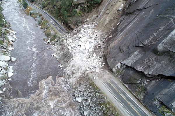
CSI: Rockfall Forensics
Improving Earthquake Monitoring with Deep Learning
How Often Do Rainstorms Cause Debris Flows in Burned Areas of the Southwestern U.S.?
Auroras and Earthquakes: Strange Companions
The Blind Zone of Earthquake Early Warning
What if the ShakeAlert Earthquake Early Warning System Had Been Operating During the M6.9 1989 Loma Prieta Earthquake?
Earthquake Early Warning – Fine-Tuning for Best Alerts
Earthquake Animations
Animations for earthquake terms and concepts.
Potential Landslide Paths and Implications for Tsunami Hazards in Glacier Bay, Alaska – An Initial Investigation
Geologic Cracks Record Earthquakes on the Reelfoot Fault in Central U.S.
The 2019 Ridgecrest, California, Earthquake Sequence
This USGS geonarrative (Esri Story Map) summarizes the USGS response and findings after the M6.4 on July 4 and M7.1 on July 6, 2019 in Searles Valley, Southern California, and includes links to USGS research publications and data releases.
Science and Products
- Publications
Filter Total Items: 13
Earthquake information products and tools from the Advanced National Seismic System (ANSS)
This Fact Sheet describes post-earthquake products and tools provided by the Advanced National Seismic System (ANSS) through the U.S. Geological Survey Earthquake Hazards Program. The focus is on products that provide situational awareness immediately after significant earthquakes.AuthorsLisa A. WaldUSGS near-real-time products-and their use-for the 2018 Anchorage earthquake
In the minutes to hours after a major earthquake, such as the recent 2018 Mw 7.1 Anchorage event, the U.S. Geological Survey (USGS) produces a suite of interconnected earthquake products that provides diverse information ranging from basic earthquake source parameters to loss estimates. The 2018 Anchorage earthquake is the first major domestic earthquake to occur since several new USGS products haAuthorsEric M. Thompson, Sara McBride, Gavin P. Hayes, Kate E. Allstadt, Lisa Wald, David J. Wald, Keith L. Knudsen, Charles Worden, Kristin Marano, Randall W. Jibson, Alex R. R. GrantGet your science used—Six guidelines to improve your products
Introduction Natural scientists, like many other experts, face challenges when communicating to people outside their fields of expertise. This is especially true when they try to communicate to those whose background, knowledge, and experience are far distant from that field of expertise. At a recent workshop, experts in risk communication offered insights into the communication challenges of probAuthorsSuzanne C. Perry, Michael L. Blanpied, Erin R. Burkett, Nnenia M. Campbell, Anders Carlson, Dale A. Cox, Carolyn L. Driedger, David P. Eisenman, Katherine T. Fox-Glassman, Sherry Hoffman, Susanna M. Hoffman, Kishor S. Jaiswal, Lucile M. Jones, Nicolas Luco, Sabine M. Marx, Sean M. McGowan, Dennis S. Mileti, Morgan P. Moschetti, David Ozman, Elizabeth Pastor, Mark D. Petersen, Keith A. Porter, David W. Ramsey, Liesel A. Ritchie, Jessica K. Fitzpatrick, Kenneth S. Rukstales, Timothy L. Sellnow, Wendy L. Vaughon, David J. Wald, Lisa A. Wald, Anne Wein, Christina ZarcadoolasRapid characterization of the 2015 Mw 7.8 Gorkha, Nepal, earthquake sequence and its seismotectonic context
Earthquake response and related information products are important for placing recent seismic events into context and particularly for understanding the impact earthquakes can have on the regional community and its infrastructure. These tools are even more useful if they are available quickly, ahead of detailed information from the areas affected by such earthquakes. Here we provide an overview ofAuthorsGavin P. Hayes, Richard W. Briggs, William D. Barnhart, William L. Yeck, Daniel E. McNamara, David J. Wald, Jennifer Nealy, Harley M. Benz, Ryan D. Gold, Kishor S. Jaiswal, Kristin Marano, Paul S. Earle, Mike Hearne, Gregory M. Smoczyk, Lisa A. Wald, Sergey Samsonov"Report a Landslide” A website to engage the public in identifying geologic hazards
Direct observation by people is the most practical way of identifying, locating, and describing most damaging landslides. In an effort to increase public awareness of landslide hazards and encourage public participation in collecting basic data about landslides, the USGS recently launched a website called “Report a landslide.” The website is modeled in part after the highly successful USGS websiteAuthorsRex L. Baum, Lynn M. Highland, Peter T. Lyttle, Jeremy Fee, Eric Martinez, Lisa A. WaldThe USGS Earthquake Notification Service (ENS): Customizable notifications of earthquakes around the globe
At the beginning of 2006, the U.S. Geological Survey (USGS) Earthquake Hazards Program (EHP) introduced a new automated Earthquake Notification Service (ENS) to take the place of the National Earthquake Information Center (NEIC) "Bigquake" system and the various other individual EHP e-mail list-servers for separate regions in the United States. These included northern California, southern CalifornAuthorsLisa A. Wald, David J. Wald, Stan Schwarz, Bruce Presgrave, Paul S. Earle, Eric Martinez, David OppenheimerTechnical-information products for a National Volcano Early Warning System
Technical outreach — distinct from general-interest and K-12 educational outreach — for volcanic hazards is aimed at providing usable scientific information about potential or ongoing volcanic activity to public officials, businesses, and individuals in support of their response, preparedness, and mitigation efforts. Within the context of a National Volcano Early Warning System (NVEWS) (Ewert et aAuthorsMarianne C. Guffanti, Steven R. Brantley, Peter F. Cervelli, Christopher J. Nye, George N. Serafino, Lee Siebert, Dina Y. Venezky, Lisa A. WaldUrban seismic hazard mapping for Memphis, Shelby County, Tennessee
Earthquakes cannot be predicted, but scientists can forecast how strongly the ground is likely to shake as a result of an earthquake. Seismic hazard maps provide one way of conveying such forecasts. The U.S. Geological Survey (USGS), which produces seismic hazard maps for the Nation, is now engaged in developing more detailed maps for vulnerable urban areas. The first set of these maps is now avaiAuthorsJoan GombergEarthquake information products and tools from the Advanced National Seismic System (ANSS)
This Fact Sheet provides a brief description of postearthquake tools and products provided by the Advanced National Seismic System (ANSS) through the U.S. Geological Survey Earthquake Hazards Program. The focus is on products specifically aimed at providing situational awareness in the period immediately following significant earthquake events.AuthorsLisa WaldRupture in south-central Alaska: The Denali Fault earthquake of 2002
No abstract available.AuthorsGary S. Fuis, Lisa A. Wald, James W. Hendley, Peter H. StaufferThe Southern California Network Bulletin; January - December 1994
AuthorsLisa A. Wald, Katrin N. Hafner, A. Steve BryantThe Southern California Network Bulletin, January-December 1991
AuthorsLisa A. Wald, L.K. Hutton, L.M. Jones, D.D. Given, Katrin Douglass, J.J. Mori, Egill Hauksson, Hiroo KanamoriNon-USGS Publications**
**Disclaimer: The views expressed in Non-USGS publications are those of the author and do not represent the views of the USGS, Department of the Interior, or the U.S. Government.
- Science
Filter Total Items: 34
Using Distant Seismometers to Monitor and Analyze Volcanic Eruptions
Before a volcano erupts, there are typically precursory activities that can be detected on seismometers. Thus, monitoring volcanoes with nearby seismometers is a good way to know when a volcanic eruption may be imminent. Placing these instruments around every volcano is, however, not possible due to logistical constraints, nor is it necessary in many locations far away from a population center.The 2023 National Seismic Hazard Model – What's Shaking?
No one can predict earthquakes. But existing faults and past earthquakes give us information about future earthquakes, and geology tells us how the ground shakes during an earthquake.CSI: Rockfall Forensics
The next time you find yourself at the bottom of a cliff, make sure to look up.Improving Earthquake Monitoring with Deep Learning
Release Date: MARCH 12, 2021 On January 20, 2021 at 8:32am light shaking interrupted breakfast customers at a local coffee shop south of downtown Los Angeles, California. Everyone paused briefly while they waited to see if it was going to stop… or start shaking harder.How Often Do Rainstorms Cause Debris Flows in Burned Areas of the Southwestern U.S.?
Debris flows, sometimes referred to as mudslides, mudflows, lahars, or debris avalanches, are common types of fast-moving landslides. They usually start on steep hillsides as a result of shallow landslides, or from runoff and erosion that liquefy and accelerate to speeds in excess of 35 mi/h. The consistency of debris flows ranges from thin, watery to thick, rocky mud that can carry large items...Auroras and Earthquakes: Strange Companions
Release Date: JULY 6, 2020 In 1722 and 1723 a London clockmaker, George Graham, observed daily and consistent variations on one of his instruments, a “Needle upon the Pin” (a compass), for which he had no explanation. Swedish scientists obtained some of Graham’s instruments to record what is now known to be the variations in Earth’s magnetic field. In 1741, they noticed a significant deflection of...The Blind Zone of Earthquake Early Warning
Release Date: MAY 29, 2020 Residents in California, Oregon, and Washington have been told that earthquake early warning (EEW) is at their doorstep and will alert them to the shaking from an earthquake before it arrives. Some media reports have said there will be “up to a minute of warning”. The problem is, for onshore earthquakes these claims are exaggerated, and under some conditions a warning is...What if the ShakeAlert Earthquake Early Warning System Had Been Operating During the M6.9 1989 Loma Prieta Earthquake?
Release Date: OCTOBER 17, 2019 How will ShakeAlert® likely perform now on a large earthquake impacting a major urban area? How much warning will you get? To answer this, let’s do a thought experiment...Earthquake Early Warning – Fine-Tuning for Best Alerts
Release Date: OCTOBER 8, 2019 The goal of an earthquake early warning (EEW) system is to provide an alert to people and automatic systems after an earthquake begins but before the shaking reaches their location. As the USGS and its partners are developing an EEW system, called ShakeAlert®, for the West Coast, the benefits, costs, capabilities, and limitations are being investigated. Two recent...Earthquake Animations
Animations for earthquake terms and concepts.
Potential Landslide Paths and Implications for Tsunami Hazards in Glacier Bay, Alaska – An Initial Investigation
Glacier Bay and its inlets are a popular destination for cruise ships and passenger boats; about 540,000 people visited Glacier Bay National Park and Preserve (GBNPP) in 2017. A typical tour of the Bay traverses the entire length up to the glacier calving viewpoints in the Johns Hopkins and Tarr Inlets. A 2018 article “Landslides and Giant Waves” by the National Park Service (NPS) states, “The...Geologic Cracks Record Earthquakes on the Reelfoot Fault in Central U.S.
Release Date: APRIL 25, 2019 New high-resolution lidar data reveals cracks produced from strong shaking in past earthquakes in the New Madrid seismic zone. - Multimedia
- Web Tools
The 2019 Ridgecrest, California, Earthquake Sequence
This USGS geonarrative (Esri Story Map) summarizes the USGS response and findings after the M6.4 on July 4 and M7.1 on July 6, 2019 in Searles Valley, Southern California, and includes links to USGS research publications and data releases.
- News
*Disclaimer: Listing outside positions with professional scientific organizations on this Staff Profile are for informational purposes only and do not constitute an endorsement of those professional scientific organizations or their activities by the USGS, Department of the Interior, or U.S. Government