
Patrick (Ryan) Jackson, Ph.D.
P. Ryan Jackson, Hydrologist, USGS, Central Midwest Water Science Center, located in Urbana, Illinois.
Ryan received his Ph.D. in Civil Engineering from the University of Illinois at Urbana-Champaign in 2006 and was a Postdoctoral Scholar at Woods Hole Oceanographic Institution from 2006-2008. Since joining the USGS in 2008, he has been primarily working on surface water investigations projects, though some of his time each year has been dedicated to Office of Surface Water (Hydroacoustics). While Ryan's job title is hydrologist, a more accurate and descriptive title would be Environmental and Ecological Hydrodynamicist (yes, it's a mouthful). He studies complex flows in rivers and lakes and how these flows relate to physical, chemical, and biological processes occurring in the surrounding environment and ecosystems. At the heart of many of Ryan's studies is the investigation of mixing and transport in surface water with the goal of understanding a system from a holistic perspective, which includes describing the role of hydrodynamics in driving water-quality distributions and ecological processes. Examples of such studies include fate and transport of contaminants in rivermouth mixing zones in the Great Lakes, assessment of spawning suitability of Great Lakes tributaries for invasive Asian carp, and the hydrodynamics around barges and potential for entrainment and transport of invasive fish in barge junction gap spaces.
Ryan's studies rely heavily on innovative applications of hydroacoustic and water-quality instrumentation. For example, some of his studies utilize an autonomous underwater vehicle (AUV) paired with traditional manned-boat instrument platforms for high-resolution, integrated synoptic surveys of water-quality distributions, bathymetry, and velocity of a study site. He has a passion for data analysis and visualization and use a variety of tools including Matlab, ArcGIS, and Adobe Illustrator to unlock and present the "story in the data". Since unpublished research benefits nobody, he actively strives to publish his studies in peer-reviewed journals, technical reports, conference papers, and data releases. Finally, Ryan shares many of the data processing and visualization tools that he develops through his research with others to provide transparency and standardization, improve efficiency, and minimize duplication of effort within the USGS and the broader research community. One example is the Velocity Mapping Toolbox (VMT), a suite of tools for processing and visualizing data from acoustic Doppler current profilers.
Science and Products

Real-Time Fish Telemetry
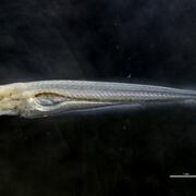
Early Life History of Bighead, Silver, Black, and Grass Carps

Leveraging the National Water Model to Inform Binational Management of Invasive Carp in North America

Improve Control Efficiency Through Better Understanding of Grass Carp Movements and Habitat Use

Identifying Spawning Tributaries and Specific Spawning Areas of Grass Carp

Waterbody Rapid Assessment Tool (WaterRAT): 3-dimensional Visualization of High-Resolution Spatial Data

Engineering and Testing of Carbon Dioxide Infusion Systems

Carbon Dioxide as an Invasive Carp Behavioral Deterrent

Invasive Carp Integrated Control and Containment: Brandon Road Lock and Dam

Invasive Carp Risk Assessment and Life History: Assessment of Hydraulic and Water-Quality Influences on Waterways to Develop Control Options

Development of a FluEgg Model for the St. Croix River
Science and Products
Real-Time Fish Telemetry
Early Life History of Bighead, Silver, Black, and Grass Carps
Leveraging the National Water Model to Inform Binational Management of Invasive Carp in North America
Improve Control Efficiency Through Better Understanding of Grass Carp Movements and Habitat Use
Identifying Spawning Tributaries and Specific Spawning Areas of Grass Carp
Waterbody Rapid Assessment Tool (WaterRAT): 3-dimensional Visualization of High-Resolution Spatial Data
Engineering and Testing of Carbon Dioxide Infusion Systems
Carbon Dioxide as an Invasive Carp Behavioral Deterrent
Invasive Carp Integrated Control and Containment: Brandon Road Lock and Dam
Invasive Carp Risk Assessment and Life History: Assessment of Hydraulic and Water-Quality Influences on Waterways to Develop Control Options