
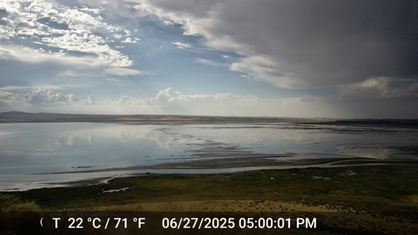
On the left, shallow lake water stretches across the expanse of the camera view. On the right, the shoreline has shifted significantly to the left in just one day.
Ramon C. Naranjo
Ramon Naranjo is Research Hydrologist in the Nevada Water Science Center. Interests include understanding biogeochemical processes at the sediment-water interface and characterizing flow and transport in hyporheic and groundwater systems using innovative technologies and modeling.
Recent research activities involve characterization of hyporheic flow and nutrients beneath barrier beaches and streams in the shore zone of Lake Tahoe, and using multi-depth observations of temperature in unlined agricultural canal sediments to quantify seepage losses. Near-shore water quality and lake clarity is of interest due to nutrient enrichment leading to algal blooms and ongoing efforts to quantify groundwater contributions to nutrient loads. Understanding the role of groundwater surface-water interactions as it relates to nutrient retention and cycling is an important consideration in this research. He has designed and patented new instrumentation for continuous monitoring of subsurface temperatures to evaluate spatial and temporal variability in seepage rates that allows further development of new heat as tracer model calibration and uncertainty techniques. He is actively testing new modeling software being developed to enable the coupled heat-flow and reactive transport processes. He serves as a member of the Tahoe Science Advisory Council.
Science and Products

Quantifying watershed controls on fine sediment particles and nutrient loading to Lake Tahoe using data mining and machine learning
Since the late 1980’s, the USGS has collected discharge, sediment, and water quality data at seven major drainages under the Lake Tahoe Interagency Monitoring Program (LTIMP). Recently, continuous, real-time measurements of turbidity were added to the LTIMP. These data can be combined with in situ, model simulations, and remotely-sensed datasets available from the USGS, National Aeronautics and...

Science in the Carson River Basin
The Carson River is an important water resource for residents, agriculture, and wildlife. The USGS provides science support on water quality and quantity, as well as on the impacts of climate change on water resources in the basin.

Lake Tahoe Nearshore Periphyton Study
Periphyton, a type of algae, is growing on bottom sediment and rocks along nearshore areas of Lake Tahoe. Periphyton is seen as a nuisance and negatively impacts the recreational value of the lake. Periphyton biomass (PB) data collected along the nearshore of Lake Tahoe exhibit increasing trends over the last decade. However, the mechanisms that have caused these changes are not well understood.

Quantifying Seepage Losses on the Truckee Canal, Derby Dam to Lahontan Reservoir
Seepage losses from the Truckee Canal poses major challenges to water managers. Seepage losses result in inefficiencies in water delivery and cause more water than is needed by farmers to be diverted from the Truckee River to meet required demands. Increased diversions from the Truckee River result in less water flowing through the lower Truckee River system and into Pyramid Lake, a terminal lake...

Nutrient Source Identification in Groundwater and Periphyton Along the Nearshore of Lake Tahoe
High concentrations of phosphorus (P) and nitrogen (N) are responsible for excessive, or nuisance algal blooms in many ecosystems world-wide, and climate change is predicted to exacerbate the problem1,2. Excessive nutrients supplied to the nearshore zone of Lake Tahoe may have significant consequences to ecological communities, water clarity, and water quality. The nearshore zone represents the...

Occurrence and Mobility of Arsenic in Groundwater Used for Public Supply in Southern Carson Valley, Douglas County, Nevada
Over the past 15 years, Douglas County, Nev., has removed production wells in northern Carson Valley from use due to relatively high arsenic concentrations. To maintain the supply of water to the public, the town of Minden has been providing water to Douglas County and Carson City. Due to the projected increases in municipal demand, water resource managers are concerned that increasing pumping...

Evaluating Artificial Storage and Recovery Potential of Bedell Flat, Washoe County, Nevada
Truckee Meadows Water Authority (TMWA) is a public water purveyor in northwest Nevada with responsibility for providing water to approximately 385,000 people in the Reno/Sparks metropolitan area and suburban communities north of Reno. TMWA has a conjunctive use strategy, which includes aquifer storage and recovery (ASR), to both maintain the health of local aquifers and supplement limited water...
Lake Abert shoreline fluctuation over 24-hours
On the left, shallow lake water stretches across the expanse of the camera view. On the right, the shoreline has shifted significantly to the left in just one day.
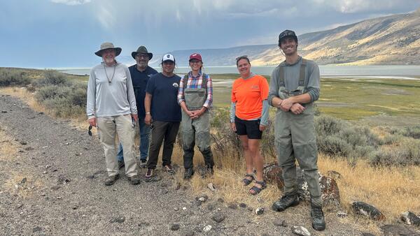
Saline Lake Ecosystems Integrated Water Availability Assessment researchers at Lake Abert
Saline Lake Ecosystems Integrated Water Availability Assessment researchers at Lake AbertSaline Lake Ecosystems Integrated Water Availability Assessment (IWAA) project researchers at Lake Abert.
From left to right:
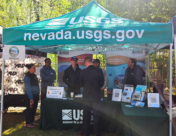
USGS booth at 2025 Tahoe Summit.
USGS booth at 2025 Tahoe Summit. Pictured from left, Sara Doyle (NV WSC), Zach Hood (NV WSC), David Smith (NV WSC), Ed Parvin (CAWSC) and Mark Dickman (CAWSC). Photograph by Ramon Naranjo (NV WSC) on 8/6/25.
USGS booth at 2025 Tahoe Summit. Pictured from left, Sara Doyle (NV WSC), Zach Hood (NV WSC), David Smith (NV WSC), Ed Parvin (CAWSC) and Mark Dickman (CAWSC). Photograph by Ramon Naranjo (NV WSC) on 8/6/25.
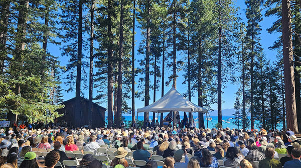
Crowd gathered at 2025 Tahoe Summit
Crown gathered at 2025 Tahoe Summit. The Lake Tahoe Summit is an annual event that brings local, federal, and state leaders together to discuss ways to protect Lake Tahoe and strengthen the partnership underlying the Lake Tahoe Environmental Improvement Program.
Crown gathered at 2025 Tahoe Summit. The Lake Tahoe Summit is an annual event that brings local, federal, and state leaders together to discuss ways to protect Lake Tahoe and strengthen the partnership underlying the Lake Tahoe Environmental Improvement Program.

Nearshore Algae
Algae along nearshore at Chimney Beach, Lake Tahoe.
Algae along nearshore at Chimney Beach, Lake Tahoe.
Science and Products
Quantifying watershed controls on fine sediment particles and nutrient loading to Lake Tahoe using data mining and machine learning
Since the late 1980’s, the USGS has collected discharge, sediment, and water quality data at seven major drainages under the Lake Tahoe Interagency Monitoring Program (LTIMP). Recently, continuous, real-time measurements of turbidity were added to the LTIMP. These data can be combined with in situ, model simulations, and remotely-sensed datasets available from the USGS, National Aeronautics and...
Science in the Carson River Basin
The Carson River is an important water resource for residents, agriculture, and wildlife. The USGS provides science support on water quality and quantity, as well as on the impacts of climate change on water resources in the basin.
Lake Tahoe Nearshore Periphyton Study
Periphyton, a type of algae, is growing on bottom sediment and rocks along nearshore areas of Lake Tahoe. Periphyton is seen as a nuisance and negatively impacts the recreational value of the lake. Periphyton biomass (PB) data collected along the nearshore of Lake Tahoe exhibit increasing trends over the last decade. However, the mechanisms that have caused these changes are not well understood.
Quantifying Seepage Losses on the Truckee Canal, Derby Dam to Lahontan Reservoir
Seepage losses from the Truckee Canal poses major challenges to water managers. Seepage losses result in inefficiencies in water delivery and cause more water than is needed by farmers to be diverted from the Truckee River to meet required demands. Increased diversions from the Truckee River result in less water flowing through the lower Truckee River system and into Pyramid Lake, a terminal lake...
Nutrient Source Identification in Groundwater and Periphyton Along the Nearshore of Lake Tahoe
High concentrations of phosphorus (P) and nitrogen (N) are responsible for excessive, or nuisance algal blooms in many ecosystems world-wide, and climate change is predicted to exacerbate the problem1,2. Excessive nutrients supplied to the nearshore zone of Lake Tahoe may have significant consequences to ecological communities, water clarity, and water quality. The nearshore zone represents the...
Occurrence and Mobility of Arsenic in Groundwater Used for Public Supply in Southern Carson Valley, Douglas County, Nevada
Over the past 15 years, Douglas County, Nev., has removed production wells in northern Carson Valley from use due to relatively high arsenic concentrations. To maintain the supply of water to the public, the town of Minden has been providing water to Douglas County and Carson City. Due to the projected increases in municipal demand, water resource managers are concerned that increasing pumping...
Evaluating Artificial Storage and Recovery Potential of Bedell Flat, Washoe County, Nevada
Truckee Meadows Water Authority (TMWA) is a public water purveyor in northwest Nevada with responsibility for providing water to approximately 385,000 people in the Reno/Sparks metropolitan area and suburban communities north of Reno. TMWA has a conjunctive use strategy, which includes aquifer storage and recovery (ASR), to both maintain the health of local aquifers and supplement limited water...
Lake Abert shoreline fluctuation over 24-hours
On the left, shallow lake water stretches across the expanse of the camera view. On the right, the shoreline has shifted significantly to the left in just one day.
On the left, shallow lake water stretches across the expanse of the camera view. On the right, the shoreline has shifted significantly to the left in just one day.
Saline Lake Ecosystems Integrated Water Availability Assessment researchers at Lake Abert
Saline Lake Ecosystems Integrated Water Availability Assessment researchers at Lake AbertSaline Lake Ecosystems Integrated Water Availability Assessment (IWAA) project researchers at Lake Abert.
From left to right:
USGS booth at 2025 Tahoe Summit.
USGS booth at 2025 Tahoe Summit. Pictured from left, Sara Doyle (NV WSC), Zach Hood (NV WSC), David Smith (NV WSC), Ed Parvin (CAWSC) and Mark Dickman (CAWSC). Photograph by Ramon Naranjo (NV WSC) on 8/6/25.
USGS booth at 2025 Tahoe Summit. Pictured from left, Sara Doyle (NV WSC), Zach Hood (NV WSC), David Smith (NV WSC), Ed Parvin (CAWSC) and Mark Dickman (CAWSC). Photograph by Ramon Naranjo (NV WSC) on 8/6/25.
Crowd gathered at 2025 Tahoe Summit
Crown gathered at 2025 Tahoe Summit. The Lake Tahoe Summit is an annual event that brings local, federal, and state leaders together to discuss ways to protect Lake Tahoe and strengthen the partnership underlying the Lake Tahoe Environmental Improvement Program.
Crown gathered at 2025 Tahoe Summit. The Lake Tahoe Summit is an annual event that brings local, federal, and state leaders together to discuss ways to protect Lake Tahoe and strengthen the partnership underlying the Lake Tahoe Environmental Improvement Program.
Nearshore Algae
Algae along nearshore at Chimney Beach, Lake Tahoe.
Algae along nearshore at Chimney Beach, Lake Tahoe.
*Disclaimer: Listing outside positions with professional scientific organizations on this Staff Profile are for informational purposes only and do not constitute an endorsement of those professional scientific organizations or their activities by the USGS, Department of the Interior, or U.S. Government