



Since 2009, the WFRC has partnered with Real Time Research to study bird predation of suckers. Scientists scan large nesting sites of fish-eating (piscivorous) birds, looking for PIT tags from juvenile and adult suckers that have been eaten by the birds.
Images
Images intro.
Filter Total Items: 262
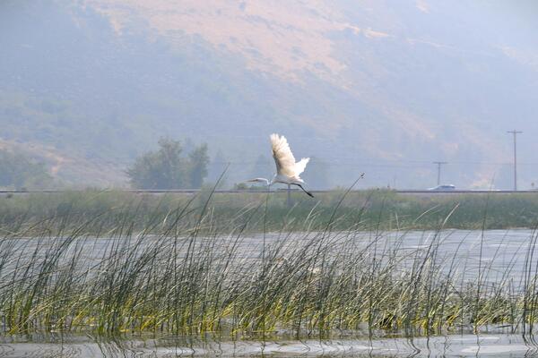
Pelican on Upper Klamath Lake
Since 2009, the WFRC has partnered with Real Time Research to study bird predation of suckers. Scientists scan large nesting sites of fish-eating (piscivorous) birds, looking for PIT tags from juvenile and adult suckers that have been eaten by the birds.
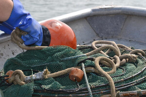
Nets Used to Sample Juvenile Suckers in Upper Klamath Lake, OR
Nets Used to Sample Juvenile Suckers in Upper Klamath Lake, ORLost River and Shortnose suckers are on the verge of extinction in Upper Klamath Lake. Age data indicate that almost all adult suckers remaining in the lake spawning populations were hatched in the early 1990s.
Nets Used to Sample Juvenile Suckers in Upper Klamath Lake, OR
Nets Used to Sample Juvenile Suckers in Upper Klamath Lake, ORLost River and Shortnose suckers are on the verge of extinction in Upper Klamath Lake. Age data indicate that almost all adult suckers remaining in the lake spawning populations were hatched in the early 1990s.
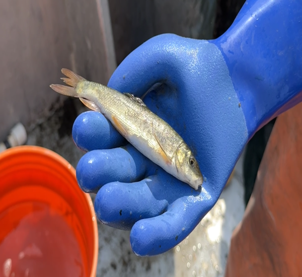
Endangered Klamath Sucker
This is a photo of the endangered Klamath Sucker in Upper Klamath Lake, OR. Through decades of research, scientists of the USGS Western Fisheries Research Center have determined that, over the last 30 years, something has prevented young suckers from reaching adulthood.
This is a photo of the endangered Klamath Sucker in Upper Klamath Lake, OR. Through decades of research, scientists of the USGS Western Fisheries Research Center have determined that, over the last 30 years, something has prevented young suckers from reaching adulthood.
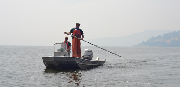
Sampling for Juvenile Klamath Suckers on Upper Klamath Lake, OR
Sampling for Juvenile Klamath Suckers on Upper Klamath Lake, ORWe pack up, leave shore, and head toward our first target—a set of trap nets--with tempered hopes of finding something exceedingly rare: evidence of surviving juvenile suckers. After hours on the lake and around 20 nets void of juvenile suckers, we steer the boat back towards the marshlands near our truck.
Sampling for Juvenile Klamath Suckers on Upper Klamath Lake, OR
Sampling for Juvenile Klamath Suckers on Upper Klamath Lake, ORWe pack up, leave shore, and head toward our first target—a set of trap nets--with tempered hopes of finding something exceedingly rare: evidence of surviving juvenile suckers. After hours on the lake and around 20 nets void of juvenile suckers, we steer the boat back towards the marshlands near our truck.
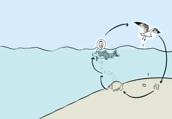
Life Cycle of Parasite Diplostomum gavium
This is an infographic of the life cycle of the parasite, Diplostomum gavium. This parasite affects the Sucker fish in the Upper Klamath Lake. Upper Klamath Lake is home to large colonies of birds and an abundance of snails and fish, making it a haven for trematodes who are reliant on all three for their life cycle. Birds host adult flukes in their intestines.
This is an infographic of the life cycle of the parasite, Diplostomum gavium. This parasite affects the Sucker fish in the Upper Klamath Lake. Upper Klamath Lake is home to large colonies of birds and an abundance of snails and fish, making it a haven for trematodes who are reliant on all three for their life cycle. Birds host adult flukes in their intestines.
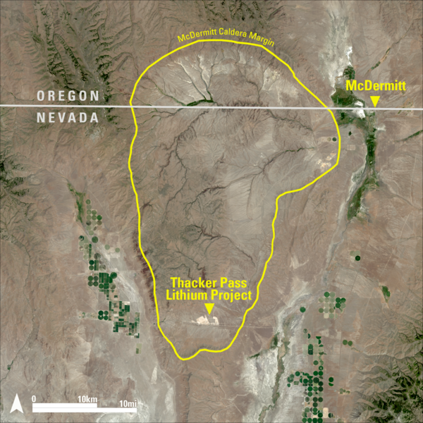
Landsat 8 Image of Thacker Pass
This Landsat 8 image highlights the McDermitt Caldera, which straddles the Nevada–Oregon border. The yellow boundary outlines the caldera margin, a geologic feature formed by a massive volcanic eruption millions of years ago. Over time, weathering of lithium-rich volcanic material led to the formation of clay deposits within the caldera basin.
This Landsat 8 image highlights the McDermitt Caldera, which straddles the Nevada–Oregon border. The yellow boundary outlines the caldera margin, a geologic feature formed by a massive volcanic eruption millions of years ago. Over time, weathering of lithium-rich volcanic material led to the formation of clay deposits within the caldera basin.
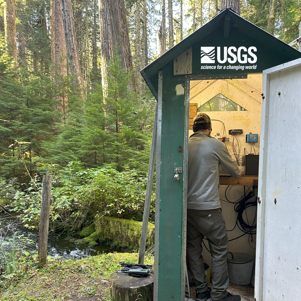
Hydrologic technician inspects gage equipment
A routine field visit at the Bull Run River at Lower Flume near Brightwood, Oregon (14138720). The U.S. Geological Survey operates several streamgages and monitoring stations throughout the Bull Run watershed.
A routine field visit at the Bull Run River at Lower Flume near Brightwood, Oregon (14138720). The U.S. Geological Survey operates several streamgages and monitoring stations throughout the Bull Run watershed.
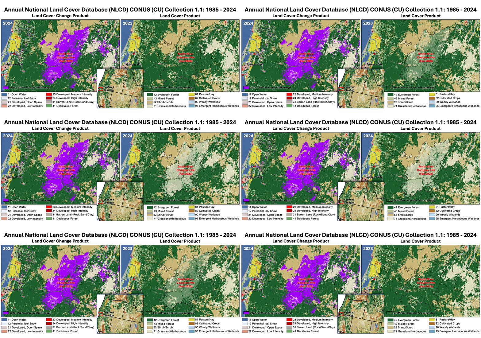
Annual NLCD animation of the Smith River Complex Fire land change between 2023 and 2024
Annual NLCD animation of the Smith River Complex Fire land change between 2023 and 2024This Annual National Land Cover Database (NLCD) animation shows how the Smith River Complex Fire, which occurred in the fall of 2023 at the California-Oregon border, left a devastating mark on the landscape.
Annual NLCD animation of the Smith River Complex Fire land change between 2023 and 2024
Annual NLCD animation of the Smith River Complex Fire land change between 2023 and 2024This Annual National Land Cover Database (NLCD) animation shows how the Smith River Complex Fire, which occurred in the fall of 2023 at the California-Oregon border, left a devastating mark on the landscape.
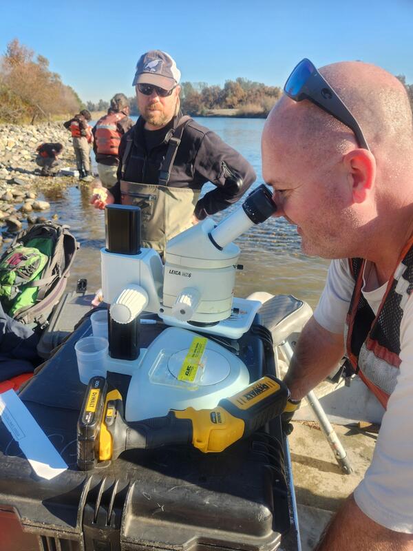
Chinook Salmon Egg Survival Fieldwork in the Sacramento River, CA
Chinook Salmon Egg Survival Fieldwork in the Sacramento River, CAThis is fieldwork from a Chinook salmon egg survival pilot study in the Sacramento River. Egg boxes were placed in the river at different locations to collect data on egg-to-fry survival. Some examples of data collected include water velocity and river flow, gravel temperature, scour and deposition, and sediment type.
Chinook Salmon Egg Survival Fieldwork in the Sacramento River, CA
Chinook Salmon Egg Survival Fieldwork in the Sacramento River, CAThis is fieldwork from a Chinook salmon egg survival pilot study in the Sacramento River. Egg boxes were placed in the river at different locations to collect data on egg-to-fry survival. Some examples of data collected include water velocity and river flow, gravel temperature, scour and deposition, and sediment type.
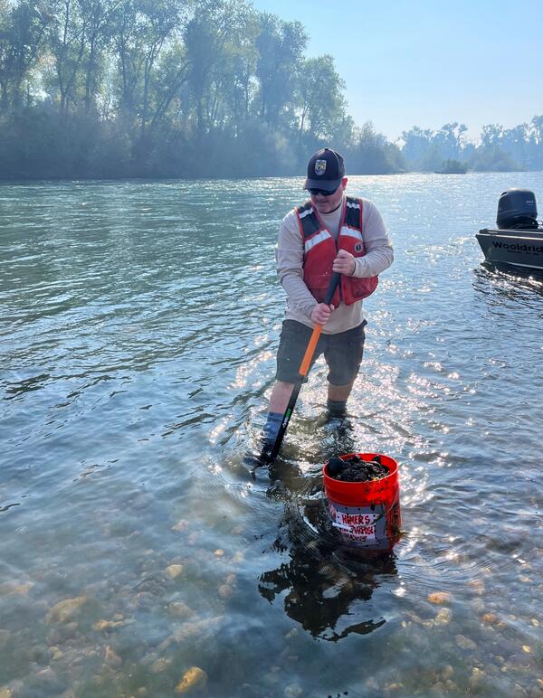
Chinook Salmon Egg Survival Study Fieldwork
This is a photo of fieldwork on the pilot Chinook egg survival study occurring in the Sacramento River, California.
This is a photo of fieldwork on the pilot Chinook egg survival study occurring in the Sacramento River, California.

The lower Granite Lock and Dam
This is the lower Granite Lock and Dam. Lower Granite Lock and Dam was authorized by the River and Harbor Act of 1945. The project includes a dam, a navigation lock, powerhouse, a fish ladder and associated facilities. It provides hydropower, navigation, flood risk management, fish and wildlife habitat, recreation and incidental irrigation.
This is the lower Granite Lock and Dam. Lower Granite Lock and Dam was authorized by the River and Harbor Act of 1945. The project includes a dam, a navigation lock, powerhouse, a fish ladder and associated facilities. It provides hydropower, navigation, flood risk management, fish and wildlife habitat, recreation and incidental irrigation.

Diagram of Gas Bubbles at Dam
This is a diagram of a cross section of a dam. This diagram is to show where gas bubble trauma could occur.
This is a diagram of a cross section of a dam. This diagram is to show where gas bubble trauma could occur.
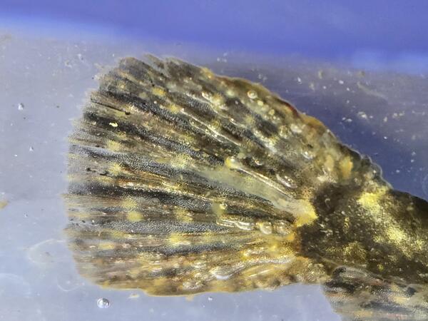
Fish Fin With Gas Bubble Trauma
To understand gas bubble trauma, imagine scuba divers surfacing too quickly. As pressure decreases, dissolved gases in their blood can form bubbles, causing joint pain, paralysis, and even death—a condition commonly known as “the bends.” Fish can experience something similar.
To understand gas bubble trauma, imagine scuba divers surfacing too quickly. As pressure decreases, dissolved gases in their blood can form bubbles, causing joint pain, paralysis, and even death—a condition commonly known as “the bends.” Fish can experience something similar.
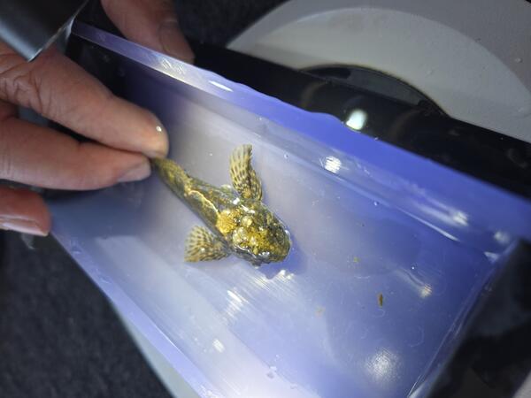
Sculpin with Gas Bubble Trauma
Since the early 1990s, WFRC has supported state and federal agencies by providing regular assessments of gas bubble trauma in salmon. But salmon aren’t the only fish affected. In 2020, scientists at the Cook lab began monitoring GBT in resident species like sculpin, northern pikeminnow, and three-spined stickleback.
Since the early 1990s, WFRC has supported state and federal agencies by providing regular assessments of gas bubble trauma in salmon. But salmon aren’t the only fish affected. In 2020, scientists at the Cook lab began monitoring GBT in resident species like sculpin, northern pikeminnow, and three-spined stickleback.
Chinook Salmon Egg Survival Fieldwork in the Sacramento River, CA
Chinook Salmon Egg Survival Fieldwork in the Sacramento River, CAThis is fieldwork from a Chinook salmon egg survival pilot study in the Sacramento River. Egg boxes were placed in the river at different locations to collect data on egg-to-fry survival. Some examples of data collected include water velocity and river flow, gravel temperature, scour and deposition, and sediment type.
Chinook Salmon Egg Survival Fieldwork in the Sacramento River, CA
Chinook Salmon Egg Survival Fieldwork in the Sacramento River, CAThis is fieldwork from a Chinook salmon egg survival pilot study in the Sacramento River. Egg boxes were placed in the river at different locations to collect data on egg-to-fry survival. Some examples of data collected include water velocity and river flow, gravel temperature, scour and deposition, and sediment type.
USGS Researchers Electrofishing on the Yakima River
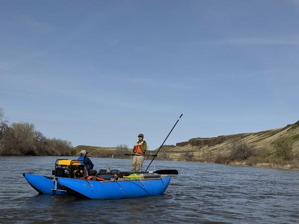
USGS Researchers Electrofishing on the Yakima RiverThis is a photo from our scientists working with the Yakama Nation to remove smallmouth bass and other invasive salmon-eating predators. The work involves taking fin clips, scales, diet samples, and tagging and releasing larger fish. This fieldwork will continue through late May 2025. The crew shown in the photos are Ben, Becky, Jeff, and Chloe.
USGS Researchers Electrofishing on the Yakima River
USGS Researchers Electrofishing on the Yakima RiverThis is a photo from our scientists working with the Yakama Nation to remove smallmouth bass and other invasive salmon-eating predators. The work involves taking fin clips, scales, diet samples, and tagging and releasing larger fish. This fieldwork will continue through late May 2025. The crew shown in the photos are Ben, Becky, Jeff, and Chloe.
Boat on Shasta Reservoir
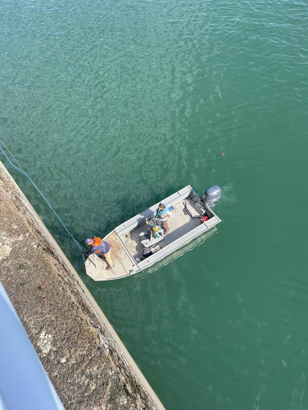
California Department of Fish & Wildlife boat on Shasta Reservoir partnering with USGS Western Fisheries Research Center to conduct telemetry studies.
California Department of Fish & Wildlife boat on Shasta Reservoir partnering with USGS Western Fisheries Research Center to conduct telemetry studies.

Telemetry Receivers on Shasta Reservoir, CA
Mitchell Morse and Caitlin Stockwell drove down to Redding, CA to wrap up the Shasta Reservoir fish telemetry project. They worked with California Department of Fish and Wildlife partners to remove 16 submersible acoustic telemetry receivers within the reservoir, and 5 receivers installed on Shasta Dam.
Mitchell Morse and Caitlin Stockwell drove down to Redding, CA to wrap up the Shasta Reservoir fish telemetry project. They worked with California Department of Fish and Wildlife partners to remove 16 submersible acoustic telemetry receivers within the reservoir, and 5 receivers installed on Shasta Dam.

Shasta Reservoir McCloud Arm
A photo of the McCloud arm looking upstream from one of the telemetry deployment sites.
A photo of the McCloud arm looking upstream from one of the telemetry deployment sites.
Shasta Dam
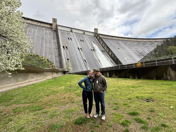
This is Shasta Dam in California. Mitchell Morse and Caitlin Stockwell drove down to Redding, CA to wrap up the Shasta Reservoir fish telemetry project. They worked with California Department of Fish and Wildlife partners to remove 16 submersible acoustic telemetry receivers within the reservoir, and 5 receivers installed on Shasta Dam.
This is Shasta Dam in California. Mitchell Morse and Caitlin Stockwell drove down to Redding, CA to wrap up the Shasta Reservoir fish telemetry project. They worked with California Department of Fish and Wildlife partners to remove 16 submersible acoustic telemetry receivers within the reservoir, and 5 receivers installed on Shasta Dam.
Owyhee Reservoir in Oregon
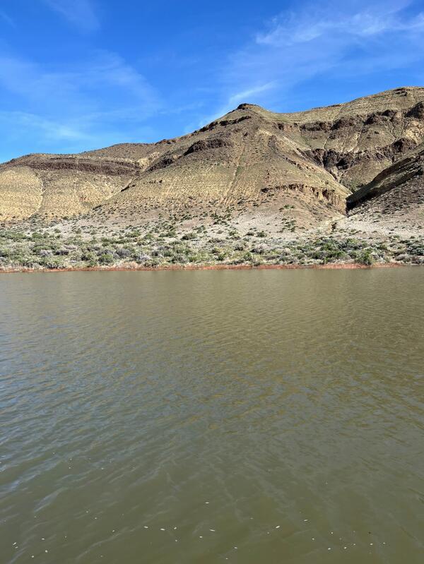
View of Owyhee Reservoir in Oregon. Water samples collected from this reservoir are used to validate satellite remote sensing of water quality.
View of Owyhee Reservoir in Oregon. Water samples collected from this reservoir are used to validate satellite remote sensing of water quality.