
Firelight - Vol. 4 | Issue 1
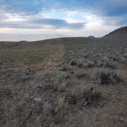
Post-fire Debris Flow
Post-fire Debris Flow
-

Postfire debris-flow hazards
Wildfires can dramatically alter how water moves across the landscape. After a fire, vegetation is removed and soil properties change, reducing the ground’s ability to absorb rainfall. As a result, even modest rainstorms can trigger dangerous flash floods and debris flows in steep burned areas. Postfire debris flows are fast-moving mixtures of water, mud, rocks, and vegetation that can surge...
-

Post-Fire Sediment Research at the Pacific Coastal and Marine Science Center
The USGS Pacific Coastal and Marine Science Center (PCMSC) in Santa Cruz, California, has been growing our post-fire research contributions since 2017, through studies of post-fire sediment movement that address the Natural Hazards Mission Area objectives for understanding wildfire hazards.
-
2024 Elk Fire Postfire Flooding and Debris Flows 2024 Elk Fire Postfire Flooding and Debris Flows
This geonarrative explores why the Elk Fire left the landscape vulnerable to flooding and debris flows and documents the resulting impacts using maps, videos, and field photographs. The U.S. Geological Survey (USGS) evaluates postfire debris-flow hazard to help identify areas with the greatest risk.
-

Effects of Wildfire and Fire Retardants on Nutrient Transport in California Watersheds
Large wildfires have increased in size and frequency in the western United States over the past several decades. This has led to increased soil erosion and the transport of sediment containing nutrients into streams and reservoirs. Excess nutrients typically lead to the increased production of algae which can then lead to low levels of dissolved oxygen. This degrades the habitat for fish and...
Water Quality
Water Quality
-

Water Quality After Wildfire
Wildfires pose a substantial risk to water supplies because they can lead to severe flooding, erosion, and delivery of sediment, nutrients, and metals to rivers, lakes, and reservoirs. The USGS works with federal and state land managers and local water providers to monitor and assess water quality after wildfires in order to help protect our Nation’s water resources.
-
How Wildfires Threaten U.S. Water Supplies How Wildfires Threaten U.S. Water Supplies
The 2020 fire season provided stark evidence that wildfires are changing the landscape of America. But when a forest burns, the impacts on water supply and quality last long after the flames go out. Learn more about how wildfires threaten U.S. water supplies – and what we can do to adapt to the complex impacts of hotter and bigger fires.
Fuels Treatment Effectiveness, Burn Severity, and Long-term Recovery
Fuels Treatment Effectiveness, Burn Severity, and Long-term Recovery
-

National Fuels Treatment and Post-fire Treatment Effectiveness Assessment Strategies
Managing wildland fuels and post-fire environments are key strategies to reduce the risk and negative impacts of wildfire, and can even promote beneficial effects of wildfire. Researchers from the U.S. Geological Survey are reviewing, summarizing, and analyzing what is currently known about fuel treatment and post-fire treatment effectiveness in the United States. Monitoring and evaluating the...
-

Post-Fire Restoration
Exotic plant invasions and increasing wildfire have greatly impacted rangelands in the American West, particularly areas that normally support perennial shrub-steppe vegetation. The FIREss team produces science to inform proactive and reactive management of sagebrush steppe with the goal of increasing resistance to invasion and resilience to wildfire. Many on the team participate in fire...
-

LTDL and LTET Team (FRESC)
The Land Treatment Digital Library (LTDL) and The Land Treatment Exploration Tool (LTET) are practical resources for land managers planning restoration and rehabilitation projects on public lands.
-

Expanded Access to Real-Time Burn Severity Mapping
Near real-time burn severity maps are created by request to support Burned Area Emergency Response Teams managed by the US Forest Service and Department of the Interior agencies. This project expands the availability of these data for additional post-fire landscapes to support post-fire stabilization and rehabilitation activities of local, state, tribal, and non-land management federal agencies.
-

Using Drone Imagery to Assess Impacts of the 2018 Carr Fire
USGS WERC’s Dr. Karen Thorne and her research team are using drone imagery to understand how the 2018 Carr Fire affected ecosystems and cultural resources. The study, a collaboration with the National Park Service (NPS), focuses on Whiskeytown National Recreation Area in northern California. The drone images will help the WERC researchers identify changes in topography, cultural sites, debris...
-

Characterizing Post-Fire Burn Severity And Vegetation Recovery At High Spatial And Temporal Resolutions Using Basal Area Measurements
USGS scientists are studying the effects of wildfires on forests and developing models to predict forest recovery potential after fires. They have collected and analyzed data from several recent California wildfires, including the Dixie, Caldor, KNP Complex, Carr, and Mosquito fires. Researchers are using the data to analyze changes in basal area (the cross-sectional area of tree trunks) to...
-
Edge effects along roadside fuel treatments in sagebrush steppe Edge effects along roadside fuel treatments in sagebrush steppe
Does the construction of fuel breaks in sagebrush steppe increase the risk of exotic grass invasion? Researchers surveyed for invaders along fuel break edges to find out.
Data
Data
-
2024 Post-Wildfire Debris-Flow Hazard Assessments 2024 Post-Wildfire Debris-Flow Hazard Assessments
Wildfire can substantially alter the hydrologic response of watersheds to rainfall, and debris-flow activity is among the most destructive consequences of these events. To assist federal, state, and local agencies in planning for postfire hazards, the U.S. Geological Survey (USGS) conducts debris-flow hazard assessments for recent wildfires. This collection holds all postfire debris-flow...
Publications
Publications
-
Post-wildfire water quality and aquatic ecosystem response in the U.S. Pacific Northwest: science and monitoring gaps Post-wildfire water quality and aquatic ecosystem response in the U.S. Pacific Northwest: science and monitoring gaps
An increase in the occurrence of large, high severity wildfires in the western Pacific Northwest (PNW), USA, has created an urgent need for science to better inform forest management and policy decisions to maintain source water quality in the region. The western PNW faces similar challenges to other regions with shifting wildfire regimes and large population centers reliant on surface...Helping California get ready for when the mud hits the fan Helping California get ready for when the mud hits the fan
With frequent wildfires, powerful rainstorms, steep terrain, and dense population, California is particularly vulnerable to postfire hazards like flooding and debris flow. Major postfire flooding and debris-flow events can be more costly than the fire itself, causing dozens of fatalities and widespread damage (Chawner, 1934; Lancaster et al., 2021). Smaller events occur nearly every year...
USGS Wildland Fire Science
USGS Wildland Fire Science