
Land Management
Land Management
Learn more about FORT research on land management.
Land management research in support of the Department of the Interior
Land management research in support of the Department of the Interior
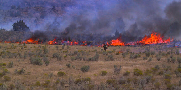
FORT researchers provide sound science to support the Department of the Interior in its efforts to streamline reliable energy development, enhance cost efficiency in public lands management, and manage fire-prone habitats for public safety.
Filter Total Items: 136

Human Dimensions of Resource Management
Human dimensions in the context of natural resource management refers to understanding attitudes, preferences, and behaviors of American citizens in order to improve conservation and management of public lands and waters. Human Dimensions at the FORT also includes understanding the users and applications of data and technology in the context of natural resource management.

Feasibility of Remote Sensing Data Sets for Evaluation of Next Generation Fire Behavior Models
U.S. Geological Survey (USGS) scientists are working with the U.S. Department of Defense (DoD) Environmental Security Technology Certification Program (ESTCP) to advance efforts to deploy next generation fire behavior models through a research-to-operations transition to enable land managers to use advanced modeling tools for real-time decision making. As part of this effort, USGS is leading an...

Fish and wildlife science in support of heritage preservation, efficient decision making, wild ungulate management, and outdoor recreation
FORT researchers provide sound science to support the Department of Interior in its efforts to preserve American heritage, streamline species listing decisions and promote species recovery, manage wild horses and burros using efficient, cost-effective tools, and sustain hunting and fishing on public lands. This research is developed in partnership with resource managers from local, State, Federal...

Estimating locally relevant scales of effect for population trends of a species of conservation concern
Wildlife movement and distribution can be influenced by local conditions like topography and landscape features, and the distances within which species respond to their landscape – scales of effect – can vary over space and time. We are estimating scales of effect for wildlife population trends to help land managers determine the distance within which wildlife will respond to landscape change.

Prioritizing restoration and conservation of sagebrush ecosystems in northwestern Colorado
We are working with Colorado Parks and Wildlife (CPW) to pilot an expansion of the Prioritizing Restoration of Sagebrush Ecosystems Tool (PReSET; Duchardt et al. 2021) across northwestern Colorado. We recently completed Phase I of this project where we leveraged existing data resources to provide customized scenarios that are now directly guiding landscape-scale conservation delivery by CPW...

Fire Behavior and Effects Model Evaluation and Demonstration across Innovation Landscapes.
U.S. Geological Survey (USGS) scientists are working with the U.S. Department of War (DoW) Environmental Security Technology Certification Program (ESTCP) to demonstrate and improve how next-generation fire behavior models inform land management decision-making for partners within the National Innovation Landscape Network (Innovation Landscapes Network). Specifically, this project looks to...

Economics of Outdoor Recreation
Planning and managing outdoor recreation on public land and water entails a series of choices, many of which are economic in nature. Economics is useful for informing a wide range of decision-making processes in the context of outdoor recreation management, including why people choose to engage in recreation and where, how people substitute between different types of recreation activities and...

Fostering greater use of habitat models for managing rare and invasive plants on public lands
Habitat models can provide critical information on the current and potential distribution of plant species, as well as help target and support conservation efforts. Despite their potential utility in public land management, model use may be constrained by a variety of factors including staff access to and trust in models. In this project, we seek to bring together model users and model developers...

Counting America’s Wild Horses and Burros: Better Estimates for Population Management
The Wild Free-Roaming Horses and Burros Act of 1971, as amended, states that, "It is the policy of Congress that wild free-roaming horses and burros shall be protected from capture, branding, harassment, or death; and to accomplish this they are to be considered in the area where presently found, as an integral part of the natural system of the public lands (PL 92-195, Sec. 1331, Congressional...

Economic Impacts of Public Lands Management
Federal investments in land management projects protect Federal trusts, ensure public health and safety, and preserve and enhance the benefits provided by ecosystems to people. These investments also generate business activity and create jobs. However, limited information often exists on the costs and associated economic impacts of public land management activities.

Economic Implications of Sagebrush Treatment and Restoration Practices Across the Great Basin and Wyoming
USGS and Colorado State University researchers are conducting analyses and predictions of sagebrush recovery in the Great Basin and Wyoming and assess the role of weather, soils, and reseeding treatments.

Economic assessment of addressing annual invasive grasses across the sagebrush biome
This interdisciplinary project combines expert judgment on treatment costs with spatially explicit ecological modeling to estimate the financial resources needed to address the threat of invasive annual grass across the entire sagebrush biome. Results of the assessment will provide economic insights that can inform cost-effective resource allocation to efficiently achieve sagebrush conservation...