
Continuous water quality gaging station located at Norwalk River at Norwalk Aquarium near South Norwalk, Connecticut (USGS site ID 410606073245700)
Images
Click through our gallery of photographs showcasing New England Water Science Center research projects and monitoring work throughout the region.
Filter Total Items: 601

Continuous water quality gaging station
Continuous water quality gaging station located at Norwalk River at Norwalk Aquarium near South Norwalk, Connecticut (USGS site ID 410606073245700)

Inspecting the water quality monitoring equipment
New England WSC hydrologic technician inspecting the continuous water quality monitoring equipment deployed at 410606073245700, Norwalk River at the Norwalk Aquarium.
New England WSC hydrologic technician inspecting the continuous water quality monitoring equipment deployed at 410606073245700, Norwalk River at the Norwalk Aquarium.

Inspecting continuous water quality monitoring equipment
Inspecting continuous water quality monitoring equipmentNew England WSC scientists inspecting the continuous water quality monitoring equipment deployed at 410606073245700, Norwalk River at the Norwalk Aquarium.
Inspecting continuous water quality monitoring equipment
Inspecting continuous water quality monitoring equipmentNew England WSC scientists inspecting the continuous water quality monitoring equipment deployed at 410606073245700, Norwalk River at the Norwalk Aquarium.
USGS Buoy
A buoy is deployed at the Merrimack River estuary (USGS site 011008745) just off of Salisbury MA from May to October each year.
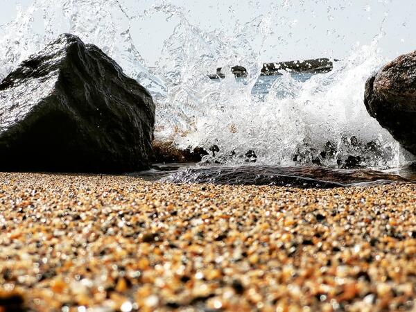
Wave Crashing on Beach in Reid State Park, Maine
A wave crashes on the sand at a beach in Reid State Park in Georgetown, Maine.
A wave crashes on the sand at a beach in Reid State Park in Georgetown, Maine.

Scituate Reservoir, Rhode Island
Scituate Reservoir on Plainfield Pike, Scituate, RI.
Photo taken on the eastern side of the reservoir, facing northwest.
Scituate Reservoir on Plainfield Pike, Scituate, RI.
Photo taken on the eastern side of the reservoir, facing northwest.

Measuring water quality properties
Photograph of U.S. Geological Survey technician measuring water quality properties at USGS streamgage 01115265, Hemlock Brook at King Road near Foster, Rhode Island.
Photograph of U.S. Geological Survey technician measuring water quality properties at USGS streamgage 01115265, Hemlock Brook at King Road near Foster, Rhode Island.

Installation of continuous water quality station
Installation of continuous water quality gaging station at Mystic River at RAM Island Yacht Club at Noank, Connecticut (USGS site ID 411940071590300)
Installation of continuous water quality gaging station at Mystic River at RAM Island Yacht Club at Noank, Connecticut (USGS site ID 411940071590300)

Multi-parameter probes, temperature and dissolved oxygen sensors
Multi-parameter probes, temperature and dissolved oxygen sensors(A) Examples of the multi-parameter water-quality probes used for continuous fixed-station monitoring, moving boat surveys, and vertical water-quality profiles. (B) Example of smaller temperature and dissolved oxygen sensors with and without a wiper unit.

Conducting a discharge measurement
Hydrologic technician conducting a discharge measurement at USGS site 011006988, Merrimack River at Bates Bridge, Haverhill Massachusetts.
Hydrologic technician conducting a discharge measurement at USGS site 011006988, Merrimack River at Bates Bridge, Haverhill Massachusetts.

Collecting a water-quality sample from a boat
Hydrologic technicians collecting a water-quality sample from a boat at USGS site 011006988, Merrimack River at Bates Bridge, Haverhill, Massachusetts.
Hydrologic technicians collecting a water-quality sample from a boat at USGS site 011006988, Merrimack River at Bates Bridge, Haverhill, Massachusetts.

Examples of monitoring buoys
Examples of monitoring buoys deployed in (A) 2018 and (B) 2019 and (C) example of a bottom cage containing a sensor.
Examples of monitoring buoys deployed in (A) 2018 and (B) 2019 and (C) example of a bottom cage containing a sensor.

USGS Station ID 01075000 Pemigewasset River high-water mark monument
USGS Station ID 01075000 Pemigewasset River high-water mark monumentUSGS station ID 01075000 Pemigewasset River at Woodstock, New Hampshire. The high-water mark monument was installed in May 2021, and shows the peak for the period of record at this gage was from Tropical Storm Irene. It still remains the highest peak to this day.


Mousam River at West Kennebunk, Maine
Hydrologic Technician Andy Cloutier visited USGS gaging station 01069500 on the Mousam River at West Kennebunk, Maine in mid-April of 2021.
Hydrologic Technician Andy Cloutier visited USGS gaging station 01069500 on the Mousam River at West Kennebunk, Maine in mid-April of 2021.

Bridge board sampler for collecting water-quality samples
Bridge board sampler for collecting water-quality samplesA bridge board sampler used for collecting water-quality samples set up at USGS site 01100000, Merrimack River, Lowell, Massachusetts.
Bridge board sampler for collecting water-quality samples
Bridge board sampler for collecting water-quality samplesA bridge board sampler used for collecting water-quality samples set up at USGS site 01100000, Merrimack River, Lowell, Massachusetts.

Continuous stage only gaging station
Continuous stage only gaging station located at Mystic River at Rt. 1 bridge, Connecticut (USGS Site ID 412117071580800)
Continuous stage only gaging station located at Mystic River at Rt. 1 bridge, Connecticut (USGS Site ID 412117071580800)

Tidal monitoring gage
Tidal monitoring gage on a drawbridge over the Mystic River in Mystic, Connecticut.
Tidal monitoring gage on a drawbridge over the Mystic River in Mystic, Connecticut.

Burlington Falls on Bunnell Brook
Studying the mountain streams and rivers of New England means never being too far from a scenic and historic waterfall, like the Burlington Falls on Bunnell Brook pictured here. This natural resource attracted small industries to a mostly rural Burlington, CT in the early-19th century.
Studying the mountain streams and rivers of New England means never being too far from a scenic and historic waterfall, like the Burlington Falls on Bunnell Brook pictured here. This natural resource attracted small industries to a mostly rural Burlington, CT in the early-19th century.

Gainer Memorial Dam, Scituate Reservoir, Rhode Island
Gainer Memorial Dam, Scituate Reservoir, Rhode IslandThe north side of the Gainer Memorial Dam, Scituate Reservoir, Rhode Island.
Gainer Memorial Dam, Scituate Reservoir, Rhode Island
Gainer Memorial Dam, Scituate Reservoir, Rhode IslandThe north side of the Gainer Memorial Dam, Scituate Reservoir, Rhode Island.

Gainer Memorial Dam, Rhode Island
The south side of the Gainer Memorial Dam, Scituate Reservoir, Rhode Island. The reservoir began storing water on November 10, 1925.
The south side of the Gainer Memorial Dam, Scituate Reservoir, Rhode Island. The reservoir began storing water on November 10, 1925.