



Coastal Hydrology
Coastal Hydrology
Filter Total Items: 19
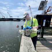
Algal Community Composition within the Lower Norwalk River
Harmful algal blooms (HABs), fish kills, and shellfish contamination are increasingly affecting coastal estuaries like the Norwalk River. Understanding the microscopic algae responsible for these events is essential for protecting public health, local economies, and marine ecosystems. As the environmental conditions of estuaries continue to change from nutrient enrichment, warming temperatures...
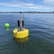
Coastal Water-Quality Monitoring in Massachusetts
The U.S. Geological Survey (USGS) operates high‑resolution, continuous water‑quality monitoring stations in estuaries across coastal Massachusetts to better understand these dynamic ecosystems. These efforts include collaborations with the Massachusetts Bays National Estuary Partnership (MassBays) and the Massachusetts Department of Environmental Protection (MassDEP) to support Clean Water Act...
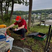
Changes in Nitrogen Contributions from Groundwater to the Niantic River Before and After Sewering
Onsite residential septic systems can be a major nonpoint source of nitrogen contamination. The excess nitrogen entering Connecticut’s Niantic River estuary is associated with high nitrate concentrations in the groundwater of the river’s 28-square-mile watershed, creating unsuitable habitat for the growth and recovery of eelgrass (Zostera marina). In an attempt to improve the river’s water quality...

Estimating Nitrogen Loading from Groundwater and Potential Effects of Sea-Level Rise in Rhode Island's Salt Ponds Region
The U.S. Geological Survey (USGS), in cooperation with the Southeast New England Program of the U.S. Environmental Protection Agency, is estimating the magnitude, spatial distribution, and travel times of nitrogen-loading to ponds and streams in the Salt Ponds region of southern Rhode Island. This information can be used to guide conservation-management efforts aimed at reducing nitrogen inputs to...

Effects of Sea-Level Rise and Climate Change on the Groundwater-Flow System of Martha’s Vineyard, Massachusetts
The U.S. Geological Survey (USGS), in cooperation with the Massachusetts Department of Environmental Protection (MassDEP), is investigating the effects of sea-level rise and climate change on the groundwater resources of Martha’s Vineyard, Massachusetts.

Water Quality Monitoring of Merrimack River Watershed
The U.S. Geological Survey, in cooperation with the Massachusetts Department of Environmental Protection (MassDEP), is currently conducting a 4-year water-quality investigation in the lower portion of the Merrimack River watershed, April 2020 – October 2024.

Water Quality Sampling in the Tributaries of the Long Island Sound
Coastal estuaries in southern New England and New York show the effects of excess nutrients and coastal eutrophication. These include excessive growth of macroalgae, excessive blooms of phytoplankton, oxygen depletion, hypoxia and deteriorated substrates. State and Federal regulators have responded to these nutrient-caused impairments by requiring more stringent permit limits for National...

Flood Documentation and Inundation Mapping of the January and March 2018 Nor’easters in Coastal Massachusetts
2018 Nor’easters in Coastal Massachusetts

Embayment Monitoring to Support Nutrient Management Activities in Connecticut for Long Island Sound
The USGS, in cooperation with the Connecticut Department of Energy and Environmental Protection will be collecting water-quality and hydrologic data at six embayments from April 2021 to June 2027: Mystic, Norwalk, Saugatuck, Sasco-Southport complex, Farm, and Poquonnock.

Remembering Tropical Storm Irene in New England
On August 28, 2011 Tropical Storm Irene made landfall in New England, leading to coastal storm surge, significant riverine flooding, sediment transport to Long Island Sound, and major infrastructure damage and destruction. Ten years later, the USGS New England Water Science Center looks back at Irene, the data collected by our Center during the event, the response by our employees before, during...

Assessment of Nutrient Transport and Discharge to Coastal Embayments, Wickford, Rhode Island
In 2020, the USGS began a partnership with the U.S. Environmental Protection Agency (EPA) Region 1 Southeast New England Program for Coastal Watershed Restoration (SNEP) and EPA Office of Research and Development (ORD), Atlantic Coastal Sciences Division, Narragansett, RI in support of water-quality and ecological monitoring being conducted by ORD in the coastal waters around Wickford, RI. The...

Monitoring Merrimack River Mainstem and Tidal Reaches in Massachusetts to Evaluate Water Quality Conditions, May to September 2020
The Merrimack River watershed, the 4th largest watershed in New England (Massachusetts Executive Office of Environmental Affairs, 2001), has seen substantial growth and development in recent years.