
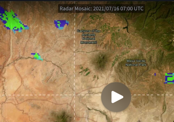
Precipitation radar mosaic videos of snapshots in time from 2021 and 2022. Data are from NOAA. This is for the San Juan River website by New Mexico Water Science Center
Images
All images in this gallery are considered public domain unless otherwise noted.
Filter Total Items: 102
Precipitation radar mosaic
Precipitation radar mosaic videos of snapshots in time from 2021 and 2022. Data are from NOAA. This is for the San Juan River website by New Mexico Water Science Center
BernCo Emerging Site Map
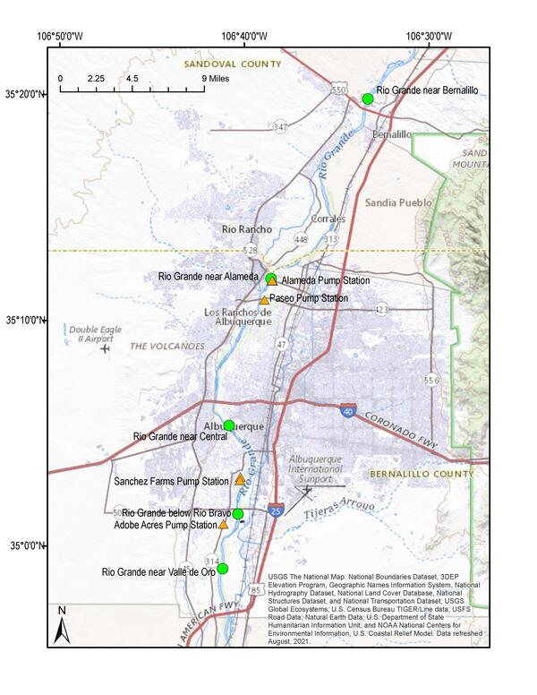
Study site area of pump stations centered around Albuquerque, New Mexico
Study site area of pump stations centered around Albuquerque, New Mexico
CAFB_Study_Area_Updated
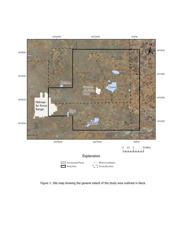
The Cannon Air Force Base project study area includes eastern New Mexico and western Texas.
The Cannon Air Force Base project study area includes eastern New Mexico and western Texas.
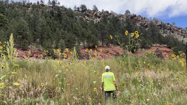
Sunflower Field at Mora River in La Cueva, NM
One of our scientists walks through a field of sunflowers to access one of our streamgaging sites on Mora River in La Cueva, NM.
One of our scientists walks through a field of sunflowers to access one of our streamgaging sites on Mora River in La Cueva, NM.
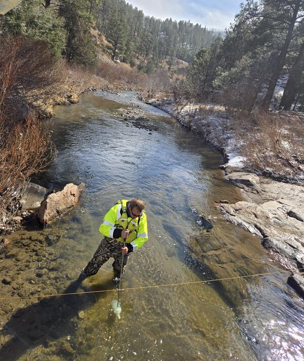
Gallinas Creek Suspended Sediment Collection
Hydrologist Mike Whiting stands in the water at Gallinas Creek in north-central New Mexico. He is holding a DH-81 sampler under water to collect a suspended sediment sample.
Hydrologist Mike Whiting stands in the water at Gallinas Creek in north-central New Mexico. He is holding a DH-81 sampler under water to collect a suspended sediment sample.
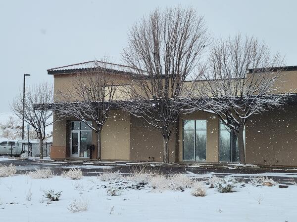
Snowy Las Cruces
Winter weather moved through southern New Mexico in January 2025, leading to our Las Cruces office receiving a dusting of snow.
Winter weather moved through southern New Mexico in January 2025, leading to our Las Cruces office receiving a dusting of snow.
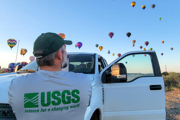
Albuquerque International Balloon Fiesta
One of our scientists got an up-close view to the annual Albuquerque International Balloon Fiesta while visiting one of our local field sites.
One of our scientists got an up-close view to the annual Albuquerque International Balloon Fiesta while visiting one of our local field sites.
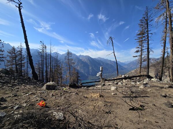
Aftermath of a Wildfire in Ruidoso, NM
An early-warning rain gauge is installed on a burn scar within the Sierra Blanca Mountain Range in Ruidoso, NM. As the risk of flooding substantially increases after a wildfire, this gauge provides us with critical flood information when it rains or snows.
An early-warning rain gauge is installed on a burn scar within the Sierra Blanca Mountain Range in Ruidoso, NM. As the risk of flooding substantially increases after a wildfire, this gauge provides us with critical flood information when it rains or snows.
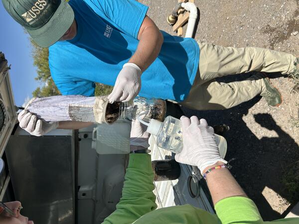
Microplastic Sample chamber
Two hydrologists rinsing materials from a microplastics collection chamber into a glass jar that is sent to the lab for analysis.
Two hydrologists rinsing materials from a microplastics collection chamber into a glass jar that is sent to the lab for analysis.
Team Microplastics Sampling Alameda.jpg
USGS team members preparing to sample the Rio Grande near Alameda (USGS-08329918) in fall 2024 for microplastics using the ‘pump-sampler’ method.
USGS team members preparing to sample the Rio Grande near Alameda (USGS-08329918) in fall 2024 for microplastics using the ‘pump-sampler’ method.
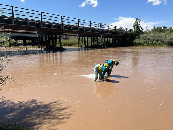
Net Sampler Rio Grande
USGS hydrologists conducting microplastics sampling using the ‘in-stream-net’ method.
USGS hydrologists conducting microplastics sampling using the ‘in-stream-net’ method.
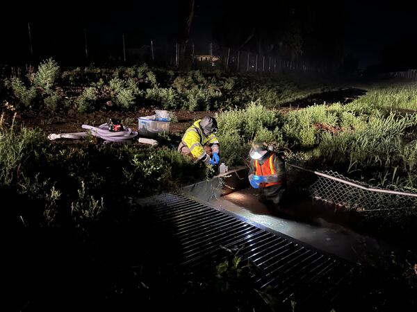
ABQ_Night_Sampling
USGS employees surface water sampling during evening monsoon storm in July 2024 at Adobe Acres Inflow at Albuquerque, New Mexico – USGS-350100106410810.
USGS employees surface water sampling during evening monsoon storm in July 2024 at Adobe Acres Inflow at Albuquerque, New Mexico – USGS-350100106410810.
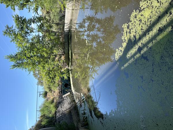
OutfallAlameda_w-Algae
Photograph of stormwater outfall sampling location, Alameda Pump Station Outflow – USGS-351146106382801
Photograph of stormwater outfall sampling location, Alameda Pump Station Outflow – USGS-351146106382801

USGS scientist retrieves water quality sensor on the Rio Grande in Albuquerque, New Mexico
USGS scientist retrieves water quality sensor on the Rio Grande in Albuquerque, New MexicoUSGS scientist Kimberly Beisner retrieves a water quality sensor on the Rio Grande for a PFAS study in Albuquerque, New Mexico.
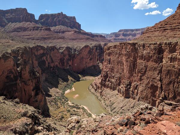
Grand_Canyon_20230908_Brennan.jpg
Photograph of the Colorado River in the Grand Canyon, Arizona, USA. Photo taken on September 8, 2023.
By
Core Science Systems Mission Area, Natural Hazards Mission Area, Water Resources Mission Area, Mineral Resources Program, National Cooperative Geologic Mapping Program, National Water Quality Program, Toxic Substances Hydrology, Geology, Geophysics, and Geochemistry Science Center, Geology, Minerals, Energy, and Geophysics Science Center, Geosciences and Environmental Change Science Center, New Mexico Water Science Center, Southwest Biological Science Center, Denver Radiogenic Isotope Lab, National Water Quality Laboratory, New Mexico Water Science Center Sediment Laboratory, Organic Geochemistry Laboratory, Geological Materials Repository, Geology and Ecology of National Parks, Colorado River Basin: Actionable and Strategic Integrated Science and Technology

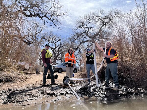
PFAS Surface Water Sampling
Photograph of PFAS sampling at Animas near Farmington, NM, USGS - New Mexico Water Science Center.
Photograph of PFAS sampling at Animas near Farmington, NM, USGS - New Mexico Water Science Center.

PFAS SW Site Map
Image of Site Map of PFAS Surface Water Sites, USGS - New Mexico Water Science Center
Image of Site Map of PFAS Surface Water Sites, USGS - New Mexico Water Science Center

NMWSC Sediment Lab, RO-TAP (Dry-Sieve Shaker) Machine in Shed with a Sieve Stack Ready to Run
NMWSC Sediment Lab, RO-TAP (Dry-Sieve Shaker) Machine in Shed with a Sieve Stack Ready to RunNMWSC Sediment Laboratory, RO-TAP (Dry-Sieve Shaker) Machine in Shed with a Sieve Stack Ready to Run
NMWSC Sediment Lab, RO-TAP (Dry-Sieve Shaker) Machine in Shed with a Sieve Stack Ready to Run
NMWSC Sediment Lab, RO-TAP (Dry-Sieve Shaker) Machine in Shed with a Sieve Stack Ready to RunNMWSC Sediment Laboratory, RO-TAP (Dry-Sieve Shaker) Machine in Shed with a Sieve Stack Ready to Run

NMWSC Sediment Laboratory, Visual Accumulation (VA) Tube Setup (an older but still valid method of analyzing sand grain size composition)
NMWSC Sediment Laboratory, Visual Accumulation (VA) Tube Setup (an older but still valid method of analyzing sand grain size composition)NMWSC Sediment Laboratory, Visual Accumulation (VA) Tube Setup (an older but still valid method of analyzing sand grain size composition)

NMWSC Sediment Laboratory, Pipet Bath Used to Withdraw Aliquots for Full-size Analysis of Fine Material
NMWSC Sediment Laboratory, Pipet Bath Used to Withdraw Aliquots for Full-size Analysis of Fine MaterialNMWSC Sediment Laboratory, Pipet Bath Used to Withdraw Aliquots for Full-size Analysis of Fine Material

NMWSC Sedimentary Lab, 2.5 Inch Sieve Stack Setup to Wet Sieve Sand Grains over a Filtered Dish
NMWSC Sedimentary Lab, 2.5 Inch Sieve Stack Setup to Wet Sieve Sand Grains over a Filtered DishNew Mexico Water Science Center Sediment Lab, 2.5 Inch Sieve Stack Setup to Wet Sieve Sand Grains over a Filtered Dish