U.S. flag

An official website of the United States government

Images

Images intro.
Filter Total Items: 30
Two USGS scientists on a motorboat with sampling gear on a river
Cruising down the Kalamazoo River

Angus Vaughan (USGS Upper Midwest Environmental Sciences Center, right) and Heidi Broerman (USGS Upper Midwest Water Science Center, left) pilot a research vessel down the Kalamazoo River, Michigan toward a reference reach where riverbed substrate will be characterized.

Angus Vaughan (USGS Upper Midwest Environmental Sciences Center, right) and Heidi Broerman (USGS Upper Midwest Water Science Center, left) pilot a research vessel down the Kalamazoo River, Michigan toward a reference reach where riverbed substrate will be characterized.

ADCP data of  the St. Croix River, near Franconia, Minnesota, in May 2021
ADCP data of the St. Croix River, near Franconia, Minnesota, in May 2021

Figure 4. River current velocities captured on the St. Croix River, near Franconia, Minnesota, in May 2021.

A smiling woman stands holding a large silver fish.  She is wearing brown pants, green tshirt and a neon green vest.
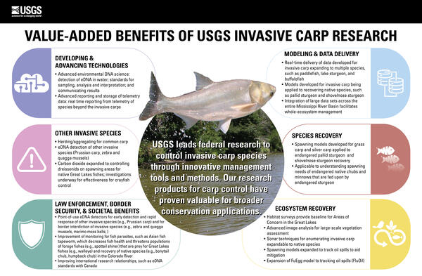
"Carp"e Diem!
"Carp"e Diem!
"Carp"e Diem!

USGS scientist Andres Fritts holding a telemetered invasive bighead carp on the Mississippi River near Keokuk, Iowa.

USGS scientist Andres Fritts holding a telemetered invasive bighead carp on the Mississippi River near Keokuk, Iowa.

Prairie grassland flowers on the Upper Midwest Environmental Sciences Center campus.
Grassland at the Upper Midwest Environmental Sciences Center

Prairie grassland flowers on the Upper Midwest Environmental Sciences Center campus, with USGS silos pictured in the background. 

Prairie grassland flowers on the Upper Midwest Environmental Sciences Center campus, with USGS silos pictured in the background. 

USGS scientist measuring sediment pH

USGS scientist measuring sediment pH in a sample taken from a tributary of the Maumee River in Ohio

USGS scientist measuring sediment pH in a sample taken from a tributary of the Maumee River in Ohio

Map showing new Gulf of Mexico storm tide bracket network
New Gulf of Mexico network speeds USGS hurricane preparations

Each one these blue dots represents a site where a storm-tide sensor bracket has been installed for the Gulf of Mexico pre-defined network. There are currently 85 brackets in Florida, 6 in Alabama, 3 in Mississippi, 18 in Louisiana and 26 in Texas, for a total of 138 bracketed sites. (Not all brackets will be used in all storms.)


Each one these blue dots represents a site where a storm-tide sensor bracket has been installed for the Gulf of Mexico pre-defined network. There are currently 85 brackets in Florida, 6 in Alabama, 3 in Mississippi, 18 in Louisiana and 26 in Texas, for a total of 138 bracketed sites. (Not all brackets will be used in all storms.)


Monarch on Joe Pyeweed plant
Monarch on hairy puccoon

A monarch butterfly on a hairy puccoon plant.

Bull moose at Isle Royale National Park.

Bull moose (Alces alces) browsing within Isle Royale National Park.

Bull moose (Alces alces) browsing within Isle Royale National Park.

blue Snake River water running through an arid, high desert canyon. Two boats are travelling on the river into the distance.
Looking downstream onto Hells Canyon Reservoir

The Snake River is the largest tributary of the Columbia River. It drains over 108,000 square miles in mainly Idaho and portions of Montana, Nevada, Oregon, Washington, and Wyoming. The climate of much of the Snake River watershed is arid or semi-arid and spring snowmelt contributes substantially to the river’s flow.

The Snake River is the largest tributary of the Columbia River. It drains over 108,000 square miles in mainly Idaho and portions of Montana, Nevada, Oregon, Washington, and Wyoming. The climate of much of the Snake River watershed is arid or semi-arid and spring snowmelt contributes substantially to the river’s flow.

Point count survey near Wabesha, Minnesota

Jules Teskie paddling in to do a point count survey near Wabesha, Minnesota (Pool 4)

Jules Teskie paddling in to do a point count survey near Wabesha, Minnesota (Pool 4)

USGs Water towers
USGS Water towers
USGS Water towers
USGS Water towers

USGS Water towers at Upper Midwest Environmental Sciences Center

USGS Water towers at Upper Midwest Environmental Sciences Center

Northern waterthrush

Northern waterthrush

Goose Island, Mississippi River, Wisconsin

Goose Island, Mississippi River, Wisconsin

Black River, Wisconsin

Black River, Wisconsin

Loons on Lake
Loons on Lake
Loons on Lake
Lock and Dam 7 Panorama

Lock and Dam 7 Panorama

Found Lake Loons, Gavia immer

Found Lake Loons, Gavia immer

Black River, Wisconsin

Black River, Wisconsin

USGS Scientist Robert Kennedy examining freshwater mussel.

USGS Scientist Robert Kennedy examining freshwater mussel.

three neotropical birds (Left to right: Magnolia warbler, Wilson's warbler, Canada warbler - all males) that were cought in mist
three neotropical birds

Three neotropical birds (Left to right: Magnolia warbler, Wilson's warbler, Canada warbler - all males) that were cought in mist net for banding

Three neotropical birds (Left to right: Magnolia warbler, Wilson's warbler, Canada warbler - all males) that were cought in mist net for banding