
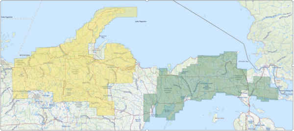
Map of the Upper Peninsula of Michigan and nearby areas of Northern Wisconsin, with areas of overflights shaded in yellow (Wisconsin) and green (Michigan).
Images
Images
Filter Total Items: 9447
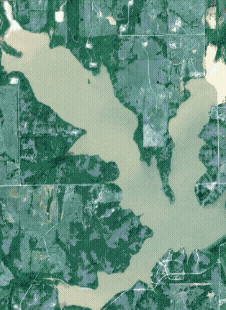
UPMI-WS LLFA.png
Map of the Upper Peninsula of Michigan and nearby areas of Northern Wisconsin, with areas of overflights shaded in yellow (Wisconsin) and green (Michigan).

Discover Ecosystems
America’s diverse ecosystems are an asset to current and future generations by supporting economically and recreationally important fish, wildlife, and lands. Healthy ecosystems support people and nature, fostering prosperity and enjoyment for all.
By
Ecosystems Mission Area, Biological Threats and Invasive Species Research Program, Climate Adaptation Science Centers, Cooperative Research Units, Ecosystems Land Change Science Program, Environmental Health Program, Land Management Research Program, Species Management Research Program, Communications and Publishing
Flooding extents in Lake Fuqua, Oklahoma following flooding in May 2025
Flooding extents in Lake Fuqua, Oklahoma following flooding in May 2025Satellite data shows flooding extents before and after a 6-foot lake level rise in Lake Fuqua, Oklahoma, following flooding in May 2025.
Flooding extents in Lake Fuqua, Oklahoma following flooding in May 2025
Flooding extents in Lake Fuqua, Oklahoma following flooding in May 2025Satellite data shows flooding extents before and after a 6-foot lake level rise in Lake Fuqua, Oklahoma, following flooding in May 2025.

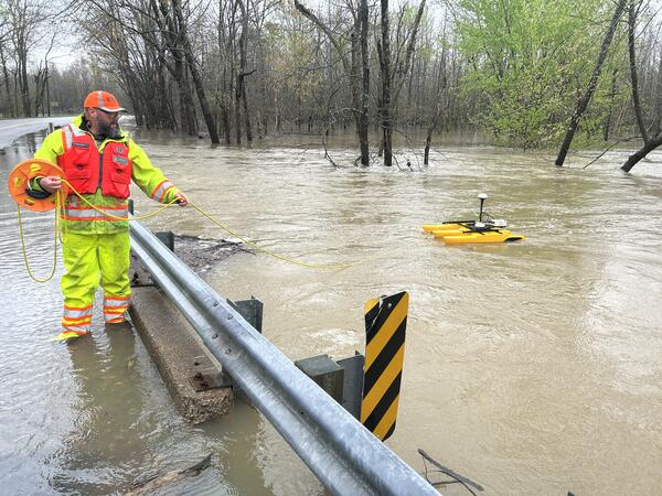
USGS water expert measures the height of floodwaters over a submerged bridge near Shepherdsville, Kentucky
USGS water expert measures the height of floodwaters over a submerged bridge near Shepherdsville, KentuckyUSGS water expert Emma Spicer uses specialized wading rod to measure the height of floodwaters over a submerged bridge on Cedar Creek at Highway 1442 near Shepherdsville, Kentucky on April 7, 2025.
USGS expert measures floodwaters near Providence, Kentucky
USGS expert measures floodwaters near Providence, KentuckyUSGS water expert Donnie Keeling uses special equipment to measure how fast floodwaters are moving in the Tradewater River near Providence, Kentucky on April 6, 2025.
USGS expert measures floodwaters near Providence, Kentucky
USGS expert measures floodwaters near Providence, KentuckyUSGS water expert Donnie Keeling uses special equipment to measure how fast floodwaters are moving in the Tradewater River near Providence, Kentucky on April 6, 2025.

USGS water expert performs maintenance on a streamgage upstream of a water-treatment facility in Batesville, Arkansas
USGS water expert performs maintenance on a streamgage upstream of a water-treatment facility in Batesville, ArkansasA USGS water expert performs maintenance on a streamgage upstream of a water-treatment facility in Batesville, Arkansas on April 5, 2025.

Solid Gallium Metal
Gallium is used in gallium arsenide and gallium nitride compound semiconductors. There is additional production capacity for gallium outside China with the potential to produce gallium in Germany, Kazakhstan and South Korea in response to China’s gallium export ban to the U.S.
Gallium is used in gallium arsenide and gallium nitride compound semiconductors. There is additional production capacity for gallium outside China with the potential to produce gallium in Germany, Kazakhstan and South Korea in response to China’s gallium export ban to the U.S.
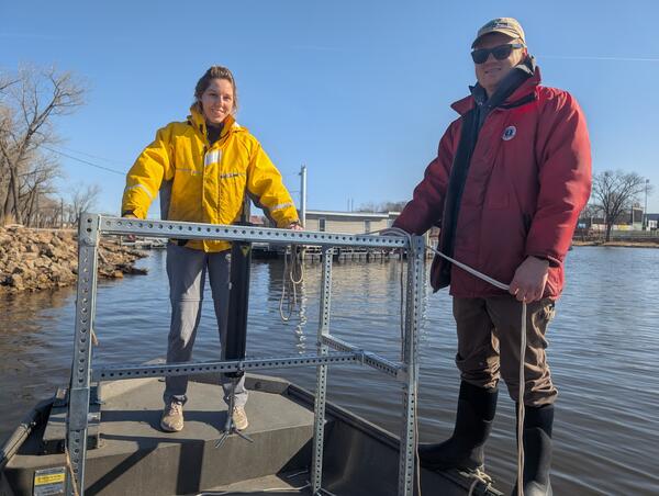
Scientists get ready to deploy wave monitoring equipment
Scientists get ready to deploy wave monitoring equipmentStaff prepare to place the deployment structure with monitoring equipment into Pool 13 of the Upper Mississippi River to measure waves and sediment resuspension. Deployment structures will be near the surface of the water and will be marked with buoys to alert boaters.
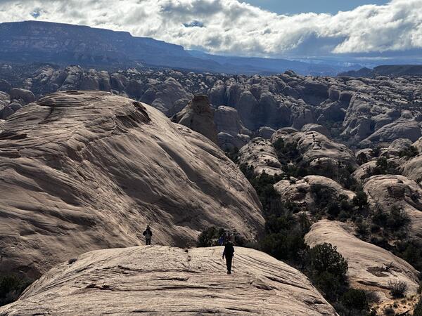
USGS crews hike to install a streamgage near Moab, Utah
USGS crews hike to install a streamgage near Moab, UtahUSGS crews hike to install a streamgage on the North Fork of Mill Creek near Moab, Utah. The new monitoring system provides vital real-time data for flood warnings and public safety
USGS crews hike to install a streamgage near Moab, Utah
USGS crews hike to install a streamgage near Moab, UtahUSGS crews hike to install a streamgage on the North Fork of Mill Creek near Moab, Utah. The new monitoring system provides vital real-time data for flood warnings and public safety
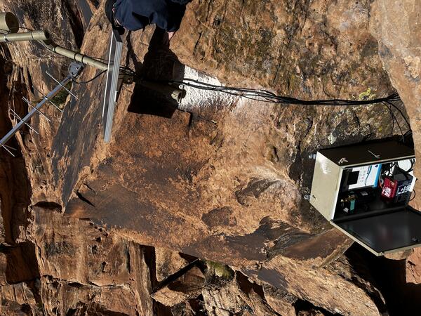
A new streamgage installed on the North Fork of Mill Creek near Moab, Utah
A new streamgage installed on the North Fork of Mill Creek near Moab, UtahA new streamgage is installed on the North Fork of Mill Creek near Moab, Utah on February 21, 2025. The new monitoring system provides vital real-time data for flood warnings and public safety.
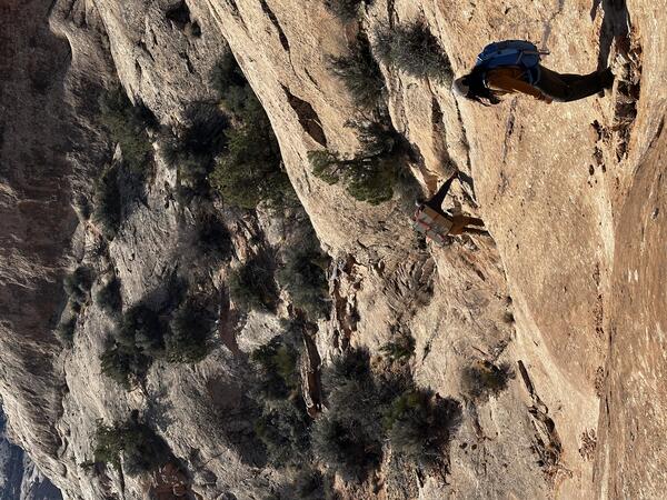
USGS crew carries equipment to install a USGS streamgage near Moab, Utah
USGS crew carries equipment to install a USGS streamgage near Moab, UtahUSGS crews hike in equipment to install a streamgage on the North Fork of Mill Creek near Moab, Utah. The new monitoring system provides vital real-time data for flood warnings and public safety.
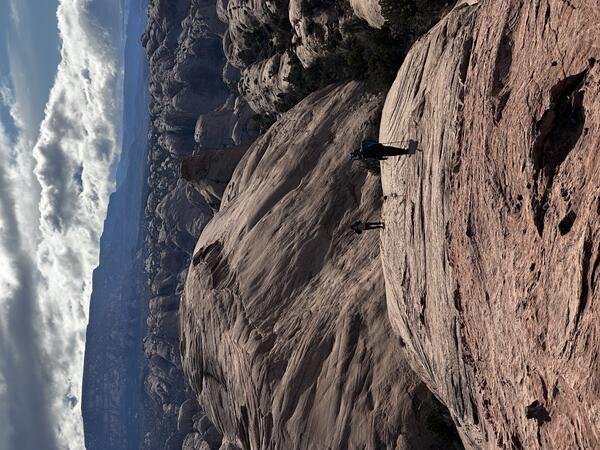
USGS team hikes to install a new streamgage near Moab, Utah
USGS team hikes to install a new streamgage near Moab, UtahUSGS crews hike to install a streamgage on the North Fork of Mill Creek near Moab, Utah. The new monitoring system provides vital real-time data for flood warnings and public safety.
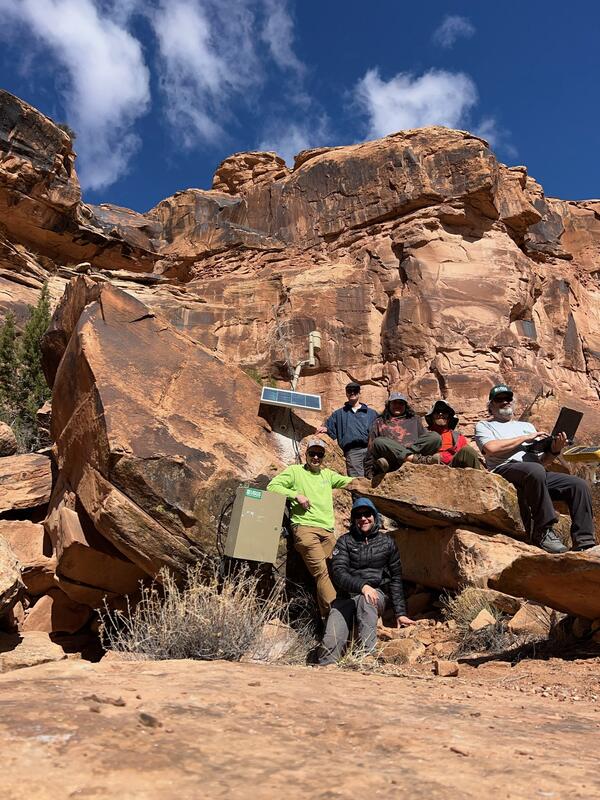
USGS team that installed a new streamgage near Moab, Utah
USGS team that installed a new streamgage near Moab, UtahUSGS crews that installed a streamgage on the North Fork of Mill Creek near Moab, Utah on February 21, 2025. The new monitoring system provides vital real-time data for flood warnings and public safety.

USGS water expert measures floodwaters at Piney Creek near Raleigh, WV.
USGS water expert measures floodwaters at Piney Creek near Raleigh, WV.USGS water expert Jeremy White measures how high and fast floodwaters are moving at Piney Creek near Raleigh, WV. He's using special water measurement equipment (a hydroacoustic doppler profiler) to collect this data.

USGS water experts measure floodwaters at Green River in Munfordville, KY
USGS water experts measure floodwaters at Green River in Munfordville, KYUSGS water experts Logan VanWatermulen and Shawn LeMaster measure how high and fast floodwaters move at Green River in Munfordville, KY on February 17. This real-time data is used by emergency managers to help protect lives and property. The Green River streamgage has been collecting data since 1915 and is funded by the U.S. Army Corps of Engineers and USGS.

USGS water expert measures floodwaters in Barbourville, KY
USGS water expert measures floodwaters in Barbourville, KYUSGS water expert Conner Langley measures flood water speed and height at Cumberland River in Barbourville, KY on February 17. He holds a radio in his left hand to stay in contact with colleagues for safety and to relay water flow measurements. This Cumberland River streamgage is funded by the U.S.
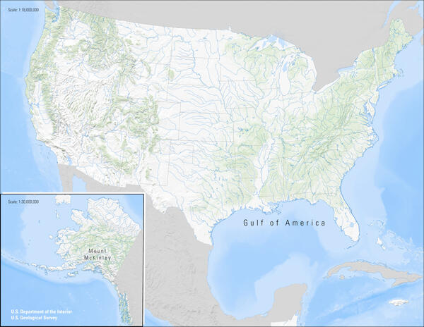
US_NameChanges.jpg
USGS and the U.S. Board on Geographic Names have implemented name changes following Executive and Secretary’s Orders.
USGS and the U.S. Board on Geographic Names have implemented name changes following Executive and Secretary’s Orders.

GulfOfAmerica_8x11.jpg
USGS and the U.S. Board on Geographic Names have implemented name changes following Executive and Secretary’s Orders.
USGS and the U.S. Board on Geographic Names have implemented name changes following Executive and Secretary’s Orders.
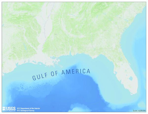
Gulf of America
Following President Trump’s Executive Order 14172, “Restoring Names That Honor American Greatness,” on February 7, Secretary of the Interior Doug Burgum signed Secretary’s Order (SO) 3423 - The Gulf of America and directed the BGN to immediately rename the Gulf of Mexico to the Gulf of America. Here is a map showing the name change for use with feature story.
Following President Trump’s Executive Order 14172, “Restoring Names That Honor American Greatness,” on February 7, Secretary of the Interior Doug Burgum signed Secretary’s Order (SO) 3423 - The Gulf of America and directed the BGN to immediately rename the Gulf of Mexico to the Gulf of America. Here is a map showing the name change for use with feature story.

Almost 1,000 sea turtles returned to the wild after being saved from frigid water in Florida
Almost 1,000 sea turtles returned to the wild after being saved from frigid water in FloridaA USGS boat holds dozens of endangered sea turtles recovered from St. Joseph Bay, Florida on January 24, 2025 in a coordinated effort to save over 1,000 turtles from a winter cold-stun event. (Dan Catizone, USGS)

Almost 1,000 sea turtles returned to the wild after being saved from frigid water in Florida
Almost 1,000 sea turtles returned to the wild after being saved from frigid water in FloridaU.S. Geological Survey biologist Dan Catizone pulls rescued endangered sea turtles along the shore of St. Joseph Bay, Florida, January 23, 2025 during a coordinated recovery event after water temperature drops made waters off of Florida's coast unsafe for the animals. (Samantha Snow, USGS)