
Episode 43 of the ongoing Kīlauea summit eruption occurred on March 10. Lava fountains from the north and south vents on the western side of Halema‘uma‘u crater floor produced a large eruption plume of volcanic gases and rock fragments (tephra).
Multimedia
Images

Episode 43 of the Kīlauea summit eruption
Episode 43 of the ongoing Kīlauea summit eruption occurred on March 10. Lava fountains from the north and south vents on the western side of Halema‘uma‘u crater floor produced a large eruption plume of volcanic gases and rock fragments (tephra).
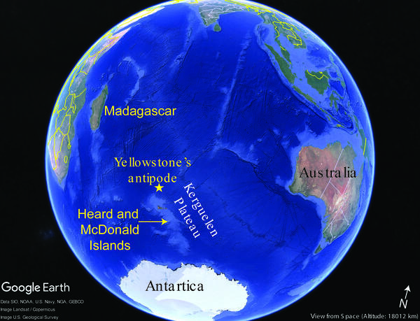
Google Earth map showing the location of Yellowstone Caldera’s antipode
Google Earth map showing the location of Yellowstone Caldera’s antipodeGoogle Earth map showing the location of Yellowstone Caldera’s antipode, the Kerguelen Plateau in the southern Indian Ocean, and Heard and McDonald Islands, which host active volcanoes.
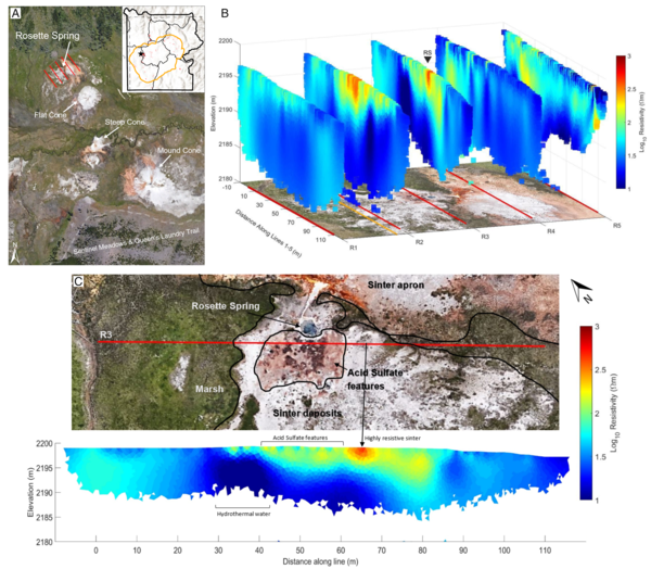
Surface imagery and subsurface electrical resistivity tomography results from Rosette Spring in Yellowstone’s Lower Geyser Basin
Surface imagery and subsurface electrical resistivity tomography results from Rosette Spring in Yellowstone’s Lower Geyser BasinSurface imagery and subsurface electrical resistivity tomography results from Rosette Spring in Yellowstone’s Lower Geyser Basin. A) Site Overview: Google Earth imagery of Sentinel Meadows identifying Rosette Spring, Flat Cone, Steep Cone, and Mound Cone. Red lines denote the five parallel NW-SE electrical resistivity tomography (ERT) survey profiles.
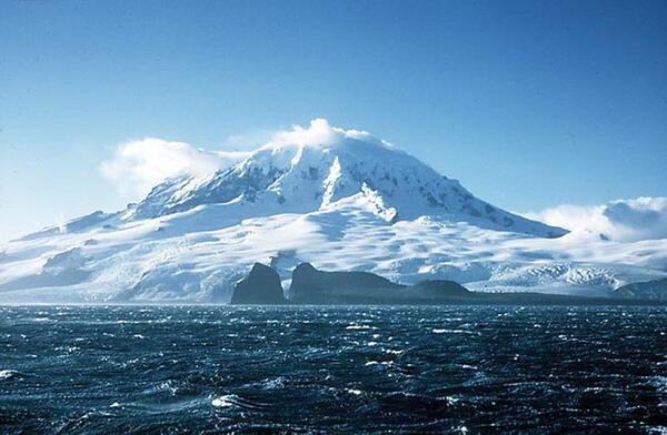
Big Ben Volcano on Heard Island
Big Ben Volcano on Heard Island. Credit: Australian Antarctic Division (A.J. Graff).
Big Ben Volcano on Heard Island. Credit: Australian Antarctic Division (A.J. Graff).
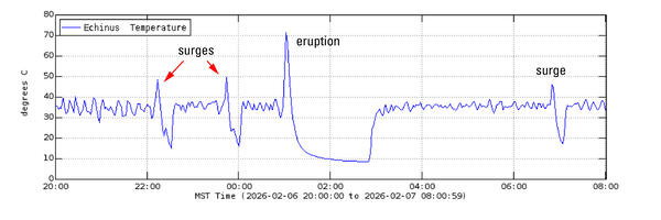
Echinus temperature record during February 6-7, 2026
Echinus temperature record during February 6-7, 2026Temperature record from Echinus Geyser outflow channel for February 6, 2026, at 8 p.m. MST to February 7, 2026, at 8 a.m. MST. The plot shows initial baseline temperatures, then two spikes to 50 °C representing water surges, then an eruption marked by a spike to 70 °C followed by a lull to 10 °C, and finally a return to baseline.
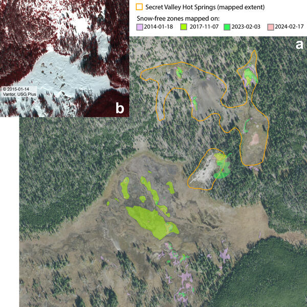
Satellite mapping of thermal ground at Secret Valley Hot Springs, Yellowstone National Park
Satellite mapping of thermal ground at Secret Valley Hot Springs, Yellowstone National Park(a) NAIP (National Agriculture Imagery Program) natural-color aerial photograph of Secret Valley Hot Springs, in the backcountry between Norris Geyser Basin and Madison Junction, from September 25, 2015, showing snow-free zone mapping based on snowy wintertime imagery from multiple years. The mapped boundaries of the thermal area are indicated by the orange out
Videos
")
The New Norris Hot Spring (Yellowstone Monthly Update - March 2026)
The New Norris Hot Spring (Yellowstone Monthly Update - March 2026)KABOOM! That’s what Yellowstone is famous for – huge explosive volcanic eruptions. There’s really nothing brewing right now, the magma chamber is mostly solid, but there have been quite a few hydrothermal eruptions and small explosions in both Biscuit Basin and Norris Geyser Basin as water in the hydrothermal system flashes to steam.
")
Top 5 Yellowstone geological stories of 2025 (Yellowstone monthly update - January 2026)
Top 5 Yellowstone geological stories of 2025 (Yellowstone monthly update - January 2026)Happy New Year! Let's go back and take a look at the top five geologic stories for Yellowstone in 2025.
Number five: Rumors. It was a year of internet rumors, mostly related to animals fleeing the park, and none of which were true.
")
Grand Prismatic Spring: Boiling, colorful, and full of bacteria! (Yellowstone Monthly Update - July 2025)
Grand Prismatic Spring: Boiling, colorful, and full of bacteria! (Yellowstone Monthly Update - July 2025)Grand Prismatic Spring is the largest hot spring in the US, and one of the largest in the world. The boiling lake was named for the spectacular array of colors along its rim.
 eruption on May 31, 2025")
Black Diamond Pool (Biscuit Basin, Yellowstone National Park) eruption on May 31, 2025
Black Diamond Pool (Biscuit Basin, Yellowstone National Park) eruption on May 31, 2025This video, recorded by a webcam, shows a small eruption from Black Diamond Pool in the Biscuit Basin subbasin of Upper Geyser Basin, Yellowstone National Park, at 8:39 p.m. MDT on May 31, 2025. The pool was the site of a hydrothermal explosion on July 23, 2024.

The Challenge of Volcano Monitoring, Eruption Forecasting, and Protecting Vulnerable Populations
The Challenge of Volcano Monitoring, Eruption Forecasting, and Protecting Vulnerable PopulationsThis presentation by Dr. Jake Lowenstern was prepared for the AGU 2024-2025 Distinguished Lecture Series. It discusses the challenges of volcano monitoring, eruption forecasting, and protecting vulnerable populations.
")
Biscuit Basin Hydrothermal Explosion Update (Yellowstone Monthly Update — October 2024)
Biscuit Basin Hydrothermal Explosion Update (Yellowstone Monthly Update — October 2024)Let’s get you caught up on what we’ve learned about the July 23, 2024, hydrothermal explosion in Biscuit Basin, in this Yellowstone Volcano Observatory Monthly Update for October 2024.
Read Caldera Chronicles
Webcams
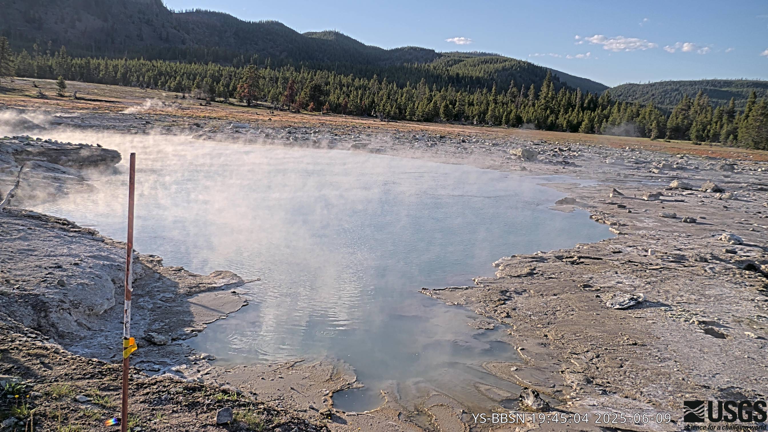
Biscuit Basin webcam
The camera view is north-northwest from the Biscuit Basin boardwalk looking at Black Diamond Pool, which is in the foreground (the tilted viewing angle is due to the slope of the boardwalk).
The camera view is north-northwest from the Biscuit Basin boardwalk looking at Black Diamond Pool, which is in the foreground (the tilted viewing angle is due to the slope of the boardwalk).
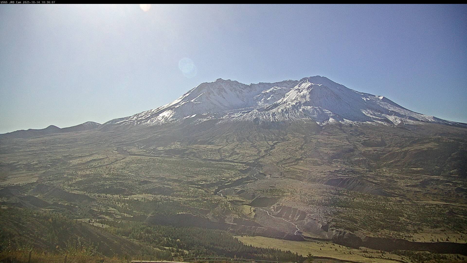
Johnston Ridge Observatory, Mount St. Helens
This static image is from a USGS Cascades Volcano Observatory research camera located at the Johnston Ridge Observatory, north of Mount St. Helens. The view is to the south. This camera is intended to assist the USGS with situational awareness. At times, clouds, rain, and snow obscure visibility.
This static image is from a USGS Cascades Volcano Observatory research camera located at the Johnston Ridge Observatory, north of Mount St. Helens. The view is to the south. This camera is intended to assist the USGS with situational awareness. At times, clouds, rain, and snow obscure visibility.

[HLcam] Live Image of Mauna Loa's northwest flank from Hualālai volcano
[HLcam] Live Image of Mauna Loa's northwest flank from Hualālai volcanoLive view of the northwest flank of Mauna Loa; the view is from the southeast flank of Hualālai [HLcam]. This camera is a pan-tilt-zoom model and the view may change depending on activity.