
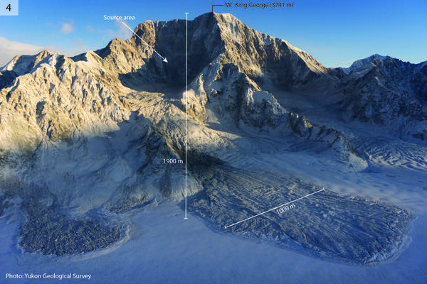
Large landslides on the southwest side of Mt. King George. The main debris lobe on the right is approximately 1000 m wide. The elevation difference between the peak and the glacier is approximately 1900 m. Photo courtesy of Yukon Geological Survey.
Multimedia
To See More USGS Images
To Watch More USGS Videos
To Listen to More USGS Audio Files
To See More USGS Webcams
Photos, videos, audio files, and webcam photos described and linked on this webpage come from a wide variety of USGS science activities and presentations done by USGS Science Center staff members in the Region 7: Upper Colorado Basin. The "View All" link buttons at the bottom of the sections on this page lead to webpages containing links to additional multimedia files.
Images
12-12-25 Mt. King George West Face Landslides
Large landslides on the southwest side of Mt. King George. The main debris lobe on the right is approximately 1000 m wide. The elevation difference between the peak and the glacier is approximately 1900 m. Photo courtesy of Yukon Geological Survey.
12-12-25 Mt. Vancouver Toppled Seracs
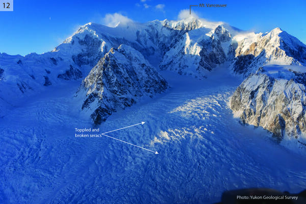
Seracs in an icefall on the east side of Mt. Vancouver (4812 m), toppled by shaking. Field of view is approximately 3.5 km wide. Photo courtesy of Yukon Geological Survey.
Seracs in an icefall on the east side of Mt. Vancouver (4812 m), toppled by shaking. Field of view is approximately 3.5 km wide. Photo courtesy of Yukon Geological Survey.
12-12-25 Hubbard Glacier Collapsed Snow Bridges
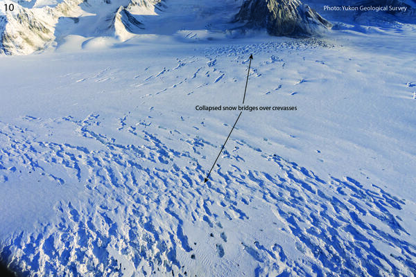
Collapsed snow bridges on crevasse field on the Hubbard Glacier between McArthur Peak and Mt. King George. Photo courtesy of Yukon Geological Survey.
Collapsed snow bridges on crevasse field on the Hubbard Glacier between McArthur Peak and Mt. King George. Photo courtesy of Yukon Geological Survey.
12-12-25 Mt. Vancouver and Mt. Logan Arete Landslides
12-12-25 Mt. Vancouver and Mt. Logan Arete LandslidesCollapsed snow bridges on crevasse field on the Hubbard Glacier between McArthur Peak and Mt. King George. Photo courtesy of Yukon Geological Survey.
12-12-25 Mt. Vancouver and Mt. Logan Arete Landslides
12-12-25 Mt. Vancouver and Mt. Logan Arete LandslidesCollapsed snow bridges on crevasse field on the Hubbard Glacier between McArthur Peak and Mt. King George. Photo courtesy of Yukon Geological Survey.
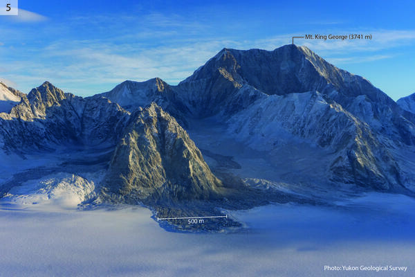
12-12-25 Mt. King George West Face Landslides
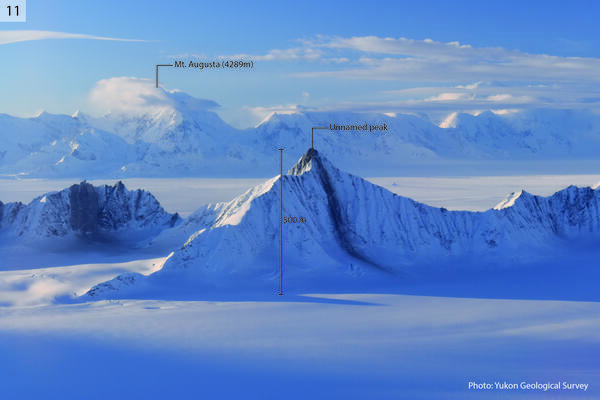
Landslides on the west side of Mt. King George. The central debris lobe is 500 m wide. Photo courtesy of Yukon Geological Survey.
Landslides on the west side of Mt. King George. The central debris lobe is 500 m wide. Photo courtesy of Yukon Geological Survey.
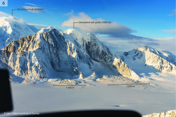
12-12-25 McArthur Peak East Face Landslides & Avalanches
12-12-25 McArthur Peak East Face Landslides & AvalanchesLandslides and avalanches on the east side of McArthur Peak. The left-hand debris lobe is 1100 m wide, and the right-hand debris lobe is 1500 m wide. The elevation difference between the peak and the glacier is approximately 1500 m. Photo courtesy of Yukon Geological Survey.
Videos

Bison in Theodore Roosevelt National Park
USGS researchers and collaborators are currently studying the grazing behavior of bison in Theodore Roosevelt National Park to determine the effects of ungulates on vegetation in the park. These studies will support park managers in maintaining healthy bison herds, conserving critical habitat, and sustaining outdoor recreation.
USGS researchers and collaborators are currently studying the grazing behavior of bison in Theodore Roosevelt National Park to determine the effects of ungulates on vegetation in the park. These studies will support park managers in maintaining healthy bison herds, conserving critical habitat, and sustaining outdoor recreation.

Saline Lakes Ecosystems IWAA Fall 2024 Webinar Series: Bird Movements
Saline Lakes Ecosystems IWAA Fall 2024 Webinar Series: Bird MovementsThe fourth webinar in the Saline Lakes Ecosystems IWAA Fall 2024 Webinar Series is on movement of bird species associated with Great Basin terminal lake ecosystems. Cory Overton of the Western Ecological Research Center gives an overview of the USGS bird movement monitoring strategy and presents results from the 2024 field season.
By
Ecosystems Mission Area, Water Resources Mission Area, Species Management Research Program, Water Availability and Use Science Program, Forest and Rangeland Ecosystem Science Center, Fort Collins Science Center, Nevada Water Science Center, Oregon Water Science Center, Utah Water Science Center, Western Ecological Research Center (WERC), Saline Lake Ecosystems Integrated Water Availability Assessment

Saline Lakes Ecosystems IWAA Fall 2024 Webinar Series: Water-Quality Monitoring of Great Basin Terminal Lake Ecosystems
Saline Lakes Ecosystems IWAA Fall 2024 Webinar Series: Water-Quality Monitoring of Great Basin Terminal Lake EcosystemsThe third webinar in the Saline Lakes Ecosystems IWAA Fall 2024 Webinar Series is on water-quality monitoring of Great Basin terminal lake ecosystems. Christine Rumsey of the Utah Water Science Center and Casie Smith of the Oregon Water Science Center give an overview of the USGS water-quality monitoring strategy and present results from the 2024 field season.
By
Ecosystems Mission Area, Water Resources Mission Area, Species Management Research Program, Water Availability and Use Science Program, Forest and Rangeland Ecosystem Science Center, Fort Collins Science Center, Nevada Water Science Center, Oregon Water Science Center, Utah Water Science Center, Western Ecological Research Center (WERC), Saline Lake Ecosystems Integrated Water Availability Assessment

Saline Lake Ecosystems IWAA Fall 2024 Webinar Series: Physical and Chemical Monitoring in Support of Water Budgets of Select Great Basin Saline Lakes
Saline Lake Ecosystems IWAA Fall 2024 Webinar Series: Physical and Chemical Monitoring in Support of Water Budgets of Select Great Basin Saline LakesThe second webinar in the Saline Lake Ecosystems IWAA Fall 2024 Webinar Series is on physical and chemical monitoring in support of water budgets of select Great Basin saline lakes.
By
Ecosystems Mission Area, Water Resources Mission Area, Species Management Research Program, Water Availability and Use Science Program, Forest and Rangeland Ecosystem Science Center, Fort Collins Science Center, Nevada Water Science Center, Oregon Water Science Center, Utah Water Science Center, Western Ecological Research Center (WERC), Saline Lake Ecosystems Integrated Water Availability Assessment

Saline Lake Ecosystems IWAA Fall 2024 Webinar Series: Project Overview
Saline Lake Ecosystems IWAA Fall 2024 Webinar Series: Project OverviewAllison Shipp, Deputy Regional Director for Science and Research and Saline Lake Ecosystems IWAA Project Manager, kicked off the Fall 2024 webinar series. This presentation gives an overview of the project and introduces topics that will be covered by the USGS research team throughout the webinar series.
By
Ecosystems Mission Area, Water Resources Mission Area, Species Management Research Program, Water Availability and Use Science Program, Forest and Rangeland Ecosystem Science Center, Fort Collins Science Center, Nevada Water Science Center, Oregon Water Science Center, Utah Water Science Center, Western Ecological Research Center (WERC), Saline Lake Ecosystems Integrated Water Availability Assessment
")
USGS NEIC Earthquake Response (AD)
At the USGS National Earthquake Information Center (NEIC), our team locates and researches earthquakes to provide information on how to reduce risk from earthquakes.
At the USGS National Earthquake Information Center (NEIC), our team locates and researches earthquakes to provide information on how to reduce risk from earthquakes.
Audio

Outstanding in the Field (Ep 5): Fish in the Grand Canyon
Outstanding in the Field (Ep 5): Fish in the Grand CanyonThe USGS Ecosystems Mission Area brings you Outstanding in the Field, a series of stories about our science, our adventures, and our efforts to better understand our fish and wildlife and the ecosystems that support them. In this episode we describe some of the one-of-a-kind native fish species that call the Grand Canyon segment of the Colorado River home.
Webcams
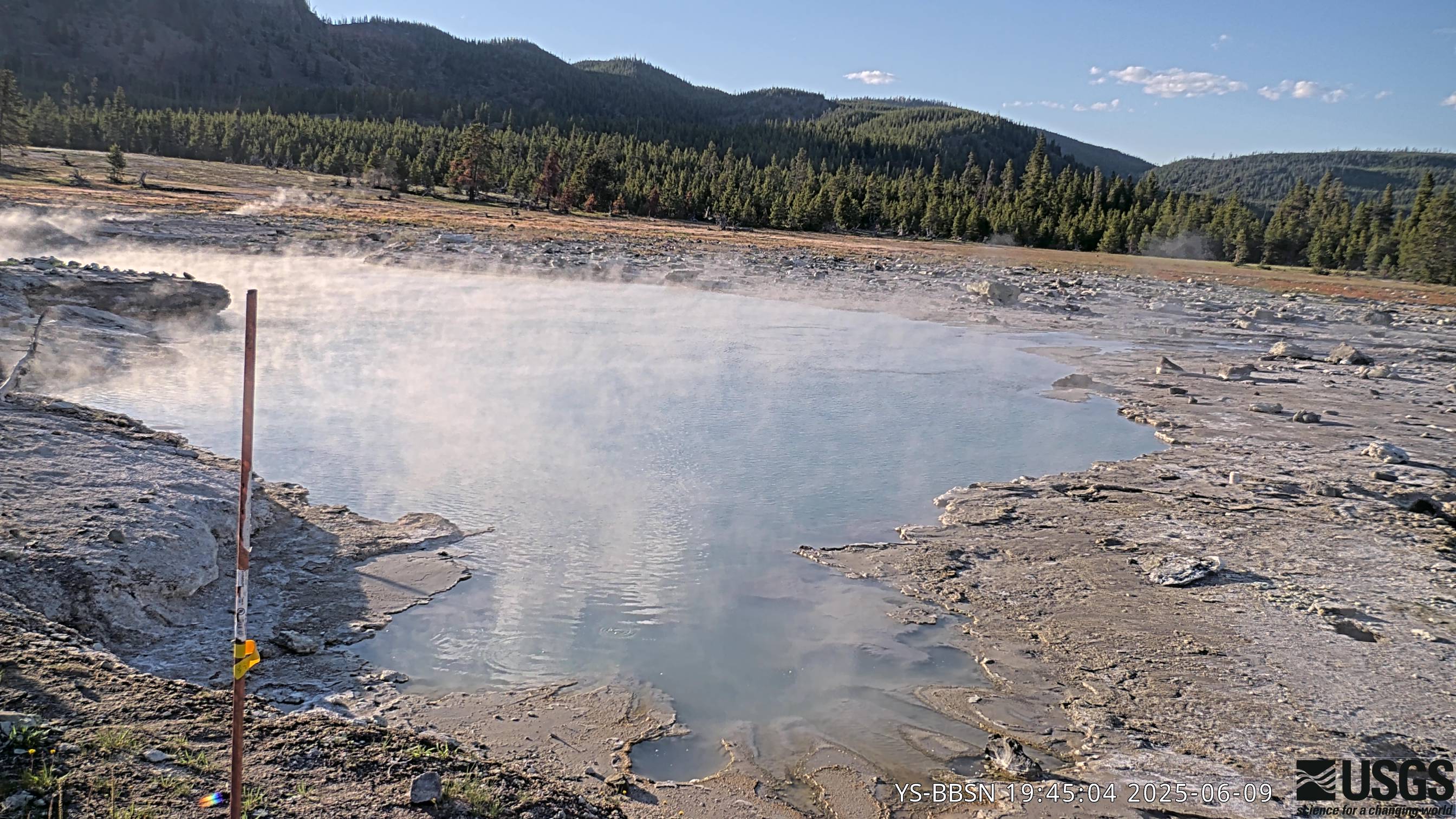
Biscuit Basin webcam
The camera view is north-northwest from the Biscuit Basin boardwalk looking at Black Diamond Pool, which is in the foreground (the tilted viewing angle is due to the slope of the boardwalk).
The camera view is north-northwest from the Biscuit Basin boardwalk looking at Black Diamond Pool, which is in the foreground (the tilted viewing angle is due to the slope of the boardwalk).
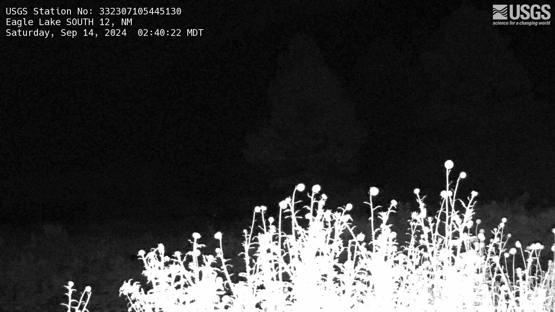
Eagle Lake South 12, NM Webcam
This is a webcam near the Eagle Lake South 12 streamgage (USGS Site: 332307105445130) west of Alto, New Mexico. Still images are collected every five minutes and available as a timelapse of the previous 30-day period.
This is a webcam near the Eagle Lake South 12 streamgage (USGS Site: 332307105445130) west of Alto, New Mexico. Still images are collected every five minutes and available as a timelapse of the previous 30-day period.
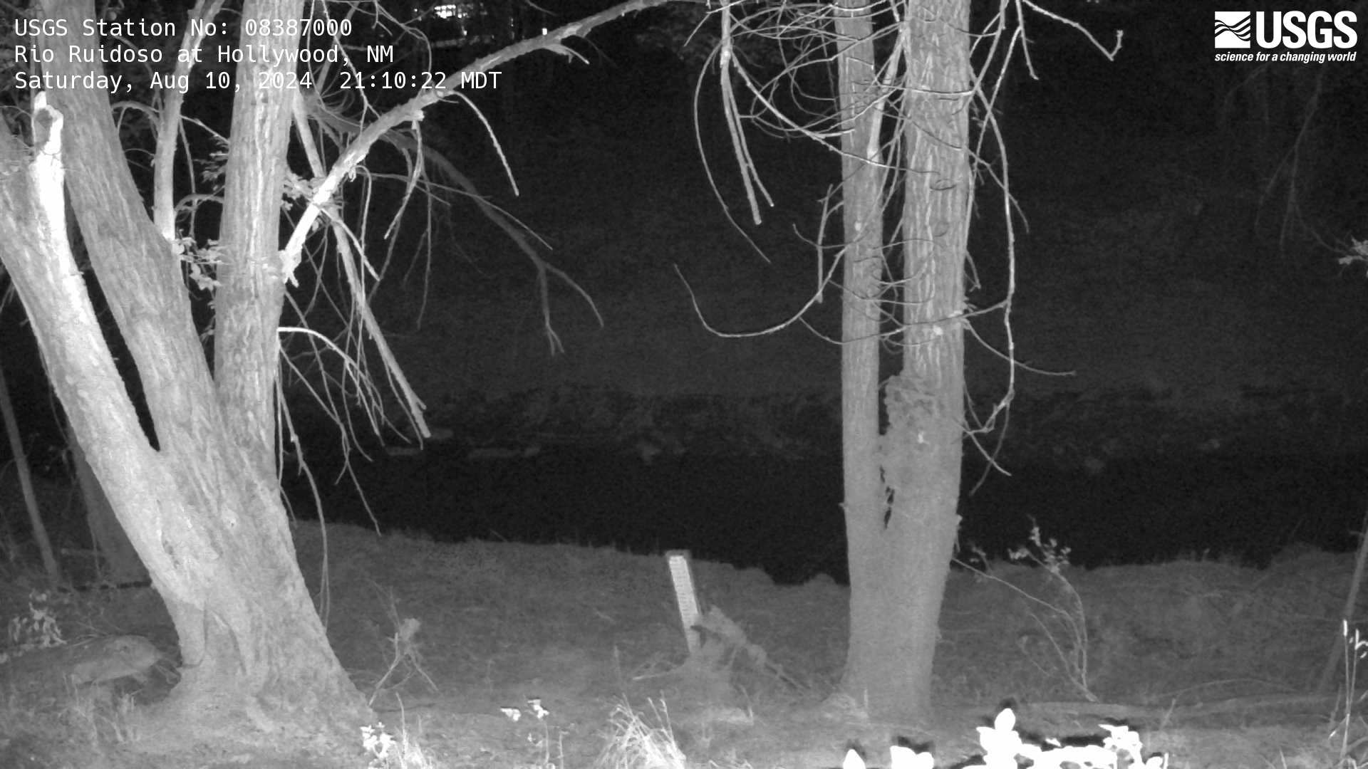
Rio Ruidoso at Hollywood
This is a webcam located near the Rio Ruidoso at Hollywood, NM streamgage (USGS Site: 08387000). Still images are collected every five minutes and available as a timelapse of the previous 30-day period.
This is a webcam located near the Rio Ruidoso at Hollywood, NM streamgage (USGS Site: 08387000). Still images are collected every five minutes and available as a timelapse of the previous 30-day period.

Colorado River near Cameo, CO (09095500)
Webcam at USGS Streamgage 09095500 Colorado River near Cameo, CO.
Visit Water Data For the Nation to get current data for this site.
Webcam at USGS Streamgage 09095500 Colorado River near Cameo, CO.
Visit Water Data For the Nation to get current data for this site.

Colorado River above Glenwood Springs, CO (09071750)
Colorado River above Glenwood Springs, CO (09071750)Webcam at USGS Streamgage 09071750 Colorado River above Glenwood Springs, CO.
Visit Water Data For the Nation to get current data for this site.
Colorado River above Glenwood Springs, CO (09071750)
Colorado River above Glenwood Springs, CO (09071750)Webcam at USGS Streamgage 09071750 Colorado River above Glenwood Springs, CO.
Visit Water Data For the Nation to get current data for this site.
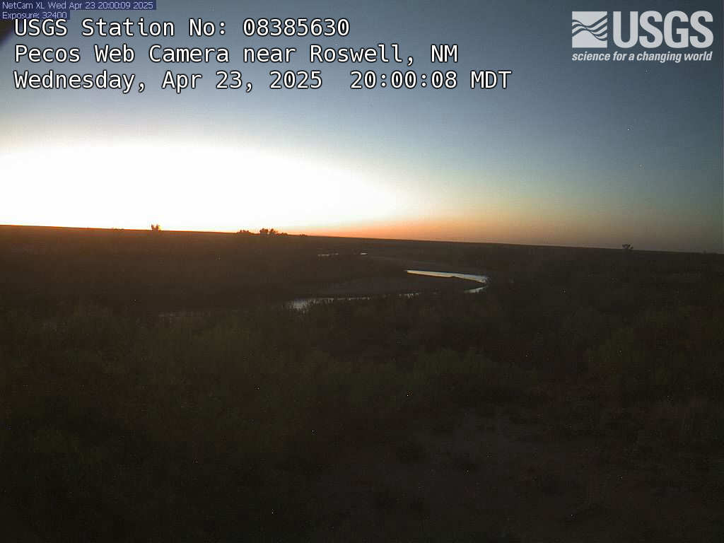
Pecos River Near Roswell, NM
This is a webcam image of the Pecos River near Roswell, New Mexico - Site #334716104175400
This is a webcam image of the Pecos River near Roswell, New Mexico - Site #334716104175400