U.S. flag

An official website of the United States government

Multimedia

Photos, videos, audio files, and webcam photos described and linked on this webpage come from a wide variety of USGS science activities and presentations done by USGS Science Center staff members in the Southwest Region. 

Images

Five ranchers and researchers stand outdoors in a field looking at a large map, discussing land management
Researchers and ranchers discuss land management in Northern Arizona

Researchers from the U.S. Geological Survey and University of Arizona collaborate with Diablo Trust ranchers on range improvement and restoration efforts on Northern Arizona rangelands. Photo by Jessica Archibald (Diablo Trust).

Researchers from the U.S. Geological Survey and University of Arizona collaborate with Diablo Trust ranchers on range improvement and restoration efforts on Northern Arizona rangelands. Photo by Jessica Archibald (Diablo Trust).

A field of native plants under a cloud filled sky in Northern Arizona grasslands/rangelands
Monsoon season at a Northern Arizona RestoreNet site

A RestoreNet site in Northern Arizona with late summer monsoon rain clouds in the background. Photo by Laura Shriver.

Students watch a USGS ecologist describe restoration experiments in a field in Northern Arizona rangelands
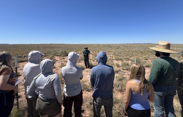
A USGS Ecologist gives a tour of a Northern Arizona RestoreNet site

Laura Shriver, RAMPS coordinator, gives a tour of a Northern Arizona RestoreNet site to Northern Arizona University students. Photo by Jessica Archibald (Diablo Trust).

Schematic flowchart showing relations between porphyry copper mining, drought, water resources, ecosystems, health, and economic factors in the Lower Colorado River Basin and adjoining areas
Flowchart showing relations between porphyry copper mining, drought, water resources, and economic effects
Map of the Southwest showing level 3 ecoregions and black dots representing the locations of 23 RestoreNet sites in California, Arizona, New Mexico, Utah, and Colorado
RestoreNet Map
RestoreNet Map
RestoreNet Map

RestoreNet is a networked ecological restoration experiment spanning drylands of the American Southwest. It is engaging diverse partners to develop methods for successful revegetation projects that mitigate the effects of drought, invasion by non-native species, and land use practices.

RestoreNet is a networked ecological restoration experiment spanning drylands of the American Southwest. It is engaging diverse partners to develop methods for successful revegetation projects that mitigate the effects of drought, invasion by non-native species, and land use practices.

Videos

Shoreline Seasonality of California's Beaches (AD)

Most of the world’s beaches have regular cycles of erosion and recovery, but new USGS research is showing that these cycles may be considerably different from common perceptions. 

Most of the world’s beaches have regular cycles of erosion and recovery, but new USGS research is showing that these cycles may be considerably different from common perceptions. 

Landsat's 12 Millionth Image - Image of the Week Landsat's 12 Millionth Image - Image of the Week
Landsat's 12 Millionth Image (Image of the Week)

The USGS EROS Landsat archive recently reached a milestone of 12 million Landsat Collection 2 Level-1 products. These are available for download at no charge. The image representing this milestone displays a sprawling desert landscape and contains a multitude of agricultural, geological, and urban features.

The USGS EROS Landsat archive recently reached a milestone of 12 million Landsat Collection 2 Level-1 products. These are available for download at no charge. The image representing this milestone displays a sprawling desert landscape and contains a multitude of agricultural, geological, and urban features.

Can these rocks reduce flooding? (English captions)

Creating a binational sponge city in the desert: Flooding in the binational cities at Ambos Nogales on the Arizona-Sonora portion of the US-Mexico border has caused damage, ruined livelihoods and taken lives for hundreds of years.

Creating a binational sponge city in the desert: Flooding in the binational cities at Ambos Nogales on the Arizona-Sonora portion of the US-Mexico border has caused damage, ruined livelihoods and taken lives for hundreds of years.

Can these rocks reduce flooding? (Spanish captions)

Flooding in the binational cities at Ambos Nogales on the Arizona-Sonora portion of the US-Mexico border has caused damage, ruined livelihoods and taken lives for hundreds of years.

Flooding in the binational cities at Ambos Nogales on the Arizona-Sonora portion of the US-Mexico border has caused damage, ruined livelihoods and taken lives for hundreds of years.

Loma Prieta ShakeMovie Loma Prieta ShakeMovie
ShakeMovie Animation: 1989 M6.9 Loma Prieta Earthquake

The 1989 Loma Prieta earthquake, measuring magnitude 6.9, was the strongest to hit the San Francisco Bay Area since the Great San Francisco earthquake of 1906. Although it provided extensive data on ground shaking, the available observations don’t fully capture all the quake's important features. 

The 1989 Loma Prieta earthquake, measuring magnitude 6.9, was the strongest to hit the San Francisco Bay Area since the Great San Francisco earthquake of 1906. Although it provided extensive data on ground shaking, the available observations don’t fully capture all the quake's important features. 

Green pan used for gold mining with a small amount of mercury in it Green pan used for gold mining with a small amount of mercury in it
Legacy Mercury Contamination from Historical Gold Mining

Mercury contamination from historic gold mining represents a potential risk to human health and the environment. There is a lack of public awareness of the history mercury use in gold mining and how it contributed to this situation, and also what the present concerns are. Specifically, the public is not aware of locations and levels of contamination.

Mercury contamination from historic gold mining represents a potential risk to human health and the environment. There is a lack of public awareness of the history mercury use in gold mining and how it contributed to this situation, and also what the present concerns are. Specifically, the public is not aware of locations and levels of contamination.

Was this page helpful?