The USGS has a long history of cooperative studies and research in the Middle East and North Africa.

Ongoing and recent efforts include:
- Arab-Israeli Water: Current activities with Israelis, Jordanians, and Palestinians are an outgrowth of involvement since 1994 in the Regional Water Data Banks and the Public Awareness and Water Conservation Projects of the Multilateral Working Group on Water Resources, managed by the Executive Action Team (EXACT) as part of Middle East Peace process. Over the past decade, USGS provided technical assistance to the Department of State on topics of water monitoring and hydrologic data, specifically, facilitating joint meetings of Israeli and Palestinian Water Authorities to discuss water issues of mutual concern including sustainability of groundwater and surface water resources, water monitoring, and integrated water management.
- Iraq Water: Supporting the Iraq Ministry of Water Resources in remote-sensing based investigations to monitor meteorological and hydrologic conditions of headwaters region of Tigris and Euphrates Rivers. Information used to inform management of transboundary flow and reservoir inventories.
- Middle East Earthquake Hazards: Capacity building and data sharing program for seismic networks in the Arabian Peninsula region
Completed efforts:
- Aquifer Storage and Recovery: At the request of the U.S. Agency for International Development, USGS helped Jordan and Lebanon to assess suitability for artificial recharge methods to help manage scarce groundwater resources, and improve water supply. Methods developed were suitable for use in the Middle East-North Africa region.
- Algeria Mineral Resources: Mineral resource assessment of Eglab region in western Algeria along Mauritania border. Two 1-month-long field campaigns and two US-based training sessions for Algerian project members
- RELEMR: USGS cooperated with UNESCO on a project for the Reduction of Earthquake Losses in the Eastern Mediterranean Region (RELEMR). More than 15 meetings involving Israel and its neighbors have focused on the exchange of seismological data and the examination of common issues that influence the damage caused by earthquakes.
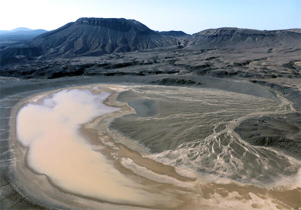
- Saudi Volcanic Hazards: A 5-year program with the Saudi Geological Survey providing information for use in planning for urban expansion. Focused on understanding of active volcanism and dating of young eruptive events, Madinah area, on the edge of a volcanic field that has seen historic eruptions and experiences on-going seismicity.
- Abu Dhabi: USGS partnered with the Abu Dhabi Emirate to collect information on the groundwater resources, to conduct research on the hydrology of the arid environment, to provide training in water-resources investigations, and to document the results of the cooperative work in scientific publications. Special projects included groundwater modeling, tree ring work, perchlorate contamination, land-use change, and microgravity surveys.
*Any use of trade, firm, or product names is for descriptive purposes only and does not imply endorsement by the U.S. Government.
Related Content
Accelerating Aquifer Storage & Recovery in the Middle East and North Africa Region
Regional screening for managed aquifer recharge suitability in Jordan, Lebanon, and surrounding areas
Assembly of satellite-based rainfall datasets in situ data and rainfall climatology contours for the MENA region
Modeling accumulated surface runoff and water availability for aquifer storage and recovery in the MENA region from 1984-2015
Satellite precipitation bias estimation and correction using in situ observations and climatology isohyets for the MENA region
Managed aquifer recharge suitability—Regional screening and case studies in Jordan and Lebanon
Mapping croplands of Europe, Middle East, Russia, and Central Asia using Landsat 30-m data, machine learning algorithms and Google Earth Engine
Assessment of continuous oil and gas resources in Lower Silurian Shales of the Arabian Peninsula, 2019
Hydrogeologic framework and simulation of predevelopment groundwater flow, eastern Abu Dhabi Emirate, United Arab Emirates
40Ar/39Ar and U-Pb SIMS zircon ages of Ediacaran dikes from the Arabian-Nubian Shield of south Jordan
A spectacular feature of the Arabian-Nubian Shield (ANS) is the abundance of well-exposed and extensive Neoproterozoic dike swarms of multiple generations. These dikes are generally categorized into metamorphosed and unmetamorphosed post-orogenic dike swarms. The unmetamorphosed dikes in the northern ANS can be grouped into an old and young generations. We dated three dikes from the old generation
The NASA hydrological forecast system for food and water security applications
An overview of bioaerosol load and health impacts associated with dust storms: A focus on the Middle East
Quantitative coseismic and precipitation-induced landslide risk mapping for the country of Lebanon
Message in a bottle: The story of drifting plastic in the eastern Mediterranean Sea
Minerals Yearbook, volume III, Area Reports — International — Africa and the Middle East
Pliocene-Pleistocene water bodies and associated geologic deposits in Southern Israel and Southern Jordan
Related Content
- Science
Accelerating Aquifer Storage & Recovery in the Middle East and North Africa Region
In cooperation with the U.S. Agency for International Development, USGS helped regional partners assess the suitability for managing scarce groundwater resources, and improving water supply, using artificial recharge methods. - Data
Regional screening for managed aquifer recharge suitability in Jordan, Lebanon, and surrounding areas
The U.S. Geological Survey (USGS), in cooperation with the U.S. Agency for International Development, Arab Water Council, Hydrology.NL, National Center for Research and Development (Jordan), and American University of Beirut, completed a project for acceleration of aquifer storage and recovery in the Middle East and North Africa (MENA) region. The MENA region is globally the most water-scarce regiAssembly of satellite-based rainfall datasets in situ data and rainfall climatology contours for the MENA region
Information on the spatio-temporal distribution of rainfall is very critical for addressing water related disasters, especially in the arid to semi-arid regions of the Middle East and North Africa region. However, availability of reliable rainfall datasets for the region is limited. In this study we combined observation from satellite-based rainfall data, in situ rain gauge observation and rainfalModeling accumulated surface runoff and water availability for aquifer storage and recovery in the MENA region from 1984-2015
The Middle East and North Africa (MENA) region is the most water-scarce region with only two percent of the global average annual rainfall, hence underground aquifers are the major source of water. The need to improve water productivity and increase aquifer storage and recovery (ASR) is driving the efforts for this acceleration of aquifer storage and recovery project. The objective was to model ru - Publications
Filter Total Items: 23
Satellite precipitation bias estimation and correction using in situ observations and climatology isohyets for the MENA region
The availability of reliable gridded precipitation datasets is limited around the world, especially in arid regions. In this study, we utilized observations from satellite-based precipitation data and in situ rain gauge observations to determine a suitable precipitation dataset in the Middle East & North Africa (MENA) region. First, we evaluated seven different precipitation products using rain gaAuthorsStefanie Kagone, Naga Manohar Velpuri, Kul Bikram Khand, Gabriel B. Senay, Michael R. Van der Valk, Daniel J. Goode, Salam Abu Hantash, Thair M. Al-Momani, Nanor Momejian, Jack R. EgglestonManaged aquifer recharge suitability—Regional screening and case studies in Jordan and Lebanon
The U.S. Geological Survey, at the request of the U.S. Agency for International Development, led a 5-year regional project to develop and apply methods for water availability and suitability mapping for managed aquifer recharge (MAR) in the Middle East and North Africa region. A regional model of surface runoff for the period from 1984 to 2015 was developed to characterize water availability usingMapping croplands of Europe, Middle East, Russia, and Central Asia using Landsat 30-m data, machine learning algorithms and Google Earth Engine
Accurate and timely information on croplands is important for environmental, food security, and policy studies. Spatially explicit cropland datasets are also required to derive information on crop type, crop yield, cropping intensity, as well as irrigated areas. Large area defined as continental to global cropland mapping is challenging due to differential manifestation of croplands, wide rangeAuthorsAparna Phalke, Mutlu Ozdogan, Prasad Thenkabail, Tyler Erickson, Noel GorelickAssessment of continuous oil and gas resources in Lower Silurian Shales of the Arabian Peninsula, 2019
Using a geology-based assessment methodology, the U.S. Geological Survey estimated undiscovered, technically recoverable mean resources of 4.6 billion barrels of oil and 561 trillion cubic feet of gas in the Lower Silurian Shale Total Petroleum System of the Arabian Peninsula.AuthorsChristopher J. Schenk, Tracey J. Mercier, Cheryl A. Woodall, Marilyn E. Tennyson, Thomas M. Finn, Michael E. Brownfield, Kristen R. Marra, Phuong A. Le, Ronald M. Drake, Scott A. KinneyHydrogeologic framework and simulation of predevelopment groundwater flow, eastern Abu Dhabi Emirate, United Arab Emirates
Groundwater in eastern Abu Dhabi in the United Arab Emirates is an important resource that is widely used for irrigation and domestic supplies in rural areas. The U.S. Geological Survey and the Environment Agency—Abu Dhabi cooperated on an investigation to integrate existing hydrogeologic information and to answer questions about regional groundwater resources in Abu Dhabi by developing a numericaAuthorsJack R. Eggleston, Thomas J. Mack, Jeffrey L. Imes, Wade Kress, Dennis W. Woodward, Daniel J. Bright40Ar/39Ar and U-Pb SIMS zircon ages of Ediacaran dikes from the Arabian-Nubian Shield of south Jordan
A spectacular feature of the Arabian-Nubian Shield (ANS) is the abundance of well-exposed and extensive Neoproterozoic dike swarms of multiple generations. These dikes are generally categorized into metamorphosed and unmetamorphosed post-orogenic dike swarms. The unmetamorphosed dikes in the northern ANS can be grouped into an old and young generations. We dated three dikes from the old generation
AuthorsHind Ghanem, Ryan J. McAleer, Ghaleb Jarrar, Mu'ayyad Al Hseinat, Martin WhitehouseThe NASA hydrological forecast system for food and water security applications
Many regions in Africa and the Middle East are vulnerable to drought and to water and food insecurity, motivating agency efforts such as the U.S. Agency for International Development’s (USAID) Famine Early Warning System Network (FEWS NET) to provide early warning of drought events in the region. Each year these warnings guide life-saving assistance that reaches millions of people. A new NASA multAuthorsKristi Arsenault, Shraddhanand Shukla, Abheera Hazra, Agusto Getirana, Amy McNally, Sujay Kumar, Randal Koster, Christa Peters-Lidard, Ben Zaitchik, Hamada Badr, Hahn Chul Jung, Bala Narapusetty, Mahdi Navari, Shugong Wang, David M. Mocko, Chris Funk, Laura Harrison, Gregory J. Husak, Alkhalil Adoum, Gideon Galu, Tamuka Magadzire, Jeanne Roningen, Michael J. Shaw, John Eylander, Karim Bergaoui, Rachael A. McDonnell, James VerdinAn overview of bioaerosol load and health impacts associated with dust storms: A focus on the Middle East
Dust storms are an important environmental problem worldwide. The main sources of dust storms include the Sahara, the Middle East, and central and northeastern Asia. Dust storms originating from these regions can be dispersed across oceans and in some cases globally. They occur throughout the year and vary in frequency and intensity. The biological agents (e.g., fungi, bacteria and viruses) and thAuthorsZahra Soleimani, Pari Teymouri, Ali Darvishi Boloorani, Alireza Mesdaghinia, Nick Middleton, Dale W. GriffinQuantitative coseismic and precipitation-induced landslide risk mapping for the country of Lebanon
Quantitative landslide risk assessment is a key step in creating appropriate land use policies. The forced migration of those displaced by recent events in Syria has highlighted the need for studies to guide humanitarian aid and resettlement policies. In 2011, armed conflict in the region precipitated the largest refugee crisis in a generation. Over 1.5 million displaced Syrians now reside in LebaAuthorsWilliam Pollock, Joseph Wartman, Grace Abou-Jaoude, Alex R. R. GrantMessage in a bottle: The story of drifting plastic in the eastern Mediterranean Sea
The Mediterranean Sea is a closed basin with limited water exchange through the Strait of Gibraltar, and sites along its shores show the greatest densities of marine debris in the world. Plastic bottles, which are a growing concern due to high consumption of soft drinks and bottled water, constitute most of the floating marine debris. In this paper we present the transport mechanisms of floating mAuthorsGalia Pasternak, Dov Zviely, Asaf Ariel, Ehud Spanier, Christine RibicMinerals Yearbook, volume III, Area Reports — International — Africa and the Middle East
The U.S. Geological Survey (USGS) Minerals Yearbook discusses the performance of the worldwide minerals and materials industries and provides background information to assist in interpreting that performance. Content of the individual Minerals Yearbook volumes follows:Volume I, Metals and Minerals, contains chapters about virtually all metallic and industrial mineral commodities important to the UAuthorsPliocene-Pleistocene water bodies and associated geologic deposits in Southern Israel and Southern Jordan
No abstract available.AuthorsJason A. Rech, Hanan Ginat, Gentry Catlett, Steffen Mischke, Emily Winer-Tully, Jeffrey S. Pigati