Aerial view of summit eruption in Halema‘uma‘u - June 7, 2023
Aerial view of summit eruption in Halema‘uma‘u - June 7, 2023Aerial view shows multiple active vent sources and lava flooding the crater floor.

Official websites use .gov
A .gov website belongs to an official government organization in the United States.
Secure .gov websites use HTTPS
A lock () or https:// means you’ve safely connected to the .gov website. Share sensitive information only on official, secure websites.
Images related to natural hazards.

Aerial view shows multiple active vent sources and lava flooding the crater floor.
Aerial view shows multiple active vent sources and lava flooding the crater floor.

A view across the Halemaʻumaʻu crater floor, at one of the new vents that began erupting on June 7, 2023. Fountain heights have decreased since the eruption onset and, as of approximately 3 p.m., were about 4-9 meters (13-30 feet) high. The new eruption is confined to Kīlauea summit region, within Hawai‘i Volcanoes National Park.
A view across the Halemaʻumaʻu crater floor, at one of the new vents that began erupting on June 7, 2023. Fountain heights have decreased since the eruption onset and, as of approximately 3 p.m., were about 4-9 meters (13-30 feet) high. The new eruption is confined to Kīlauea summit region, within Hawai‘i Volcanoes National Park.

A helicopter overflight on June 7, 2023, allowed for aerial visual and thermal imagery to be collected of Halema‘uma‘u crater at the summit of Kīlauea. The overflight happened about two hours after the start of the new eruption at the summit, and eruptive activity consisted of lava fountaining and lava lake activity.
A helicopter overflight on June 7, 2023, allowed for aerial visual and thermal imagery to be collected of Halema‘uma‘u crater at the summit of Kīlauea. The overflight happened about two hours after the start of the new eruption at the summit, and eruptive activity consisted of lava fountaining and lava lake activity.

A telephoto view of the locus of four lava fountains in the southern part of Halema‘uma‘u's active lava lake during the mid-afternoon of June 7, 2023. These fountains were approximately 4-9 meters (13-30 feet) high throughout the afternoon, with occasional bursts that were higher. USGS photo by K. Lynn.
A telephoto view of the locus of four lava fountains in the southern part of Halema‘uma‘u's active lava lake during the mid-afternoon of June 7, 2023. These fountains were approximately 4-9 meters (13-30 feet) high throughout the afternoon, with occasional bursts that were higher. USGS photo by K. Lynn.

A summit eruption of Kīlauea volcano, within Halemaʻumaʻu crater, began at approximately 4:44 a.m. on June 7, 2023. Lava is flowing on the crater floor and there are several active vent sources. The eruption at Kīlauea’s summit is occurring within a closed area of Hawai'i Volcanoes National Park and high levels of volcanic gas are the primary hazard of concern.
A summit eruption of Kīlauea volcano, within Halemaʻumaʻu crater, began at approximately 4:44 a.m. on June 7, 2023. Lava is flowing on the crater floor and there are several active vent sources. The eruption at Kīlauea’s summit is occurring within a closed area of Hawai'i Volcanoes National Park and high levels of volcanic gas are the primary hazard of concern.

HVO scientists collect detailed data to assess hazards and understand how the eruption is evolving at Kīlauea's summit, all of which are shared with the National Park Service and emergency managers. Access to this hazardous area is by permission from, and in coordination with, Hawai‘i Volcanoes National Park.
HVO scientists collect detailed data to assess hazards and understand how the eruption is evolving at Kīlauea's summit, all of which are shared with the National Park Service and emergency managers. Access to this hazardous area is by permission from, and in coordination with, Hawai‘i Volcanoes National Park.

HVO scientists monitor the ongoing Kīlauea summit eruption from within an area of Hawai‘i Volcanoes National Park that remains closed to the public for safety reasons. They are equipped with a range of specialized safety gear and personal protective equipment such as gas masks, helmets, gloves, and eye protection.
HVO scientists monitor the ongoing Kīlauea summit eruption from within an area of Hawai‘i Volcanoes National Park that remains closed to the public for safety reasons. They are equipped with a range of specialized safety gear and personal protective equipment such as gas masks, helmets, gloves, and eye protection.

Hawaiian Volcano Observatory geologists scouted the perimeter of Halemaʻumaʻu crater floor for a location to sample lava erupted by new vents that opened the morning of June 7, 2023. Initial lava flows inundated the crater floor (an area of approximately 1.5 square km or 370 acres) and added about 10 meters (32 feet) depth of new lava.
Hawaiian Volcano Observatory geologists scouted the perimeter of Halemaʻumaʻu crater floor for a location to sample lava erupted by new vents that opened the morning of June 7, 2023. Initial lava flows inundated the crater floor (an area of approximately 1.5 square km or 370 acres) and added about 10 meters (32 feet) depth of new lava.

Duane Champion (shown here on the left, with two coworkers) helped us to unlock Pele’s secrets by studying the magnetic properties preserved in lava flows. A good friend and valuable colleague, he greatly improved our ability to reconstruct past geological events using paleomagnetism. He will be missed.
Duane Champion (shown here on the left, with two coworkers) helped us to unlock Pele’s secrets by studying the magnetic properties preserved in lava flows. A good friend and valuable colleague, he greatly improved our ability to reconstruct past geological events using paleomagnetism. He will be missed.

Wendy Stovall photographed at a monitoring station in the Prince William Sound, Alaska.
Wendy Stovall photographed at a monitoring station in the Prince William Sound, Alaska.

Map showing distribution of average annualized earthquake loss by region. The high concentration of loss in California and the West Coast is consistent with that region’s high seismic hazard, significant population, and building exposure.
Map showing distribution of average annualized earthquake loss by region. The high concentration of loss in California and the West Coast is consistent with that region’s high seismic hazard, significant population, and building exposure.

Although most economic loss is concentrated along the west coast, the distribution of relative earthquake risk, as measured by the Annualized Earthquake Loss Ratio (AELR), is spread throughout the country and it reinforces the fact that earthquakes are a national problem.
Although most economic loss is concentrated along the west coast, the distribution of relative earthquake risk, as measured by the Annualized Earthquake Loss Ratio (AELR), is spread throughout the country and it reinforces the fact that earthquakes are a national problem.

Jonathan Godt is the Program Coordinator for Landslide Hazards and leads the only federal program dedicated to landslide science and risk reduction.
Jonathan Godt is the Program Coordinator for Landslide Hazards and leads the only federal program dedicated to landslide science and risk reduction.

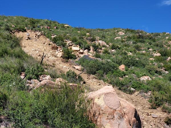
Landslides near the 2017 Thomas fire burn area that initiated during a series of atmospheric river events in December 2022 and January 2023.
Landslides near the 2017 Thomas fire burn area that initiated during a series of atmospheric river events in December 2022 and January 2023.
Example of a landslide that initiated within the footprint of the 2019 Cave Fire during the 9 January 2023 rainstorm. The landslide source area is shown in the upper left of this image. The debris-flow runout path is shown in the center and lower right of this image.
Example of a landslide that initiated within the footprint of the 2019 Cave Fire during the 9 January 2023 rainstorm. The landslide source area is shown in the upper left of this image. The debris-flow runout path is shown in the center and lower right of this image.

San Lorenzo, Puerto Rico landslide lonitoring site. The San Lorenzo monitoring station is located in a moderately vegetated area underlain by Cretaceous volcaniclastic rock.
San Lorenzo, Puerto Rico landslide lonitoring site. The San Lorenzo monitoring station is located in a moderately vegetated area underlain by Cretaceous volcaniclastic rock.

Dr. Donya-Frank Gilchrist of the USGS St. Petersburg Coastal and Marine Science Center facilitated a session on "Approaches to Resilience from the International Caribbean" at the 2023 Southeast and Caribbean Disaster Resilience Partnership (SCDRP) Annual Meeting in Miami, Florida.
Dr. Donya-Frank Gilchrist of the USGS St. Petersburg Coastal and Marine Science Center facilitated a session on "Approaches to Resilience from the International Caribbean" at the 2023 Southeast and Caribbean Disaster Resilience Partnership (SCDRP) Annual Meeting in Miami, Florida.

From left to right: Meaghan Emory, Dr. Donya Frank-Gilchrist, Dr.
From left to right: Meaghan Emory, Dr. Donya Frank-Gilchrist, Dr.

Dr. Donya-Frank Gilchrist of the USGS St. Petersburg Coastal and Marine Science Center facilitated a session on "Approaches to Resilience from the International Caribbean" at the 2023 Southeast and Caribbean Disaster Resilience Partnership (SCDRP) Annual Meeting in Miami, Florida.
Dr. Donya-Frank Gilchrist of the USGS St. Petersburg Coastal and Marine Science Center facilitated a session on "Approaches to Resilience from the International Caribbean" at the 2023 Southeast and Caribbean Disaster Resilience Partnership (SCDRP) Annual Meeting in Miami, Florida.

A USGS Hawaiian Volcano Observatory geologist documents the new eruption within Halema‘uma‘u crater, at Kīlauea summit within Hawai‘i Volcanoes National Park. The eruption began just after 4:30 p.m. on January 5, 2023, and remains confined to Halema‘uma‘u crater. USGS image by D. Downs.
A USGS Hawaiian Volcano Observatory geologist documents the new eruption within Halema‘uma‘u crater, at Kīlauea summit within Hawai‘i Volcanoes National Park. The eruption began just after 4:30 p.m. on January 5, 2023, and remains confined to Halema‘uma‘u crater. USGS image by D. Downs.

The KWcam webcam, on the west rim of Kīlauea caldera, was upgraded on January 4, 2023, to a more advanced model, which provides a slightly wider view and higher image quality. This should provide an improved view of any future activity in Halema‘uma‘u. In this photo, an HVO scientist begins the process of the webcam swap. USGS photo by M. Patrick.
The KWcam webcam, on the west rim of Kīlauea caldera, was upgraded on January 4, 2023, to a more advanced model, which provides a slightly wider view and higher image quality. This should provide an improved view of any future activity in Halema‘uma‘u. In this photo, an HVO scientist begins the process of the webcam swap. USGS photo by M. Patrick.