



Comparison of photographs taken on June 13 and 26 from near Keanakāko'i Crater overlook in Hawai'i Volcanoes National Park shows a subsidence scarp that formed as the Kīlauea Crater floor subsided. Scientists estimate the dramatic dropping of the crater floor in this area occurred sometime between June 23 and 26. The view is to the west.
Images
Images related to natural hazards.
Filter Total Items: 7278

Kīlauea Volcano —
Comparison of photographs taken on June 13 and 26 from near Keanakāko'i Crater overlook in Hawai'i Volcanoes National Park shows a subsidence scarp that formed as the Kīlauea Crater floor subsided. Scientists estimate the dramatic dropping of the crater floor in this area occurred sometime between June 23 and 26. The view is to the west.

Kīlauea Volcano — Documenting Fissure 8 Activity
USGS Hawaiian Volcano Observatory geology field crews maintain watch over the eruptive activity in the lower East Rift Zone and at Kīlauea's summit. Here, a geologist documents the behavior of lava as it exits the Fissure 8 cone. Lava enters the upper channel traveling as fast as 30 km/hour (18 mi/hour).
USGS Hawaiian Volcano Observatory geology field crews maintain watch over the eruptive activity in the lower East Rift Zone and at Kīlauea's summit. Here, a geologist documents the behavior of lava as it exits the Fissure 8 cone. Lava enters the upper channel traveling as fast as 30 km/hour (18 mi/hour).

Fissure 8 tephra cone changes shape through time
This animated gif shows the fissure 8 tephra (cinder and spatter) cone morphology changes between June 15 and 24, 2018. During this time a shoulder grew on the channel side of the cone as the vent shifted from being two distinct fountains to three, then to a single source of voluminous roiling.
This animated gif shows the fissure 8 tephra (cinder and spatter) cone morphology changes between June 15 and 24, 2018. During this time a shoulder grew on the channel side of the cone as the vent shifted from being two distinct fountains to three, then to a single source of voluminous roiling.

Woods Hole's Aerial Imaging and Mapping pilots in Hawaii
Woods Hole's Aerial Imaging and Mapping pilots in HawaiiWoods Hole Coastal and Marine Science Center's Aerial Imaging and Mapping rock stars preparing to fly Unmanned Aerial Systems (UAS) mission while a river of lava flows in the background
Woods Hole's Aerial Imaging and Mapping pilots in Hawaii
Woods Hole's Aerial Imaging and Mapping pilots in HawaiiWoods Hole Coastal and Marine Science Center's Aerial Imaging and Mapping rock stars preparing to fly Unmanned Aerial Systems (UAS) mission while a river of lava flows in the background

Kīlauea Volcano — Fissure 8 From Luana Street
View of the fissure 8 cone and fountain from the end of Luana Street in Leilani Estates. Photo taken at 12:20 p.m.
View of the fissure 8 cone and fountain from the end of Luana Street in Leilani Estates. Photo taken at 12:20 p.m.
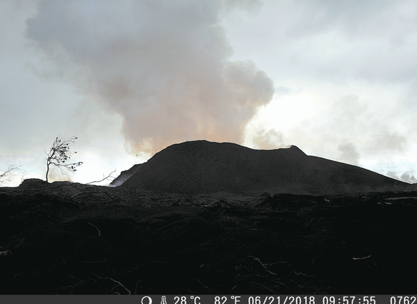
Kīlauea Volcano — Fissure 8 Cone Changes (GIF)

Kīlauea Volcano — Halema`uma`u Panoramic
This panorama of Kīlauea's summit caldera was made about 10 a.m. HST from the Keanakāko‘i overlook on the south side of the caldera. Halema‘uma‘u is visible steaming to the left, and the ongoing ground cracking is visible in the center of the image.
This panorama of Kīlauea's summit caldera was made about 10 a.m. HST from the Keanakāko‘i overlook on the south side of the caldera. Halema‘uma‘u is visible steaming to the left, and the ongoing ground cracking is visible in the center of the image.

USGS HVO geology field crews document the behavior of lava as it ex...
USGS HVO geology field crews document the behavior of lava as it ex...USGS Hawaiian Volcano Observatory geology field crews document the behavior of lava as it exits the Fissure 8 cone. Lava enters the upper channel traveling as fast as 30 km/hour (18 mi/hour).
USGS HVO geology field crews document the behavior of lava as it ex...
USGS HVO geology field crews document the behavior of lava as it ex...USGS Hawaiian Volcano Observatory geology field crews document the behavior of lava as it exits the Fissure 8 cone. Lava enters the upper channel traveling as fast as 30 km/hour (18 mi/hour).

Kīlauea Volcano — Sunrise Over Lava Channel
Early morning view of the open lava channel during helicopter overflight of the lower East Rift Zone.
Early morning view of the open lava channel during helicopter overflight of the lower East Rift Zone.

Subsidence of caldera floor impedes ability to transmit data
Subsidence of caldera floor impedes ability to transmit dataLocation of the NPIT GPS station, relative to the Hawaiian Volcano Observatory (HVO). Beginning on June 8, 2018, a portion of the caldera floor north of Halema'uma'u, where NPIT was located, began to slump into the crater.
Subsidence of caldera floor impedes ability to transmit data
Subsidence of caldera floor impedes ability to transmit dataLocation of the NPIT GPS station, relative to the Hawaiian Volcano Observatory (HVO). Beginning on June 8, 2018, a portion of the caldera floor north of Halema'uma'u, where NPIT was located, began to slump into the crater.

Kīlauea Volcano — Lava Flows from Fissure 8
View to the southwest, looking "up" the lava channel. Lava flows from Fissure 8 (not pictured) through the open channel about 13 km (8 mi) to the ocean. Lava remains incandescent (glowing orange) along the entire length of the channel with sections of cooled lava (black) on the surface.
View to the southwest, looking "up" the lava channel. Lava flows from Fissure 8 (not pictured) through the open channel about 13 km (8 mi) to the ocean. Lava remains incandescent (glowing orange) along the entire length of the channel with sections of cooled lava (black) on the surface.

Kīlauea Volcano — Fissure 8 Fountain
At fissure 8, fountains provide a vigorous supply of lava that exits the cinder cone and drops over a spillway to enter a well-established lava channel that extends to the sea.
At fissure 8, fountains provide a vigorous supply of lava that exits the cinder cone and drops over a spillway to enter a well-established lava channel that extends to the sea.

Kīlauea Volcano — Small Halema`uma`u Eruption (June 24, 2018)
Kīlauea Volcano — Small Halema`uma`u Eruption (June 24, 2018)On June 24 a small ash-poor steam plume rose above the Halema‘uma‘u crater rim following another collapse explosion event at 4:12 p.m. HST (image taken at 4:27 p.m.).
Kīlauea Volcano — Small Halema`uma`u Eruption (June 24, 2018)
Kīlauea Volcano — Small Halema`uma`u Eruption (June 24, 2018)On June 24 a small ash-poor steam plume rose above the Halema‘uma‘u crater rim following another collapse explosion event at 4:12 p.m. HST (image taken at 4:27 p.m.).

Kīlauea summit subsides and produces frequent earthquakes
Kīlauea summit subsides and produces frequent earthquakesOn June 23, 2018 at 4:32 p.m. HST after approximately 17 hours of elevated seismicity, a collapse explosion occurred at the summit if Kīlauea. The energy released by the event was equivalent to a magnitude 5.3 earthquake.
Kīlauea summit subsides and produces frequent earthquakes
Kīlauea summit subsides and produces frequent earthquakesOn June 23, 2018 at 4:32 p.m. HST after approximately 17 hours of elevated seismicity, a collapse explosion occurred at the summit if Kīlauea. The energy released by the event was equivalent to a magnitude 5.3 earthquake.

Kīlauea Volcano — Ocean Entry
Lava is entering the sea on the southern side of the entry area primarily through the open channel, but also along a 1 km (0.6 mi) wide area. The entry areas are marked by billowing laze plumes.
Lava is entering the sea on the southern side of the entry area primarily through the open channel, but also along a 1 km (0.6 mi) wide area. The entry areas are marked by billowing laze plumes.

Kīlauea Volcano — Fissure 8 Lava Fountain
Aerial view of lava fountain at Fissure 8 and uppermost lava channel during an early morning overflight of the lava flow&nbs
Aerial view of lava fountain at Fissure 8 and uppermost lava channel during an early morning overflight of the lava flow&nbs

The spatter cone at fissure 8 is now about 55 m (180 ft) tall. Lava...
The spatter cone at fissure 8 is now about 55 m (180 ft) tall. Lava...The spatter cone at fissure 8 is now about 55 m (180 ft) tall. Lava fountains rise only occasionally above that point, sending a shower of tephra (cooled lava fragments) over the rim.
The spatter cone at fissure 8 is now about 55 m (180 ft) tall. Lava...
The spatter cone at fissure 8 is now about 55 m (180 ft) tall. Lava...The spatter cone at fissure 8 is now about 55 m (180 ft) tall. Lava fountains rise only occasionally above that point, sending a shower of tephra (cooled lava fragments) over the rim.

Fissure 8, lava channel, and ocean entry all active
Fissure 8, lava channel, and ocean entry all activeAerial view of lava fountain at Fissure 8 and uppermost lava channel during an early morning overflight of the lava flow field.
Fissure 8, lava channel, and ocean entry all active
Fissure 8, lava channel, and ocean entry all activeAerial view of lava fountain at Fissure 8 and uppermost lava channel during an early morning overflight of the lava flow field.

View to SW, looking "up" the lava channel. Lava flows from Fissure ...
View to SW, looking "up" the lava channel. Lava flows from Fissure ...View to the southwest, looking "up" the lava channel. Lava flows from Fissure 8 (not pictured) through the open channel about 13 km (8 mi) to the ocean. Lava remains incandescent (glowing orange) along the entire length of the channel with sections of cooled lava (black) on the surface.
View to SW, looking "up" the lava channel. Lava flows from Fissure ...
View to SW, looking "up" the lava channel. Lava flows from Fissure ...View to the southwest, looking "up" the lava channel. Lava flows from Fissure 8 (not pictured) through the open channel about 13 km (8 mi) to the ocean. Lava remains incandescent (glowing orange) along the entire length of the channel with sections of cooled lava (black) on the surface.

Kīlauea Volcano — Roadway Crack Observations
USGS field crews track activity in and around Leilani Estates in Kīlauea Volcano's lower East Rift Zone. Observations are also collected on a daily basis from cracks in the area of Highway 130, shown here (no changes in temperature, crack width, or gas emissions have been noted recently).
USGS field crews track activity in and around Leilani Estates in Kīlauea Volcano's lower East Rift Zone. Observations are also collected on a daily basis from cracks in the area of Highway 130, shown here (no changes in temperature, crack width, or gas emissions have been noted recently).

Kīlauea Volcano — Spatter Cone (Fissure 8)
The spatter cone at fissure 8 is now about 55 m (180 ft) tall. Lava fountains rise only occasionally above that point, sending a shower of
The spatter cone at fissure 8 is now about 55 m (180 ft) tall. Lava fountains rise only occasionally above that point, sending a shower of