
Groundwater, Aquifers, Wells, and Springs
Groundwater, Aquifers, Wells, and Springs
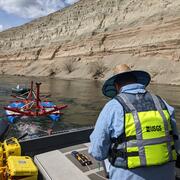
Filter Total Items: 107

National Water-Quality Project Sampling Methods
USGS National Water Quality Assessment (NAWQA) studies require analyses of stream and bed-sediment samples for major ions, nutrients, sediments, and organic contaminants that are consistent across time and space. Procedures have been designed specifically to produce information that is comparable among studies in different parts of the Nation.

Thermal Imaging Cameras for Studying Groundwater/Surface-Water Exchange
USGS scientists are using high-resolution handheld and airborne thermal imaging cameras in groundwater/surface-water exchange studies and other investigations where surface temperature contrasts indicate various hydrological processes. These cameras are used to quickly locate and characterize thermal (temperature) anomalies along streams, lakes, wetlands, estuaries, and across the landscape...

What does groundwater have to do with ice in Alaska?
USGS scientists are working alongside university researchers in Alaska to understand how groundwater and permafrost conditions change over time due to seasonal variations and climate change. Changes in permafrost can pose a threat to built infrastructure (like roads, homes, and pipelines) and to valued ecological resources that provide important habitats for wildlife.

Fiber-Optic Distributed Temperature Sensing Technology for Surface-Water and Groundwater Studies
Fiber-optic distributed temperature sensing (FO-DTS) technology can be used for characterizing estuary-aquifer and stream-aquifer interaction and for identifying transmissive fractures in bedrock boreholes.

Borehole Nuclear Magnetic Resonance (NMR)
Borehole nuclear magnetic resonance (NMR) is an emerging geophysical method being applied to hydrogeology investigations.

Spectral Gamma Borehole Logging
Spectral gamma borehole geophysical methods measure natural-gamma energy spectra, which are caused by the decay of uranium, thorium, potassium-40, and anthropogenic radioactive isotopes. Spectral gamma data can be used to identify and quantify the amount of uranium, thorium, and potassium-40 isotopes detected in boreholes.
Geophysics for USGS Groundwater/Surface Water Exchange Studies
Locating and quantifying exchanges of groundwater and surface water, along with characterizing geologic structure, is essential to water-resource managers and hydrologists for the development of effective water-resource policy, protection, and management. The USGS conducts applied research to evaluate the use of new or emerging hydrogeophysical tools and methods to improve our understanding of...

Water Chemistry Data for Selected Springs, Geysers, and Streams in Yellowstone National Park, Wyoming, Beginning 2009
Results of water analyses conducted on numerous thermal and non-thermal features in Yellowstone National Park beginning in 2009. Water samples were collected and analyzed as part of research investigations on arsenic, iron, nitrogen, and sulfur redox species in hot springs and overflow drainages; the occurrence and distribution of dissolved mercury; and general hydrogeochemistry of hot springs.

Groundwater-Level Response to Virginia Earthquake, August 23, 2011
A magnitude 5.8 (Mw) earthquake occurred at 1:51 pm EDT (17:51 UTC) on August 23, 2011, at a depth of about 3.7 miles (6 kilometers) beneath the town of Mineral, Virginia, located approximately 27 miles (45 kilometers) east of Charlottesville. The event is among the largest earthquakes recorded in the eastern United States.

Pore-Water Profiler, US Patent 8,051,727
Patent for a pore-water profiler and method for sampling pore water. The pore-water profiler includes a sample intake probe that receives the fluid to be sampled. (Full details provided by the U.S. Patent and Trademark Office website.)

Sequential, Time-Integrated Collector of Precipitation, Ground Water, and Surface Water for Analysis of Isotopes; US Patent 7,687,028
Patent for a sequential, time-integrated collector having an electronic controller that actuates either of two electrically-actuated valves, each connected to a water reservoir. (Full details provided by the U.S. Patent and Trademark Office website.)

Small-Scale, Hydrogen-Oxidizing Denitrifying Bioreactor, US Patent 6,863,815
A method for treating nitrate-contaminated water comprising treating said water with hydrogen-oxidizing denitrifying bacteria in the presence of hydrogen. (Full details provided by the U.S. Patent and Trademark Office website.)