U.S. flag

An official website of the United States government

Images

California Volcano Observatory images.

Filter Total Items: 179
 A woman geologist stands on the rubbly black surface of a lava flow exposed in the middle of the woods
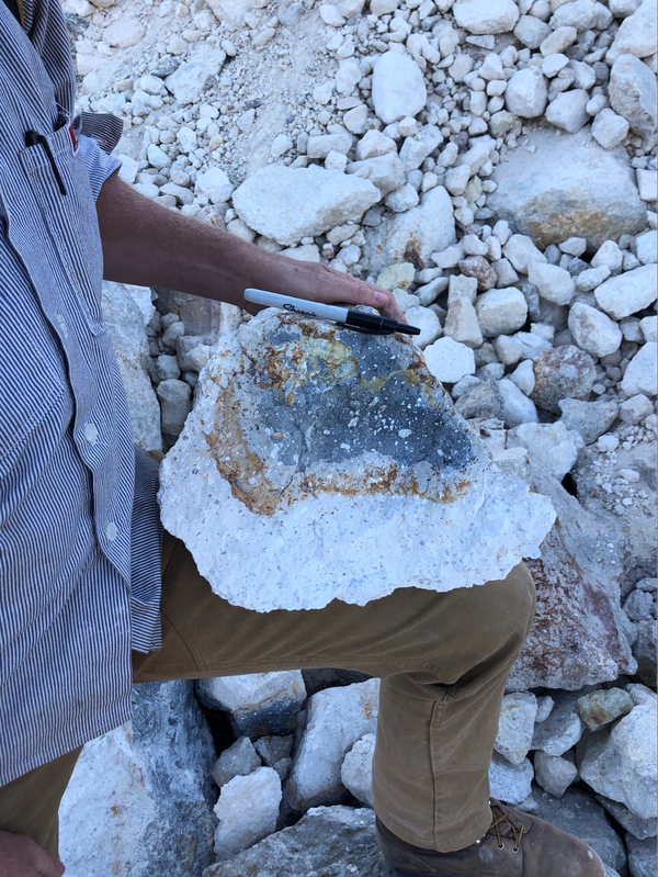
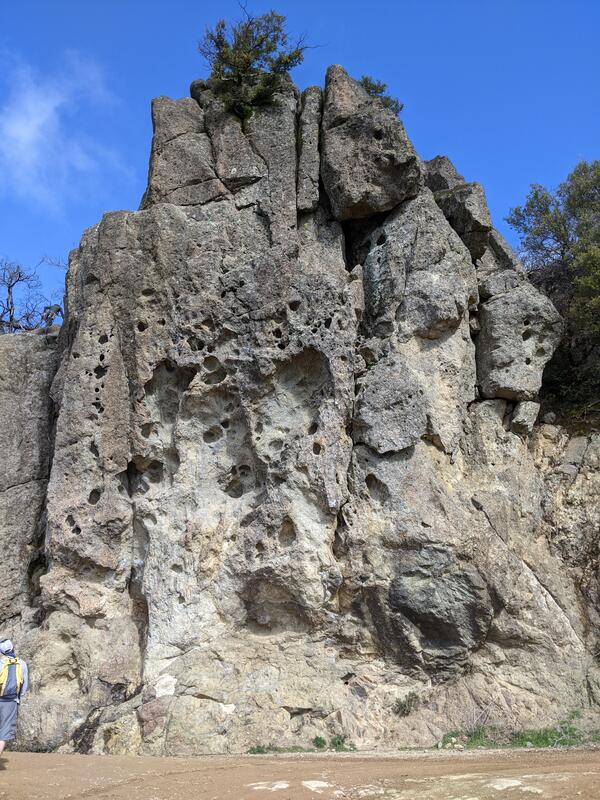
High Valley basaltic andesite lava flow, Clear Lake Volcanic Field, California

This lava flow of basaltic andesite composition erupted in the High Valley area. The blocky appearance of this flow top is termed 'A'ā (pronounced "ah-ah"), which is a Hawaiian term for lava flows that have a rough rubbly surface composed of broken lava blocks called clinkers. USGS photo by Dawnika Blatter

This lava flow of basaltic andesite composition erupted in the High Valley area. The blocky appearance of this flow top is termed 'A'ā (pronounced "ah-ah"), which is a Hawaiian term for lava flows that have a rough rubbly surface composed of broken lava blocks called clinkers. USGS photo by Dawnika Blatter

Man with baseball cap, sunglasses, and blue shirt standing in front of volcanic crater at Mount St. Helens.
Kyle R. Anderson
Kyle R. Anderson
Kyle R. Anderson

Kyle R. Anderson is a Volcano Geophysicist who works at the USGS California Volcano Observatory.

Kyle R. Anderson is a Volcano Geophysicist who works at the USGS California Volcano Observatory.

Several meter-size, rough-textured tan boulders sit among tall weeds and grass. In the distance, a steep slope sparsely covered with sagebrush makes up the horizon.
Dacite, Clear Lake Volcanic Field

This outcropping of rocks along Morgan Valley Road is comprised of dacite, the most common composition in the Clear Lake Volcanic Field. Dacite contains more silica than basalt but less than rhyolite, so it’s commonly referred to as an “intermediate” composition.

This outcropping of rocks along Morgan Valley Road is comprised of dacite, the most common composition in the Clear Lake Volcanic Field. Dacite contains more silica than basalt but less than rhyolite, so it’s commonly referred to as an “intermediate” composition.

Man standing next to rock with hat and high-vis vest. Snow covered mountain in background.
Phil Dawson at Mount Shasta

Phil Dawson, a Volcano Seismologist with the California Volcano Observatory, stands next to a volcanic rock on the flank of Mount Shasta, California.

Phil Dawson, a Volcano Seismologist with the California Volcano Observatory, stands next to a volcanic rock on the flank of Mount Shasta, California.

person with light blue button up shirt and short hair.
Joshua Crozier
Joshua Crozier
Joshua Crozier

Joshua Crozier is a Mendenhall Postdoctoral Fellow working at the USGS California Volcano Observatory

Joshua Crozier is a Mendenhall Postdoctoral Fellow working at the USGS California Volcano Observatory

A steaming hot spring and stream flow through the yellow-and-white altered rock of a hydrothermal area. A raised walkway is visible in the background.
Devil's Kitchen hydrothermal area in the Lassen Volcanic Center

Devils Kitchen in the Lassen Volcanic Region (within the bounds of the Lassen Volcanic National Park) is the second largest of Lassen's hydrothermal areas, after Bumpass Hell. Located in the Warner Valley in the southeast corner of the Park, Devils Kitchen contains boiling springs, mudpots, hot streams, and steam vents. USGS photo courtesy of Deb Bergfeld

Devils Kitchen in the Lassen Volcanic Region (within the bounds of the Lassen Volcanic National Park) is the second largest of Lassen's hydrothermal areas, after Bumpass Hell. Located in the Warner Valley in the southeast corner of the Park, Devils Kitchen contains boiling springs, mudpots, hot streams, and steam vents. USGS photo courtesy of Deb Bergfeld

A female geologist in a bright fuschia shirt stands on a brushy slope in front of several conical hills
Eruption Episode 1 rocks, Clear Lake Volcanic Field, California

Eruption episode 1 contains the oldest rocks in the Clear Lake Volcanic Field. The rock on the ridge in the background., located off Butts Canyon Road, is a lava flow that erupted around 2 million years ago.

Eruption episode 1 contains the oldest rocks in the Clear Lake Volcanic Field. The rock on the ridge in the background., located off Butts Canyon Road, is a lava flow that erupted around 2 million years ago.

An isolated, large rocky hill rises above a foggy Pacific beach lined with crashing waves
Morro Rock
Morro Rock
Morro Rock

Morro Rock is the westernmost peak in a chain of hills known locally as the “Morros” or the “Nine Sisters.”. It is a volcanic neck or plug composed of dacite which crystallized in the vent of a volcano and was later exposed by erosion. USGS photo by J. Ball

Morro Rock is the westernmost peak in a chain of hills known locally as the “Morros” or the “Nine Sisters.”. It is a volcanic neck or plug composed of dacite which crystallized in the vent of a volcano and was later exposed by erosion. USGS photo by J. Ball

An expansive view from the top of a tall hill shows a large lake bordered by a large forested mountain with several peaks.
Mount Konocti, Clear Lake Volcanic Field

A southwesterly view of Mount Konocti, which is one of the largest volcanic features in the Clear Lake Volcanic Field. Buckingham Peninsula can also be seen stretching from the base of Mount Konocti into the foreground toward the eastern shore of the lake.  USGS photo by J.Ball

A southwesterly view of Mount Konocti, which is one of the largest volcanic features in the Clear Lake Volcanic Field. Buckingham Peninsula can also be seen stretching from the base of Mount Konocti into the foreground toward the eastern shore of the lake.  USGS photo by J.Ball

A hiker looks up at a cliff of pockmarked, grungy gray rock which has fractures and multiple shades of white and tan breaking up its surface. The pockmarks resemble honeycomb, and the overall texture of the rock shows that it has numerous chunks of smaller rocks embedded in a white matrix.
Intracaldera tuff on Mount St. Helena, Sonoma Volcanic Field, CA

Ash-flow tuff (ignimbrite) on the fire road leading to the summit of Mount St. Helena, mapped as part of the intracaldera Sonoma volcanics. 

A dark red, rubbly cliff of lava angles sharply into the background over a flat terrace of bright green grass
Berkeley Hills Volcanic Field

The Moraga Volcanics, one of several volcanic formations found in the Berkeley Hills Volcanic Field, frame a view of Mount Diablo to the east. The basaltic lava flows and their associated lapilli tuffs can be found in the Sibley Volcanic Regional Preserve. USGS photo by J. Ball

The Moraga Volcanics, one of several volcanic formations found in the Berkeley Hills Volcanic Field, frame a view of Mount Diablo to the east. The basaltic lava flows and their associated lapilli tuffs can be found in the Sibley Volcanic Regional Preserve. USGS photo by J. Ball

A geologist in a blue shirt and khakis supports a basketball-sized chunk of lava on his knee. A bright white "rind" makes up about half of the chunk, surrounding a core of dark gray lava speckled with white crystals. A marker rests on the chunk for a sense of scale, and similar white chunks of lava make up the background of the photo.
A heavily hydrothermally-altered sample of lava from the Clear Lake Volcanic Field

Geologists often break off the weathered surfaces of rocks in the field to get at the fresh, clean cores. This makes it easier to see the original mineralogy of the rock in question without oxidation, alteration, or other environmental impacts. USGS photo by D. Blatter

Geologists often break off the weathered surfaces of rocks in the field to get at the fresh, clean cores. This makes it easier to see the original mineralogy of the rock in question without oxidation, alteration, or other environmental impacts. USGS photo by D. Blatter

A geologist wearing a blue button-down shirt, khaki pants, and an orange ball cap uses a rock hammer to break smaller chunks off the large, weathered, brownish boulders that surround him. The interior of the chunks is revealed to be a pale, speckled gray.
Breaking off the weathered surface of lavas in the Clear Lake Volcanic Field to sample the fresh, unaltered cores

Geologists often break off the weathered surfaces of rocks in the field to get at the fresh, clean cores. This makes it easier to see the original mineralogy of the rock in question without oxidation, alteration, or other environmental impacts. USGS photo by D. Blatter.

A geologist in tan pants, a blue button-down shirt and an orange hat stands with one foot on a boulder at the side of a road, holding up a baggie of rocks. Behind him the ground has been scraped bare by construction equipment.
Basalt, Clear Lake Volcanic Field

These freshly excavated boulders along Spruce Grove Road are basalt, which is an iron and magnesium-rich rock that’s fairly uncommon in the Clear Lake Volcanic Field.

These freshly excavated boulders along Spruce Grove Road are basalt, which is an iron and magnesium-rich rock that’s fairly uncommon in the Clear Lake Volcanic Field.

A male geologist in an orange ballcap and blue button-down shirt holds a rock hammer in one hand and a rock in the other.
Eruption Episode 3 rocks, Clear Lake Volcanic Field, California

Eruption episode 3 is the most voluminous in the history of the Clear Lake Volcanic Field. Episode 3 rocks are of intermediate composition, primarily dacite, and make up many of the topographic high points in the field, including Mt. Konocti, where this photo is taken.

Eruption episode 3 is the most voluminous in the history of the Clear Lake Volcanic Field. Episode 3 rocks are of intermediate composition, primarily dacite, and make up many of the topographic high points in the field, including Mt. Konocti, where this photo is taken.

In front of an outcrop of matte grey rock splotched with lichens, a young man in an orange safety vest gives a happy thumbs up and an older man sits writing notes in a small notebook and smiles at the camera. The rocks are perched on a moderate slope covered in brushy manzanita and scraggly pine trees.
CalVO geologists take paleomag samples from a basaltic andesite lava flow on Ash Creek Butte

Andy Calvert and Tony Pivarunas drill into the face of a lava flow on Ash Creek Butte, a Pleistocene shield volcano northeast of Mount Shasta. USGS photo by Dawnika Blatter

Geophysicist works at station PR05, part of the Mount Rainier lahar detection network.
Station PR05 is part of the Mount Rainier lahar detection network.

USGS-Cascades Volcano Observatory geophysicist Rebecca Kramer works on station PR05, which is part of the Mount Rainier lahar detection network (Mount Rainier is pictured in the distance). The purpose of the site visit was to upgrade the power system and deploy infrasound equipment. 

USGS-Cascades Volcano Observatory geophysicist Rebecca Kramer works on station PR05, which is part of the Mount Rainier lahar detection network (Mount Rainier is pictured in the distance). The purpose of the site visit was to upgrade the power system and deploy infrasound equipment. 

This photo looks across an active rock quarry at a conical hill that has been mined, revealing a dark red interior
Clearlake Oaks cinder cone, Clear Lake Volcanic Field, California

Cinder cones (or scoria cones) are relatively small, steep-sided volcanoes that are constructed around a single vent when lava is ejected into the air, breaks into smaller pieces, and builds up around the sides of the vent. This photo is looking across the quarry which exposes the interior of a cinder cone east of Clearlake Oaks in the Clear Lake Volcanic Field.

Cinder cones (or scoria cones) are relatively small, steep-sided volcanoes that are constructed around a single vent when lava is ejected into the air, breaks into smaller pieces, and builds up around the sides of the vent. This photo is looking across the quarry which exposes the interior of a cinder cone east of Clearlake Oaks in the Clear Lake Volcanic Field.

A view on a clear day, looking down from a high volcanic peak at a cratered promontory in the blue waters of Clear Lake.
Buckingham Peninsula, Clear Lake, CA

Located at the midpoint of Clear Lake in Lake County, California, Buckingham Peninsula shows evidence of young explosive volcanism in the Clear Lake Volcanic Field. Little Borax Lake, enclosed within the Buckingham golf course, is a water-filled maar crater, as is Horseshoe Bay to its northeast. USGS photo by J. Ball.

Located at the midpoint of Clear Lake in Lake County, California, Buckingham Peninsula shows evidence of young explosive volcanism in the Clear Lake Volcanic Field. Little Borax Lake, enclosed within the Buckingham golf course, is a water-filled maar crater, as is Horseshoe Bay to its northeast. USGS photo by J. Ball.

Was this page helpful?