
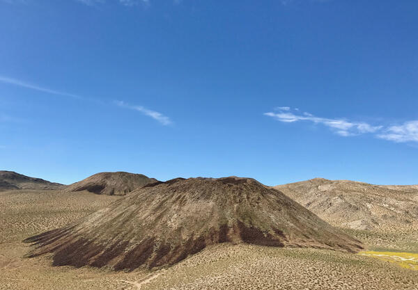
The photo shows several silica-rich lava domes in the Coso Volcanic Field, the closest of which erupted onto the desert floor around 80,000 years ago. USGS photo by Seth Burgess.
Images
California Volcano Observatory images.
Filter Total Items: 186
Lava domes in the Coso Volcanic Field
The photo shows several silica-rich lava domes in the Coso Volcanic Field, the closest of which erupted onto the desert floor around 80,000 years ago. USGS photo by Seth Burgess.

Flow banding of Panum pumice and obsidian
Flow banding of Panum pumice and obsidian of the same composition.
Flow banding of Panum pumice and obsidian of the same composition.

Salton Sea mud pot
A mud pot releases a burst of gas in the Davis-Schrimpf Seep Field near the Salton Sea. The geothermal area here is related to the same faulting and volcanic system which created the Salton Buttes lava domes. USGS photo by Deb Bergfeld, 2016.
A mud pot releases a burst of gas in the Davis-Schrimpf Seep Field near the Salton Sea. The geothermal area here is related to the same faulting and volcanic system which created the Salton Buttes lava domes. USGS photo by Deb Bergfeld, 2016.

Drew Downs in Iceland
Drew Downs in Iceland with a glacier in hte background.
Drew Downs in Iceland with a glacier in hte background.

Model of reservoirs underneath Long Valley Caldera
Model of reservoirs underneath Long Valley CalderaMain hydrothermal features of the new (2016) 3-D model of the subsurface at Long Valley Caldera. This schematic is based on a survey of the electrical properties of the earth (magnetotellurics) below. Arrows show subsurface water flow, with colors keyed to changing water temperature, from blue (cold) to red (hot). Purple arrows show an extinct hot water pathway.

View of a snow-covered Mount Shasta, CA, photo taken in June 2017
View of a snow-covered Mount Shasta, CA, photo taken in June 2017The photo was taken from a vantage looking up Avalanche Gulch at Red Banks (a line of cliffs along the ridge central to the photograph).
View of a snow-covered Mount Shasta, CA, photo taken in June 2017
View of a snow-covered Mount Shasta, CA, photo taken in June 2017The photo was taken from a vantage looking up Avalanche Gulch at Red Banks (a line of cliffs along the ridge central to the photograph).

USGS offices at Moffett Field, CA
The USGS Bay Area offices are located in Building 19 at Moffett Field, part of the NASA Ames Research Center
The USGS Bay Area offices are located in Building 19 at Moffett Field, part of the NASA Ames Research Center

Long Valley Caldera range-front faults terminate at the caldera bou...
Long Valley Caldera range-front faults terminate at the caldera bou...This is a simplified diagram of regional range front faults as they intersect the Long Valley Caldera.
Long Valley Caldera range-front faults terminate at the caldera bou...
Long Valley Caldera range-front faults terminate at the caldera bou...This is a simplified diagram of regional range front faults as they intersect the Long Valley Caldera.

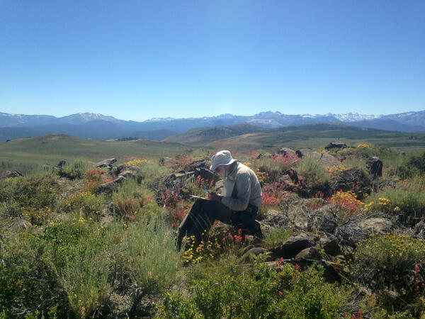
Geologic field-trip guide to Lassen Volcanic National Park
Geologic field-trip guide to Lassen Volcanic National ParkGeologic field-trip guide to Lassen Volcanic National Park and vicinity, California
Geologic field-trip guide to Lassen Volcanic National Park
Geologic field-trip guide to Lassen Volcanic National ParkGeologic field-trip guide to Lassen Volcanic National Park and vicinity, California

Monitoring Seismicity in the Long Valley
CalVO's Stuart Wilkinson skis out to a remote seismic instrument in the Long Valley volcanic region to perform routine maintenance.
CalVO's Stuart Wilkinson skis out to a remote seismic instrument in the Long Valley volcanic region to perform routine maintenance.

Cliffs near Point Bonita lighthouse, Golden Gate National Recreation Area, California
Cliffs near Point Bonita lighthouse, Golden Gate National Recreation Area, CaliforniaCliffs of Franciscan Complex rocks near the Point Bonita Lighthouse reveal metamorphosed pillow lava at their bases. USGS photo by Jessica L. Ball

Point Bonita metabasalt pillows, Bay Area, California
Point Bonita metabasalt pillows, Bay Area, CaliforniaIn this view down from the Point Bonita lighthouse, a sea arch made up of slightly metamorphosed pillow basalts rises from the surf. The green tinge on some of the "pillows" is the result of metamorphism, replacing primary minerals with greener ones such as chlorite and epidote. USGS photo by Jessica L. Ball

Conceptual geologic model of partially crystallized magma (C1, C3) ...
Conceptual geologic model of partially crystallized magma (C1, C3) ...C1 and C3 are granitic crystal-melt mush (partially crystallized magma) columns that fed the most recent Mono Craters eruptions. The connection from C1 to South Coulée (SC) is older and colder than the connection from C3 to North Coulée (NC) and Panum Crater (PC), which carries hydrothermal fluid to the surface.
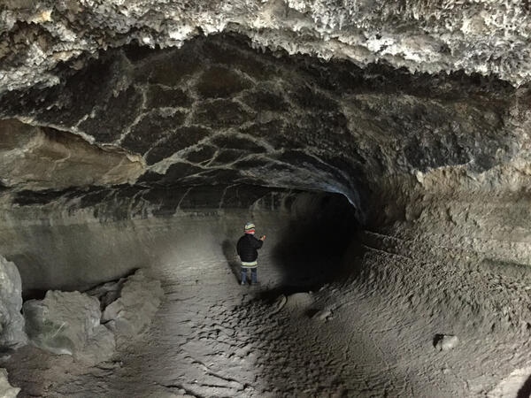
Valentine Cave lava tube at Medicine Lake volcano
View from entrance of Valentine Cave toward interior shows the raised lines of high-lava marks on wall on wall of central pillar. USGS photo by J. Donnelly-Nolan.
View from entrance of Valentine Cave toward interior shows the raised lines of high-lava marks on wall on wall of central pillar. USGS photo by J. Donnelly-Nolan.
Wes Hildreth in Long Valley, 2016
Wes spent much of his 48 years with the USGS working in the Long Valley Caldera. USGS photo by Emily Montgomery-Brown.
Wes spent much of his 48 years with the USGS working in the Long Valley Caldera. USGS photo by Emily Montgomery-Brown.

Plot of quakes in Mount Shasta region greater M1.0 from 2010 to 2016
Plot of quakes in Mount Shasta region greater M1.0 from 2010 to 2016Plot of earthquakes in Mount Shasta region greater than M1.0 from April 3, 2010 to April 3, 2015.
Plot of quakes in Mount Shasta region greater M1.0 from 2010 to 2016
Plot of quakes in Mount Shasta region greater M1.0 from 2010 to 2016Plot of earthquakes in Mount Shasta region greater than M1.0 from April 3, 2010 to April 3, 2015.
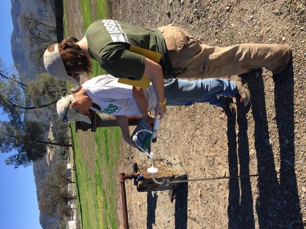
Sampling gas at Kelseyville, California's Gas Hill
Sampling gas at Kelseyville, California's Gas HillUSGS scientists Deb Bergfeld and Laura Clor collect samples of the gas from the old Gas Hill wellhead in Kelseyville, CA. USGS photo by Jen Lewicki.
Sampling gas at Kelseyville, California's Gas Hill
Sampling gas at Kelseyville, California's Gas HillUSGS scientists Deb Bergfeld and Laura Clor collect samples of the gas from the old Gas Hill wellhead in Kelseyville, CA. USGS photo by Jen Lewicki.

Mount Shasta, CA simplified hazards map
Mount Shasta, California simplified hazards map showing potential impact area for ground-based hazards during a volcanic event.
Mount Shasta, California simplified hazards map showing potential impact area for ground-based hazards during a volcanic event.

Lidar images of Shastina cone, west flank of Mount Shasta, CA. Deta...
Lidar images of Shastina cone, west flank of Mount Shasta, CA. Deta...Lidar images of Shastina cone, west flank of Mount Shasta, California. Details of lava flows and other surficial features are best seen in the image to the right with vegetation removed.
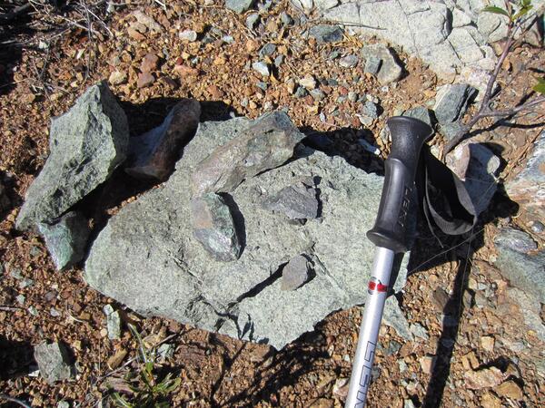
Serpentinite in California's Coast Range mountains
Serpentinite in California's Coast Range mountainsA typical California serpentinite shining in the sun. The greenish hues come from the minerals lizardite, antigorite, and chrysotile. USGS photo by J. Ball.
Serpentinite in California's Coast Range mountains
Serpentinite in California's Coast Range mountainsA typical California serpentinite shining in the sun. The greenish hues come from the minerals lizardite, antigorite, and chrysotile. USGS photo by J. Ball.

Titanium tubed used to collect gas from a fumarole near Lassen, CA
Titanium tubed used to collect gas from a fumarole near Lassen, CATitanium tubed used to collect gas from a fumarole near Lassen Peak, California.
Titanium tubed used to collect gas from a fumarole near Lassen, CA
Titanium tubed used to collect gas from a fumarole near Lassen, CATitanium tubed used to collect gas from a fumarole near Lassen Peak, California.