
(Left to right) Danny Brothers (USGS Pacific Coastal and Marine Science Center [PCMSC]), Peter Haeussler (USGS Alaska Science Center), Maureen Walton (PCMSC), and Jamie Conrad (PCMSC) select seafloor sediment samples from cores collected along the Queen Charlotte-Fairweather fault.
Images
Explore our planet through photography and imagery, including climate change and water all the way back to the 1800s when the USGS was surveying the country by horse and buggy.
Filter Total Items: 21343

Selecting sediment samples from cores
(Left to right) Danny Brothers (USGS Pacific Coastal and Marine Science Center [PCMSC]), Peter Haeussler (USGS Alaska Science Center), Maureen Walton (PCMSC), and Jamie Conrad (PCMSC) select seafloor sediment samples from cores collected along the Queen Charlotte-Fairweather fault.

Siklus Air - The Water Cycle, Bahasa
Siklus Air - The Water Cycle, Bahasa
Siklus Air - The Water Cycle, Bahasa

Veeringe Skeem - The Water Cycle, Estonian
Mis on veeringe?
Veeringe kirjeldab vee olemasolu ja liikumist Maa peal, sees ja kohal. Maakeral on vesi alati liikvel ning oma olekut muutmas - vedelast auruks ja jääks ning uuesti vedelaks. Veeringe on toiminud miljardeid aastaid ning sellest oleneb kogu elu Maal. Ilma selleta oleks Maa päris surnud paik.

המחזור ההידרולוגי - The Water Cycle, Hebrew
המחזור ההידרולוגי - The Water Cycle, Hebrew
המחזור ההידרולוגי - The Water Cycle, Hebrew

प्राकृतिक जल चक्र - The Natural Water Cycle, Hindi
प्राकृतिक जल चक्र - The Natural Water Cycle, Hindiबच्चों के लिए पानी/जल चक्र - The Water Cycle, Hindi
आप सोचते होंगे कि आसमान से गिरी बारिश की हर एक बूंद, या आपके पीने के पानी का प्रत्येक गिलास, हर बार नया है, परन्तु यह हमेशा से यहां पर है और यह पानी/जल का भाग है ।

জল-চক্র, The Water Cycle, Bangla
জল-চক্র, The Water Cycle, Bangla
জল-চক্র, The Water Cycle, Bangla

ວັດທະຈັກ ນໍ້າ ສໍາລັບ ໂຮງຮຽນ - The Water Cycle, Lao
ວັດທະຈັກ ນໍ້າ ສໍາລັບ ໂຮງຮຽນ - The Water Cycle, Laoວັດທະຈັກ ນໍ້າ ສໍາລັບ ໂຮງຮຽນ - The Water Cycle, Lao
ວັດທະຈັກ ນໍ້າ ສໍາລັບ ໂຮງຮຽນ - The Water Cycle, Lao
ວັດທະຈັກ ນໍ້າ ສໍາລັບ ໂຮງຮຽນ - The Water Cycle, Laoວັດທະຈັກ ນໍ້າ ສໍາລັບ ໂຮງຮຽນ - The Water Cycle, Lao

어린이를 위한 물의 순환 - The Water Cycle, Korean
어린이를 위한 물의 순환 - The Water Cycle, Korean
이 다이어그램은 자연 물 순환 만 보여줍니다. 인간의 영향을 무시하십시오.
어린이를 위한 물의 순환 - The Water Cycle, Korean
이 다이어그램은 자연 물 순환 만 보여줍니다. 인간의 영향을 무시하십시오.

Sunset view at Sunset Cliffs Natural Park, San Diego, CA
Sunset view at Sunset Cliffs Natural Park, San Diego, CAPeople watching a sunset at Sunset Cliffs Natural Park, San Diego, California. These natural cliffs overlook the Pacific Ocean and are a popular location to watch the sunset.
Sunset view at Sunset Cliffs Natural Park, San Diego, CA
Sunset view at Sunset Cliffs Natural Park, San Diego, CAPeople watching a sunset at Sunset Cliffs Natural Park, San Diego, California. These natural cliffs overlook the Pacific Ocean and are a popular location to watch the sunset.
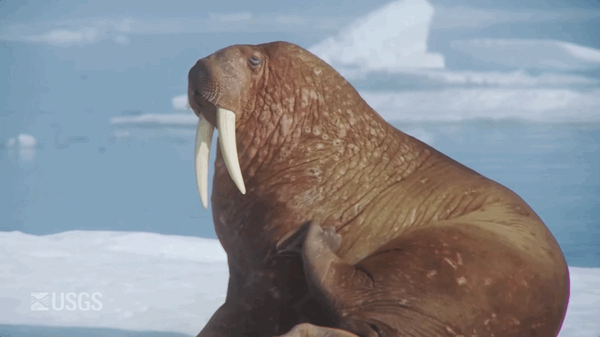
Walrus Itch
An animated GIF showing a Pacific Walrus scratching/rubbing themselves on their side with their "eye" rolling. The animation repeats in a reverse-motion.
An animated GIF showing a Pacific Walrus scratching/rubbing themselves on their side with their "eye" rolling. The animation repeats in a reverse-motion.

Cutting through 2-ft thick ice to sample Yellowstone River, Sidney MT
Cutting through 2-ft thick ice to sample Yellowstone River, Sidney MTCutting through 2-ft thick ice to sample Yellowstone River, Sidney MT
Cutting through 2-ft thick ice to sample Yellowstone River, Sidney MT
Cutting through 2-ft thick ice to sample Yellowstone River, Sidney MTCutting through 2-ft thick ice to sample Yellowstone River, Sidney MT

Egret Flyover, Petaluma River
While heading out to a survey plot off of San Pablo Bay, an egret flies over the Petaluma River in the early morning.
While heading out to a survey plot off of San Pablo Bay, an egret flies over the Petaluma River in the early morning.

Kanakee River at Davis, IN - ice and snow on gage
Kanakee River at Davis, IN - ice and snow on the gage.
Kanakee River at Davis, IN - ice and snow on the gage.

Kanakee River at Davis, IN - ice and snow on gage house
Kanakee River at Davis, IN - ice and snow on gage houseKanakee River at Davis, IN - ice and snow on gage house
Kanakee River at Davis, IN - ice and snow on gage house
Kanakee River at Davis, IN - ice and snow on gage houseKanakee River at Davis, IN - ice and snow on gage house

Kankakee River at Davis, IN - ice on gage
Kankakee River at Davis, IN - ice on gage

Kankakee River at Davis, IN - QW equipment
Kankakee River at Davis, IN - QW equipment

Kankakee River at Davis, IN - snow and ice on gage
Kankakee River at Davis, IN - snow and ice on gageKankakee River at Davis, IN - snow and ice on gage
Kankakee River at Davis, IN - snow and ice on gage
Kankakee River at Davis, IN - snow and ice on gageKankakee River at Davis, IN - snow and ice on gage

WERC Scientists Measure Wetland Elevation, Tule Slough
WERC Scientists Measure Wetland Elevation, Tule SloughKevin Buffington (USGS) and Tess Forstner (USGS) measure the elevation of the Tule Slough wetlands, CA.
WERC Scientists Measure Wetland Elevation, Tule Slough
WERC Scientists Measure Wetland Elevation, Tule SloughKevin Buffington (USGS) and Tess Forstner (USGS) measure the elevation of the Tule Slough wetlands, CA.

WERC Scientists on Petaluma River
Tess Forstner (USGS) and Kevin Buffington (USGS) set out on the Petaluma River, CA. Under the guidance of Dr. Karen Thorne, they are studying the effects of rising seas on Pacific coastal wetlands.
Tess Forstner (USGS) and Kevin Buffington (USGS) set out on the Petaluma River, CA. Under the guidance of Dr. Karen Thorne, they are studying the effects of rising seas on Pacific coastal wetlands.

WFRC Quantitative Culture for Renibacterium salmoninarum Image 2
WFRC Quantitative Culture for Renibacterium salmoninarum Image 2Spread plate procedure for quantitative culture Renibacterium salmoninarum from fish tissue or ovarian fluid.
WFRC Quantitative Culture for Renibacterium salmoninarum Image 2
WFRC Quantitative Culture for Renibacterium salmoninarum Image 2Spread plate procedure for quantitative culture Renibacterium salmoninarum from fish tissue or ovarian fluid.

Olympic Skiing and Land Change
Images from the Advanced Spaceborne Thermal Emission and Reflection Radiometer (ASTER) onboard NASA's Terra satellite show how one area in South Korea transformed from mountainous forest to a world-class downhill skiing venue to get ready for the 2018 Winter Olympics.
Images from the Advanced Spaceborne Thermal Emission and Reflection Radiometer (ASTER) onboard NASA's Terra satellite show how one area in South Korea transformed from mountainous forest to a world-class downhill skiing venue to get ready for the 2018 Winter Olympics.