
Controlled burn at Hart Mountain National Wildlife Refuge, Oregon.
Images
Explore photos, graphics, and illustrations related to projects from across the CASC Network. And be sure to check out our Climate Illustrations page, featuring free-to-download illustrations that help describe tricky climate concepts and explain how climate change affects the world around us.
Filter Total Items: 640

Sagebrush on fire in a controlled burn
Controlled burn at Hart Mountain National Wildlife Refuge, Oregon.
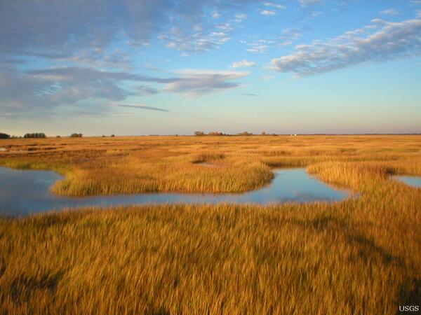
Tidal Marshland in the Plum Island Estuary, Massachusetts
Tidal Marshland in the Plum Island Estuary, MassachusettsThe marshes of Plum Island Estuary are among those predicted by scientists to submerge during the next century under conservative projections of sea-level rise.
Tidal Marshland in the Plum Island Estuary, Massachusetts
Tidal Marshland in the Plum Island Estuary, MassachusettsThe marshes of Plum Island Estuary are among those predicted by scientists to submerge during the next century under conservative projections of sea-level rise.

Desert Cottontail (Sylvilagus audubonii) with Tick in Ear
Desert Cottontail (Sylvilagus audubonii) with Tick in EarSide-view of a desert Cottontail sitting on the ground with tick in ear.
Desert Cottontail (Sylvilagus audubonii) with Tick in Ear
Desert Cottontail (Sylvilagus audubonii) with Tick in EarSide-view of a desert Cottontail sitting on the ground with tick in ear.

Rural stream in New York State
Gaged stream reach East Brook east of Walton, NY
Gaged stream reach East Brook east of Walton, NY

Lower Falls of the Yellowstone River, Yellowstone National Park, WY
Lower Falls of the Yellowstone River, Yellowstone National Park, WYThis is nearly the same view depicted in the 1872 sketch by Thomas Moran, and printed for the 150th anniversary commemoration of DOI.
Lower Falls of the Yellowstone River, Yellowstone National Park, WY
Lower Falls of the Yellowstone River, Yellowstone National Park, WYThis is nearly the same view depicted in the 1872 sketch by Thomas Moran, and printed for the 150th anniversary commemoration of DOI.

Photo of Dinkey Creek in the southern Sierra Nevada, California
Photo of Dinkey Creek in the southern Sierra Nevada, CaliforniaPhoto of Dinkey Creek in the southern Sierra Nevada, California, showing a small waterfall cascading down a bedrock slope.
Photo of Dinkey Creek in the southern Sierra Nevada, California
Photo of Dinkey Creek in the southern Sierra Nevada, CaliforniaPhoto of Dinkey Creek in the southern Sierra Nevada, California, showing a small waterfall cascading down a bedrock slope.

Sagebrush-grasslands
Sagebrush-grasslands

Sabine's Gull in Flight
Yukon Delta National Wildlife Refuge, Alaska.
Yukon Delta National Wildlife Refuge, Alaska.

Wetlands from ACE Basin National Wildlife Refuge
View of wetlands at ACE Basin National Wildlife Refuge.
View of wetlands at ACE Basin National Wildlife Refuge.

Jemez Red Rocks at Walatowa
A view of the Red Rocks at Walatowa on a clear day at 12:18pm.
A view of the Red Rocks at Walatowa on a clear day at 12:18pm.

Monarch butterfly on a plumeless thistle flower
A monarch butterfly drinks nectar from a plumeless thistle flower in an abandoned agricultural field.
A monarch butterfly drinks nectar from a plumeless thistle flower in an abandoned agricultural field.

Cosby Creek in Flood, Great Smoky Mountains National Park
Cosby Creek in Flood, Great Smoky Mountains National ParkI was hiking to Mt. Cammerer in the park and got caught in a torrential thunderstorm. On my way back to the campground, I met this view of the swollen creek and crossed by foot using hiking poles at the widest, shallowest point I could find.

Fish River on the Seward Peninsula, Alaska
Scenic view of the Fish River on Seward Peninsula, Alaska.
Scenic view of the Fish River on Seward Peninsula, Alaska.

Yukon River near Eagle, Alaska
Yukon River and rainbow near Eagle, Alaska
Yukon River and rainbow near Eagle, Alaska

Steam plume rising from Mount St. Helens, viewed from NW.
Steam plume rising from Mount St. Helens, viewed from NW.Steam plume rising from Mount St. Helens, viewed from the northwest.
Steam plume rising from Mount St. Helens, viewed from NW.
Steam plume rising from Mount St. Helens, viewed from NW.Steam plume rising from Mount St. Helens, viewed from the northwest.

Mount St. Helens and Mount Rainier, aerial view toward the north.
Mount St. Helens and Mount Rainier, aerial view toward the north.Mount St. Helens and Mount Rainier, aerial view toward the north.
Mount St. Helens and Mount Rainier, aerial view toward the north.
Mount St. Helens and Mount Rainier, aerial view toward the north.Mount St. Helens and Mount Rainier, aerial view toward the north.

Maui silversword on Haleakalā volcano
Beautifully striking contrast between the pale Maui silversword plant and the red volcanic rock of Haleakalā volcano.
Beautifully striking contrast between the pale Maui silversword plant and the red volcanic rock of Haleakalā volcano.

Cement Creek Following Storm Event
Cement Creek following storm event in July, 2004. Note the orange discoloration of the stream derived from weathering of bedrocks and from mined areas. This type of event happens frequently in the Animas Watershed near Silverton, Colorado. View is to the south, with Kendall Mountain in the distance.
Cement Creek following storm event in July, 2004. Note the orange discoloration of the stream derived from weathering of bedrocks and from mined areas. This type of event happens frequently in the Animas Watershed near Silverton, Colorado. View is to the south, with Kendall Mountain in the distance.

Scenic Panjsher Valley
Scenic Panjsher Valley hosts emerald deposits
Scenic Panjsher Valley hosts emerald deposits

Grassland-Forest Ecotone Near Tebicuary River
Grassland-Forest ecotone near Tebicuary river. This former pasture has not been grazed since an endangered bird species was discovered there half a dozen years ago. Monkeys are still found in the forest. The Ñeembucú Region is typified by extensive grasslands and wetlands.
Grassland-Forest ecotone near Tebicuary river. This former pasture has not been grazed since an endangered bird species was discovered there half a dozen years ago. Monkeys are still found in the forest. The Ñeembucú Region is typified by extensive grasslands and wetlands.

Roosevelt National Forest
Scenic view of Roosevelt National Forest.
Scenic view of Roosevelt National Forest.