
View of the apalachicola River looking upstream from in a bluff in the Nature Conservancy's Apalchicola Bluffs and Ravines Preserve.
Images
Explore photos, graphics, and illustrations related to projects from across the CASC Network. And be sure to check out our Climate Illustrations page, featuring free-to-download illustrations that help describe tricky climate concepts and explain how climate change affects the world around us.
Filter Total Items: 640

Apalachicola River Near Bristol, FL
View of the apalachicola River looking upstream from in a bluff in the Nature Conservancy's Apalchicola Bluffs and Ravines Preserve.

View of Colorado River confluence with the Little Colorado River
View of Colorado River confluence with the Little Colorado RiverView of Colorado River confluence with the Little Colorado River taken from the rim of Marble Canyon
View of Colorado River confluence with the Little Colorado River
View of Colorado River confluence with the Little Colorado RiverView of Colorado River confluence with the Little Colorado River taken from the rim of Marble Canyon

Snow Geese (Chen caerulescens)
Many snow geese flying.

Snow Geese (Chen caerulescens)
Snow geese.

Steller's Eiders in Izembek Lagoon. Isanotski Volcano in background
Steller's Eiders in Izembek Lagoon. Isanotski Volcano in backgroundSteller's Eiders in Izembek Lagoon. Isanotski Volcano in background
Steller's Eiders in Izembek Lagoon. Isanotski Volcano in background
Steller's Eiders in Izembek Lagoon. Isanotski Volcano in backgroundSteller's Eiders in Izembek Lagoon. Isanotski Volcano in background

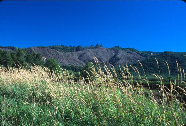
Skagit River Near Newhalem, WA
Summer view of the river.

Dryland agriculture in the Northwestern Great Plains ecoregion.
Dryland agriculture in the Northwestern Great Plains ecoregion.Dryland agriculture in the Northwestern Great Plains ecoregion.
Dryland agriculture in the Northwestern Great Plains ecoregion.
Dryland agriculture in the Northwestern Great Plains ecoregion.Dryland agriculture in the Northwestern Great Plains ecoregion.

Black Buttes and Mount Baker in WA.
Black Buttes stratovolcano and south side of ice-mantled Mount Baker. Aerial view northeastward. For Black Buttes, strata of the two highest crags (Lincoln Peak, left, and Colfax Peak) display opposing 308 dips that frame the gutted edifice.
Black Buttes stratovolcano and south side of ice-mantled Mount Baker. Aerial view northeastward. For Black Buttes, strata of the two highest crags (Lincoln Peak, left, and Colfax Peak) display opposing 308 dips that frame the gutted edifice.

Haleakala National Park
Haleakala National Park.

Waterfall, Maui, Hawaii
Waterfall, Maui, Hawaii.

Sunrise Over Haleakala National Park
Sunrise over Haleakala National Park.

Central Alaska Range
View of central Alaska Range from the south.
View of central Alaska Range from the south.

Portage, Burns and Shakespeare glaciers in Southcentral Alaska
Portage, Burns and Shakespeare glaciers in Southcentral AlaskaPortage Glacier (right), Burns Glacier (center), Shakespeare Glacier (left) in Southcentral Alaska from the air.
Portage, Burns and Shakespeare glaciers in Southcentral Alaska
Portage, Burns and Shakespeare glaciers in Southcentral AlaskaPortage Glacier (right), Burns Glacier (center), Shakespeare Glacier (left) in Southcentral Alaska from the air.

White-Tailed Deer (Odocoileus virginianus)
White-tailed deer in a field.
Clear Cut Forest
A wetland, with a clear cut forest in the distance, taken in the Coast Range Ecoregion (OR) in August 2002.
A wetland, with a clear cut forest in the distance, taken in the Coast Range Ecoregion (OR) in August 2002.

Beaver Lodge
Beaver lodge in a lake.
Beaver lodge in a lake.

Beaver Dam
Beaver dam.

Alaska Mountain Range
Alaska mountain range.

Rio Grande and Cliffs in Boquillas Canyon, Big Bend National Park
Rio Grande and Cliffs in Boquillas Canyon, Big Bend National ParkThe Rio Grande as it flows in Big Bend National Park, mostly flow from the Rio Conchos in Mexico. The canyon is downstream of the USGS gage.
Rio Grande and Cliffs in Boquillas Canyon, Big Bend National Park
Rio Grande and Cliffs in Boquillas Canyon, Big Bend National ParkThe Rio Grande as it flows in Big Bend National Park, mostly flow from the Rio Conchos in Mexico. The canyon is downstream of the USGS gage.

Atigun River in Alaska Brooks Range foothills
View westward along Atigun River in Atigun Gorge. Rocks in foreground are Lower Cretaceous Fortress Mountain Formation. Rocks in gorge, along river, are Lower Cretaceous Okpikruak Formation. Mountains on horizon are mostly carbonates of Carboniferous Lisburne Group. Location in Brooks Range foothills, about 100 miles southeast of Umiat.
View westward along Atigun River in Atigun Gorge. Rocks in foreground are Lower Cretaceous Fortress Mountain Formation. Rocks in gorge, along river, are Lower Cretaceous Okpikruak Formation. Mountains on horizon are mostly carbonates of Carboniferous Lisburne Group. Location in Brooks Range foothills, about 100 miles southeast of Umiat.

Redwater River, South Dakota
Redwater River near Belle Fourche, SD.
Redwater River near Belle Fourche, SD.