Long Island Estuary - North Atlantic Coastal Plain (NACP)
Long Island Estuary - North Atlantic Coastal Plain (NACP)Long Island Estuary - part of the North Atlantic Coastal Plain

Official websites use .gov
A .gov website belongs to an official government organization in the United States.
Secure .gov websites use HTTPS
A lock () or https:// means you’ve safely connected to the .gov website. Share sensitive information only on official, secure websites.
Images below come from a wide variety of USGS science activities in the Northeast Region. Science Center staff showcase what we do, who we are, and where we work conducting science that inform decision makers and addresses societal needs.

Long Island Estuary - part of the North Atlantic Coastal Plain
Long Island Estuary - part of the North Atlantic Coastal Plain

Black River at Elyria, OH - lowflow

Black River at Elyria, OH - low flow

USGS gage house on Long Island, New York
USGS gage house on Long Island, New York

Seismic Lab aboard R/V Marcus G. Langseth
Seismic Lab aboard R/V Marcus G. Langseth

Timeline of past drilling activities conducted by countries, private sector firms, government agencies, and academe that have helped to refine global gas hydrate estimates and possible future drilling and production testing
Timeline of past drilling activities conducted by countries, private sector firms, government agencies, and academe that have helped to refine global gas hydrate estimates and possible future drilling and production testing

Airgun array aboard R/V Marcus G. Langseth
Airgun array aboard R/V Marcus G. Langseth

Schematic showing the general setting of seeps on the US Atlantic margin and related processes, such as gas hydrate degradation, groundwater seepage, leakage through fractured rocks, or emissions from the seafloor overlying salt diapirs. Pockmarks shown in white, and the nominal updip limit of gas hydrate stability is represented by the dashed black line.
Schematic showing the general setting of seeps on the US Atlantic margin and related processes, such as gas hydrate degradation, groundwater seepage, leakage through fractured rocks, or emissions from the seafloor overlying salt diapirs. Pockmarks shown in white, and the nominal updip limit of gas hydrate stability is represented by the dashed black line.

Sample preparation and processing area in the K.O. Emery Geotechnical Wing at the Woods Hole Coastal and Marine Science Center, Woods Hole, MA
Sample preparation and processing area in the K.O. Emery Geotechnical Wing at the Woods Hole Coastal and Marine Science Center, Woods Hole, MA

Long Island beach at sunset
Long Island beach at sunset

Flooded Gage House Carlls River, Suffolk County, Long Island, NY
Flooded Gage House Carlls River, Suffolk County, Long Island, NY

Carlls River at Babylon, NY approximately 3000 ft downstream of the gaging station (01308500). Part of a video by William Capurso of USGS on 8/13/2014. (Public domain)
Carlls River at Babylon, NY approximately 3000 ft downstream of the gaging station (01308500). Part of a video by William Capurso of USGS on 8/13/2014. (Public domain)

Photograph of bridge-deck scuppers draining into the Charles River on State Route 2A in Boston near U.S. Geological Survey bridge-deck-monitoring station 422108071052501 during a rainstorm.
Photograph of bridge-deck scuppers draining into the Charles River on State Route 2A in Boston near U.S. Geological Survey bridge-deck-monitoring station 422108071052501 during a rainstorm.

Borehole logging
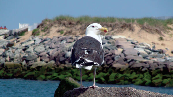
A Great Black‑backed Gull stands on a rock at Plum Island, MA, looking out over the water with the sand dunes behind it. Its bright white head and big yellow beak stand out against its dark wings.
A Great Black‑backed Gull stands on a rock at Plum Island, MA, looking out over the water with the sand dunes behind it. Its bright white head and big yellow beak stand out against its dark wings.

Cornell University's Geothermal Test Site on Roosevelt Island, NY
Cornell University's Geothermal Test Site on Roosevelt Island, NY

USGS hydrologist conducting a groundwater elevation survey on Long Island, New York
USGS hydrologist conducting a groundwater elevation survey on Long Island, New York

Water-quality sampling on Long Island, New York
Water-quality sampling on Long Island, New York
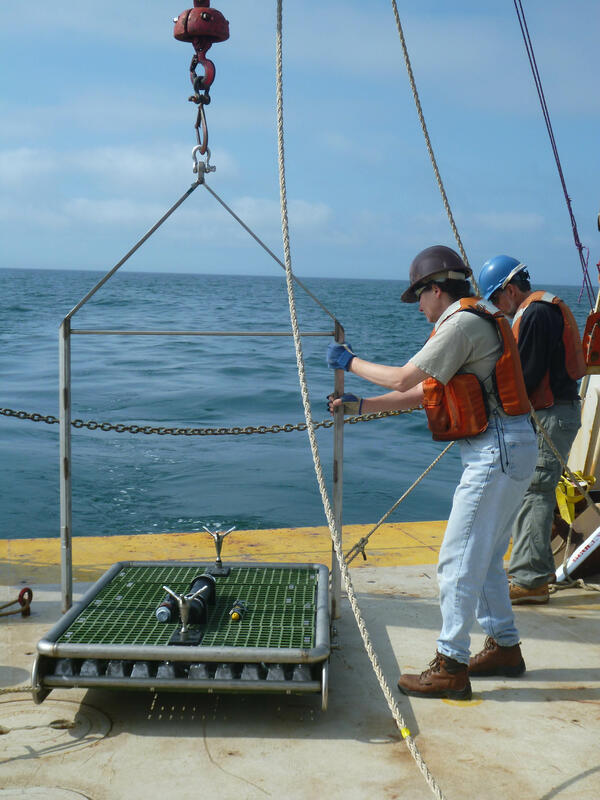
Marinna Martini prepares to deploy a NIMBBLE from the R/V Connecticut south of Martha's Vineyard
Marinna Martini prepares to deploy a NIMBBLE from the R/V Connecticut south of Martha's Vineyard

Drilling on Maravista peninsula in Falmouth, Massachusetts
Drilling on Maravista peninsula in Falmouth, Massachusetts

A Sontek IQ ADCP measures depth and velocity of a salt marsh creek (Cape Cod, MA)
A Sontek IQ ADCP measures depth and velocity of a salt marsh creek (Cape Cod, MA)