
Before landing on the surface of the moon in 1969, astronauts Neil Armstrong and Buzz Aldrin needed a training ground that matched their destination's cratered surface.
Threats from Space
Not all natural hazards that affect Earth come from here. Sometimes things from space can have a huge effect on our planet. From geomagnetic storms to meteor impacts, the USGS has a long history of mapping celestial bodies, investigating planetary anomalies, and monitoring the Earth’s geomagnetic and atmospheric conditions.
Planetary Defense
Planetary Defense

At the USGS Astrogeology Science Center, we conduct research on Planetary Defense, including predicting potential meteor impactors and studying how to deflect or divert them Effects include short-term effects such as blast damage, but also long-term effects such as climate and social impacts.
Geomagnetism Program
Geomagnetism Program
The USGS Geomagnetism Program monitors the Earth's magnetic field, with a key focus on space-weather hazard science. Geomagnetic research projects support the pursuit of a fundamental understanding of geomagnetic storms and related phenomena, while developing products to assist with situational awareness here on Earth.
Although USGS may not be seen as a space research agency, we do study a variety of threats from space. Whether it is geomagnetic storms, meteor impacts, or satellite research, the USGS has a long history of exploring what comes from above.
Here are a few examples of projects that have us looking up.
Media

Space, it turns out, can be a messy place. Sixty years of space flight and satellite activity have left a cosmic junkyard circling the planet. From spent boosters to the detritus of defunct satellites, collisions, and explosions, there are countless potential cataclysms waiting to happen for future launches as space debris travels at relative velocities approaching 18,000 miles per hour.
Sources/Usage: Public Domain. View Media Details
Media

Magnetic storms are potentially hazardous to the activities and technological infrastructure of modern civilization. This reality was dramatically demonstrated during a magnetic storm in 1989 when surface geoelectric fields were coupled onto the Hydro-Québec electric power grid in Canada. Protective relays were tripped, the grid collapsed, and about 9 million people were temporarily left without electricity.
Sources/Usage: Public Domain. View Media Details
Media

When meteors reach the earth, they can cause mass destruction quickly and have lasting impacts on ecosystems and geologic characteristics. USGS predicts potential impactors and studies how to deflect or divert them, as well as the potential effects of an impact.
Sources/Usage: Public Domain. View Media Details
Science

Terrestrial Analogs for Research and Geologic Exploration Training (TARGET)
The U. S. Geological Survey (USGS) Astrogeology Science Center (ASC) recently established the Terrestrial Analogs for Research and Geologic Exploration Training (TARGET) program. This service-oriented program is built around the recognition that the Earth is a fundamental training ground for human and robotic planetary exploration, and that ASC is in a unique position in northern Arizona with...

Terrestrial Analog Sample Collections
The Astrogeology Terrestrial Analog Sample Collections include three individual sample collections: the Meteor Crater Sample Collection, the Flynn Creek Crater Sample Collection, and the Shoemaker Sample Collection (embed links to individual pages; add buttons to click to go to individual pages). Click Related Science tab above to navigate to the individual collections pages.

Keeping the Lights On in North America
Realtime geoelectric maps during a magnetic storm can assist utility companies with their operations and can help power-grid managers to make decisions that may minimize the impact to their systems.

Meteor Crater Sample Collection
Meteor Crater is a 180 m deep, 1.2 km diameter bowl-shaped impact crater in Northern Arizona, and has long been a terrestrial analog site for planetary exploration. During the 1960’s, Eugene Shoemaker trained NASA astronauts at the crater to prepare for the Apollo missions to the Moon. The Meteor Crater Sample Collection consists of geologic samples from the Meteor Crater ejecta blanket. USGS...
Flynn Creek Crater Sample Collection
Flynn Creek crater is a 3.8 km diameter, 360-million-year-old impact structure located in north central Tennessee, and is an invaluable terrestrial analog for the study of impact cratering dynamics. The Flynn Creek Crater Sample Collection consists of over two thousand boxes of drill core from 18 drill holes in the crater’s central uplift, floor, and rim. USGS Astrogeology curates and provides...
Multimedia

Image of the Week - Moon Craters in Arizona
Before landing on the surface of the moon in 1969, astronauts Neil Armstrong and Buzz Aldrin needed a training ground that matched their destination's cratered surface.

Hazards: Geomagnetic Storms
Space weather can have important consequences for our lives, such as interference with radio communication, GPS systems, electric power grids, the operation and orientation of satellites, oil and gas drilling, and even air travel as high altitude pilots and astronauts can be subjected to enhanced levels of radiation.
By
Terrestrial Analogs for Research and Geologic Exploration Training (TARGET)
The U. S. Geological Survey (USGS) Astrogeology Science Center (ASC) recently established the Terrestrial Analogs for Research and Geologic Exploration Training (TARGET) program. This service-oriented program is built around the recognition that the Earth is a fundamental training ground for human and robotic planetary exploration, and that ASC is in a unique position in northern Arizona with...
Terrestrial Analog Sample Collections
The Astrogeology Terrestrial Analog Sample Collections include three individual sample collections: the Meteor Crater Sample Collection, the Flynn Creek Crater Sample Collection, and the Shoemaker Sample Collection (embed links to individual pages; add buttons to click to go to individual pages). Click Related Science tab above to navigate to the individual collections pages.
Keeping the Lights On in North America
Realtime geoelectric maps during a magnetic storm can assist utility companies with their operations and can help power-grid managers to make decisions that may minimize the impact to their systems.
Meteor Crater Sample Collection
Meteor Crater is a 180 m deep, 1.2 km diameter bowl-shaped impact crater in Northern Arizona, and has long been a terrestrial analog site for planetary exploration. During the 1960’s, Eugene Shoemaker trained NASA astronauts at the crater to prepare for the Apollo missions to the Moon. The Meteor Crater Sample Collection consists of geologic samples from the Meteor Crater ejecta blanket. USGS...
Flynn Creek Crater Sample Collection
Flynn Creek crater is a 3.8 km diameter, 360-million-year-old impact structure located in north central Tennessee, and is an invaluable terrestrial analog for the study of impact cratering dynamics. The Flynn Creek Crater Sample Collection consists of over two thousand boxes of drill core from 18 drill holes in the crater’s central uplift, floor, and rim. USGS Astrogeology curates and provides...

Observatories
Get information on and locations of geomagnetic observatories operated by the USGS and partners of the USGS geomagnetism program.

Geomagnetism Monitoring Operations
Learn more about the USGS Geomagnetism operations.

Geomagnetism Research
Research projects within the USGS Geomagnetism Program are targeted for societal relevance, especially for space-weather hazard science.
Image of the Week - Moon Craters in Arizona
Before landing on the surface of the moon in 1969, astronauts Neil Armstrong and Buzz Aldrin needed a training ground that matched their destination's cratered surface.
Before landing on the surface of the moon in 1969, astronauts Neil Armstrong and Buzz Aldrin needed a training ground that matched their destination's cratered surface.
Hazards: Geomagnetic Storms
Space weather can have important consequences for our lives, such as interference with radio communication, GPS systems, electric power grids, the operation and orientation of satellites, oil and gas drilling, and even air travel as high altitude pilots and astronauts can be subjected to enhanced levels of radiation.
By
Space weather can have important consequences for our lives, such as interference with radio communication, GPS systems, electric power grids, the operation and orientation of satellites, oil and gas drilling, and even air travel as high altitude pilots and astronauts can be subjected to enhanced levels of radiation.
By

What is a magnetic storm? What is a magnetic storm?
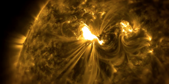
A magnetic storm is a period of rapid magnetic field variation. It can last from hours to days. Magnetic storms have two basic causes: The Sun sometimes emits a strong surge of solar wind called a coronal mass ejection. This gust of solar wind disturbs the outer part of the Earth's magnetic field, which undergoes a complex oscillation. This generates associated electric currents in the near-Earth...

How does the Earth's core generate a magnetic field? How does the Earth's core generate a magnetic field?
The Earth's outer core is in a state of turbulent convection as the result of radioactive heating and chemical differentiation. This sets up a process that is a bit like a naturally occurring electrical generator, where the convective kinetic energy is converted to electrical and magnetic energy. Basically, the motion of the electrically conducting iron in the presence of the Earth's magnetic...

What are the hazards of magnetic storms? What are the hazards of magnetic storms?
Our technology based infrastructure can be adversely affected by rapid magnetic field variations. This is especially true during “magnetic storms." Because the ionosphere is heated and distorted during storms, long range radio communication that relies on sub-ionospheric reflection can be difficult or impossible and global-positioning system (GPS) communications can be degraded. Ionospheric...

Do solar flares or magnetic storms (space weather) cause earthquakes? Do solar flares or magnetic storms (space weather) cause earthquakes?
Solar flares and magnetic storms belong to a set of phenomena known collectively as "space weather." Technological systems and the activities of modern civilization can be affected by changing space-weather conditions. However, it has never been demonstrated that there is a causal relationship between space weather and earthquakes. Indeed, over the course of the Sun's 11-year variable cycle, the...

Does the Earth's magnetic field affect human health? Does the Earth's magnetic field affect human health?
The Earth's magnetic field does not directly affect human health. Humans evolved to live on this planet. High altitude pilots and astronauts can experience higher levels of radiation during magnetic storms, but the hazard is due to the radiation, not the magnetic field itself. Geomagnetism can also impact the electrically based technology that we rely on, but it does not impact people themselves...

Why measure the magnetic field at the Earth's surface? Wouldn't satellites be better suited for space-weather studies? Why measure the magnetic field at the Earth's surface? Wouldn't satellites be better suited for space-weather studies?
Satellites and ground-based magnetometers are both important for making measurements of the Earth’s magnetic field. They are not redundant but are instead complementary: Satellites provide good geographical coverage for data collection. Ground-based magnetometers are much less expensive and much easier to install than satellites. An array of magnetometers provides coverage from numerous locations...

Could magnetic reversals be caused by meteorite or comet impacts? Could magnetic reversals be caused by meteorite or comet impacts?
Although extremely unlikely, it might be possible for a reversal of the Earth's magnetic field to be triggered by a meteorite or comet impact, or even for it to be caused by something more "gentle," such as the melting of the polar ice caps. Self-contained dynamic systems like Earth’s dynamo can have reversals without any outside influence. Reversals of Earth's magnetic field can simply happen...

I think I found a meteorite. How can I tell for sure? I think I found a meteorite. How can I tell for sure?
Meteorites are fragments of rock or metal that fall to Earth from space. They are very rare, but many people find unusual rocks or pieces of metal and wonder if they might have found a meteorite. The USGS doesn't verify meteorites, but they have several properties that help distinguish them from other rocks: Density: Meteorites are usually quite heavy for their size, since they contain metallic...

How can I tell if I have found an impact crater? How can I tell if I have found an impact crater?
There are many natural processes other than impacts that can create circular features and depressions on the surface of the Earth. Examples include glaciation, volcanism, sinkholes, atolls, salt domes, intrusions, and hydrothermal explosions (to name just a few). Prehistoric mines and quarries are also sometimes mistaken for impact craters. Although the USGS has been involved in impact crater...
Not all natural hazards that affect Earth come from here. Sometimes things from space can have a huge effect on our planet. From geomagnetic storms to meteor impacts, the USGS has a long history of mapping celestial bodies, investigating planetary anomalies, and monitoring the Earth’s geomagnetic and atmospheric conditions.
Planetary Defense
Planetary Defense
At the USGS Astrogeology Science Center, we conduct research on Planetary Defense, including predicting potential meteor impactors and studying how to deflect or divert them Effects include short-term effects such as blast damage, but also long-term effects such as climate and social impacts.
Geomagnetism Program
Geomagnetism Program
The USGS Geomagnetism Program monitors the Earth's magnetic field, with a key focus on space-weather hazard science. Geomagnetic research projects support the pursuit of a fundamental understanding of geomagnetic storms and related phenomena, while developing products to assist with situational awareness here on Earth.
Although USGS may not be seen as a space research agency, we do study a variety of threats from space. Whether it is geomagnetic storms, meteor impacts, or satellite research, the USGS has a long history of exploring what comes from above.
Here are a few examples of projects that have us looking up.
Media
Space, it turns out, can be a messy place. Sixty years of space flight and satellite activity have left a cosmic junkyard circling the planet. From spent boosters to the detritus of defunct satellites, collisions, and explosions, there are countless potential cataclysms waiting to happen for future launches as space debris travels at relative velocities approaching 18,000 miles per hour.
Sources/Usage: Public Domain. View Media Details
Media
Magnetic storms are potentially hazardous to the activities and technological infrastructure of modern civilization. This reality was dramatically demonstrated during a magnetic storm in 1989 when surface geoelectric fields were coupled onto the Hydro-Québec electric power grid in Canada. Protective relays were tripped, the grid collapsed, and about 9 million people were temporarily left without electricity.
Sources/Usage: Public Domain. View Media Details
Media
When meteors reach the earth, they can cause mass destruction quickly and have lasting impacts on ecosystems and geologic characteristics. USGS predicts potential impactors and studies how to deflect or divert them, as well as the potential effects of an impact.
Sources/Usage: Public Domain. View Media Details
Science
Terrestrial Analogs for Research and Geologic Exploration Training (TARGET)
The U. S. Geological Survey (USGS) Astrogeology Science Center (ASC) recently established the Terrestrial Analogs for Research and Geologic Exploration Training (TARGET) program. This service-oriented program is built around the recognition that the Earth is a fundamental training ground for human and robotic planetary exploration, and that ASC is in a unique position in northern Arizona with...
Terrestrial Analog Sample Collections
The Astrogeology Terrestrial Analog Sample Collections include three individual sample collections: the Meteor Crater Sample Collection, the Flynn Creek Crater Sample Collection, and the Shoemaker Sample Collection (embed links to individual pages; add buttons to click to go to individual pages). Click Related Science tab above to navigate to the individual collections pages.
Keeping the Lights On in North America
Realtime geoelectric maps during a magnetic storm can assist utility companies with their operations and can help power-grid managers to make decisions that may minimize the impact to their systems.
Meteor Crater Sample Collection
Meteor Crater is a 180 m deep, 1.2 km diameter bowl-shaped impact crater in Northern Arizona, and has long been a terrestrial analog site for planetary exploration. During the 1960’s, Eugene Shoemaker trained NASA astronauts at the crater to prepare for the Apollo missions to the Moon. The Meteor Crater Sample Collection consists of geologic samples from the Meteor Crater ejecta blanket. USGS...
Flynn Creek Crater Sample Collection
Flynn Creek crater is a 3.8 km diameter, 360-million-year-old impact structure located in north central Tennessee, and is an invaluable terrestrial analog for the study of impact cratering dynamics. The Flynn Creek Crater Sample Collection consists of over two thousand boxes of drill core from 18 drill holes in the crater’s central uplift, floor, and rim. USGS Astrogeology curates and provides...
Multimedia
Image of the Week - Moon Craters in Arizona
Before landing on the surface of the moon in 1969, astronauts Neil Armstrong and Buzz Aldrin needed a training ground that matched their destination's cratered surface.
Before landing on the surface of the moon in 1969, astronauts Neil Armstrong and Buzz Aldrin needed a training ground that matched their destination's cratered surface.
Hazards: Geomagnetic Storms
Space weather can have important consequences for our lives, such as interference with radio communication, GPS systems, electric power grids, the operation and orientation of satellites, oil and gas drilling, and even air travel as high altitude pilots and astronauts can be subjected to enhanced levels of radiation.
By
Space weather can have important consequences for our lives, such as interference with radio communication, GPS systems, electric power grids, the operation and orientation of satellites, oil and gas drilling, and even air travel as high altitude pilots and astronauts can be subjected to enhanced levels of radiation.
By
Terrestrial Analogs for Research and Geologic Exploration Training (TARGET)
The U. S. Geological Survey (USGS) Astrogeology Science Center (ASC) recently established the Terrestrial Analogs for Research and Geologic Exploration Training (TARGET) program. This service-oriented program is built around the recognition that the Earth is a fundamental training ground for human and robotic planetary exploration, and that ASC is in a unique position in northern Arizona with...
Terrestrial Analog Sample Collections
The Astrogeology Terrestrial Analog Sample Collections include three individual sample collections: the Meteor Crater Sample Collection, the Flynn Creek Crater Sample Collection, and the Shoemaker Sample Collection (embed links to individual pages; add buttons to click to go to individual pages). Click Related Science tab above to navigate to the individual collections pages.
Keeping the Lights On in North America
Realtime geoelectric maps during a magnetic storm can assist utility companies with their operations and can help power-grid managers to make decisions that may minimize the impact to their systems.
Meteor Crater Sample Collection
Meteor Crater is a 180 m deep, 1.2 km diameter bowl-shaped impact crater in Northern Arizona, and has long been a terrestrial analog site for planetary exploration. During the 1960’s, Eugene Shoemaker trained NASA astronauts at the crater to prepare for the Apollo missions to the Moon. The Meteor Crater Sample Collection consists of geologic samples from the Meteor Crater ejecta blanket. USGS...
Flynn Creek Crater Sample Collection
Flynn Creek crater is a 3.8 km diameter, 360-million-year-old impact structure located in north central Tennessee, and is an invaluable terrestrial analog for the study of impact cratering dynamics. The Flynn Creek Crater Sample Collection consists of over two thousand boxes of drill core from 18 drill holes in the crater’s central uplift, floor, and rim. USGS Astrogeology curates and provides...
Observatories
Get information on and locations of geomagnetic observatories operated by the USGS and partners of the USGS geomagnetism program.
Geomagnetism Monitoring Operations
Learn more about the USGS Geomagnetism operations.
Geomagnetism Research
Research projects within the USGS Geomagnetism Program are targeted for societal relevance, especially for space-weather hazard science.
Image of the Week - Moon Craters in Arizona
Before landing on the surface of the moon in 1969, astronauts Neil Armstrong and Buzz Aldrin needed a training ground that matched their destination's cratered surface.
Before landing on the surface of the moon in 1969, astronauts Neil Armstrong and Buzz Aldrin needed a training ground that matched their destination's cratered surface.
Hazards: Geomagnetic Storms
Space weather can have important consequences for our lives, such as interference with radio communication, GPS systems, electric power grids, the operation and orientation of satellites, oil and gas drilling, and even air travel as high altitude pilots and astronauts can be subjected to enhanced levels of radiation.
By
Space weather can have important consequences for our lives, such as interference with radio communication, GPS systems, electric power grids, the operation and orientation of satellites, oil and gas drilling, and even air travel as high altitude pilots and astronauts can be subjected to enhanced levels of radiation.
By
What is a magnetic storm? What is a magnetic storm?
A magnetic storm is a period of rapid magnetic field variation. It can last from hours to days. Magnetic storms have two basic causes: The Sun sometimes emits a strong surge of solar wind called a coronal mass ejection. This gust of solar wind disturbs the outer part of the Earth's magnetic field, which undergoes a complex oscillation. This generates associated electric currents in the near-Earth...
How does the Earth's core generate a magnetic field? How does the Earth's core generate a magnetic field?
The Earth's outer core is in a state of turbulent convection as the result of radioactive heating and chemical differentiation. This sets up a process that is a bit like a naturally occurring electrical generator, where the convective kinetic energy is converted to electrical and magnetic energy. Basically, the motion of the electrically conducting iron in the presence of the Earth's magnetic...
What are the hazards of magnetic storms? What are the hazards of magnetic storms?
Our technology based infrastructure can be adversely affected by rapid magnetic field variations. This is especially true during “magnetic storms." Because the ionosphere is heated and distorted during storms, long range radio communication that relies on sub-ionospheric reflection can be difficult or impossible and global-positioning system (GPS) communications can be degraded. Ionospheric...
Do solar flares or magnetic storms (space weather) cause earthquakes? Do solar flares or magnetic storms (space weather) cause earthquakes?
Solar flares and magnetic storms belong to a set of phenomena known collectively as "space weather." Technological systems and the activities of modern civilization can be affected by changing space-weather conditions. However, it has never been demonstrated that there is a causal relationship between space weather and earthquakes. Indeed, over the course of the Sun's 11-year variable cycle, the...
Does the Earth's magnetic field affect human health? Does the Earth's magnetic field affect human health?
The Earth's magnetic field does not directly affect human health. Humans evolved to live on this planet. High altitude pilots and astronauts can experience higher levels of radiation during magnetic storms, but the hazard is due to the radiation, not the magnetic field itself. Geomagnetism can also impact the electrically based technology that we rely on, but it does not impact people themselves...
Why measure the magnetic field at the Earth's surface? Wouldn't satellites be better suited for space-weather studies? Why measure the magnetic field at the Earth's surface? Wouldn't satellites be better suited for space-weather studies?
Satellites and ground-based magnetometers are both important for making measurements of the Earth’s magnetic field. They are not redundant but are instead complementary: Satellites provide good geographical coverage for data collection. Ground-based magnetometers are much less expensive and much easier to install than satellites. An array of magnetometers provides coverage from numerous locations...
Could magnetic reversals be caused by meteorite or comet impacts? Could magnetic reversals be caused by meteorite or comet impacts?
Although extremely unlikely, it might be possible for a reversal of the Earth's magnetic field to be triggered by a meteorite or comet impact, or even for it to be caused by something more "gentle," such as the melting of the polar ice caps. Self-contained dynamic systems like Earth’s dynamo can have reversals without any outside influence. Reversals of Earth's magnetic field can simply happen...
I think I found a meteorite. How can I tell for sure? I think I found a meteorite. How can I tell for sure?
Meteorites are fragments of rock or metal that fall to Earth from space. They are very rare, but many people find unusual rocks or pieces of metal and wonder if they might have found a meteorite. The USGS doesn't verify meteorites, but they have several properties that help distinguish them from other rocks: Density: Meteorites are usually quite heavy for their size, since they contain metallic...
How can I tell if I have found an impact crater? How can I tell if I have found an impact crater?
There are many natural processes other than impacts that can create circular features and depressions on the surface of the Earth. Examples include glaciation, volcanism, sinkholes, atolls, salt domes, intrusions, and hydrothermal explosions (to name just a few). Prehistoric mines and quarries are also sometimes mistaken for impact craters. Although the USGS has been involved in impact crater...