
Marine Geology
Exploring
Research
Analysis
Mapping
A well-developed understanding of the geological framework within the marine environment is foundational for expanding our knowledge about hazards, minerals and living resources in the ocean. Because the ocean covers the majority of the Earth’s surface, improved marine geologic knowledge broadens our understanding of geologic features and characteristics on land.
Geology is the study of the Earth. This includes how the Earth was formed, how the Earth has changed since it was formed, the materials that make up the Earth, and the processes that act on it. While marine geology focuses on areas affected by our oceans including the deep ocean floor, the shallower slopes and shelves that surround the continents, and coastal areas like beaches and estuaries, geology is a continuum that links these processes to those seen on land. USGS studies and links land-based geologic knowledge to marine geology, which includes studying the geology in coastal, riverine and lake areas.
Coastal and marine geology expertise contributes to the greater USGS mission of providing impartial information on the health of our ecosystems and environment, the natural hazards that threaten us, the natural resources we rely on, the impacts of climate and land-use change, and the core science systems that help us provide timely, relevant, and usable information.
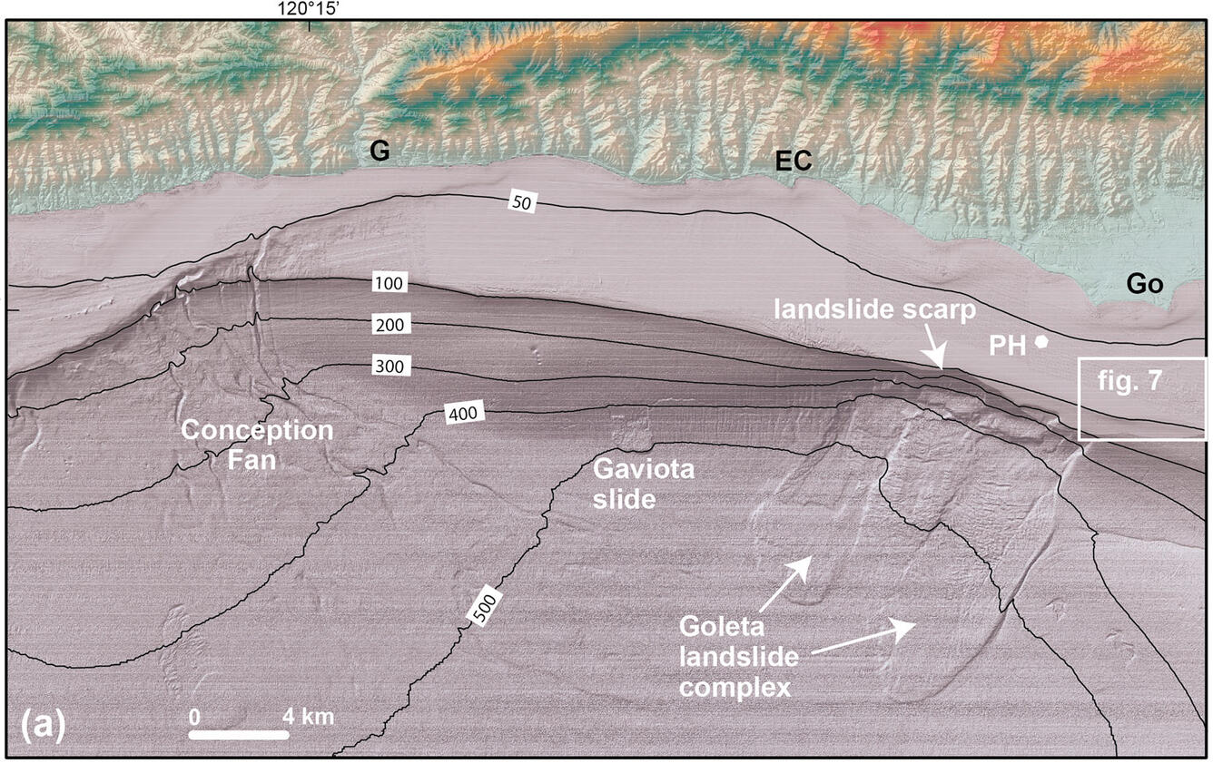
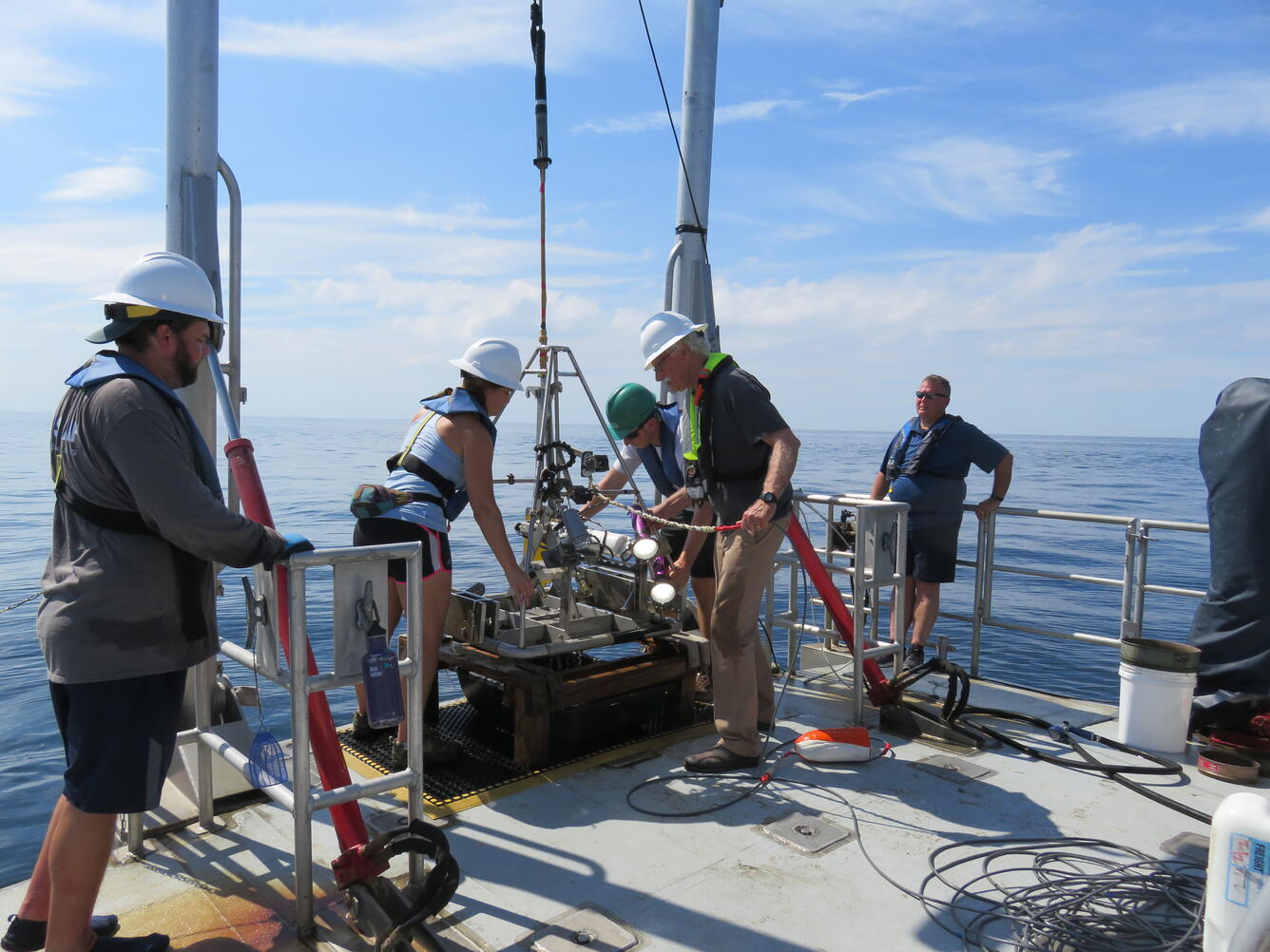
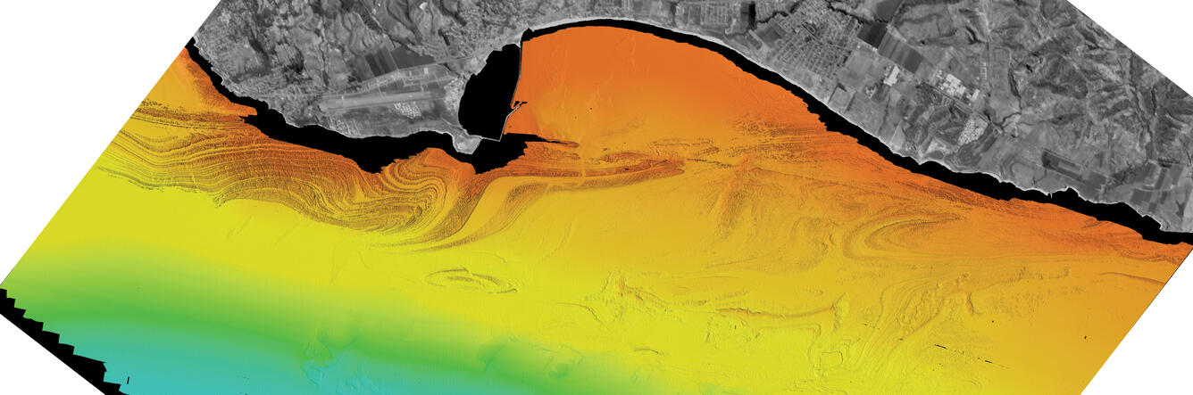
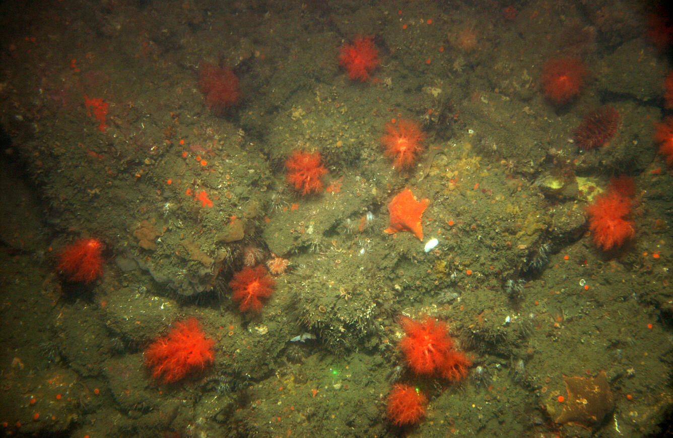
The USGS marine geology and geophysics team maps seafloor morphology and images the shallow sub-seafloor structure of the canyons, plateaus, and other components of the deep-sea landscape to better understand the processes that form and shape these features. Sampling sediment and rocks allows scientists to ground truth geophysical and visual observations, while providing valuable information about the composition and age of these underwater geologic environments.


Science

USGS Law of the Sea

Cascadia Subduction Zone Marine Geohazards

Marine Geomorphology, Evolution, and Habitats

California Seafloor Mapping Program

Seafloor Faults off Southern California

Sea Floor Mapping Group

Geologic Records of High Sea Levels

How do we know glaciers are shrinking? How do we know glaciers are shrinking?
Repeat photography and aerial / satellite photo analysis provide evidence of glacier loss in terms of shape and area. The USGS Benchmark Glacier project has collected mass balance data on a network of glaciers in Alaska, Washington, and Montana for decades, quantifying trends of mass loss at all sites. Extensive field data collection at these sites includes twice yearly visits to measure seasonal...

How would sea level change if all glaciers melted? How would sea level change if all glaciers melted?
There is still some uncertainty about the full volume of glaciers and ice caps on Earth, but if all of them were to melt, global sea level would rise approximately 70 meters (approximately 230 feet), flooding every coastal city on the planet. Learn more: USGS Water Science School: Glaciers and Icecaps National Snow and Ice Data Center: Facts about Glaciers U.S. Global Change Research Program: Sea...
A well-developed understanding of the geological framework within the marine environment is foundational for expanding our knowledge about hazards, minerals and living resources in the ocean. Because the ocean covers the majority of the Earth’s surface, improved marine geologic knowledge broadens our understanding of geologic features and characteristics on land.
Geology is the study of the Earth. This includes how the Earth was formed, how the Earth has changed since it was formed, the materials that make up the Earth, and the processes that act on it. While marine geology focuses on areas affected by our oceans including the deep ocean floor, the shallower slopes and shelves that surround the continents, and coastal areas like beaches and estuaries, geology is a continuum that links these processes to those seen on land. USGS studies and links land-based geologic knowledge to marine geology, which includes studying the geology in coastal, riverine and lake areas.
Coastal and marine geology expertise contributes to the greater USGS mission of providing impartial information on the health of our ecosystems and environment, the natural hazards that threaten us, the natural resources we rely on, the impacts of climate and land-use change, and the core science systems that help us provide timely, relevant, and usable information.
The USGS marine geology and geophysics team maps seafloor morphology and images the shallow sub-seafloor structure of the canyons, plateaus, and other components of the deep-sea landscape to better understand the processes that form and shape these features. Sampling sediment and rocks allows scientists to ground truth geophysical and visual observations, while providing valuable information about the composition and age of these underwater geologic environments.
Science
USGS Law of the Sea
Cascadia Subduction Zone Marine Geohazards
Marine Geomorphology, Evolution, and Habitats
California Seafloor Mapping Program
Seafloor Faults off Southern California
Sea Floor Mapping Group
Geologic Records of High Sea Levels
How do we know glaciers are shrinking? How do we know glaciers are shrinking?
Repeat photography and aerial / satellite photo analysis provide evidence of glacier loss in terms of shape and area. The USGS Benchmark Glacier project has collected mass balance data on a network of glaciers in Alaska, Washington, and Montana for decades, quantifying trends of mass loss at all sites. Extensive field data collection at these sites includes twice yearly visits to measure seasonal...
How would sea level change if all glaciers melted? How would sea level change if all glaciers melted?
There is still some uncertainty about the full volume of glaciers and ice caps on Earth, but if all of them were to melt, global sea level would rise approximately 70 meters (approximately 230 feet), flooding every coastal city on the planet. Learn more: USGS Water Science School: Glaciers and Icecaps National Snow and Ice Data Center: Facts about Glaciers U.S. Global Change Research Program: Sea...