
Sound Waves Newsletter: February-May 2026
GeoPackage of Seabed Hazards: A Resource for Safeguarding Offshore Infrastructure
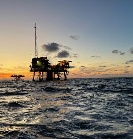
The USGS and the Bureau of Safety and Environmental Enforcement developed a GeoPackage of seabed hazards for the U.S. Atlantic and Pacific continental shelves. By visualizing hazards in a spatial context, this resource helps users manage and protect essential offshore infrastructure.
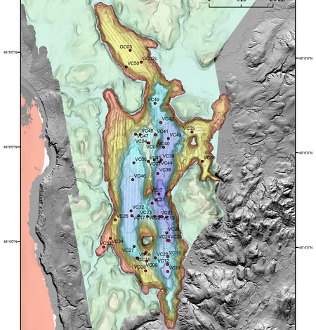
Ozette Lake: A natural seismograph along the northern Cascadia Subduction Zone (Video)
Ozette Lake, on Washington State’s Olympic Peninsula, is the largest unaltered lake in the state. Glacially carved to depths of about 100 meters (328 feet), the lake is just 4.8 kilometers (3 miles) from the present-day Pacific coastline. Its sediments preserve a record of seismic activity going back more than 14,000 years.
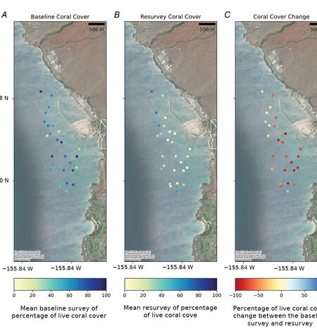
Repeated Marine Heatwaves Have Dramatically Reshaped Coral Reefs in Hawaiʻi National Parks
Coral reefs along Hawaiʻi’s Kona Coast have undergone major declines over the past two decades, according to a new report from USGS and the National Park Service (NPS).
A Path to National-Scale Coastal Change Projections
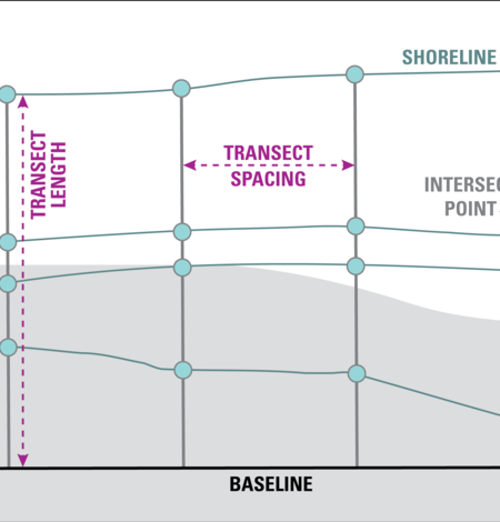
Your Favorite Software for Calculating Shoreline Change Just Got Better
Digital Shoreline Analysis System (DSAS) version 6.1 is now available, offering new and reinstated features such as more data export options, enhanced editing tools and customizable symbology, and the ability to forecast shoreline positions.
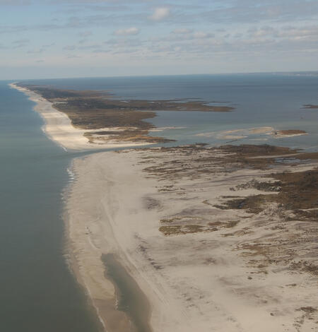
Fate of barrier islands facing rising seas tied to underwater shape, new models show
Barrier islands—long, narrow strips of sand that line many coasts around the world—serve as a first line of defense against storms and rising seas. These dynamic landforms are heavily influenced by wind and waves, and new research suggests that seafloor features just offshore of barrier islands may play a bigger role in their survival than previously understood.
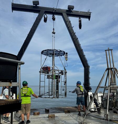
Offshore Analysis of Seafloor Instability and Sediments (OASIS)
The Offshore Analysis of Seafloor Instability and Sediments (OASIS) project is an interagency partnership coordinated by the Bureau of Ocean Energy Management to better understand underwater mudslides and their impacts in the Mississippi River Delta Front. The USGS plays a central role in the project, contributing long-term expertise in coastal and marine geology, seafloor mapping, and geohazard...
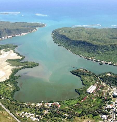
Tracking sediment erosion and transport in a reef-adjacent watershed
A new study from USGS uses strontium isotopes and mixing models to determine the provenance of terrestrial sediment clouding an ecologically important bay in southwestern Puerto Rico, offering a clearer path for restoration efforts aimed at protecting coastal waters and territorially protected coral reef habitats.
National Shoreline Change Data Publication Catalog
The U.S. Geological Survey (USGS) maintains shoreline positions for the United States from older sources, such as aerial photos and topographic surveys, and contemporary sources like digital elevation models (DEMs) and lidar elevation point cloud data.It's important to maintain, and make available, records of historical shoreline positions to allow monitoring of change over time, and to identify...
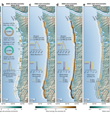
Linking climate variability to shoreline change in the Pacific Northwest
Sandy beaches worldwide are constantly shifting, sometimes subtly, sometimes dramatically. Now, new research focused on the U.S. Pacific Northwest coast finds that climate patterns such as El Niño and La Niña don’t just influence beaches seasonally—they shape their year-to-year evolution in measurable and predictable ways.
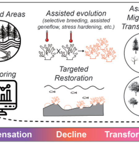
USGS Powell Center Releases New Guidance for Managing Ecosystems Amid Rising Climatic Novelty
The USGS Powell Center has released new guidance to help land and natural-resource managers navigate a future where climate-driven environmental conditions increasingly diverge from historical norms.
Coastal and Marine Science in Long Island Sound
Long Island Sound is a highly productive estuary and vital natural resource bordering New York and Connecticut. It’s essential for its massive economic impact, generating billions annually by supporting recreation, fisheries, and transportation, as well as its biodiversity, serving as a critical habitat for thousands of marine species.USGS research in Long Island Sound helps protect these benefits...
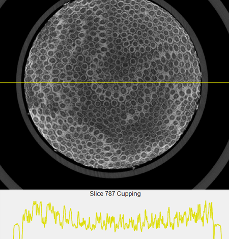
USGS Releases Global 3D Archive of Coral Reef Cores to Support Climate and Coastal Research
A new digital archive released by the USGS Pacific and St. Petersburg Coastal and Marine Science Centers gives scientists an unprecedented look inside reef-building corals, layer by layer, using advanced imaging technology.
-
Woods Hole Coastal and Marine Science Center Newsletter: Spring 2026 Woods Hole Coastal and Marine Science Center Newsletter: Spring 2026
Welcome to our newsletter, where we share science stories, recent publications, fieldwork activities, and more center happenings.
-
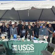
USGS Science Shared at St. Petersburg Science Festival USGS Science Shared at St. Petersburg Science Festival
The USGS celebrated science with the St. Petersburg community at the St. Petersburg Science Festival
-
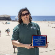
PCMSC’s Andy O’Neill Receives CSBPA’s Joe Johnson Outstanding Service Award PCMSC’s Andy O’Neill Receives CSBPA’s Joe Johnson Outstanding Service Award
This annual award honors coastal scientists, planners, engineers, and innovators who advance the knowledge and understanding of coastal science and coastal processes, with special focus on California and the West Coast.
-
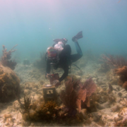
SPCMSC and University of Miami Scientists Collaborate on New Experiments to Guide National Park Service Coral Restoration Plans SPCMSC and University of Miami Scientists Collaborate on New Experiments to Guide National Park Service Coral Restoration Plans
Scientists from the U.S. Geological Survey’s St. Petersburg Coastal and Marine Science Center (SPCMSC) and the University of Miami have launched a new collaborative effort to support the National Park Service (NPS) in restoring endangered corals within Dry Tortugas National Park.
-
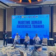
USGS Geophysicist among Federal Technical Experts at Seafloor Mapping Presentations in the Philippines USGS Geophysicist among Federal Technical Experts at Seafloor Mapping Presentations in the Philippines
In September 2025, USGS Research Geophysicist Guy Cochrane served as a technical expert on seafloor mapping and marine benthic ecosystems during two presentations in the Philippines.
-
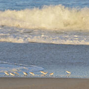
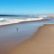
Photo Roundup: February-May 2026 Photo Roundup: February-May 2026
A selection of coastal and ocean videos and photographs from across the USGS.