
Monitoring and Validation
Monitoring and Validation
LCMAP Monitoring uses all available Landsat observations to perform nationwide characterization of change in land cover and condition annually. Validation provides a measure of map accuracy for use in evaluating the appropriateness of a map for a specific application. LCMAP collects reference data that is used to perform a validation analysis, and all datasets are available at the links below.


Filter Total Items: 8

LCMAP Change Stories: Sequoias under Siege, Progression of a Wildfire
Sequoia National Park encompasses over 400,000 acres across the Sierra Nevada mountains. The park’s giant old growth sequoias are the largest trees in the world, growing 30 feet (9.1 m) in diameter and 250 feet (76.2 m) tall over their 3,000-year lifespans.

USGS Land Change Monitoring, Assessment, and Projection releases ‘unprecedented’ reference dataset for United States
The USGS Land Change Monitoring, Assessment and Projection (LCMAP) team has released its reference dataset for the Conterminous U.S. (CONUS), an 25,000-point trove of land cover data that represents the culmination of nearly five years of intensive human labor.
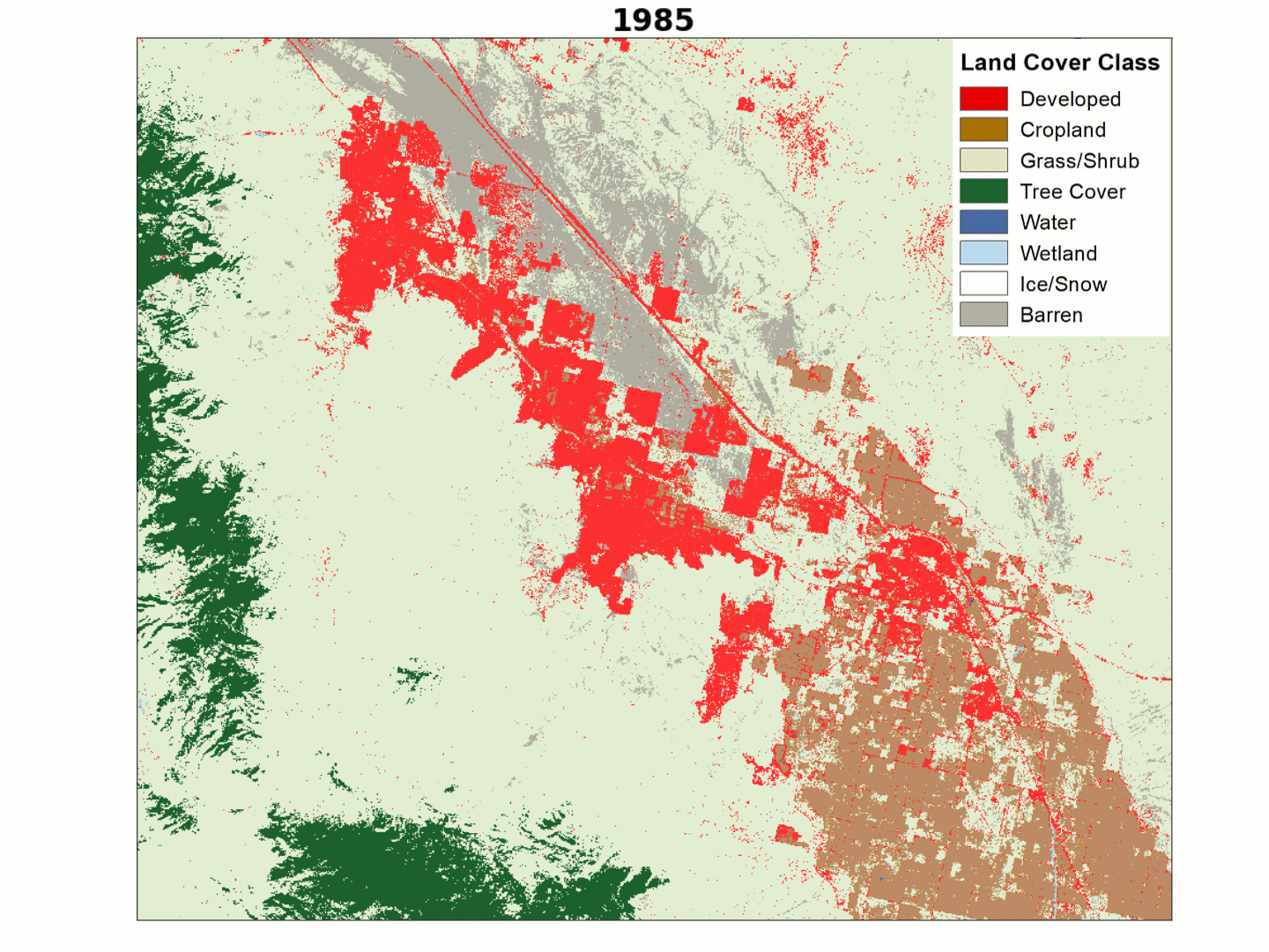
LCMAP Change Stories: Building a Boomtown, Block by Block
The desert outpost of Palm Springs, California and the surrounding Thousand Palms region has experienced explosive population growth over the past four decades, with tract after tract of development filling in previously barren landscapes along Interstate 10.

LCMAP Change Stories: Gone in 60 Seconds
At first glance, the most striking patterns in land cover change over time in this animation of the Oso, Washington area would appear to be forest harvest and regrowth, but a more dramatic change emerged in 2014.
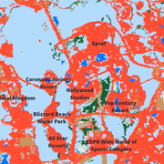
LCMAP Change Stories: It's a Sprawl World After All
The man-made Florida playland of Walt Disney World has grown outward on all sides since the amusement park’s construction commenced in the 1960s. Much of that growth has overtaken the wetlands, tree cover and grassland/shrublands near Orlando.

LCMAP Validation Data Captures Impact of U.S. Economic Downturn
The USGS Land Change Monitoring, Assessment, and Projection (LCMAP) initiative focuses on the creation of annual map products and the application of those products to advance the understanding of land surface change for the scientific community, the land management community, and the general public. Both the map products and the work performed to validate them offer insight into the multitude of...

LCMAP Change Stories: Hurricanes in the Everglades
When Atlantic hurricanes make landfall in south Florida, the coastal marshes and mangrove forests of the Everglades often act as a buffer that protects residents from rising sea levels, high winds and storm surge.

LCMAP Change Stories: Alabama Tornadoes
The USGS Land Change Monitoring, Assessment, and Projection initiative aims to identify where the landscape is changing and why.