
Long Island Sound Projects
Explore our projects to learn more about the scientific investigations we conduct within the Long Island Sound watershed. Use keywords and the available filters to narrow your search scope.
Explore Our Projects
Explore Our Projects
Filter Total Items: 38

COAWST: A Coupled-Ocean-Atmosphere-Wave-Sediment Transport Modeling System
Understanding the processes responsible for coastal change is important for managing both our natural and economic coastal resources. Storms are one of the primary driving forces causing coastal change from a coupling of wave- and wind-driven flows. To better understand storm impacts and their effects on our coastlines, there is an international need to better predict storm paths and intensities...
Changes in Nitrogen Contributions from Groundwater to the Niantic River Before and After Sewering
Onsite residential septic systems can be a major nonpoint source of nitrogen contamination. The excess nitrogen entering Connecticut’s Niantic River estuary is associated with high nitrate concentrations in the groundwater of the river’s 28-square-mile watershed, creating unsuitable habitat for the growth and recovery of eelgrass (Zostera marina). In an attempt to improve the river’s water quality...

Life History and Migration of Sturgeons in New England Waters
Sturgeons appear in the fossil record as early as the Triassic, 200 million years ago. Although most populations could once tolerate harvesting pressures, most populations have collapsed and nearly all of the 28 species alive today are listed as threatened or endangered. In New England, dams and water regulation challenge population recoveries of the two resident species, the shortnose and...

Estimating Nitrogen Loading from Groundwater and Potential Effects of Sea-Level Rise in Rhode Island's Salt Ponds Region
The U.S. Geological Survey (USGS), in cooperation with the Southeast New England Program of the U.S. Environmental Protection Agency, is estimating the magnitude, spatial distribution, and travel times of nitrogen-loading to ponds and streams in the Salt Ponds region of southern Rhode Island. This information can be used to guide conservation-management efforts aimed at reducing nitrogen inputs to...

Coastal Acidification Monitoring in Long Island Sound
Understanding coastal acidification, as it varies from open ocean acidification, is crucial to identifying the unique problems occurring in coastal ecosystems such as Long Island Sound (LIS). The U.S. Geological Survey (USGS) is monitoring water quality parameters throughout LIS and its embayments to evaluate the status and trends of acidification processes in these waters. This project will...

Groundwater Sustainability of the Long Island Aquifer System
The U.S. Geological Survey (USGS) has partnered with the New York State Department of Environmental Conservation (NYSDEC) to conduct a comprehensive study of the Long Island aquifer system. The major findings of this investigation include: The location of the boundary between fresh and salty groundwater is much closer to the shoreline than previously thought. The historical onshore saltwater...

Fish Passage Design and Analysis at the S.O. Conte Research Laboratory
There are more than 92,000 dams in the United States, of which at least 3% of these produce hydropower. Hydropower projects create renewable energy but also can alter habitats, restrict upstream and downstream movements of fishes and other aquatic organisms, and may stress, injure or kill migrant fishes and other aquatic organisms. In addition, there are more than 5 million culverts and other road...

Long Island Sound Spatially Referenced Regressions on Watershed Attributes (SPARROW) Models
The U.S. Geological Survey, New England Water Science Center, in collaboration with the U.S. Environmental Protection Agency (EPA), is modeling seasonal nutrient loads to Long Island Sound (LIS). Nutrients that originate from within the 41,867-square-mile section of the LIS watershed that is north of the Sound include both point (specific) and nonpoint (widespread) sources. Dynamic modeling of the...

Base-Flow Water Quality Sampling in Small Basins Draining to Long Island Sound
During the past 20 years, nitrogen loads to Long Island Sound (LIS) have been substantially reduced in large watersheds affected by municipal wastewater loads.
Connecticut Statewide Streamflow Table
This web page provides the user with an interactive map of streamflow stations in Connecticut and a link to a table that provides Station IDs, Station names, current gage height and streamflow (cubic feet per second) as well as the long-term median flow for all active stations in Connecticut. This site also allows the user to build time series of streamflow.
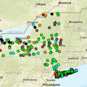
New York Statewide Streamflow Table
This web page provides the user with an interactive map of streamflow stations in New York and a link to a table that provides Station IDs, Station names, current gage height and streamflow (cubic feet per second) as well as the long-term median flow for all active stations in New York. This site also allows the user to build time series of streamflow.

USGS Groundwater data for Connecticut
This web page provides the user with access to a table showing current conditions for active groundwater level sites, historical observations, and various summary statistics for both currently active and discontinued sites, for stations in Connecticut.
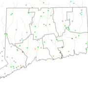
Connecticut Active Water Level Network
This site provides an interactive map with symbols showing locations of groundwater level measurement sites in New England. The symbols are color coded to indicate percentile classes and whether the sites report data in real-time-delivered to NWISWEB, continuous or periodic measurements.
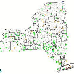
New York Active Water Level Network
This site is the New York portion of the USGS groundwater Watch program that tracks groundwater levels in the United States. This site provides an interactive map with symbols showing locations of groundwater level measurement sites. The symbols are color coded to indicate percentile classes and whether the sites report data in real-time-delivered to NWISWEB, continuous or periodic measurements.

Water Quality Sampling in the Tributaries of the Long Island Sound
Coastal estuaries in southern New England and New York show the effects of excess nutrients and coastal eutrophication. These include excessive growth of macroalgae, excessive blooms of phytoplankton, oxygen depletion, hypoxia and deteriorated substrates. State and Federal regulators have responded to these nutrient-caused impairments by requiring more stringent permit limits for National...

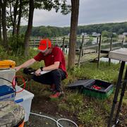
Embayment Monitoring to Support Nutrient Management Activities in Connecticut for Long Island Sound
The USGS, in cooperation with the Connecticut Department of Energy and Environmental Protection will be collecting water-quality and hydrologic data at six embayments from April 2021 to June 2027: Mystic, Norwalk, Saugatuck, Sasco-Southport complex, Farm, and Poquonnock.

Coastal Change Hazards
Natural processes such as waves, tides, and weather, continually change coastal landscapes. The integrity of coastal homes, businesses, and infrastructure can be threatened by hazards associated with event-driven changes, such as extreme storms and their impacts on beach and dune erosion, or longer-term, cumulative changes associated with coastal and marine processes, such as sea-level rise...
By
Natural Hazards Mission Area, Coastal and Marine Hazards and Resources Program, Pacific Coastal and Marine Science Center, St. Petersburg Coastal and Marine Science Center, Woods Hole Coastal and Marine Science Center, Supplemental Appropriations for Disaster Recovery Activities, Hurricanes, USGS Science in Long Island Sound and its Watershed

An Analysis of Trends in the Magnitude of Floods in Urbanized Watersheds on Long Island, New York
Summary: This study aims to do a thorough analysis of trends in peak streamflows on Long Island. Reliable information about the magnitude and frequency of floods is essential for flood insurance studies, flood-plain management, and the design of transportation and water-conveyance infrastructure, such as roads, bridges, culverts, dams, and levees. Federal, State, regional, and local...

Assessment of fecal contamination sources to Alley Creek, Queens County, New York
PROBLEM Alley Creek, a tributary to Little Neck Bay (Queens County, New York; figure 1) has been designated as impaired by the New York State Department of Environmental Conservation (NYS DEC) for primary and secondary contact and included on the 303(d) Impaired Waterways for pathogens related to combined sewer overflow contributions. The New York City Department of Environmental...

Sea-Level Rise Hazards and Decision Support
The Sea-Level Rise Hazards and Decision-Support project assesses present and future coastal vulnerability to provide actionable information for management of our Nation’s coasts. Through multidisciplinary research and collaborative partnerships with decision-makers, physical, biological, and social factors that describe landscape and habitat changes are incorporated in a probabilistic modeling...

Water Quality Sampling and Monitoring of the Pawcatuck River Watershed
The Pawcatuck River and the Pawcatuck River Estuary and Little Narragansett Bay form part of the boundary between the States of Connecticut and Rhode Island. Both states have identified water quality impairments within these waters related to nutrients (insufficient oxygen) and bacteria. Studies of the eutrophication potential of Long Island Sound embayments have identified that the Pawcatuck...