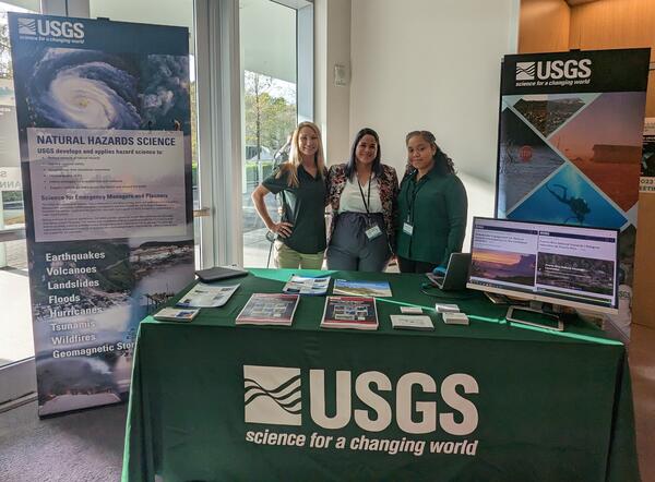
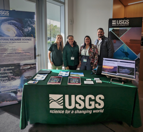
Donya Frank-Gilchrist is a Research Physical Scientist at the St. Petersburg Coastal and Marine Science Center in St. Petersburg, Florida.
Donya studies hydrodynamics and sediment transport in the nearshore to improve predictions of coastal processes and storm impacts on shorelines and communities. Her research spans a wide range of scales from investigating incipient motion of individual sand grains up to modeling the evolution of barrier islands in response to tropical storms and sea level rise. Donya is also involved with several stakeholder engagement efforts to improve the accessibility of USGS natural hazards resources for various stakeholders.
Professional Experience
Donya conducted her post-doctoral research in the Seafloor Sciences Branch of the U.S. Naval Research Laboratory.
Prior to joining the USGS, she also worked in private industry modeling nearshore hydrodynamics and pollutant transport in coastal regions.
Education and Certifications
Ph.D. Ocean Engineering, University of New Hampshire
M.S. Civil Engineering, The Ohio State University
B.S. Engineering, Harvey Mudd College
Science and Products
SENHIC Project Milestones and Meetings
Stakeholder Engagement for Natural Hazards Investigations in the Caribbean (SENHIC)
Puerto Rico Natural Hazards | Peligros naturales de Puerto Rico
Puerto Rico Natural Hazards: Coastal | Peligros naturales de Puerto Rico: Costas
Puerto Rico Natural Hazards: Ecosystems and Environmental Contaminants | Peligros naturales de Puerto Rico: Ecosistemas y contaminantes ambientales
Puerto Rico Natural Hazards: Hurricanes | Peligros naturales de Puerto Rico: Huracanes
Puerto Rico Natural Hazards: Landslides | Peligros naturales de Puerto Rico: Deslizamientos de tierra
Puerto Rico Natural Hazards: Water Resources | Peligros naturales de Puerto Rico: Recursos de agua
Laboratory Observations of Variable Size and Shape Particles: Artificial Sand and Oil Agglomerates


Vortex trapping of sand grains over ripples under oscillatory flow
Hindcast of Hurricane Sally impacts on barrier islands in the Gulf of Mexico
Non-USGS Publications**
**Disclaimer: The views expressed in Non-USGS publications are those of the author and do not represent the views of the USGS, Department of the Interior, or the U.S. Government.
Drs. Donya Frank-Gilchrist and Legna Torres-García were funded to assess the feasibility for international collaborations on natural hazards investigations in the Caribbean
Drs. Donya Frank-Gilchrist and Legna Torres-García of the St. Petersburg Coastal and Marine Science Center (SPCMSC) are co-leading the project entitled “Stakeholder Engagement for Natural Hazards Investigations in the Caribbean (SENHIC),” jointly funded by the USGS Risk Community of Practice and the United States Agency for International Development’s (USAID) Bureau for Humanitarian Assistance.
Science and Products
- Science
SENHIC Project Milestones and Meetings
As part of the Stakeholder Engagement for Natural Hazards Investigations in the Caribbean (SENHIC) project, the USGS team aims to connect with scientists who are conducting natural hazards research in the Caribbean, build relationships with natural hazards researchers based in the Caribbean and those specializing in the region, and develop a framework for collaborating with international partners.Stakeholder Engagement for Natural Hazards Investigations in the Caribbean (SENHIC)
USGS staff are connecting with natural hazards researchers based in the Caribbean and those specializing in the region to find out which natural hazards are of primary concern, learn about their mitigation efforts, and explore the potential for research collaboration.Puerto Rico Natural Hazards | Peligros naturales de Puerto Rico
The island of Puerto Rico is subject to numerous threats from natural hazards, including hurricanes, landslides, earthquakes, tsunamis, coastal and inland flooding, environmental contaminants, and freshwater scarcity, among others. USGS science can help citizens better prepare for, mitigate, and adapt to these hazards. This website compiles USGS resources available for Puerto Rico to provide...Puerto Rico Natural Hazards: Coastal | Peligros naturales de Puerto Rico: Costas
This page is a collection of USGS coastal hazard research in Puerto Rico, including shoreline changes, coral reef assessments, and coastal flooding. A brief description of highlighted projects can be found below. All coastal hazard publications, data releases, and news for Puerto Rico can be accessed on this page. Esta página es una recopilación de investigaciones del USGS sobre los riesgos...Puerto Rico Natural Hazards: Ecosystems and Environmental Contaminants | Peligros naturales de Puerto Rico: Ecosistemas y contaminantes ambientales
USGS researchers have studied environmental contaminants and pathogens to address questions involving exposure pathways and human-health implications. They also study climate change impacts and ecosystem health. On this page, read about ecosystems and environmental health research in Puerto Rico, including contaminants in tap water, and possible human exposures. Investigadores del USGS han...Puerto Rico Natural Hazards: Hurricanes | Peligros naturales de Puerto Rico: Huracanes
Hurricanes are one of the most frequent natural hazards that Caribbean islands are prone to encounter. The frequency of storms and their intensity could increase with climate change. This page contains a variety of USGS research on hurricane impacts to Puerto Rico, dating back to 1989, when Hurricane Hugo impacted the island. Research topics include storm-induced landslides, as well as impacts on...Puerto Rico Natural Hazards: Landslides | Peligros naturales de Puerto Rico: Deslizamientos de tierra
The Landslide Hazards Program from USGS works to help reduce the impact of landslides to people and infrastructure by furthering our understanding of causes of ground failure and by recommending strategies for risk mitigation. In Puerto Rico, USGS researchers have rigorously studied rainfall-induced landslides to provide maps that depict landslide susceptibility. Educational materials that...Puerto Rico Natural Hazards: Water Resources | Peligros naturales de Puerto Rico: Recursos de agua
The USGS monitors and studies water resources to deliver a wide range of data including streamflow conditions, groundwater information, lake and reservoir elevation, water quality, water use, and water availability, which can be accessed through the USGS National Water Dashboard. As of 2022, the USGS real-time water data network is comprised of 109 streamflow observation stations, 20 groundwater... - Data
Laboratory Observations of Variable Size and Shape Particles: Artificial Sand and Oil Agglomerates
Following marine oil spills, weathered oil can mix with sediment in the surf zone and settle to the seafloor to form mats up to hundreds of meters long. Wave action fragments these mats into 1 to 10 cm diameter sand and oil agglomerates (SOAs). SOAs can persist for years, becoming buried in or exhumed from the seafloor and/or transported cross-shore and alongshore (Dalyander and others, 2015). The - Multimedia
Dr. Donya Frank-Gilchrist presents at the Marine and River Dune Dynamics Conference in Rennes, FranceDonya-Frank Gilchrist facilitates session on "Approaches to Resilience from the International Caribbean" at the SCDRP Annual MeetingDonya-Frank Gilchrist facilitates session on "Approaches to Resilience from the International Caribbean" at the SCDRP Annual Meeting
- Publications
Vortex trapping of sand grains over ripples under oscillatory flow
Sand ripples significantly impact morphodynamics in the nearshore by generating coherent vortices, which can transport suspended sediment to greater heights in the water column than above flat beds. Coherent vortices can trap sediment grains if the settling velocity of the grain is smaller than the maximum vertical fluid velocity in the vortex (Nielsen 1992). Particle image and tracking velocimetrAuthorsDonya P. Frank-Gilchrist, Allison Penko, Margaret Louise Palmsten, Joseph CalantoniHindcast of Hurricane Sally impacts on barrier islands in the Gulf of Mexico
We performed XBeach and ADIRC+SWAN model simulations of Hurricane Sally over Dauphin and Petit Bois Islands off the Alabama-Mississippi coast to evaluate the morphologic response. Simulated water levels compared well with NOAA tide gauge observations to the east of Dauphin Island with a high model skill of 0.9. In addition, the XBeach model results of water levels, mean current speeds and significAuthorsDonya P. Frank-Gilchrist, Davina Passeri, Matthew V. BilskieNon-USGS Publications**
Hagan, D., Wengrove, M., Dubief, Y., Dejardins, O., Frank-Gilchrist, D., and Calantoni, J., 2023, “Particle based Large Eddy Simulation of vortex ripple dynamics using an Euler-Lagrange approach.” European Journal of Mechanics - B/Fluids. 97, 53-69.Frank-Gilchrist, D. P., A. Penko, and J. Calantoni, 2018, Investigation of Sand Ripple Dynamics with Combined Particle Image and Tracking Velocimetry: Journal of Atmospheric and Oceanic Technology., v. 35, no. 10, p. 2019–2036, https://doi.org/10.1175/JTECH-D-18-0054.1.Frank, D., Landry, B., and Calantoni, J. 2016. “Investigating munitions mobility in oscillatory flows with Inertial Measurement Units”. MTS/IEEE Oceans16 Conference Proceedings, Monterey, CA, USA.Frank, D., Penko, A., and Calantoni, J. 2016. “High-speed phase-separated PIV over laboratory sand ripples”. Marine and River Dune Dynamics Conf. Proceedings, Wales, U.K.Frank, D., Foster, D., Sou, I. M., and Calantoni, J. 2015. “Incipient Motion of Surf Zone Sediments”. J. of Geophys. Res. Oceans, 120, 5710-5734, doi: 10.1002/ 2014JC010424.Frank, D., Foster, D., Sou, I. M., Calantoni, J., and Chou, P., 2015. “Lagrangian Measurements of Incipient Motion in Oscillatory Flows”, J. of Geophys. Res. Oceans, 120, 244–256, doi:10.1002/2014JC010183.Kao, C.-Y., Kao, Y.-M., Frank, D., Foster, D., Huang, K. and Chou, P. H. 2014.“An In-Situ Motion Measurement System for Underwater Sediments Tracking,'' in Proc. 2014 IEEE International Conference on Cyber, Physical and Social Computing (CPSCom 2014). Taipei, Taiwan, Sept. 1-3, 2014. pp. 360-367.Frank, D. P., Foster, D., Chou, P., Kao, Y.-M., Sou, I. M., Calantoni, J., 2014. “Development and Evaluation of an Autonomous Sensor for the Observation of Sediment Motion”. Journal of Atmospheric and Oceanic Technology. 31(4):1012-1019, 2014.Frank, D. P., Foster, D., Chou, P., Kao, Y.-M., Sou, I. M., Calantoni, J., 2013. “Direct Measurements of Sediment Response to Waves with ‘Smart Sediment Grains’ ”. MTS/IEEE Oceans 13 Conference Proceedings, San Diego, CA, USA.**Disclaimer: The views expressed in Non-USGS publications are those of the author and do not represent the views of the USGS, Department of the Interior, or the U.S. Government.
- News
Drs. Donya Frank-Gilchrist and Legna Torres-García were funded to assess the feasibility for international collaborations on natural hazards investigations in the Caribbean
Drs. Donya Frank-Gilchrist and Legna Torres-García of the St. Petersburg Coastal and Marine Science Center (SPCMSC) are co-leading the project entitled “Stakeholder Engagement for Natural Hazards Investigations in the Caribbean (SENHIC),” jointly funded by the USGS Risk Community of Practice and the United States Agency for International Development’s (USAID) Bureau for Humanitarian Assistance.
Filter Total Items: 14