
This geomorphic map of Echo, Oregon shows the town is built on valley bottom terrain. Other landforms such as slopes, fans, bedrock, etc. are delineated in the surrounding area. From https://www.usgs.gov/maps/geomorphic-map-umatilla-river-corridor-oregon.
Jim E O'Connor
Jim O'Connor is a Research Geologist in the Geology, Minerals, Energy, and Geophysics Science Center. He chiefly works on the geology and geomorphology of the Pacific Northwest.
Jim O’Connor majored in Geological Science at University of Washington and earned his M.S. and Ph.D. degrees at University of Arizona. Since 1991, he has worked at the U.S. Geological Survey, intent on improving understanding of the processes and events that shape the remarkable and diverse landscapes of the Pacific Northwest.
Science and Products

Pacific Northwest Geologic Mapping: Northern Pacific Border, Cascades and Columbia
The Pacific Northwest is an area created by active and complex geological processes. On its path to the Pacific Ocean, the Columbia River slices through a chain of active volcanoes located along the western margin of the U.S. in Washington, Oregon, and northern California. These volcanoes rest above the active Cascadia subduction zone, which is the boundary where the oceanic tectonic plate dives...

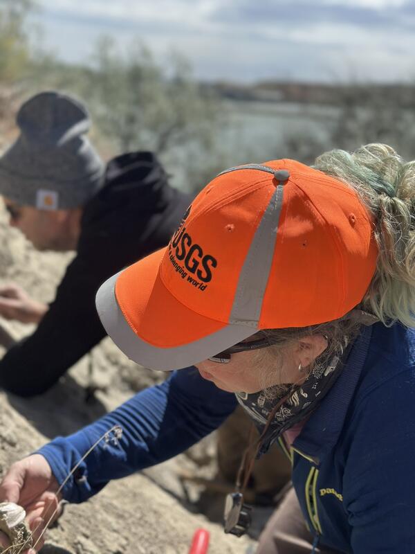
Geomorphology of the Sprague River Basin
The USGS documents historical and current channel and floodplain processes and conditions to assist management and regulatory agencies in evaluating restoration proposals and designing effective restoration and monitoring strategies for the Sprague River and its principle tributaries. The study involves multiple analyses, including assessments of historical channel change, riparian and floodplain...

Dam removal: synthesis of ecological and physical responses
Dam decommissioning is rapidly emerging as an important river restoration strategy in the U.S., with several major removals recently completed or in progress. But few studies have evaluated the far-reaching consequences of these significant environmental perturbations, especially those resulting from removals of large (>10-15 m tall) structures during the last decade. In particular...

Quinault Indian Reservation
The rivers and forests of the Olympic Peninsula have long been important sources of natural resources. For the Quinault Indian Nation of the southwestern Olympic Peninsula, forests and fisheries have been the cultural and economic mainstay for thousands of years. To protect and restore these dwindling resources, the Quinault Indian Nation is undertaking a science-based approach for land management...

Geomorphic map of Echo, Oregon
This geomorphic map of Echo, Oregon shows the town is built on valley bottom terrain. Other landforms such as slopes, fans, bedrock, etc. are delineated in the surrounding area. From https://www.usgs.gov/maps/geomorphic-map-umatilla-river-corridor-oregon.
Geologists examining sedimentary rocks
USGS geologists Laura Walkup and Jim O'Connor examine the Glenns Ferry Formation, a sedimentary unit deposited in the western Snake River Plain
USGS geologists Laura Walkup and Jim O'Connor examine the Glenns Ferry Formation, a sedimentary unit deposited in the western Snake River Plain

Upstream view of the Columbia River flowing through the Hanford reach
Upstream view of the Columbia River flowing through the Hanford reachThe Columbia River flowing through the Hanford reach of the arid Columbia River basin, eastern Washington. This reach is one of the few undammed segments of the Columbia River within the United States. Photograph taken from the White Bluffs, composed of sediment deposited in late Miocene and Pliocene Lake Ringold which occupied the Pasco Basin.

The Columbia River and Miller Island
A panoramic view of the Columbia River and Miller Island near the eastern end of the Columbia River Gorge National Scenic Area. The island and cliff walls on both sides of the Columbia River are composed of stacked lava flows of the Columbia River Basalt Group.
A panoramic view of the Columbia River and Miller Island near the eastern end of the Columbia River Gorge National Scenic Area. The island and cliff walls on both sides of the Columbia River are composed of stacked lava flows of the Columbia River Basalt Group.

The Bonneville landslide and Bonneville Dam from Munra Point
The Bonneville landslide and Bonneville Dam from Munra PointA view east from Munra Point, Oregon showing Bonneville Dam, the Bonneville landslide, and snowy Mount Adams in the hazy distance.
The Bonneville landslide and Bonneville Dam from Munra Point
The Bonneville landslide and Bonneville Dam from Munra PointA view east from Munra Point, Oregon showing Bonneville Dam, the Bonneville landslide, and snowy Mount Adams in the hazy distance.

Western Columbia River Gorge, Columbia River Gorge Nat'l Scenic Area
Western Columbia River Gorge, Columbia River Gorge Nat'l Scenic AreaA view west of the western Columbia River Gorge National Scenic Area from near Cascade Locks, Oregon. The toe of the Bonneville landslide is on the right, which blocked the Columbia River about 500 years ago.

Freshwater tidal marshes of the Columbia River estuary, Oregon
Freshwater tidal marshes of the Columbia River estuary, OregonFreshwater tidal marsh of the Columbia River estuary, Cathlamet Bay in foreground, uplifted coastal ranges of the Cascadia forearc of Washington in background.
Freshwater tidal marshes of the Columbia River estuary, Oregon
Freshwater tidal marshes of the Columbia River estuary, OregonFreshwater tidal marsh of the Columbia River estuary, Cathlamet Bay in foreground, uplifted coastal ranges of the Cascadia forearc of Washington in background.

Sampling sediment transport during Marmot Dam removal, Sandy River, OR
Sampling sediment transport during Marmot Dam removal, Sandy River, ORUSGS scientists sampled sediment transport during (and after) the breaching of the Marmot Dam on the Sandy River, OR.
Sampling sediment transport during Marmot Dam removal, Sandy River, OR
Sampling sediment transport during Marmot Dam removal, Sandy River, ORUSGS scientists sampled sediment transport during (and after) the breaching of the Marmot Dam on the Sandy River, OR.
Science and Products
Pacific Northwest Geologic Mapping: Northern Pacific Border, Cascades and Columbia
The Pacific Northwest is an area created by active and complex geological processes. On its path to the Pacific Ocean, the Columbia River slices through a chain of active volcanoes located along the western margin of the U.S. in Washington, Oregon, and northern California. These volcanoes rest above the active Cascadia subduction zone, which is the boundary where the oceanic tectonic plate dives...
Geomorphology of the Sprague River Basin
The USGS documents historical and current channel and floodplain processes and conditions to assist management and regulatory agencies in evaluating restoration proposals and designing effective restoration and monitoring strategies for the Sprague River and its principle tributaries. The study involves multiple analyses, including assessments of historical channel change, riparian and floodplain...
Dam removal: synthesis of ecological and physical responses
Dam decommissioning is rapidly emerging as an important river restoration strategy in the U.S., with several major removals recently completed or in progress. But few studies have evaluated the far-reaching consequences of these significant environmental perturbations, especially those resulting from removals of large (>10-15 m tall) structures during the last decade. In particular...
Quinault Indian Reservation
The rivers and forests of the Olympic Peninsula have long been important sources of natural resources. For the Quinault Indian Nation of the southwestern Olympic Peninsula, forests and fisheries have been the cultural and economic mainstay for thousands of years. To protect and restore these dwindling resources, the Quinault Indian Nation is undertaking a science-based approach for land management...
Geomorphic map of Echo, Oregon
This geomorphic map of Echo, Oregon shows the town is built on valley bottom terrain. Other landforms such as slopes, fans, bedrock, etc. are delineated in the surrounding area. From https://www.usgs.gov/maps/geomorphic-map-umatilla-river-corridor-oregon.
This geomorphic map of Echo, Oregon shows the town is built on valley bottom terrain. Other landforms such as slopes, fans, bedrock, etc. are delineated in the surrounding area. From https://www.usgs.gov/maps/geomorphic-map-umatilla-river-corridor-oregon.
Geologists examining sedimentary rocks
USGS geologists Laura Walkup and Jim O'Connor examine the Glenns Ferry Formation, a sedimentary unit deposited in the western Snake River Plain
USGS geologists Laura Walkup and Jim O'Connor examine the Glenns Ferry Formation, a sedimentary unit deposited in the western Snake River Plain
Upstream view of the Columbia River flowing through the Hanford reach
Upstream view of the Columbia River flowing through the Hanford reachThe Columbia River flowing through the Hanford reach of the arid Columbia River basin, eastern Washington. This reach is one of the few undammed segments of the Columbia River within the United States. Photograph taken from the White Bluffs, composed of sediment deposited in late Miocene and Pliocene Lake Ringold which occupied the Pasco Basin.
The Columbia River and Miller Island
A panoramic view of the Columbia River and Miller Island near the eastern end of the Columbia River Gorge National Scenic Area. The island and cliff walls on both sides of the Columbia River are composed of stacked lava flows of the Columbia River Basalt Group.
A panoramic view of the Columbia River and Miller Island near the eastern end of the Columbia River Gorge National Scenic Area. The island and cliff walls on both sides of the Columbia River are composed of stacked lava flows of the Columbia River Basalt Group.
The Bonneville landslide and Bonneville Dam from Munra Point
The Bonneville landslide and Bonneville Dam from Munra PointA view east from Munra Point, Oregon showing Bonneville Dam, the Bonneville landslide, and snowy Mount Adams in the hazy distance.
The Bonneville landslide and Bonneville Dam from Munra Point
The Bonneville landslide and Bonneville Dam from Munra PointA view east from Munra Point, Oregon showing Bonneville Dam, the Bonneville landslide, and snowy Mount Adams in the hazy distance.
Western Columbia River Gorge, Columbia River Gorge Nat'l Scenic Area
Western Columbia River Gorge, Columbia River Gorge Nat'l Scenic AreaA view west of the western Columbia River Gorge National Scenic Area from near Cascade Locks, Oregon. The toe of the Bonneville landslide is on the right, which blocked the Columbia River about 500 years ago.
Freshwater tidal marshes of the Columbia River estuary, Oregon
Freshwater tidal marshes of the Columbia River estuary, OregonFreshwater tidal marsh of the Columbia River estuary, Cathlamet Bay in foreground, uplifted coastal ranges of the Cascadia forearc of Washington in background.
Freshwater tidal marshes of the Columbia River estuary, Oregon
Freshwater tidal marshes of the Columbia River estuary, OregonFreshwater tidal marsh of the Columbia River estuary, Cathlamet Bay in foreground, uplifted coastal ranges of the Cascadia forearc of Washington in background.
Sampling sediment transport during Marmot Dam removal, Sandy River, OR
Sampling sediment transport during Marmot Dam removal, Sandy River, ORUSGS scientists sampled sediment transport during (and after) the breaching of the Marmot Dam on the Sandy River, OR.
Sampling sediment transport during Marmot Dam removal, Sandy River, OR
Sampling sediment transport during Marmot Dam removal, Sandy River, ORUSGS scientists sampled sediment transport during (and after) the breaching of the Marmot Dam on the Sandy River, OR.
*Disclaimer: Listing outside positions with professional scientific organizations on this Staff Profile are for informational purposes only and do not constitute an endorsement of those professional scientific organizations or their activities by the USGS, Department of the Interior, or U.S. Government