Dr. Michael (Mike) Duniway is a soil scientist focused on soils and soil processes in dryland ecosystems and the interactions between environmental and land-use drivers, vegetation, soils, and geomorphology. His areas of focus include restoration, ecohydrology, effects of land-use (grazing, energy, and recreation), dust production, plant-soil feedbacks, and soil mapping and interpretations.
Brief Research Description: 
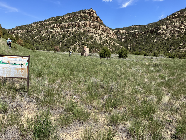
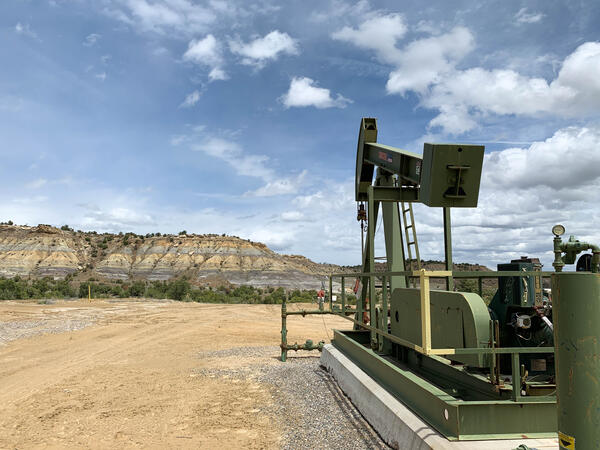
In his research and outreach activities, Dr. Duniway seeks to provide information for land managers and owners to facilitate sustainable land-use activities. He works closely with federal agencies partners (BLM, NPS, NRCS, USFWS, and others) in designing research studies, conducting technology transfer, and outreach activities. Some primary current research focuses include understanding impacts of drought on Colorado Plateau landscapes, evaluating recovery of oil and gas pads on the Colorado Plateau and opportunities for improved restoration practices, developing novel restoration techniques for highly disturbed lands using biological soil crusts and physical barriers, and basic research into the importance of soils for dryland ecosystem processes.
- Learn about our dryland climate and land use change studies
Education
- B.S., 1994 — Environmental Resource Science, University of California, Davis, CA
- Ph.D., 2006 — Agronomy (Soil Science), New Mexico State University, Las Cruces, NM
Research and Professional Experience
- 2011-Present: Research Ecologist, USGS SBSC, Moab, UT
- 2010-2011: Research Soil Scientist, USDA ARS Jornada, Las Cruces, NM
- 2006-2010: Research Soil Scientist (post doc), USDA ARS Jornada, Las Cruces, NM
- 2012-Present: Adjunct Faculty, USU, Logan, UT
- 2007-Present: Adjunct Faculty, NMSU, Las Cruces, NM
For more information, please reference online:
- My google scholar page (Michael C. Duniway)
- The Canyonlands Research Center
Science and Products
Climate Adaptation Strategies for Arid Grasslands
Developing a Decision Support Framework for Prioritizing Pinyon Juniper Forest Treatments on the Colorado Plateau
Drought & Grazing Experiment: Understanding Impacts and Identifying Mitigation Strategies
Remote Sensing of Energy Development
Well Pad Reclamation and Research
Learning From the Past and Planning for the Future: Experience-Driven Insight Into Managing for Ecosystem Transformations Induced by Drought and Wildfire
Drylands are highly vulnerable to climate and land use changes: what ecosystem changes are in store?
Digital Soil Mapping: New Tools for Modern Land Management Decisions
Wind Erosion and Dust Emissions on the Colorado Plateau
Long-Term Vegetation Change on the Colorado Plateau
RestoreNet: Distributed Field Trial Network for Dryland Restoration
Colorado Plateau Futures: Understanding Agents of Change on the Colorado Plateau to Facilitate Collaborative Adaptation
Soil, geologic, geomorphic, climate, and vegetation data from long-term monitoring plots (2009 - 2018) in Arches, Canyonlands, and Capitol Reef National Parks, Utah, USA
Biocrust cover, vegetation, and climate data across 23 years (1996-2019) from a protected grassland within Canyonlands National Park, Utah
Sagebrush recovery analyzed with a dynamic reference approach in southwestern Wyoming, USA 1985-2018
Soil family particle size class map for Colorado River Basin above Lake Mead
Soil geomorphic unit and ecological site group maps for the rangelands of the Upper Colorado River Basin region
Precipitation, soil moisture, and vegetation data from 36 experimental plots in southeastern Utah, near Canyonlands National Park (2015 - 2018)
Soil surface properties and roughness data at two experimental restoration sites within the Southwestern USA
A snapshot of stakeholder science needs related to drought in the Colorado River Basin
Long-term annual aeolian dust deposition data from seven locations in southeastern Utah
Rangeland Ecosystem Data, Grand Canyon - Parashant National Monument, AZ, USA
Predictive soil property maps with prediction uncertainty at 30-meter resolution for the Colorado River Basin above Lake Mead
High-resolution object-based image classifications of biological soil crusts and vegetation (Beef Basin, Utah)
Geologic, geomorphic, and edaphic underpinnings of dryland ecosystems: Colorado Plateau landscapes in a changing world
Adapting to climate change on desert rangelands: A multi-site comparison of grazing behavior plasticity of heritage and improved beef cattle
Conflict of energies: Spatially modeling mule deer caloric expenditure in response to oil and gas development
Supporting the development and use of native plant materials for restoration on the Colorado Plateau (Fiscal Year 2021 Report)
Soil depth and precipitation moderate soil textural effects on seedling survival of a foundation shrub species
Decline in biological soil crust N-fixing lichens linked to increasing summertime temperatures
Assessing vegetation recovery from energy development using a dynamic reference approach
A quantitative soil-geomorphic framework for developing and mapping ecological site groups
Parameterizing an aeolian erosion model for rangelands
What determines the effectiveness of Pinyon-Juniper clearing treatments? Evidence from the remote sensing archive and counter-factual scenarios
Oil and gas reclamation on US public lands: How it works and improving the process with land potential concepts
Guiding principles for using satellite-derived maps in rangeland management
Non-USGS Publications**
**Disclaimer: The views expressed in Non-USGS publications are those of the author and do not represent the views of the USGS, Department of the Interior, or the U.S. Government.
Informing Future Decision Making on Uranium Mining in Arizona: Science for Health and Environment
The USGS is conducting research at uranium-bearing breccia pipe deposits to address data gaps related to the potential effects of uranium exploration and mining activities on the Grand Canyon watershed, its people, wildlife, and water resources. Study locations are primarily on Federal lands with a few locations on Tribal lands, and include historic and active mines.
Colorado River Basin Projects
The Colorado River Basin Actionable and Strategic Integrated Science and Technology Team has created an interactive map of USGS projects to highlight the integrated science currently conducted within the Colorado River Basin. These projects are not all inclusive of the work conducted by the USGS within the CRB, but highlight the broad range of integrated science currently conducted.
Science and Products
- Science
Filter Total Items: 18
Climate Adaptation Strategies for Arid Grasslands
Helping National Parks in the 4-Corners region manage grasslands in a changing climate.Developing a Decision Support Framework for Prioritizing Pinyon Juniper Forest Treatments on the Colorado Plateau
Across the western U.S., pinyon and juniper trees are expanding into sagebrush and grassland plant communities. This vegetation change has been perceived to have a significant impact on the economic value of these grasslands, which support activities such as livestock grazing and hunting, but expanding pinyon and juniper forests may also lead to increased risk of fire. Over the past several decadeDrought & Grazing Experiment: Understanding Impacts and Identifying Mitigation Strategies
Drylands (sometimes called ‘deserts’ or ‘arid and semi-arid' ecosystems) are defined by water scarcity. Understanding how land-use activities may effect dryland ecosystems and dryland ecological processes is a high priority for land conservation and management. Grazing by domestic livestock (typically cattle but also sheep and goats) is the most widespread land-use in drylands globally and a large...Remote Sensing of Energy Development
Oil and gas development across the western United States has increased substantially in recent decades, including within the Colorado Plateau. The Colorado Plateau is a high desert region of grasslands, shrublands, and woodlands and is home to a large number of world-renowned national and tribal parks and monuments (e.g., Grand Canyon, Zion, Bryce, Arches, Canyonlands, Monument Valley, and Mesa...Well Pad Reclamation and Research
Reclamation on lands impacted by energy development is complicated and extremely challenging in arid environments due to unstable soils, exotic species, and low and variable precipitation. The reclamation tactics employed by energy operators vary widely and outcomes can differ across plant communities and soil types. In order to address the knowledge gaps regarding how to successfully and...Learning From the Past and Planning for the Future: Experience-Driven Insight Into Managing for Ecosystem Transformations Induced by Drought and Wildfire
Drought and wildfire pose enormous threats to the integrity of natural resources that land managers are charged with protecting. Recent observations and modeling forecasts indicate that these stressors will likely produce catastrophic ecosystem transformations, or abrupt changes in the condition of plants, wildlife, and their habitats, in regions across the country in coming decades. In this pDrylands are highly vulnerable to climate and land use changes: what ecosystem changes are in store?
Improper land use during drought has been a major driver of land degradation in drylands globally, especially in the western U.S. Increasing aridity in western U.S. drylands under future climates will exacerbate risks associated with drought and land use decisions. This project provides critical observational, experimental, and modelling evidence to support our DOI partners with decision processes...Digital Soil Mapping: New Tools for Modern Land Management Decisions
The field of digital soil mapping has bridged the classic theories of soil science into the modern computing age to produce high resolution predictive soil maps. This body of work utilizes classic soil factorial theory (soil = f[climate, organisms, relief (topography), parent material, time] + ɛ, or ‘clorpt’). The clorpt framework has been approximated using various environmental spatial data...Wind Erosion and Dust Emissions on the Colorado Plateau
Wind erosion of soils and dust emissions are a significant resource management challenge on the Colorado Plateau. Loss of topsoil and associated aeolian sediment (wind-driven sediment) movement can lead to reduced soil fertility as well as abrasion and burial of vegetation. Dust in the atmosphere poses a threat to human health, visual resources, and regional water supplies (due to interactions...Long-Term Vegetation Change on the Colorado Plateau
The Colorado Plateau, centered around the four corners area of the Southwest, and includes much of Arizona, Utah, Colorado, and New Mexico, is a large and important component of U.S. drylands. This important home to mountains, desert basins, dramatic canyons, and arid woodlands and grasslands is also one of North America’s most rapidly warming hot spots, with rates of warming of up to 2-3° C...RestoreNet: Distributed Field Trial Network for Dryland Restoration
Starting in 2017, U.S. Geological Survey (USGS) researchers and land managers are co-producing a network of restoration field trial sites on Department of Interior (DOI) and surrounding lands in the southwestern U.S. The network systematically tests restoration treatments across a broad range of landscape, soil, and climate conditions. Each site in the network is used to test suitable seed mixes...Colorado Plateau Futures: Understanding Agents of Change on the Colorado Plateau to Facilitate Collaborative Adaptation
The objective of this interdisciplinary research effort is to 1) characterize agents of change important to land management decision makers on the Colorado Plateau; 2) identify and analyze relationships between agents of change and key landscape attributes and processes; 3) collectively assess the influence of agents of change and attributes and processes on the services provided by the ecosystem... - Data
Filter Total Items: 20
Soil, geologic, geomorphic, climate, and vegetation data from long-term monitoring plots (2009 - 2018) in Arches, Canyonlands, and Capitol Reef National Parks, Utah, USA
These data (all data tables for the data release) represent a suite of biotic and abiotic variables that characterized plant communities and the geologic, geomorphic, edaphic, climatic, and land use history context in which distinct plant communities occur. In 2009, the National Park Service's Inventory and Monitoring program for the Northern Colorado Plateau Network (NCPN) began measuring vegetatBiocrust cover, vegetation, and climate data across 23 years (1996-2019) from a protected grassland within Canyonlands National Park, Utah
These tabular data were compiled for/to monitor vegetation and biocrust cover in a never grazed grassland located in Canyonlands National Park. An objective, or objectives, of our study was to document potential changes in biocrust and vegetation cover and species composition as related to changes in land use and climate change. These data represent a timeseries of long-term vegetation and biocrusSagebrush recovery analyzed with a dynamic reference approach in southwestern Wyoming, USA 1985-2018
Identifying ecologically relevant reference sites is important for evaluating ecosystem recovery, but the relevance of references that are temporally static is unclear in the context of vast landscapes with disturbance and environmental contexts varying over space and time. This question is pertinent for landscapes dominated by sagebrush (Artemisia spp.) which face a suite of threats from disturbaSoil family particle size class map for Colorado River Basin above Lake Mead
These data were compiled to support analysis of remote sensing data using the Disturbance Automated Reference Toolset (Nauman et al., 2017). The objective of our study was to assess results of pinyon and juniper land treatments. These data represent major soil types as defined primarily by soil texture and depth, but also geology, parent material, and geomorphology for relevant features that distiSoil geomorphic unit and ecological site group maps for the rangelands of the Upper Colorado River Basin region
This data release includes maps characterizing soil geomorphic units (SGUs), climate zones, and ecological site groups that classify landscapes by ecological potential and behavior for use in land management in the Upper Colorado River Basin (UCRB) region. Soil geomorphic units were created by analysis and grouping of ecological sites (ESs), a more detailed local system of ecological units managedPrecipitation, soil moisture, and vegetation data from 36 experimental plots in southeastern Utah, near Canyonlands National Park (2015 - 2018)
These data were compiled for a study that investigated the effects of drought seasonality and plant community composition on two dominant perennial grasses, Achnatherum hymenoides (C3 photosynthesis), and Pleuraphis jamesii (C4 photosynthesis), in a dryland ecosystem. In 2015 USGS Ecologists recorded vegetation and soil moisture data in 36 experimental plots which manipulated precipitation in twoSoil surface properties and roughness data at two experimental restoration sites within the Southwestern USA
This data release presents data used for analyzing spatial and temporal differences in soil surface roughness within selected biocrust communities. These records were collected by ground-based lidar for 121, 1m x 3m soil plots with biological soil crusts (biocrusts). Roughness was estimated from 5 mm resolution data (CloudCompare v. 2.10.2, 2019) for two Great Basin Desert sites (UTTR-1; UTTR-2) iA snapshot of stakeholder science needs related to drought in the Colorado River Basin
Stakeholder science needs were determined by reviewing more than 200 recently published literature items and web pages from Colorado River Basin (CRB) stakeholders. These stakeholder communications were used to characterize over 400 stakeholder science needs by reviewing their priorities, strategies, issues, missions, and concerns related to drought in the CRB. Members of the CRB Integrated SciencByArizona Water Science Center, California Water Science Center, Colorado Water Science Center, Fort Collins Science Center, Geology, Geophysics, and Geochemistry Science Center, Nevada Water Science Center, New Mexico Water Science Center, Southwest Biological Science Center, Utah Water Science Center, Wyoming-Montana Water Science CenterLong-term annual aeolian dust deposition data from seven locations in southeastern Utah
These data are annual aeolian dust deposition calculations from vertical deposition at seven locations near the vicinity of Moab, Utah covering the period from 1999 to 2020. Data were collected by the U.S. Geological Survey Geosciences and Environmental Change Science Center (Denver, Colorado) and Southwest Biological Science Center (Moab, Utah) to "monitor sediment characteristics at sites selectRangeland Ecosystem Data, Grand Canyon - Parashant National Monument, AZ, USA
These data were compiled for an assessment of rangeland ecosystem conditions of the Grand Canyon - Parashant National Monument. The approximately one-million-acre Grand Canyon-Parashant National Monument (PARA) is located in the northwest corner of Arizona and co-managed by the Bureau of Land Management (BLM) and National Park Service (NPS). This report is focused on the ca. 200,000 acres of NPSPredictive soil property maps with prediction uncertainty at 30-meter resolution for the Colorado River Basin above Lake Mead
These data were compiled to demonstrate new predictive mapping approaches and provide comprehensive gridded 30 meter resolution soil property maps for the Colorado River Basin above Hoover Dam. Random forest models related environmental raster layers representing soil forming factors with field samples to render predictive maps that interpolate between sample locations. Maps represented soil pH, tHigh-resolution object-based image classifications of biological soil crusts and vegetation (Beef Basin, Utah)
This dataset contains 10 classified raster images identifying the distribution and condition of biological soil crusts using high-resolution imagery from Unmanned Aerial Systems (UAS). Also included are: a supplemental accuracy report and accuracy matrix for each classified image, and all associated accessory files. These images are located in Beef Basin, Southeastern Utah, and focuses on two ecol - Multimedia
- Publications
Filter Total Items: 85
Geologic, geomorphic, and edaphic underpinnings of dryland ecosystems: Colorado Plateau landscapes in a changing world
Drylands represent more than 41% of the global land surface and are at degradation risk due to land use and climate change. Developing strategies to mitigate degradation and restore drylands in the face of these threats requires an understanding of how drylands are shaped by not only soils and climate, but also geology and geomorphology. However, few studies have completed such a comprehensive anaAdapting to climate change on desert rangelands: A multi-site comparison of grazing behavior plasticity of heritage and improved beef cattle
Climate change is amplifying the spatiotemporal heterogeneity of desert rangeland forages through its impact on precipitation variability. Foraging behavior plasticity (an animal's ability to alter its behavior to cope with environmental variation) could be a key trait for climate adaptation of beef cattle in arid environments. We analyzed GPS-derived movement and activity data of Criollo and commConflict of energies: Spatially modeling mule deer caloric expenditure in response to oil and gas development
ContextWildlife avoid human disturbances, including roads and development. Avoidance and displacement of wildlife into less suitable habitat due to human development can affect their energy expenditures and fitness. The heart rate and oxygen uptake of large mammals varies with both natural aspects of their habitat (terrain, climate, predators, etc.) and anthropogenic influence (noise, light, fragmSupporting the development and use of native plant materials for restoration on the Colorado Plateau (Fiscal Year 2021 Report)
A primary focus of the Colorado Plateau Native Plant Program (CPNPP) is to identify and develop appropriate native plant materials (NPMs) for current and future restoration projects. Multiple efforts have characterized the myriad challenges inherent in providing appropriate seed resources to enable effective, widespread restoration and have identified a broad suite of research activities to providSoil depth and precipitation moderate soil textural effects on seedling survival of a foundation shrub species
In drylands, there is a need for controlled experiments over multiple planting years to examine how woody seedlings respond to soil texture and the potentially interactive effects of soil depth and precipitation. Understanding how multiple environmental factors interactively influence plant establishment is critical to restoration ecology and in this case to broad-scale restoration efforts in westDecline in biological soil crust N-fixing lichens linked to increasing summertime temperatures
Across many global drylands, biocrusts form a protective barrier on the soil surface and fill many critical roles in these harsh yet fragile environments. Previous short-term research suggests that climate change and invasive plant introduction can damage and alter biocrust communities, yet few long-term observations exist. Using a globally unique long-term record of continuous biocrust surveys frAssessing vegetation recovery from energy development using a dynamic reference approach
Ecologically relevant references are useful for evaluating ecosystem recovery, but references that are temporally static may be less useful when environmental conditions and disturbances are spatially and temporally heterogeneous. This challenge is particularly acute for ecosystems dominated by sagebrush (Artemisia spp.), where communities may require decades to recover from disturbance. We demonsA quantitative soil-geomorphic framework for developing and mapping ecological site groups
Land management decisions need context about how landscapes will respond to different circumstances or actions. As ecologists’ understanding of nonlinear ecological dynamics has evolved into state-and-transition models (STMs), they have put more emphasis on defining and mapping the soil, geomorphological, and climate parameters that mediate these dynamics. The US Department of Agriculture NaturalParameterizing an aeolian erosion model for rangelands
Aeolian processes are fundamental to arid and semi-arid ecosystems, but modeling approaches are poorly developed for assessing impacts of management and environmental change on sediment transport rates over meaningful spatial and temporal scales. For model estimates to provide value, estimates of sediment flux that encapsulate intra- and inter-annual and spatial variability are needed. Further, itWhat determines the effectiveness of Pinyon-Juniper clearing treatments? Evidence from the remote sensing archive and counter-factual scenarios
In the intermountain western US, expansion of Pinyon (Pinus edulis) and Juniper (Juniperus spp.) woodlands (PJ) into grasslands and shrublands is a pervasive phenomenon, and an example of the global trend towards enhanced woody growth in drylands. Due to the perceived impacts of these expansions on ecosystem services related to biodiversity, hydrology, soil stability, fire prevention, and livestocOil and gas reclamation on US public lands: How it works and improving the process with land potential concepts
• There are three general stages of a well's life on US public land: 1) the permitting process to drill, 2) active extraction of fossil fuel resource, and 3) plugging and abandonment of well.• There is no national standard for oil and gas reclamation in the United States similar to mining and therefore current reclamation practices and standards fail to achieve long-term effectiveness across the wGuiding principles for using satellite-derived maps in rangeland management
On the GroundRangeland management has entered a new era with the accessibility and advancement of satellite-derived maps.Maps provide a comprehensive view of rangelands in space and time, and challenge us to think critically about natural variability.Here, we advance the practice of using satellite-derived maps with four guiding principles designed to increase end user confidence and thereby accesNon-USGS Publications**
Browning, D.M., Duniway, M.C., Laliberte, A., and Rango, A., 2012, Hierarchical analysis of vegetation dynamics over 71 years: Soil-rainfall interactions in a Chihuahuan desert ecosystem: Ecological Applications, v. 22, p.909-926.Duniway, M., Karl, J., Schrader, S., Baquera, N., and Herrick, J., 2012, Rangeland and pasture monitoring: an approach to interpretation of high-resolution imagery focused on observer calibration for repeatability: Environmental Monitoring and Assessment, v. 184, p. 3789-3804.Karl, J., Duniway, M.C., Nusser, S.M., Opsomer, J.D., and Unnasch, R.S., 2012, Using Very-Large-Scale Aerial Imagery for Rangeland Monitoring and Assessment: Some Statistical Considerations: Rangeland Ecology & Management, v. 65, p. 330-339.Karl, J.W., Duniway, M.C., and Schrader, T.S., 2012, A Technique for Estimating Rangeland Canopy-Gap Size Distributions From High-Resolution Digital Imagery: Rangeland Ecology & Management, v. 65, p. 196-207.Browning, D.M., and Duniway, M.C., 2011, Digital soil mapping in the absence of field training data: a case study using terrain attributes and semiautomated soil signature derivation to distinguish ecological potential: Applied and Environmental Soil Science.Duniway, M.C., and Herrick, J.E., 2011, Disentangling road network impacts: the need for a holistic approach: Journal of Soil and Water Conservation, v. 66, p. 31A-36A.Peters, D.P.C., Lugo, A.E., Chapin, F.S., Pickett, S.T.A., Duniway, M.C., Rocha, A.V., Swanson, F.J., Laney, C., and Jones, J., 2011, Cross-system comparisons elucidate disturbance complexities and generalities: Ecosphere, v. 2, art. 81.Schrader, T.S., and Duniway, M.C., 2011, Image Interpreter Tool: An ArcGIS tool for estimating vegetation cover from high-resolution imagery: Rangelands, v. 33, p. 35-40.Duniway, M., Herrick, J., and Monger, H., 2010, Spatial and temporal variability of plant-available water in calcium carbonate-cemented soils and consequences for arid ecosystem resilience: Oecologia, v. 163, p. 215-226.Duniway, M.C., Bestelmeyer, B.T., and Tugel, A., 2010, Soil processes and properties that distinguish ecological sites and states: Rangelands, v. 32, p. 9-15.Duniway, M.C., Snyder, K.A., and Herrick, J.E., 2010, Spatial and temporal patterns of water availability in a grass–shrub ecotone and implications for grassland recovery in arid environments: Ecohydrology, v. 3, p. 55-67.Duniway, M.C., Herrick, J.E., and Monger, H.C., 2007, The high water-holding capacity of petrocalcic horizons: Soil Science Society of America Journal, v. 71, p. 812-819.Duniway, M.C., 2006, The functional role of petrocalcic horizons in desert ecosystems: spatial and temporal dynamics of plant water availability [Ph.D. Dissertation]: New Mexico State Univeristy, Las Cruces, New Mexico, USA.**Disclaimer: The views expressed in Non-USGS publications are those of the author and do not represent the views of the USGS, Department of the Interior, or the U.S. Government.
- Web Tools
Informing Future Decision Making on Uranium Mining in Arizona: Science for Health and Environment
The USGS is conducting research at uranium-bearing breccia pipe deposits to address data gaps related to the potential effects of uranium exploration and mining activities on the Grand Canyon watershed, its people, wildlife, and water resources. Study locations are primarily on Federal lands with a few locations on Tribal lands, and include historic and active mines.
Colorado River Basin Projects
The Colorado River Basin Actionable and Strategic Integrated Science and Technology Team has created an interactive map of USGS projects to highlight the integrated science currently conducted within the Colorado River Basin. These projects are not all inclusive of the work conducted by the USGS within the CRB, but highlight the broad range of integrated science currently conducted.
- News