U.S. flag

An official website of the United States government

Images

Images intro.
Filter Total Items: 250
USGS scientist collecting a water-quality sample from Zollner Creek, Oregon
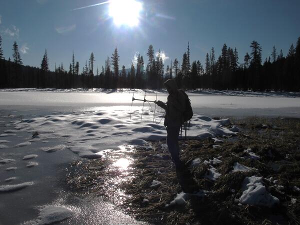
USGS Scientist Collecting a Water-Quality Sample from Zollner Creek, Oregon, for the Analysis of Dissolved Pesticides
Newberry Volcano, Oregon simplified hazards map showing potential i...
Newberry Volcano, OR simplified hazards map

Newberry Volcano, Oregon simplified hazards map showing potential impact area for ground-based hazards during a volcanic event.

muddy confluence wilson river and cedar creek
Confluence of Cedar Creek with the Wilson River, OR

Confluence of Wilson River with tributary Cedar Creek, OR, following heavy storm.

Map showing one-year probability of accumulation of 1 centimeter
Spectrogram from Central Pumice Cone Seismic Station, Newberry Volc...
Lake-Ice Quakes from Newberry Volcano

The popping and cracking of ice in lakes within the Newberry Volcano caldera is picked up by local seismic stations, such as Central Pumice Cone. The lake-ice quakes do not resemble standard volcanic low-frequency or high-frequency events and are sporadically observed in the winter at other ice-covered lakes in Yellowstone, Long Valley, and elsewhere.

The popping and cracking of ice in lakes within the Newberry Volcano caldera is picked up by local seismic stations, such as Central Pumice Cone. The lake-ice quakes do not resemble standard volcanic low-frequency or high-frequency events and are sporadically observed in the winter at other ice-covered lakes in Yellowstone, Long Valley, and elsewhere.

Tanner Creek outfall
Tanner Creek
Tanner Creek
Tanner Creek

Tanner Creek outfall delivers stormwater runoff with insecticides to Tanner Creek, tributary of the Willamette River

Tanner Creek outfall delivers stormwater runoff with insecticides to Tanner Creek, tributary of the Willamette River

Water running down a creek.
Lost Dog Creek
Lost Dog Creek
Lost Dog Creek

A turbid Lost Dog Creek tumbles down steep slopes before feeding Lake Oswego.

A turbid Lost Dog Creek tumbles down steep slopes before feeding Lake Oswego.

snow-capped volcano, Mount Hood on the horizon, with city of Portland, Oregon in foreground
Mount Hood and Portland, Oregon

Mount Hood in the not-so-far distance beyond downtown Portland, Oregon. Photograph taken at the top of the Portland Aerial Tram line on Marquam Hill.

Mount Hood in the not-so-far distance beyond downtown Portland, Oregon. Photograph taken at the top of the Portland Aerial Tram line on Marquam Hill.

Data logger suspended above a channel with a person pointing up at it from the bottom of the channel
Millicoma Meander study basin

Photograph of the channel station showing the laser distance meter (in red circle) high above the channel used to measure stage (height) of flow in the channel.

Photograph of the channel station showing the laser distance meter (in red circle) high above the channel used to measure stage (height) of flow in the channel.

snow-covered Mt. Hood volcano on the horizon overlooking tall building in city of Portland
Mount Hood
Mount Hood
Mount Hood

Mount Hood dominates the skyline outside Portland, Oregon on a clear day. A major eruption of Mount Hood would pose a great hazard to the regional economy.

Mount Hood dominates the skyline outside Portland, Oregon on a clear day. A major eruption of Mount Hood would pose a great hazard to the regional economy.

Image: Sprague River Basin, Oregon
Sprague River Basin, Oregon

Climate change projections indicate a steady increase in temperature progressing through the 21st century, generally resulting in snowpack reductions, changes to the timing of snowmelt, altered streamflows, and reductions in soil moisture, all of which could affect water management, agriculture, recreation, hazard mitigation, and ecosystems across the nat

Climate change projections indicate a steady increase in temperature progressing through the 21st century, generally resulting in snowpack reductions, changes to the timing of snowmelt, altered streamflows, and reductions in soil moisture, all of which could affect water management, agriculture, recreation, hazard mitigation, and ecosystems across the nat

cableway sampling
Sampling from a cableway, Fall Creek, OR

USGS Hydrologic Technician Heather Bragg collects suspended-sediment sample from a cableway downstream from Fall Creek Reservoir. Reservoir was drawn down to purge sediment and trapped fish from behind dam in December 2012.

Video available online.

USGS Hydrologic Technician Heather Bragg collects suspended-sediment sample from a cableway downstream from Fall Creek Reservoir. Reservoir was drawn down to purge sediment and trapped fish from behind dam in December 2012.

Video available online.

clackamas river
Clackmas River, OR
Clackmas River, OR
Clackmas River, OR

View of Clackamas River, OR.

oregon coast
Oregon Coast
Oregon Coast
Oregon Coast

Oregon Coast at Cannon Beach.

Oregon Coast at Cannon Beach.

bright green frog perched on a blade of grass in a swamp
Pacific chorus frog in reed canary grass

A Pacific chorus frog (also known as Pacific tree frog) perched in reed canary grass in the Finley National Wildlife Refuge in Oregon.

A Pacific chorus frog (also known as Pacific tree frog) perched in reed canary grass in the Finley National Wildlife Refuge in Oregon.

surveying fanno creek
Surveying channel change in Fanno Creek, OR

USGS hydrologist surveying channel depth across Fanno Creek, OR

Map of the extent of Newberry lavas including approximate ages of s...
Extent of Newberry lavas including approximate ages of surficial flows

Extending approximately 75 miles north to south and 27 miles east to west, Newberry Volcano and its broad apron of lavas (light yellow shaded area) cover a total area of almost 1,200 square miles, making it the largest volcano of the Cascades volcanic chain. Its lavas stretch north beyond Smith Rock State Park, and south almost to Fort Rock State Natural Area.

Extending approximately 75 miles north to south and 27 miles east to west, Newberry Volcano and its broad apron of lavas (light yellow shaded area) cover a total area of almost 1,200 square miles, making it the largest volcano of the Cascades volcanic chain. Its lavas stretch north beyond Smith Rock State Park, and south almost to Fort Rock State Natural Area.

A person standing by a frozen lake holding an antenna
Tracking overwintering locations of Oregon spotted frogs

A USGS scientist is using radio telemetry to track the overwintering locations of Oregon spotted frogs at Gold Lake bog in Oregon. Oregon spotted frogs spend nearly half the year at overwintering locations, which can include springs, beaver channels, and crevices in lava rock.

A USGS scientist is using radio telemetry to track the overwintering locations of Oregon spotted frogs at Gold Lake bog in Oregon. Oregon spotted frogs spend nearly half the year at overwintering locations, which can include springs, beaver channels, and crevices in lava rock.

Was this page helpful?