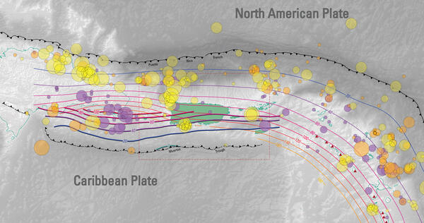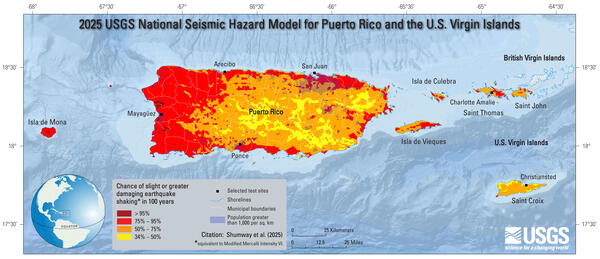
2025 USGS National Seismic Hazard Model for Puerto Rico and U.S. Virgin Islands Chance of Damaging Shaking Map
2025 USGS National Seismic Hazard Model for Puerto Rico and U.S. Virgin Islands Chance of Damaging Shaking Map2025 USGS National Seismic Hazard Model for Puerto Rico and U.S. Virgin Islands Chance of Damaging Shaking Map; chance of slight-or-greater damaging earthquake shaking in 100 years (equivalent to Modified Mercalli Intensity VI).