
Mean Annual Streamflow Permanence Probability
Images
Images intro.
Filter Total Items: 816
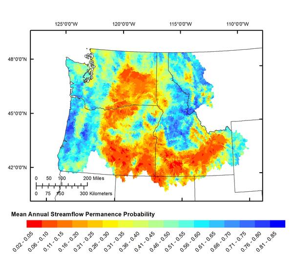
Mean annual streamflow permanence probability

Middle Elwha River digital elevation model and orthophotomosaic
Middle Elwha River digital elevation model and orthophotomosaicDigital elevation model (left) and orthomosaic (right) of the middle Elwha River
Middle Elwha River digital elevation model and orthophotomosaic
Middle Elwha River digital elevation model and orthophotomosaicDigital elevation model (left) and orthomosaic (right) of the middle Elwha River

GeoGirls 2017 science field camp at Mount St. Helens.
GeoGirls 2017 science field camp at Mount St. Helens.Image of flyer for GeoGirls 2017 science field camp at Mount St. Helens which was held July 30 to August 3, 2017.
GeoGirls 2017 science field camp at Mount St. Helens.
GeoGirls 2017 science field camp at Mount St. Helens.Image of flyer for GeoGirls 2017 science field camp at Mount St. Helens which was held July 30 to August 3, 2017.

Fanciful Fluorescence
Fluorescent colors dominate this dreamlike scene. The orange shapes look like glowfish in a fanciful underwater world. Those glowfish are actually clouds, and the neon green represents mountains, including Mount Rainier, near Seattle, Washington.
Fluorescent colors dominate this dreamlike scene. The orange shapes look like glowfish in a fanciful underwater world. Those glowfish are actually clouds, and the neon green represents mountains, including Mount Rainier, near Seattle, Washington.

Mount St. Helens as viewed from the ENE.
Mount St. Helens, as viewed from the East-Northeast. The inside of the crater rim is just visible in the upper right of the mountain.
Mount St. Helens, as viewed from the East-Northeast. The inside of the crater rim is just visible in the upper right of the mountain.

Field survey methods
Photos of survey equipment used during surveys of the Elwha River delta, Washington, from 2010-2017, showing:
Photos of survey equipment used during surveys of the Elwha River delta, Washington, from 2010-2017, showing:

Researcher works at microscope in Histology Lab
Tissue sections are mounted on glass slides, stained and examined with a microscope that magnifies cellular details up to 2,000 times with brightfield or fluorescence imaging. Microscopes are used in our research to understand the pathological changes caused by infectious agents such as bacteria, fungi, parasites and viruses.
Tissue sections are mounted on glass slides, stained and examined with a microscope that magnifies cellular details up to 2,000 times with brightfield or fluorescence imaging. Microscopes are used in our research to understand the pathological changes caused by infectious agents such as bacteria, fungi, parasites and viruses.

WFRC qPCR for detection of Renibacterium salmoninarum Image 1
WFRC qPCR for detection of Renibacterium salmoninarum Image 1Quantitative Polymerase Chain Reaction (qPCR) assay for the detection of Renibacterium salmoninarum DNA. A nucleic acid sequence detection system is shown.
WFRC qPCR for detection of Renibacterium salmoninarum Image 1
WFRC qPCR for detection of Renibacterium salmoninarum Image 1Quantitative Polymerase Chain Reaction (qPCR) assay for the detection of Renibacterium salmoninarum DNA. A nucleic acid sequence detection system is shown.

WFRC qPCR for detection of Renibacterium salmoninarum Image 2
WFRC qPCR for detection of Renibacterium salmoninarum Image 2Quantitative polymerase chain reaction (qPCR) assay for the detection of Renibacterium salmoninarum DNA. Observation of qPCR results on the screen of a sequence detection system.

Hells Canyon on the Snake River
Hells Canyon on the Snake River.

WFRC DFAT for detection of Renibacterium salmoninarum
WFRC DFAT for detection of Renibacterium salmoninarumDirect fluorescent antibody test (DFAT) for the detection of Renibacterium salmoninarum in tissues. Fluorescing R. salmoninarum cells are visible on a slide.
WFRC DFAT for detection of Renibacterium salmoninarum
WFRC DFAT for detection of Renibacterium salmoninarumDirect fluorescent antibody test (DFAT) for the detection of Renibacterium salmoninarum in tissues. Fluorescing R. salmoninarum cells are visible on a slide.

Legacy of Mount St. Helens 1980 eruption still defies perfect solution
Legacy of Mount St. Helens 1980 eruption still defies perfect solutionAerial view of Spirit Lake (center) looking north from above the crater of Mount St. Helens. The lake's outlet to the west (left) was blocked by the 1980 landslide, which required a new engineered outlet to maintain the lake at a safe level. A tunnel was drilled through a bedrock ridge on west side of lake in 1984-1985. Glacier covered Mount Rainier in distance.

Cle Elum River, a tributary of the Yakima River in Washington state
Cle Elum River, a tributary of the Yakima River in Washington stateThe Cle Elum River, a tributary of the Yakima River in Washington state. Sockeye salmon reintroduction efforts were initiated in the Cle Elum River by the Yakama Nation and Washington Department of Fish and Wildlife in 2009.

Sockeye salmon preparing to spawn
Sockeye salmon preparing to spawn upstream of Cle Elum Dam, Washington.
Sockeye salmon preparing to spawn upstream of Cle Elum Dam, Washington.

Skagit Bay bathymetry
Skagit Bay bathymetry

Temporary seismometers deployed at Mount St. Helens.
Temporary seismometers deployed at Mount St. Helens.Between August 19-22, 2017, 140 seismometers were deployed around Mount St. Helens. Instruments were placed on top of the 2004-2008 lava dome, the 1980-86 lava dome, the 1980 crater floor, and around the volcanic cone.

Mount St. Helens, as viewed from the Castle Lake Overlook.
Mount St. Helens, as viewed from the Castle Lake Overlook.Mount St. Helens, as viewed from the Castle Lake Overlook.
Mount St. Helens, as viewed from the Castle Lake Overlook.
Mount St. Helens, as viewed from the Castle Lake Overlook.Mount St. Helens, as viewed from the Castle Lake Overlook.

Collecting water quality data at Coldwater Lake
GeoGirls collect water quality data at Coldwater Lake and sieve landslide deposits to learn more about the impact of the 1980 eruption and the transport of volcanic sediment.
GeoGirls collect water quality data at Coldwater Lake and sieve landslide deposits to learn more about the impact of the 1980 eruption and the transport of volcanic sediment.

GeoGirls deploy seismometers
GeoGirls deploy seismometers at Mount St. Helens and learn how to interpret earthquake data.
GeoGirls deploy seismometers at Mount St. Helens and learn how to interpret earthquake data.

GeoGirls_Sediment1
GeoGirls collect water samples and flow measurements to model the transport of volcanic sediments.
GeoGirls collect water samples and flow measurements to model the transport of volcanic sediments.

Balloon Mapping
A balloon and simple point-and-shoot camera is used to collect digital images that are stitched together to build a 3D elevation model of the landscape.
A balloon and simple point-and-shoot camera is used to collect digital images that are stitched together to build a 3D elevation model of the landscape.