
Resource Mapping and Monitoring
Resource Mapping and Monitoring
Filter Total Items: 19

USGS Sagebrush Science: Supporting Public Safety and Economic Decision Making Across the West
The sagebrush biome is one of the largest ecosystems in North America. Encompassing nearly one-third of the continental U.S., it provides critical resources for millions of Americans and a home for hundreds of plants and animal species in the West. Natural resource management in sagebrush ecosystems can be complex, and science can support management decisions by providing knowledge and tools to...
By
Core Science Systems Mission Area, Ecosystems Mission Area, Biological Threats and Invasive Species Research Program, Climate Adaptation Science Centers, Cooperative Research Units, Land Management Research Program, Species Management Research Program, Earth Resources Observation and Science (EROS) Center, Forest and Rangeland Ecosystem Science Center, Fort Collins Science Center, Northern Rocky Mountain Science Center, Southwest Biological Science Center, Western Ecological Research Center (WERC), Wildland Fire Science

Estimating locally relevant scales of effect for population trends of a species of conservation concern
Wildlife movement and distribution can be influenced by local conditions like topography and landscape features, and the distances within which species respond to their landscape – scales of effect – can vary over space and time. We are estimating scales of effect for wildlife population trends to help land managers determine the distance within which wildlife will respond to landscape change.

Eyes on Earth Episode 135 – Exotic Annual Grasses and Sheep Grazing
Invasive grasses are degrading sagebrush in western states. Can sheep help us restore these ecosystems?

Eyes on Earth Episode 128 – 2024 EROS Fall Poster Session
Posters covered a wide range of topics as local graduate students and EROS scientists shared their work in the EROS atrium.
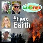
Eyes on Earth Episode 125 – The LANDFIRE Program at 20
LANDFIRE is a diverse product suite with countless uses that go beyond fire management. The program has now been providing this satellite data for 20 years.

Eyes on Earth Episode 122 – EROS Interns, 2024
What can you learn during an internship at the USGS EROS Center? A lot! Several interns talk about their experience working a summer internship at EROS.

Eyes on Earth Episode 68 - Tracking Mangroves by Satellite
Eyes on Earth is a podcast on remote sensing, Earth observation, land change and science, brought to you by the USGS Earth Resources Observation and Science (EROS) Center. In this episode, we learn what satellites can tell us about mangrove forests.

Contributions to the development of the Western Association of Fish and Wildlife Agencies Sagebrush Conservation Strategy
USGS scientists are contributing to the development of the Western Association of Fish and Wildlife Agencies Sagebrush Conservation Strategy, a strategy intended to provide guidance so that efforts to conserve the iconic greater sage-grouse can be expanded to the entire sagebrush biome to benefit the people and wildlife that depend on it.

LCMAP Change Stories: Alabama Tornadoes
The USGS Land Change Monitoring, Assessment, and Projection initiative aims to identify where the landscape is changing and why.

Land-Cover Modeling Methodology - The FORE-SCE Model
Many factors determine how human beings modify the earth's landscape. Land-cover change is inherently a local event, yet broader scale socioeconomic and biophysical factors also affect how humans make decisions to use the landscape. Projecting future land cover requires modelers to account for driving forces of land-cover change operating at scales from local ("bottom-up") to global ("top-down")...

Water Balance and Soil Moisture
Evapotranspiration (ET) rates – the combination of evaporation from soil and transpiration from plants – are powerful tools in the management of scarce water resources. Taken alone, however, those rates leave unanswered questions about water sources, questions that can offer guidance and insight on challenging decisions in areas reliant on irrigation. Researchers at EROS work to offer that insight...

United Nations Environment Programme Global Resource Information Database (UNEP-GRID)
A planet with a changing climate and growing population forces tough decisions about the use of limited resources. Making sustainable choices in the face of global change requires an accurate cataloging of those resources. Since 1991, EROS has been the North American node for the United Nations Environment Programme’s Global Resource Information Database (UNEP-GRID), which tracks environmental...