
Vivid colors and bizarre shapes come together in an image that could be an imaginative illustration for a fantasy story. This labyrinth of exotic features is present along the edge of Russia's Chaunskaya Bay (vivid blue half circle) in northeastern Siberia. Two major rivers, the Chaun and Palyavaam, flow into the bay, which in turn opens into the Arctic Ocean.
Images
Peruse our selection of remote sensing and Earth science imagery below.
Filter Total Items: 865

Siberian Ribbons
Vivid colors and bizarre shapes come together in an image that could be an imaginative illustration for a fantasy story. This labyrinth of exotic features is present along the edge of Russia's Chaunskaya Bay (vivid blue half circle) in northeastern Siberia. Two major rivers, the Chaun and Palyavaam, flow into the bay, which in turn opens into the Arctic Ocean.

Senegal landscape - 1983
A landscape scene in Senegal, photographed in 1983 by U.S. Geological Survey Scientist G. Gray Tappan as part of his work on West African land cover. Tappan photographed the scene again in 1994.
A landscape scene in Senegal, photographed in 1983 by U.S. Geological Survey Scientist G. Gray Tappan as part of his work on West African land cover. Tappan photographed the scene again in 1994.

Senegal landscape - 1994
A landscape scene in Senegal, photographed in 1994 by U.S. Geological Survey Scientist G. Gray Tappan as part of his work on West African land cover. Tappan previously photographed the scene in 1983.
A landscape scene in Senegal, photographed in 1994 by U.S. Geological Survey Scientist G. Gray Tappan as part of his work on West African land cover. Tappan previously photographed the scene in 1983.

Senegal vegetation - 2004
A scene along a road in Senegal, photographed in 2004 by U.S. Geological Survey Scientist G. Gray Tappan as part of his work on West African land cover. Tappan had previously photographed the scene in 1994.
A scene along a road in Senegal, photographed in 2004 by U.S. Geological Survey Scientist G. Gray Tappan as part of his work on West African land cover. Tappan had previously photographed the scene in 1994.

Rocky Mountain Trench
What appears to be a stroke of thick red paint is actually a remarkable interplay of light and cloud in the Canadian Rockies. Angling through them is part of the Rocky Mountain Trench, a valley that extends from Montana, USA, to just south of the Yukon Territory.
What appears to be a stroke of thick red paint is actually a remarkable interplay of light and cloud in the Canadian Rockies. Angling through them is part of the Rocky Mountain Trench, a valley that extends from Montana, USA, to just south of the Yukon Territory.
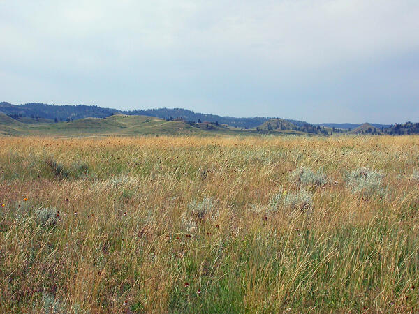
Grassland area of eastern Wyoming
A photo of a grassland area of eastern Wyoming taken for the Land Cover Trends project by Terry Sohl of the USGS.
A photo of a grassland area of eastern Wyoming taken for the Land Cover Trends project by Terry Sohl of the USGS.

Niger Giraffes
Herd of giraffes in Niger, West Africa
Herd of giraffes in Niger, West Africa
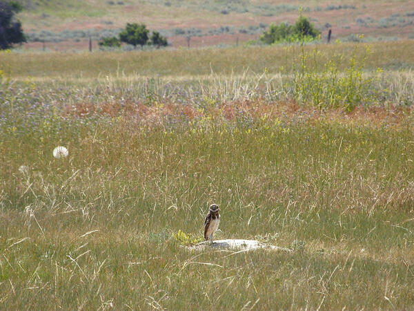
A burrowing owl amid grassland in eastern Wyoming
A burrowing owl amid grassland in eastern Wyoming is captured in a Land Cover Trends photo taken by Terry Sohl of the USGS Earth Resources Observation and Science (EROS) Center.
A burrowing owl amid grassland in eastern Wyoming is captured in a Land Cover Trends photo taken by Terry Sohl of the USGS Earth Resources Observation and Science (EROS) Center.

Dryland agriculture in the Northwestern Great Plains ecoregion.
Dryland agriculture in the Northwestern Great Plains ecoregion.Dryland agriculture in the Northwestern Great Plains ecoregion.
Dryland agriculture in the Northwestern Great Plains ecoregion.
Dryland agriculture in the Northwestern Great Plains ecoregion.Dryland agriculture in the Northwestern Great Plains ecoregion.

Meandering Mississippi
Small, blocky shapes of towns, fields, and pastures surround the graceful swirls and whorls of the Mississippi River. Countless oxbow lakes and cutoffs accompany the meandering river south of Memphis, Tennessee, on the border between Arkansas and Mississippi, USA. The "mighty Mississippi" is the largest river system in North America.
Small, blocky shapes of towns, fields, and pastures surround the graceful swirls and whorls of the Mississippi River. Countless oxbow lakes and cutoffs accompany the meandering river south of Memphis, Tennessee, on the border between Arkansas and Mississippi, USA. The "mighty Mississippi" is the largest river system in North America.

Ghostly Grease Ice
Ethereal swirls of grease ice appear turquoise against the midnight blue of the northern Baltic Sea near the Aland Islands (red) between Finland and Sweden. An early stage of sea ice formation, grease ice consists of a viscous mix of tiny ice crystals and resembles an oil slick on the ocean's surface.
Ethereal swirls of grease ice appear turquoise against the midnight blue of the northern Baltic Sea near the Aland Islands (red) between Finland and Sweden. An early stage of sea ice formation, grease ice consists of a viscous mix of tiny ice crystals and resembles an oil slick on the ocean's surface.
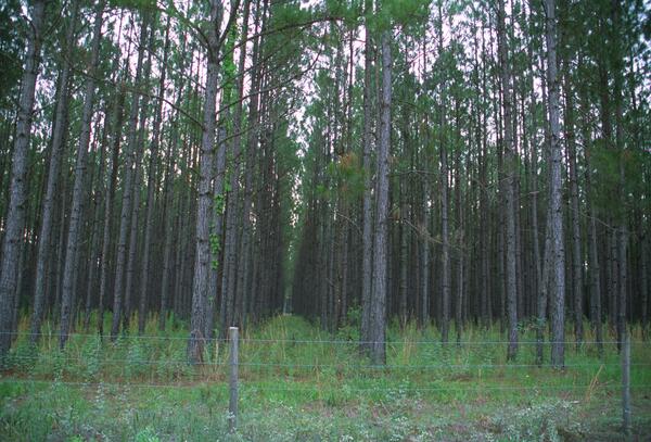
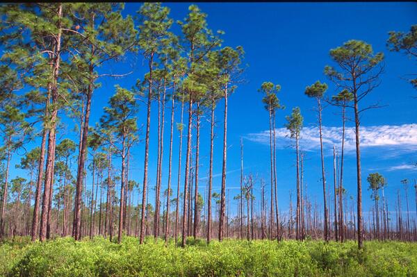
A thick stand of mature pine trees on the Southern Coastal Plain
A thick stand of mature pine trees on the Southern Coastal PlainA thick stand of mature pine trees on the Southern Coastal Plain, specifically Florida. USGS photo for the Land Cover Trends project.
A thick stand of mature pine trees on the Southern Coastal Plain
A thick stand of mature pine trees on the Southern Coastal PlainA thick stand of mature pine trees on the Southern Coastal Plain, specifically Florida. USGS photo for the Land Cover Trends project.
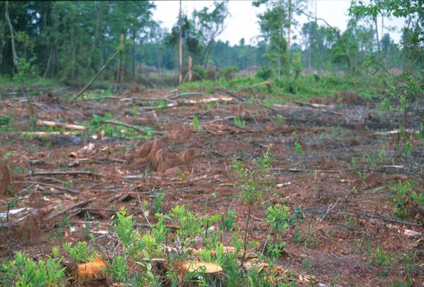
A cleared pine forest on the Southern Coastal Plain
A cleared pine forest on the Southern Coastal PlainA cleared pine forest on the Southern Coastal Plain, specifically Florida. USGS photo for the Land Cover Trends project.
A cleared pine forest on the Southern Coastal Plain
A cleared pine forest on the Southern Coastal PlainA cleared pine forest on the Southern Coastal Plain, specifically Florida. USGS photo for the Land Cover Trends project.
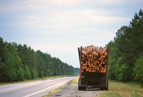
Logging truck with a load
This logging truck was hauling a load of timber in the Southern Coastal Plain, specifically Georgia. USGS photo from the Land Cover Trends project.
This logging truck was hauling a load of timber in the Southern Coastal Plain, specifically Georgia. USGS photo from the Land Cover Trends project.
A thinned stand of slash pine forest in the Southern Coastal Plain
A thinned stand of slash pine forest in the Southern Coastal PlainA thinned stand of slash pine forest in the Southern Coastal Plain, specifically Florida. USGS photo taken for the Land Cover Trends project.
A thinned stand of slash pine forest in the Southern Coastal Plain
A thinned stand of slash pine forest in the Southern Coastal PlainA thinned stand of slash pine forest in the Southern Coastal Plain, specifically Florida. USGS photo taken for the Land Cover Trends project.
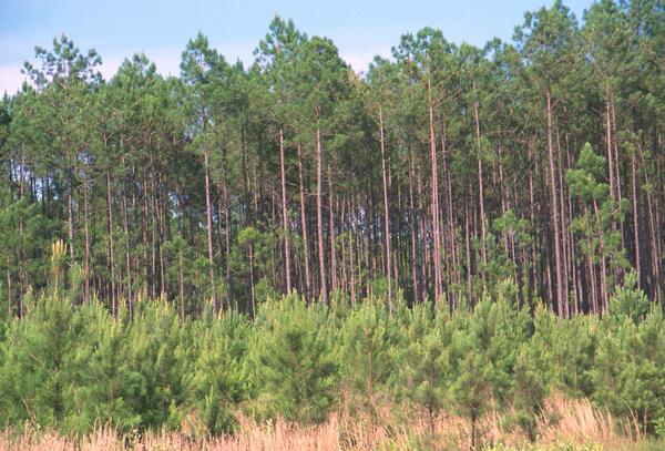
Young and old pines on a pine plantation in the Southern Coastal Plain
Young and old pines on a pine plantation in the Southern Coastal PlainYoung and old pines grow on a pine plantation in the Southern Coastal Plain, specifically Florida. USGS photo for the Land Cover Trends project.
Young and old pines on a pine plantation in the Southern Coastal Plain
Young and old pines on a pine plantation in the Southern Coastal PlainYoung and old pines grow on a pine plantation in the Southern Coastal Plain, specifically Florida. USGS photo for the Land Cover Trends project.

Southern Coast of France
France's famed Provence region meets the Mediterranean as a gentle curve intricately sculpted into sheltered bays and fringing peninsulas. The ancient port of Marseilles, the country’s second largest city, nestles in the large bay at the lower left corner of the image.
France's famed Provence region meets the Mediterranean as a gentle curve intricately sculpted into sheltered bays and fringing peninsulas. The ancient port of Marseilles, the country’s second largest city, nestles in the large bay at the lower left corner of the image.

Erongo Massif
The dark heart in this vivid African landscape is the Erongo Massif, an isolated, sheer-walled mountain that rises 1,200 meters (3,937 feet) above arid Namibian plains. The massif is a remnant of a gigantic volcano that was active roughly 150 million years ago. At some point, the volcano's center collapsed in upon itself under the weight of overlying lava.
The dark heart in this vivid African landscape is the Erongo Massif, an isolated, sheer-walled mountain that rises 1,200 meters (3,937 feet) above arid Namibian plains. The massif is a remnant of a gigantic volcano that was active roughly 150 million years ago. At some point, the volcano's center collapsed in upon itself under the weight of overlying lava.

Harrat Al Birk
Dark-colored volcanic cones sprout from an ancient lava field known as Harrat Al Birk along Saudi Arabia's Red Sea coastline. Many such lava fields dot the Arabian Peninsula and range in age from 2 million to 30 million years old.
Dark-colored volcanic cones sprout from an ancient lava field known as Harrat Al Birk along Saudi Arabia's Red Sea coastline. Many such lava fields dot the Arabian Peninsula and range in age from 2 million to 30 million years old.

Desert Patterns
Seen through the "eyes" of a satellite sensor, ribbons of Saharan sand dunes seem to glow in sunset colors. These patterned stripes are part of Erg Chech, a desolate sand sea in southwestern Algeria, Africa, where the prevailing winds create an endlessly shifting collage of large, linear sand dunes.
Seen through the "eyes" of a satellite sensor, ribbons of Saharan sand dunes seem to glow in sunset colors. These patterned stripes are part of Erg Chech, a desolate sand sea in southwestern Algeria, Africa, where the prevailing winds create an endlessly shifting collage of large, linear sand dunes.

Caribbean Luxury
The Caicos Islands (pronounced KAY-kohss) in the northern Caribbean are a popular tourist attraction, renowned for their beautiful beaches, clear waters, scuba diving, and luxury resorts.
The Caicos Islands (pronounced KAY-kohss) in the northern Caribbean are a popular tourist attraction, renowned for their beautiful beaches, clear waters, scuba diving, and luxury resorts.