This Landsat 8 images displays the Tiwi Islands.
The Tiwi Islands are part of the Northern Territory, Australia, north of Darwin in the Timor Sea. They are comprised of the islands of Melville and Bathurst, and nine smaller, uninhabited islands.

Official websites use .gov
A .gov website belongs to an official government organization in the United States.
Secure .gov websites use HTTPS
A lock () or https:// means you’ve safely connected to the .gov website. Share sensitive information only on official, secure websites.
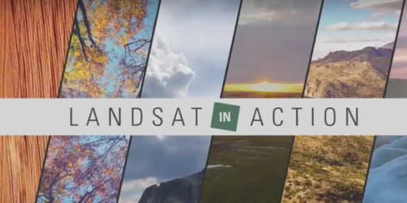
We maintain collections of images and videos that are available for download at no charge. Follow the links below to explore our multimedia.

In addition to their scientific value, many satellite images are simply intriguing to look at. Satellites capture an incredible variety of views of Earth. See the mesmerizing beauty of river deltas, mountains, and other sandy, salty, and icy landscapes.
Watch Landsat Science Team members and researchers from around the world talk about the value of remotely sensed imagery to monitoring the health of the planet.

This Landsat 8 images displays the Tiwi Islands.
The Tiwi Islands are part of the Northern Territory, Australia, north of Darwin in the Timor Sea. They are comprised of the islands of Melville and Bathurst, and nine smaller, uninhabited islands.
This Landsat 8 images displays the Tiwi Islands.
The Tiwi Islands are part of the Northern Territory, Australia, north of Darwin in the Timor Sea. They are comprised of the islands of Melville and Bathurst, and nine smaller, uninhabited islands.

In November 2023 the Svartsengi volcanic system awakened after almost 800 years with a series of earthquakes that opened large cracks in the on Iceland’s Reykjanes Peninsula. An eruption on December 18th spewed lava away from the nearby coastal town of Grindavik, but the January 14, 2024 eruption sent lava directly toward the town.
In November 2023 the Svartsengi volcanic system awakened after almost 800 years with a series of earthquakes that opened large cracks in the on Iceland’s Reykjanes Peninsula. An eruption on December 18th spewed lava away from the nearby coastal town of Grindavik, but the January 14, 2024 eruption sent lava directly toward the town.

Fractional cover of Olifants River, Koekenaap, South Africa, with 3-month intervals captured in 2020 processed by Digital Earth Africa with legend showing the RBG (Red-Blue-Green) breakdown. Image credit: Geoscience Australia
Fractional cover of Olifants River, Koekenaap, South Africa, with 3-month intervals captured in 2020 processed by Digital Earth Africa with legend showing the RBG (Red-Blue-Green) breakdown. Image credit: Geoscience Australia

Ministry of Agriculture staff in Zambia mapping and analyzing crop production. Photo credit: Geoscience Australia
Ministry of Agriculture staff in Zambia mapping and analyzing crop production. Photo credit: Geoscience Australia

Timon Weitkamp and the team collecting field data on irrigation techniques in Mozambique. Photo credit: Geoscience Australia
Timon Weitkamp and the team collecting field data on irrigation techniques in Mozambique. Photo credit: Geoscience Australia

George Xian, a research physical scientist at the USGS Earth Resources Observation and Science (EROS) Center, works in his office.
George Xian, a research physical scientist at the USGS Earth Resources Observation and Science (EROS) Center, works in his office.

Like many lakes in northern Minnesota, Mille Lacs near Brainerd experienced an uncommonly warm winter this year, with lower than average snowfall. Natural color Landsat images from the past ten Februarys reveal a stark change in 2024.
Like many lakes in northern Minnesota, Mille Lacs near Brainerd experienced an uncommonly warm winter this year, with lower than average snowfall. Natural color Landsat images from the past ten Februarys reveal a stark change in 2024.
")
On March 3rd, near South Georgia and the South Sandwich Islands, Landsat 9 captured this dream-like image. This natural color view shows a weather pattern known as a “Von Karman vortex street," caused by prevailing winds from the southeast.
On March 3rd, near South Georgia and the South Sandwich Islands, Landsat 9 captured this dream-like image. This natural color view shows a weather pattern known as a “Von Karman vortex street," caused by prevailing winds from the southeast.

Cloud-free satellite views of Lake Saimaa in Finland are rare in January. But this Landsat 9 scene, captured on January 4th, reveals over 200 miles of winter shipping lanes. The water vapor from 3 large wood pulp factories can be seen on this shoreline. One is located in Lappeenranta, where the ice route begins.
Cloud-free satellite views of Lake Saimaa in Finland are rare in January. But this Landsat 9 scene, captured on January 4th, reveals over 200 miles of winter shipping lanes. The water vapor from 3 large wood pulp factories can be seen on this shoreline. One is located in Lappeenranta, where the ice route begins.

The bushfire season in northern Australia generally runs from May to October. 2023 was an especially intense year in the north. Select infrared imagery from the Landsat archive was used here to produce a rolling mosaic timelapse of the landscape in eight-day segments.
The bushfire season in northern Australia generally runs from May to October. 2023 was an especially intense year in the north. Select infrared imagery from the Landsat archive was used here to produce a rolling mosaic timelapse of the landscape in eight-day segments.

The Grand Ethiopian Renaissance Dam is set to become the largest hydroelectric power plant in Africa.
Located near the Sudan border in Ethiopia, the promising and controversial project impacts communities up and down the Blue Nile.
Landsat sensors capture the region in false color infrared, emphasizing the reservoir's boundary.

The home of the Landsat satellite archive is surrounded by corn and soybean fields. The archive is kept at the USGS Earth Resources Observation and Science Center (EROS) located near Sioux Falls, South Dakota. EROS is celebrating its 50th anniversary this year.
The home of the Landsat satellite archive is surrounded by corn and soybean fields. The archive is kept at the USGS Earth Resources Observation and Science Center (EROS) located near Sioux Falls, South Dakota. EROS is celebrating its 50th anniversary this year.
In this episode of Eyes on Earth, we talk with several people involved with the next Landsat mission. In Part 1, we’ll hear about how different Landsat Next will be from previous Landsat missions and how its additional spectral bands, higher resolution and 6-day revisit will benefit science and society.
In this episode of Eyes on Earth, we talk with several people involved with the next Landsat mission. In Part 1, we’ll hear about how different Landsat Next will be from previous Landsat missions and how its additional spectral bands, higher resolution and 6-day revisit will benefit science and society.
Landsat has documented changes all over the world for over 50 years. Changes in polar regions are happening especially rapidly. But it’s dark in polar regions much of the time. Therefore, a new acquisition scheme is adding more imagery of these dark, polar regions so these changes can be studied in more detail, even in polar twilight.
Landsat has documented changes all over the world for over 50 years. Changes in polar regions are happening especially rapidly. But it’s dark in polar regions much of the time. Therefore, a new acquisition scheme is adding more imagery of these dark, polar regions so these changes can be studied in more detail, even in polar twilight.
Women have been crucial to the EROS workforce from the very beginning in a variety of areas, from customer service and computers to film processing and administration.
Women have been crucial to the EROS workforce from the very beginning in a variety of areas, from customer service and computers to film processing and administration.
Typically, we use Landsat data to study changes on the land—you know, Landsat. In this episode of Eyes on Earth, we learn how satellite images and pixels of water, along with actual water samples, are helpful in determining the productivity of lakes across the United States. We talk with Mendenhall Fellow and Research Geographer Dr.
Typically, we use Landsat data to study changes on the land—you know, Landsat. In this episode of Eyes on Earth, we learn how satellite images and pixels of water, along with actual water samples, are helpful in determining the productivity of lakes across the United States. We talk with Mendenhall Fellow and Research Geographer Dr.
Terry Sohl helped develop the National Land Cover Database, NLCD, when he first arrived, and now he’s overseeing significant improvements to the widely used product. But that’s just one part of his new role.
Terry Sohl helped develop the National Land Cover Database, NLCD, when he first arrived, and now he’s overseeing significant improvements to the widely used product. But that’s just one part of his new role.
In this episode of Eyes on Earth, we aim to separate science fiction from science fact when it comes to how Landsat satellites and the EROS Center are portrayed in popular media. To do that, we consulted experts on a range of potential uses, including military, heat signatures, paleontology, and forests.
In this episode of Eyes on Earth, we aim to separate science fiction from science fact when it comes to how Landsat satellites and the EROS Center are portrayed in popular media. To do that, we consulted experts on a range of potential uses, including military, heat signatures, paleontology, and forests.


