
Tools for Landscape Assessment
Tools for Landscape Assessment
Filter Total Items: 51

Synthesis of sage-grouse genetic information to support conservation and land management actions
Sage-grouse, iconic birds of the American West, have experienced dramatic reductions and fragmentation of habitat, resulting in significant conservation concern. Genetic information can help inform priorities for protection and habitat restoration as well as strategies for translocations, but may be difficult for resource managers to find, interpret, and use in their decision making. In this work...

Using Artificial Intelligence to Estimate Traffic to Improve Planning and Access to Colorado’s Public Lands
This project applies data-driven, machine‑learning methods to estimate average annual daily traffic on roads that connect people to Colorado’s public lands, where traffic data are sparse or nonexistent. Expanding on successful applications in Wyoming, the approach uses socioeconomic, land-use, roadway, and accessibility data to uniquely model traffic patterns from 2015 to 2025. These predictions...
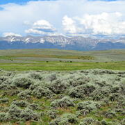
Shrubland, Alpine and Grassland Ecology (SAGE) Wildlife Research Group
The SAGE Wildlife Research Group consists of a large team of research scientists with an interest in conservation and management of wildlife and their ecosystems. Broadly, research involves understanding animal-habitat relationships, with an emphasis on conservation ecology and population demography, and a focus on shrubland, alpine, and grassland ecosystems. We are addressing the effects of...

Supporting energy and mineral development through successful reclamation
Federal lands of the US contain important reserves of oil, gas and other resources important for Unleashing American Energy (SO 3418). After development of these resources is complete, successfully reclaiming disturbed lands is a necessary step towards restoring wildlife habitat, forage production, and maintaining natural resources for future use. To improve reclamation outcomes on these lands and...

Greater Sage-Grouse Population Monitoring Framework: Cheat Sheet
The Greater Sage-grouse Population Monitoring Framework fills a prominent information gap to help inform current assessments of sage-grouse population trends at nested spatial and temporal scales. It is centered on four objectives: (1) create a standardized database of lek counts; (2) develop biologically based spatial population structures by clustering leks; (3) estimate spatial trends at...

Greater Sage-Grouse Population Monitoring Framework: Targeted Annual Warning System Information Sheet
The Greater Sage-grouse Population Monitoring Framework helps fill a major information gap to aid current assessments of sage-grouse population trends across spatial and temporal scales. It centers on four objectives: 1) create a standardized database of lek counts; 2) cluster leks to develop spatial population structures; 3) estimate spatial trends across temporal extents; and 4) develop a system...

Greater Sage-Grouse Population Monitoring Framework: Trends Analysis Information Sheet
Land and wildlife managers require accurate estimates of sensitive species’ trends to help guide conservation decisions that maintain biodiversity and promote healthy ecosystems. Accurately assessing greater sage-grouse ( Centrocercus urophasianus; sage-grouse) population trends can be difficult because of (1) missing lek counts or incomplete repeat counts, (2) variation in counts from observer...

Greater Sage-Grouse Population Monitoring Framework: Glossary of Terms
The Greater Sage-grouse Population Monitoring Framework helps aid current assessments of sage-grouse population trends across spatial and temporal scales. It centers on four objectives: 1) create a standardized database of lek counts; 2) cluster leks to develop spatial population structures; 3) estimate spatial trends across temporal extents; and 4) develop a system to estimate where and when...

Greater Sage-Grouse Population Monitoring Framework: Frequently Asked Questions
The Greater Sage-grouse Population Monitoring Framework helps aid current assessments of sage-grouse population trends across spatial and temporal scales. It centers on four objectives: 1) create a standardized database of lek counts; 2) cluster leks to develop spatial population structures; 3) estimate spatial trends across temporal extents; and 4) develop a system to estimate where and when...

A user-friendly decision support tool for monitoring and managing greater sage-grouse populations
Researchers at the U.S. Geological Survey (USGS) and Colorado State University (CSU) collaborated with the Bureau of Land Management and state wildlife agencies to develop a hierarchical population monitoring framework for managing greater sage-grouse ( Centrocercus urophasianus) populations and the sagebrush ecosystems they depend on for survival and reproduction. This greater sage-grouse...

Greater Sage-Grouse Population Monitoring Framework Data Inputs Information Sheet
To support management decisions, western state wildlife agencies identified the need for a range-wide database that tracks annual counts of greater sage-grouse ( Centrocercus urophasianus; sage-grouse) at leks (breeding sites), which have been recorded since the early 1950s. Researchers at Colorado State University (CSU) and U.S. Geological Survey (USGS) worked with state wildlife agencies to: 1)...

A targeted annual warning system (TAWS) for identifying aberrant declines in greater sage-grouse populations
Land and wildlife managers require accurate estimates of sensitive species’ trends to help guide conservation decisions that maintain biodiversity and promote healthy ecosystems. Multiple science centers with the U.S. Geological Survey (USGS), in conjunction with Colorado State University (CSU), developed a hierarchical population monitoring framework for managing greater sage-grouse (...