



New England Water Science Center Projects
The New England Water Science Center monitors, analyzes, and communicates information on the quality and movement of surface water and groundwater within the states of Connecticut, Maine, Massachusetts, New Hampshire, Rhode Island, and Vermont.
Explore our projects to learn more about the scientific investigations we conduct. Use keywords and the available filters to narrow your search scope.
Explore Our Projects
Explore Our Projects
Filter Total Items: 113

Coastal Acidification Monitoring in Long Island Sound
Understanding coastal acidification, as it varies from open ocean acidification, is crucial to identifying the unique problems occurring in coastal ecosystems such as Long Island Sound (LIS). The U.S. Geological Survey (USGS) is monitoring water quality parameters throughout LIS and its embayments to evaluate the status and trends of acidification processes in these waters. This project will...
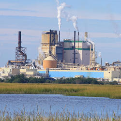
Collaborations with EPA on Contaminated Site Hydrology
The U.S. Geological Survey (USGS), in cooperation with the U.S. Environmental Protection Agency (EPA), is developing tools and methods to help assess the fate and transport of anthropogenic and geologically sourced contaminants in the water cycle at waste sites throughout the nation.

USGS to Improve Water Use Data Management for State of Massachusetts
The USGS New England Water Science Center, in cooperation with the Massachusetts Department of Environmental Protection, is collaborating on a project to improve the data management, visualization, and sharing of the state’s water use information. Additionally, two water management tools will be upgraded. The project team will develop an Executive Office of Energy and Environmental Affairs...

Augmented Site Characterization of PFAS Manufacturing and Processing Facilities
The U.S. Geological Survey (USGS) is supporting the U.S. Environmental Protection Agency (EPA) in assessing facilities nationwide that have historically produced per- and polyfluoroalkyl substances (PFAS) or used them in chemical manufacturing processes. In collaboration with EPA subcontractors, USGS is providing subject-matter expertise in PFAS fate and transport in the vadose zone and...

December 2023 Flood in Maine
The U.S. Geological Survey (USGS) New England Water Science Center, in cooperation with the Federal Emergency Management Agency (FEMA), is conducting a study to characterize the magnitude and extent of the December 18-21, 2023 Flood in various portions of the State of Maine.

July 2023 Flood in Vermont
From July 9 through July 12, 2023, 3 to 9 inches of rain fell within 48 hours across the state of Vermont, causing catastrophic flooding and millions of dollars in damage. The high amount of rain caused several rivers to peak at record levels, in some cases exceeding records set during Tropical Storm Irene in 2011.

Continuous Water Quality Monitoring in the Norwalk River Estuary
The U.S. Geological Survey (USGS), in cooperation with the U.S. Environmental Protection Agency Long Island Sound Study (LISS), is investigating how excess nutrients and low dissolved oxygen affect the water-quality of the lower portion of the Norwalk River Harbor.

Outlining High-Resolution Urban Drainage Systems for Stormwater Management in the Neponset River Watershed
The natural environment and manmade infrastructure must be considered when characterizing hydrology and water quality in urban watersheds. This requirement is critical in stormwater management, which considers water flowing above ground and below ground through stormwater networks. The U.S. Geological Survey (USGS), with support from the U.S. Environmental Protection Agency (EPA), is expanding its...

New England Tribal Engagement
The USGS New England Water Science Center (WSC) is proud to provide science support to Tribal Nations as part of our Federal Trust Responsibility to honor the government-to-government relationships that the United States has with 574 Federally-recognized Tribes. Tribal Nations have ancestral ties with the environment. Natural resources are inextricably connected to sustenance, traditional...

Investigating Connections Between Socioeconomic Data and Populations Susceptible to Private Well-Water Concerns in New Hampshire
The U.S. Geological Survey (USGS) New England Water Science Center, in cooperation with the New Hampshire Department of Environmental Services, is investigating the presence of statistical associations between socioeconomic data (or proxy data) and the susceptibility of private wells to water quality or quantity concerns in New Hampshire.

Detailed Characterization of the Savage Superfund Site, New Hampshire
The U.S. Geological Survey (USGS), in cooperation with the U.S. Environmental Protection Agency and the New Hampshire Department of Environmental Services, is conducting advanced site characterization activities at the Savage Municipal Water Supply Superfund site in Milford, New Hampshire, and implementing new remediation efforts based on USGS science and tools.

The Aqueous Flow Concentration Estimator (AFCE): Software for Estimation of Ambient Groundwater Flow in Bedrock Open Boreholes
The U.S. Geological Survey (USGS) developed a tool that uses a chemical budget approach to help determine which fractures in a fracture zone may be dominating the water chemistry of open boreholes in bedrock aquifers. The tool uses a Monte Carlo approach and measured concentrations of anthropogenic contaminants to simulate many different scenarios and predict the most likely source direction of...

USGS Assessment of Water Resources near Hanscom Air Force Base
The United States Geological Survey (USGS) New England Water Science Center is expanding its scientific investigation to better understand the water resources at, and in the vicinity of, Hanscom Air Force Base (AFB) and the potential impacts from historical base operations and other sources.

Long Island Sound Spatially Referenced Regressions on Watershed Attributes (SPARROW) Models
The U.S. Geological Survey, New England Water Science Center, in collaboration with the U.S. Environmental Protection Agency (EPA), is modeling seasonal nutrient loads to Long Island Sound (LIS). Nutrients that originate from within the 41,867-square-mile section of the LIS watershed that is north of the Sound include both point (specific) and nonpoint (widespread) sources. Dynamic modeling of the...

Erosion Potential and Flood Vulnerability of Streams and Stream Crossings at Acadia National Park, Maine
The U.S. Geological Survey (USGS) New England Water Science Center, in cooperation with Acadia National Park, is assessing the erosion potential and flood vulnerability of the park’s streams, culverts, and bridges to inform management decisions on infrastructure upgrades.

Water Resources Inventory and Assessment at Katahdin Woods and Waters National Monument
The U.S. Geological Survey (USGS) New England Water Science Center, in cooperation with the National Park Service, is compiling and evaluating all known water resources, and documented infrastructure associated with these resources, within the Katahdin Woods and Waters National Monument and contributing associated watersheds.

Delineating High-Resolution Urban Drainage Systems for Stormwater Management in the Mystic River Watershed
Characterizing hydrology and pollutant inputs in urban watersheds requires the consideration of both the natural and manmade environment. The Mystic River Basin is a highly urbanized, 76-square-mile watershed north of Boston, Massachusetts, that includes several underserved communities. The U.S. Geological Survey (USGS) developed a watershed-scale web application of the Mystic River Basin to...

Quality of Stormwater Runoff Discharged from Connecticut Highways
Existing highway-runoff data do not adequately address the informational needs of stormwater professionals in Connecticut because there have been relatively few studies of highway runoff in the Northeastern United States. Consequently, the U.S. Geological Survey, New England Water Science Center, in cooperation with Connecticut Department of Transportation (CTDOT), is conducting a 4-year project...

Effectiveness of Open-Graded Friction Course Pavement in Reducing Suspended-Sediment Loads Discharged from Massachusetts Highways
The U.S. Geological Survey New England Water Science Center, in cooperation with Massachusetts Department of Transportation (MassDOT), is evaluating how a type of porous pavement affects the discharge of suspended sediment in comparison to the asphalt surface commonly used on Massachusetts highways. The project will expand the understanding of highway runoff concentrations of suspended sediment...

A Statewide Hydraulic Modeling Tool for Stream Crossing Projects in Massachusetts
The U.S. Geological Survey (USGS), in cooperation with the Massachusetts Department of Environmental Protection (MassDEP), and collaboration with the University of Massachusetts at Amherst (UMass Amherst) began a series of studies in 2019 to develop a GIS-based hydraulic modeling tool and to provide preliminary culvert designs for stream-crossing replacement projects in Massachusetts on USGS...

Regional Regression Equations for Estimating Selected Low-flow Statistics at Ungaged Stream Sites in Massachusetts
The U.S. Geological Survey, in cooperation with the Massachusetts Department of Recreation and Conservation, Office of Water Resources, completed a study in 2025 to update the regional regression equations for estimating selected low-flow statistics at ungaged sites in Massachusetts.