
The USGS delivers continuous streamflow, stage (water-level), and tide data to help emergency managers and other decision makers protect life and property caused by floods and other water-related hazards.
The USGS New England Water Science Center maintains 434 streamgages that collect data to determine the amount of water flowing in rivers and streams in Connecticut, Maine, Massachusetts, New Hampshire, Rhode Island, and Vermont. The Water Science Center also maintains 13 tide along the coast of New England.
Nationwide, the USGS operates and maintains about 8,000 streamgages, which deliver near real-time data to the public.
Automatic alerts can be sent to mobile devices when streamflow of river or tide stage (water levels) reach user defined thresholds, such as a National Weather Service defined flood stage. These alerts help emergency managers and the public assess potentially hazardous conditions nearby a streamgage, stage-only gage, or tide gage.
USGS WaterAlert automatically sends email or SMS text messages when certain parameters at a USGS real-time data-collection station, exceed user-defined thresholds.
USGS Flood Information provides additional information about USGS flood science.
Current Flood Data for New England
- National Water Dashboard for New England
- WaterWatch Map of flood and high flow condition (select a State or Water-Resources Region)
- WaterWatch Map of flood and high flow conditions – New England
- USGS Project Alerts – Flood and Drought
- USGS Flood-Event Viewer (Data for Selected Current and Historic Floods – Coastal and Riverine)
- USGS Flood Inundation Mapper
- USGS Operational Total Water Level and Coastal Change Viewer
Flood Frequency Information
Visit USGS Floods and Recurrence Intervals for more information about floods and the annual exceedance probability (AEP).
New England Flood Frequency Studies
Flood Resources from Partner Agencies
Federal Emergency Management Agency (FEMA)
National Weather Service (NWS)
- NWS Northeast River Forecast Center
- NWS Current Precipitation Radar
- NWS Future Quantitative Precipitation Forecasts (1-7 day totals)
- NOAA Office of Water Prediction – National Water Model
Northeast River Forecast Center (NERFC)
- NERFC Daily Hydrometeorological Briefing
- Recent NERFC Observed Precipitation Maps
- NERFC 5-Day Significant River Flood Outlook
- NERFC Future Quantitative Precipitation Forecast (72 Hours)
State Emergency Management
U.S. Army Corps of Engineers
- U.S. Army Corps of Engineers – New England Reservoir Control Center
- U.S. Army Corps of Engineers Silver Jackets Program
Safety Related Resources
Below are resources associated with flood information.
USGS Flood Information
Northeast Region Flood Science Capability Team
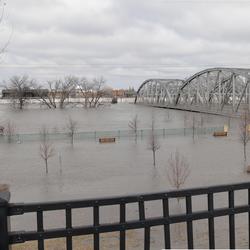
Flood Inundation Mapping (FIM) Program
Estimating Nitrogen Loading from Groundwater and Potential Effects of Sea-Level Rise in Rhode Island's Salt Ponds Region
December 2023 Flood in Maine
July 2023 Flood in Vermont
Erosion Potential and Flood Vulnerability of Streams and Stream Crossings at Acadia National Park, Maine
A Statewide Hydraulic Modeling Tool for Stream Crossing Projects in Massachusetts
New England Lidar-Derived Hydrography Project
Satellite-based Remote Sensing of River Discharge
Flood Documentation and Inundation Mapping of the January and March 2018 Nor’easters in Coastal Massachusetts
Remembering Tropical Storm Irene in New England
Rapid Deployment Gages (RDGs)
Below are data or web applications associated with flood information.
Data for the Estimation of Flood Discharges at Selected Annual Exceedance Probabilities for Unregulated, Rural Streams in Vermont, 2023 Data for the Estimation of Flood Discharges at Selected Annual Exceedance Probabilities for Unregulated, Rural Streams in Vermont, 2023
Data for an Erosion and Flood Vulnerability Assessment of Streams and Stream Crossings at Acadia National Park, Maine Data for an Erosion and Flood Vulnerability Assessment of Streams and Stream Crossings at Acadia National Park, Maine
Vermont Flood of July 2023 Data Vermont Flood of July 2023 Data
MODFLOW-NWT and MODPATH groundwater flow models of steady-state conditions in coastal Connecticut and adjacent areas of New York and Rhode Island, as well as a nitrogen transport model of the Niantic River watershed MODFLOW-NWT and MODPATH groundwater flow models of steady-state conditions in coastal Connecticut and adjacent areas of New York and Rhode Island, as well as a nitrogen transport model of the Niantic River watershed
Flood frequency and source data used in the regional regression analysis of annual peak flows in Connecticut (2020) (ver. 2.0, April 2021) Flood frequency and source data used in the regional regression analysis of annual peak flows in Connecticut (2020) (ver. 2.0, April 2021)
Data and shapefiles used to document the floods associated with the January and March 2018 Nor'easters for Coastal Areas of New England (ver. 2.0, November 2021) Data and shapefiles used to document the floods associated with the January and March 2018 Nor'easters for Coastal Areas of New England (ver. 2.0, November 2021)
Results of peak-flow frequency analysis and regionalization for selected streamgages in or near Maine, based on data through water year 2019 Results of peak-flow frequency analysis and regionalization for selected streamgages in or near Maine, based on data through water year 2019
Flood-Inundation Grids and Shapefiles for the Lower Pawcatuck River in Westerly, Rhode Island, and Stonington and North Stonington, Connecticut Flood-Inundation Grids and Shapefiles for the Lower Pawcatuck River in Westerly, Rhode Island, and Stonington and North Stonington, Connecticut
Flood Inundation Grids and Shapefiles for the Pawtuxet River in West Warwick, Warwick, and Cranston, Rhode Island Flood Inundation Grids and Shapefiles for the Pawtuxet River in West Warwick, Warwick, and Cranston, Rhode Island
Survey of first-floor elevations of buildings in the Lake Champlain floodplain, Vermont, 2020 Survey of first-floor elevations of buildings in the Lake Champlain floodplain, Vermont, 2020
Worksheet for computing annual exceedance probability flood discharges and prediction intervals at stream sites in Connecticut Worksheet for computing annual exceedance probability flood discharges and prediction intervals at stream sites in Connecticut
New England Below Normal 28-day average streamflow compared to historical streamflow for the day of year New England Below Normal 28-day average streamflow compared to historical streamflow for the day of year
Below are multimedia items associated with flood information.
Below are publications associated with flood information.
Estimating flood discharges at selected annual exceedance probabilities for unregulated, rural streams in Vermont, 2023 Estimating flood discharges at selected annual exceedance probabilities for unregulated, rural streams in Vermont, 2023
Flood of July 2023 in Vermont Flood of July 2023 in Vermont
The occurrence of large floods in the United States in the modern hydroclimate regime: Seasonality, trends, and large-scale climate associations The occurrence of large floods in the United States in the modern hydroclimate regime: Seasonality, trends, and large-scale climate associations
Documentation and mapping of flooding from the January and March 2018 nor’easters in coastal New England Documentation and mapping of flooding from the January and March 2018 nor’easters in coastal New England
Hydraulic modeling at selected dam-removal and culvert-retrofit sites in the northeastern United States Hydraulic modeling at selected dam-removal and culvert-retrofit sites in the northeastern United States
Practical field survey operations for flood insurance rate maps Practical field survey operations for flood insurance rate maps
Estimating flood magnitude and frequency on gaged and ungaged streams in Maine Estimating flood magnitude and frequency on gaged and ungaged streams in Maine
Estimating flood magnitude and frequency on streams and rivers in Connecticut, based on data through water year 2015 Estimating flood magnitude and frequency on streams and rivers in Connecticut, based on data through water year 2015
Total water level data from the January and March 2018 nor’easters for coastal areas of New England Total water level data from the January and March 2018 nor’easters for coastal areas of New England
Preliminary stage and streamflow data at selected U.S. Geological Survey streamgages in New England for the floods of April 2019 Preliminary stage and streamflow data at selected U.S. Geological Survey streamgages in New England for the floods of April 2019
Effects of climate, regulation, and urbanization on historical flood trends in the United States Effects of climate, regulation, and urbanization on historical flood trends in the United States
Flood-inundation maps for Lake Champlain in Vermont and New York Flood-inundation maps for Lake Champlain in Vermont and New York
Below are data or web applications associated with flood information.
Below are FAQ associated with flood information.
Where can I find flood maps? Where can I find flood maps?
FEMA is the official public source for flood maps for insurance purposes: FEMA’s Flood Map Service Center FEMA’s National Flood Hazard Layer NOAA is responsible for producing flood forecast maps that combine precipitation data with USGS streamflow data: NWS - National Water Prediction Service: River forecasts and long range flood outlook Coastal Inundation Dashboard: Real-time and historical...
Below are partners associated with flood information.
The USGS delivers continuous streamflow, stage (water-level), and tide data to help emergency managers and other decision makers protect life and property caused by floods and other water-related hazards.
The USGS New England Water Science Center maintains 434 streamgages that collect data to determine the amount of water flowing in rivers and streams in Connecticut, Maine, Massachusetts, New Hampshire, Rhode Island, and Vermont. The Water Science Center also maintains 13 tide along the coast of New England.
Nationwide, the USGS operates and maintains about 8,000 streamgages, which deliver near real-time data to the public.
Automatic alerts can be sent to mobile devices when streamflow of river or tide stage (water levels) reach user defined thresholds, such as a National Weather Service defined flood stage. These alerts help emergency managers and the public assess potentially hazardous conditions nearby a streamgage, stage-only gage, or tide gage.
USGS WaterAlert automatically sends email or SMS text messages when certain parameters at a USGS real-time data-collection station, exceed user-defined thresholds.
USGS Flood Information provides additional information about USGS flood science.
Current Flood Data for New England
- National Water Dashboard for New England
- WaterWatch Map of flood and high flow condition (select a State or Water-Resources Region)
- WaterWatch Map of flood and high flow conditions – New England
- USGS Project Alerts – Flood and Drought
- USGS Flood-Event Viewer (Data for Selected Current and Historic Floods – Coastal and Riverine)
- USGS Flood Inundation Mapper
- USGS Operational Total Water Level and Coastal Change Viewer
Flood Frequency Information
Visit USGS Floods and Recurrence Intervals for more information about floods and the annual exceedance probability (AEP).
New England Flood Frequency Studies
Flood Resources from Partner Agencies
Federal Emergency Management Agency (FEMA)
National Weather Service (NWS)
- NWS Northeast River Forecast Center
- NWS Current Precipitation Radar
- NWS Future Quantitative Precipitation Forecasts (1-7 day totals)
- NOAA Office of Water Prediction – National Water Model
Northeast River Forecast Center (NERFC)
- NERFC Daily Hydrometeorological Briefing
- Recent NERFC Observed Precipitation Maps
- NERFC 5-Day Significant River Flood Outlook
- NERFC Future Quantitative Precipitation Forecast (72 Hours)
State Emergency Management
U.S. Army Corps of Engineers
- U.S. Army Corps of Engineers – New England Reservoir Control Center
- U.S. Army Corps of Engineers Silver Jackets Program
Safety Related Resources
Below are resources associated with flood information.
USGS Flood Information
Northeast Region Flood Science Capability Team
Flood Inundation Mapping (FIM) Program
Estimating Nitrogen Loading from Groundwater and Potential Effects of Sea-Level Rise in Rhode Island's Salt Ponds Region
December 2023 Flood in Maine
July 2023 Flood in Vermont
Erosion Potential and Flood Vulnerability of Streams and Stream Crossings at Acadia National Park, Maine
A Statewide Hydraulic Modeling Tool for Stream Crossing Projects in Massachusetts
New England Lidar-Derived Hydrography Project
Satellite-based Remote Sensing of River Discharge
Flood Documentation and Inundation Mapping of the January and March 2018 Nor’easters in Coastal Massachusetts
Remembering Tropical Storm Irene in New England
Rapid Deployment Gages (RDGs)
Below are data or web applications associated with flood information.
Data for the Estimation of Flood Discharges at Selected Annual Exceedance Probabilities for Unregulated, Rural Streams in Vermont, 2023 Data for the Estimation of Flood Discharges at Selected Annual Exceedance Probabilities for Unregulated, Rural Streams in Vermont, 2023
Data for an Erosion and Flood Vulnerability Assessment of Streams and Stream Crossings at Acadia National Park, Maine Data for an Erosion and Flood Vulnerability Assessment of Streams and Stream Crossings at Acadia National Park, Maine
Vermont Flood of July 2023 Data Vermont Flood of July 2023 Data
MODFLOW-NWT and MODPATH groundwater flow models of steady-state conditions in coastal Connecticut and adjacent areas of New York and Rhode Island, as well as a nitrogen transport model of the Niantic River watershed MODFLOW-NWT and MODPATH groundwater flow models of steady-state conditions in coastal Connecticut and adjacent areas of New York and Rhode Island, as well as a nitrogen transport model of the Niantic River watershed
Flood frequency and source data used in the regional regression analysis of annual peak flows in Connecticut (2020) (ver. 2.0, April 2021) Flood frequency and source data used in the regional regression analysis of annual peak flows in Connecticut (2020) (ver. 2.0, April 2021)
Data and shapefiles used to document the floods associated with the January and March 2018 Nor'easters for Coastal Areas of New England (ver. 2.0, November 2021) Data and shapefiles used to document the floods associated with the January and March 2018 Nor'easters for Coastal Areas of New England (ver. 2.0, November 2021)
Results of peak-flow frequency analysis and regionalization for selected streamgages in or near Maine, based on data through water year 2019 Results of peak-flow frequency analysis and regionalization for selected streamgages in or near Maine, based on data through water year 2019
Flood-Inundation Grids and Shapefiles for the Lower Pawcatuck River in Westerly, Rhode Island, and Stonington and North Stonington, Connecticut Flood-Inundation Grids and Shapefiles for the Lower Pawcatuck River in Westerly, Rhode Island, and Stonington and North Stonington, Connecticut
Flood Inundation Grids and Shapefiles for the Pawtuxet River in West Warwick, Warwick, and Cranston, Rhode Island Flood Inundation Grids and Shapefiles for the Pawtuxet River in West Warwick, Warwick, and Cranston, Rhode Island
Survey of first-floor elevations of buildings in the Lake Champlain floodplain, Vermont, 2020 Survey of first-floor elevations of buildings in the Lake Champlain floodplain, Vermont, 2020
Worksheet for computing annual exceedance probability flood discharges and prediction intervals at stream sites in Connecticut Worksheet for computing annual exceedance probability flood discharges and prediction intervals at stream sites in Connecticut
New England Below Normal 28-day average streamflow compared to historical streamflow for the day of year New England Below Normal 28-day average streamflow compared to historical streamflow for the day of year
Below are multimedia items associated with flood information.
Below are publications associated with flood information.
Estimating flood discharges at selected annual exceedance probabilities for unregulated, rural streams in Vermont, 2023 Estimating flood discharges at selected annual exceedance probabilities for unregulated, rural streams in Vermont, 2023
Flood of July 2023 in Vermont Flood of July 2023 in Vermont
The occurrence of large floods in the United States in the modern hydroclimate regime: Seasonality, trends, and large-scale climate associations The occurrence of large floods in the United States in the modern hydroclimate regime: Seasonality, trends, and large-scale climate associations
Documentation and mapping of flooding from the January and March 2018 nor’easters in coastal New England Documentation and mapping of flooding from the January and March 2018 nor’easters in coastal New England
Hydraulic modeling at selected dam-removal and culvert-retrofit sites in the northeastern United States Hydraulic modeling at selected dam-removal and culvert-retrofit sites in the northeastern United States
Practical field survey operations for flood insurance rate maps Practical field survey operations for flood insurance rate maps
Estimating flood magnitude and frequency on gaged and ungaged streams in Maine Estimating flood magnitude and frequency on gaged and ungaged streams in Maine
Estimating flood magnitude and frequency on streams and rivers in Connecticut, based on data through water year 2015 Estimating flood magnitude and frequency on streams and rivers in Connecticut, based on data through water year 2015
Total water level data from the January and March 2018 nor’easters for coastal areas of New England Total water level data from the January and March 2018 nor’easters for coastal areas of New England
Preliminary stage and streamflow data at selected U.S. Geological Survey streamgages in New England for the floods of April 2019 Preliminary stage and streamflow data at selected U.S. Geological Survey streamgages in New England for the floods of April 2019
Effects of climate, regulation, and urbanization on historical flood trends in the United States Effects of climate, regulation, and urbanization on historical flood trends in the United States
Flood-inundation maps for Lake Champlain in Vermont and New York Flood-inundation maps for Lake Champlain in Vermont and New York
Below are data or web applications associated with flood information.
Below are FAQ associated with flood information.
Where can I find flood maps? Where can I find flood maps?
FEMA is the official public source for flood maps for insurance purposes: FEMA’s Flood Map Service Center FEMA’s National Flood Hazard Layer NOAA is responsible for producing flood forecast maps that combine precipitation data with USGS streamflow data: NWS - National Water Prediction Service: River forecasts and long range flood outlook Coastal Inundation Dashboard: Real-time and historical...
Below are partners associated with flood information.