
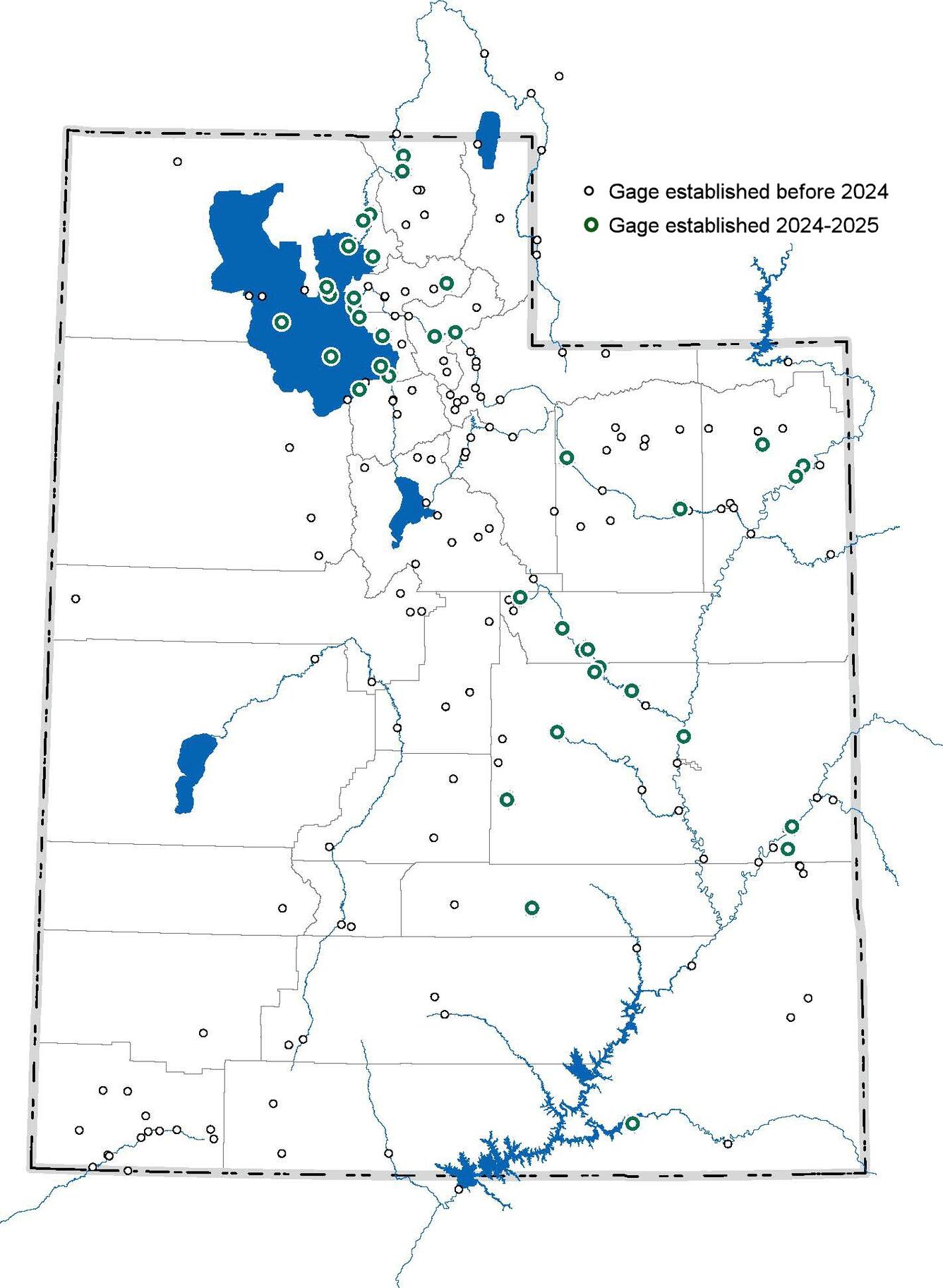
New Surface Water Gages
Thirty-eight new surface-water gages were installed in Utah from June 2024 through September 2025, thanks to the dedication and fortitude of Utah Water Science Center Hydrologic Technicians in the Salt Lake City, Moab, and Cedar City Field Offices. The Utah Water Science Center now maintains a total of 187 surface water real-time sites.
Establishing a New Surface Water Gage
"The footprint of a gage is small, but the impact immense," Ryan Rowland.
Establishing a new gage is not a simple task. It requires a lot of forethought, planning, and hard work to make it happen and to ensure its long-term success. The following considerations must be addressed throughout the process.
Step 1 - Why is the gage needed? Defining the purpose of the gage must be the first step. Common reasons new gages are needed include the following.
- New reservoirs, roads, bridges, or drinking water and wastewater facilities are planned.
- Flood warning and drought monitoring is needed.
- Waterways or power production facilities need data to maintain minimum flows.
- Discharge needs to be monitored for water rights and transboundary needs and issues.
Environmental conditions may need to be monitored to evaluate the impacts of changing land use and protect the safety of the public engaged in recreational activities.
Step 2 - What is the best location for the gage? Evaluating potential locations is the second step.
- Is the site suitable for the purpose it is being established?
- What are the river controls at various stages of water depth?
- Can discharge be measured at the site during low and high flow?
- Is there evidence of frequent stream channel changes, multiple channels, or overbank flow?
- Is there evidence of aquatic vegetation or beaver activity that will impede flow?
- Is the site accessible and is it free from safety hazards?
Who is the landowner and are they amenable to the installation of a gage on their property?
Step 3 - What kind of instrumentation will work the best given the site conditions? Determining the most appropriate instrumentation is an important third step.
- Is a stilling well, radar gage, acoustic sensor, or pressure sensor to monitor stream stage (river height) best?
- Is a velocity sensor a good option?
- Would a passive device to record maximum stage be needed?
- Would a field camera to monitor stream conditions be helpful?
- Would water-quality data collection be included?
Step 4 - Will the landowner permit the installation and ongoing access and operation of the gage? Obtaining official written permission and documenting the agreement among all parties is an imperative step.
Step 5 - How and where will instrumentation, equipment, and supplies be acquired? Knowing if and where instrumentation is available is critical to a successful installation.
- Most instrumentation is obtained through the USGS Hydrologic Instrumentation Facility (HIF), where it is tested and approved for use.
- Equipment not available from the HIF is sourced on the open market from a variety of vendors.
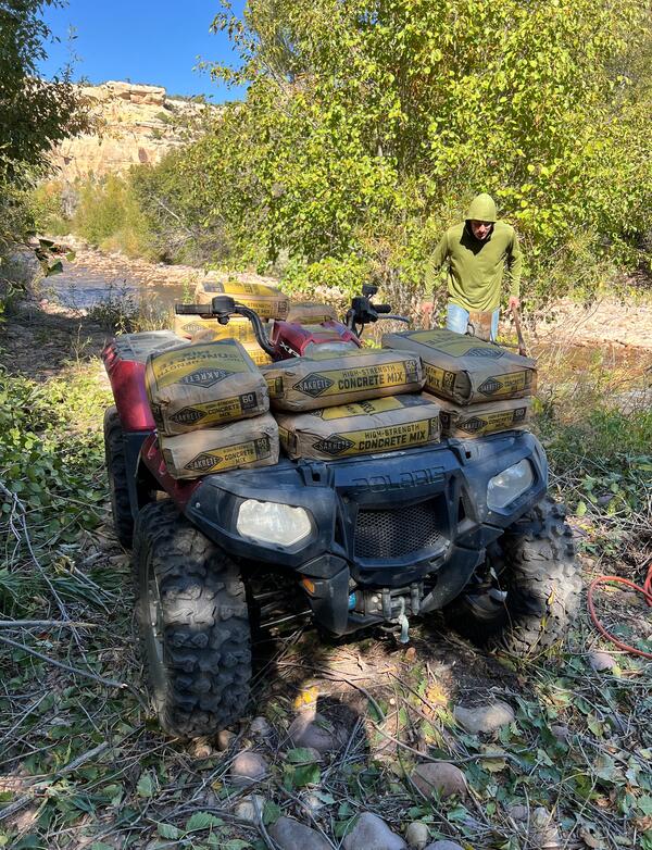
- Construction materials are usually purchased locally.
- Some items, such as instrument mounts and shelters, are designed and constructed internally by talented hydrologic technicians, or are ordered from fabricators that can meet specifications at particular sites.
A reference wire weight and reel are attached to frame for installation on bridge.
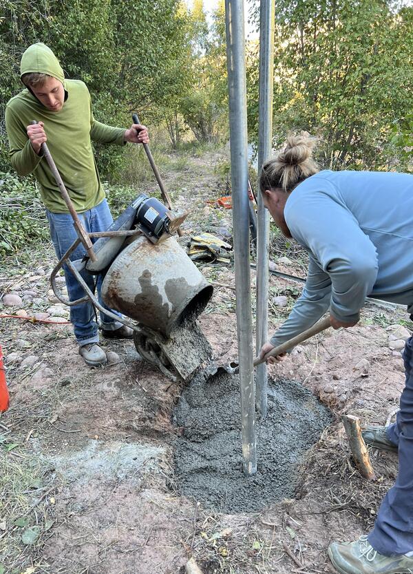
Concrete footings are poured for gage house and instrument mounts.
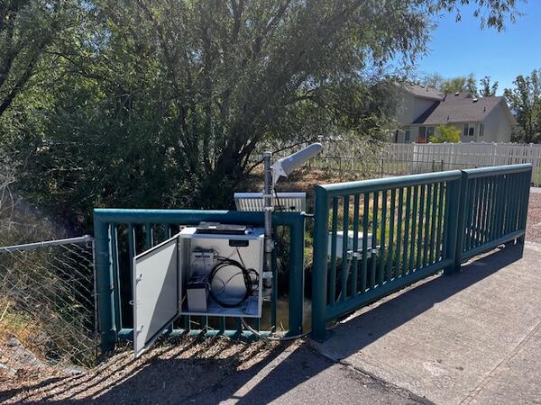
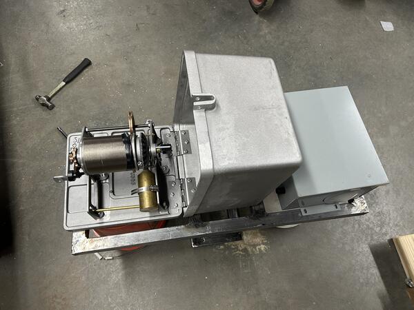
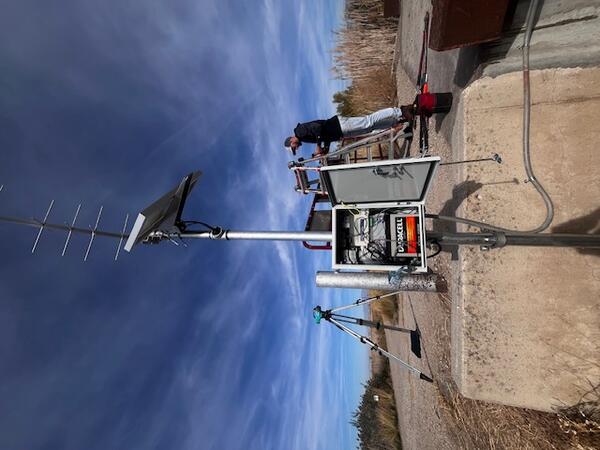
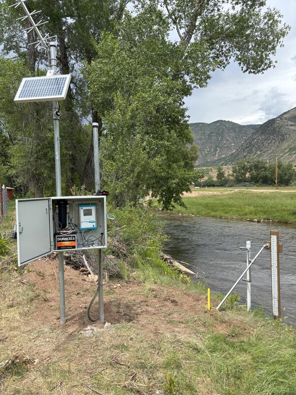
This stream gage includes a pressure sensor, data logger, and communication system.
Step 6 - Who will install the gage? Having the right crew and equipment is the only way to ensure a successful installation.
- Most surface water gages are installed by USGS hydrologic technicians. Installations usually require several technicians and several days to complete.
- Larger river or complex sites and gages may need contractors and heavy machinery to install infrastructure such as stilling wells, mounts, or cableways.
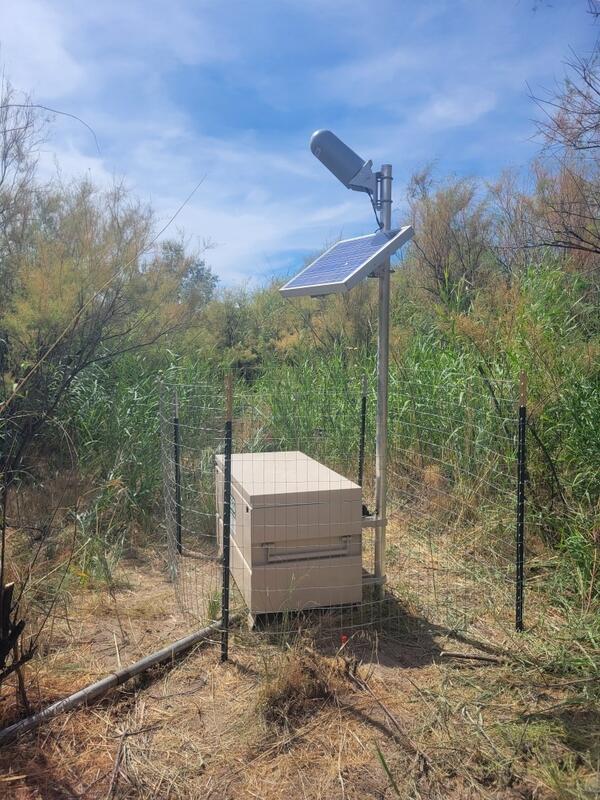
- Gage houses and instrument mounts are installed.
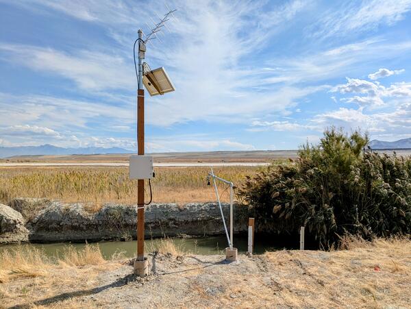
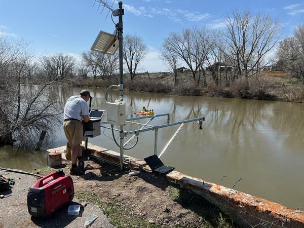
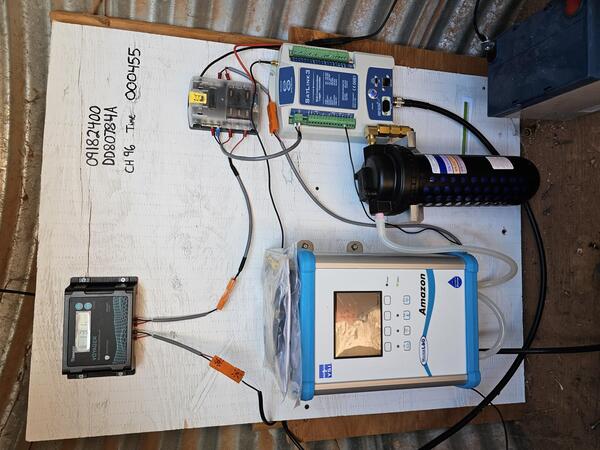
- Instrumentation, antennas (satellite, phone, or radio), and solar panels are installed and wired into the system.
- The system is powered up, and initial data are transmitted.
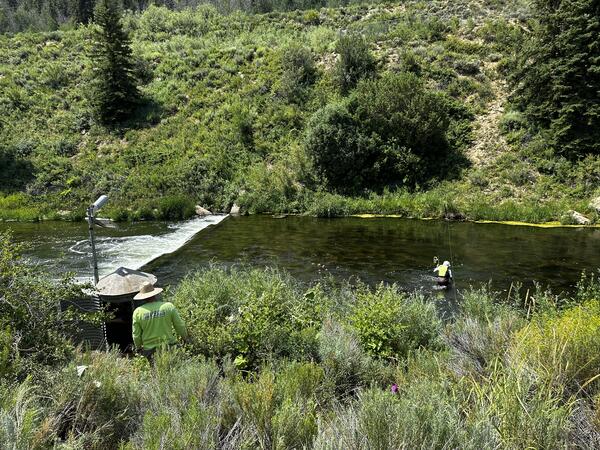
Hydrotechs pour concrete to secure posts for mounting gage equipment and shelter at Ashley Ck gage, 09271000.
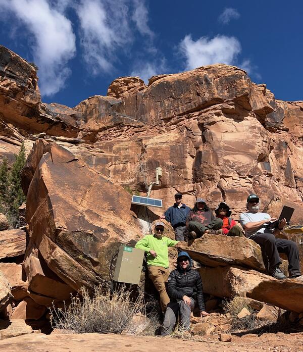
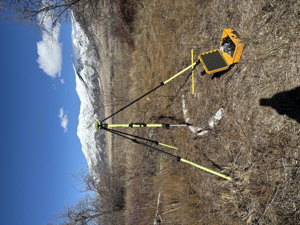
Preliminary survey of potential site on San Juan River for gage, 09379700.
Hydrotech connects equipment at new gage, 10141200, on North Fork of the Weber River.
Step 7 - Calibrating instrumentation is a critical step. Good data depends on it.
- Permanent Reference Marks are established (at least 3 and may include brass caps, post, stable rock outcrops).
- Precise levels are run to establish a gage datum reference surface (see USGS publication, Techniques and Methods 3-A19, for more information on gage datum).
- Stage instruments are set to gage datum.
- Water-quality instruments are calibrated and set accordingly.
- Meteorological equipment is generally calibrated by the manufacturer.
Step 8 - Final steps include establishing communication so that discharge can be observed in real time from any computer or mobile device.
- Programs are initiated in the office to establish and decode satellite transmissions from the stream gage (see USGS Diagram of How Stream Gage Data is Transferred to the Internet | U.S. Geological Survey for more detail).
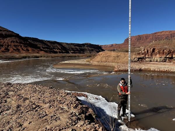
- Initial streamflow measurements are made to begin establishing discharge ratings for the stream gage.
- Data are stored and presented online as “provisional."
- Data are analyzed, updated, reviewed, and published as “Approved.”
Completed gage, 09314700, on Green River below Swasey's Rapid.
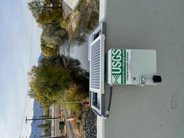
Completed gage, 10133550, on Weber River at Morgan, Utah.
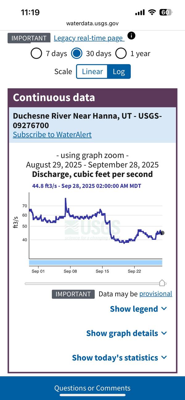
Completed gage, 09276700, on Duchesne River near Hanna, Utah.
Access more resources from links below.
National Water Dashboard
Gages Through the Ages
Related

Streamgaging Basics
How Science Helps Manage Changing Water Availability and Quality: Droughts, Floods, Avalanches and More

Federal Priority Streamgages (FPS)

USGS National Streamgaging Network

USGS Streamgages By the Numbers

Rapid Deployment Gages (RDGs)
Related
Streamgaging Basics
How Science Helps Manage Changing Water Availability and Quality: Droughts, Floods, Avalanches and More
Federal Priority Streamgages (FPS)
USGS National Streamgaging Network
USGS Streamgages By the Numbers