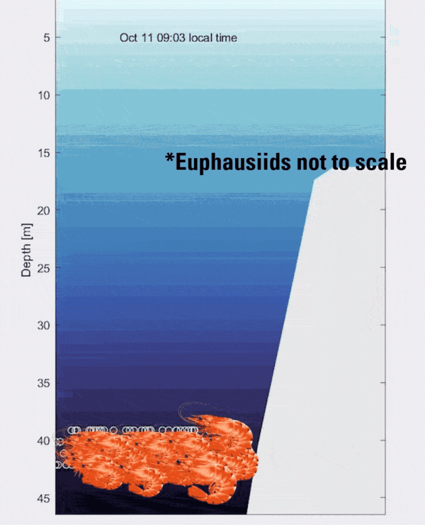
Depiction of a horizontal levee (A) and study location in San Francisco Bay, CA(B and C). Transects used in the hydrodynamic simulations are shown by the white lines in (C).
Multimedia
Images

Depiction of a horizontal levee (A) and study location in San Francisco Bay, CA(B and C). Transects used in the hydrodynamic simulations are shown by the white lines in (C).

Collage of Conceição-Duquesa beach oblique images with high-water line and prominent structures marked
linkCollage of Conceição-Duquesa beach oblique images with high-water line and prominent structures marked. From the study Historical Coast Snaps: Using Centennial Imagery to Track Shoreline Change.

Satellite image showing validation high-water lines for Conceição-Duquesa beach. From the study Historical Coast Snaps: Using Centennial Imagery to Track Shoreline Change.

Diagram showing occurrence and timeline of great earthquakes and rupture grid at the Aleutian Arc
linkFigure: a Great earthquakes in the 20th century. Inset numbers over the 3 by 12 grid indicate subfaults with large slip in meters from the updated 1957 rupture model3 with red and blue tones for shallow and deeper megathrust rupture, respectively.

Drift logs stranded by 1957 tsunami in Stardust Bay, Sedanka Island, Aleutian Islands, Alaska. From the study A 700-year rupture sequence of great eastern Aleutian earthquakes from tsunami modeling of stratigraphic records.

Floodplain maps and bar graphs depicting the expansion of floodplain after earthquake driven subsidence
linkFloodplain maps and bar graphs depicting the expansion of the 1% floodplain after earthquake-driven subsidence today (2023) and in 2100 when the earthquake-driven subsidence is amplified by climate-driven sea-level rise for the (A) Necanicum River, OR; (B) Yaquina Bay, OR; (C) Alsea Bay, OR; and (D) Humboldt Bay, CA.
Videos
To conduct the science needed to understand coastal and marine geohazards, support habitat and resource management, and monitor how these environments change over time, the USGS Coastal and Marine Hazards and Resources Program relies on engineering, mechanical, and electronics expertise for field operations along the coast, in the nearshore environment, and in the d
The global ocean is a significant carbon sink, absorbing about a third of all atmospheric carbon dioxide (CO2) emissions (Gruber et al., 2019).

The global ocean is a significant carbon sink, absorbing about a third of all atmospheric carbon dioxide (CO2) emissions (Gruber et al., 2019).
Most of the world’s beaches have regular cycles of erosion and recovery, but new USGS research is showing that these cycles may be considerably different from common perceptions.

Most of the world’s beaches have regular cycles of erosion and recovery, but new USGS research is showing that these cycles may be considerably different from common perceptions.

Hybrid coral reef restoration: A cost-effective, nature-based solution to protect people and property (AD)
linkCoral reef restoration can protect hundreds of millions of dollars of coastal property and business activity annually from storm-driven flooding.
It can protect thousands of people, especially children, the elderly, minorities, and those below the poverty line. Thus, coral reef restoration is a mechanism to provide environmental equity.
Audio


In this episode of Eyes on Earth, we begin a series on Landsat’s usefulness in coastal studies. First, we talk with Sean Vitousek, a USGS research oceanographer, about changes to beaches in California and how he is using Landsat and other data to create models that can predict how the coastline may change in the future because of sea level rise and coastal erosion.
Webcams
Two video cameras are installed atop a utility pole near the northernmost point of land in the United States at Nuvuk (Point Barrow), Alaska. The cameras point northwest toward the Arctic Ocean and the boundary between the Chukchi and Beaufort Seas. Every half hour during daylight hours, the cameras collect snapshots and video for 10 minutes.