Decision-Support Tools
Decision-Support Tools
Filter Total Items: 28
Greater Sage-Grouse Population Monitoring Framework
Greater sage-grouse ( Centrocercus urophasianus) are at the center of state and national land use policies largely because of their unique life-history traits as an ecological indicator for health of sagebrush ecosystems. Researchers within the U.S. Geological Survey (USGS) and Colorado State University (CSU) worked with the Bureau of Land Management (BLM) and state wildlife agencies to develop a...
Key Values of a Century of EESC Science
The USGS Eastern Ecological Science Center (EESC) is rooted in a proud tradition of service to the nation—advancing science that informs the conservation and management of fish, wildlife, and habitats across the eastern United States and beyond. Our mission is clear: deliver reliable, partner-driven science that supports natural resource decisions today, while ensuring these resources remain...
Land management research in support of streamlined energy development, economic growth, and wildfire management
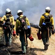
FORT researchers provide sound science to support the Department of the Interior in its efforts to streamline reliable energy development, enhance cost efficiency in public lands management, and manage fire-prone habitats for public safety. This research is developed in partnership with resource managers from local, State, Federal and Tribal governments, industry, and nongovernmental organizations...
WebDART: A Cutting-edge Web Tool that Evaluates Land Condition
WebDART is an online ecological assessment tool available to a wide audience that incorporates Landsat satellite remote sensing imagery, topography, geology, soil conditions, and rangeland geospatial and vegetation mapping to compare altered terrain with an unspoiled area that has similar characteristics in the same region. The tool gives resource managers, landowners, companies, and other...
Southwest Fire Innovation Landscape Network: Advanced tools for fuel monitoring and assessment of wildfire risk
The USGS Southwest Biological Science Center is coordinating the Southwest Fire Innovation Landscape Network to prepare fire and natural resource managers for rapidly changing fire landscapes by conducting research and building science-management partnerships. The network develops advanced tools and technologies to assess fuel loads and the effectiveness of fuel treatments, understand wildfire...
Assessing vegetation and avian community response to juniper reduction treatments in Southwest Montana
The Southwest Montana Sagebrush Partnership (SMSP) team, including land managers, landowners, and scientists, is implementing conifer removal projects encompassing over 55,000 acres of private, state, and federal lands throughout the region. To date, little place-based information exists regarding likely vegetation and bird responses to such treatments in Southwestern Montana. To address this...
Assessing the Proliferation, Connectivity, and Consequences of Invasive Fine Fuels on the Sagebrush Biome
Invasive annual grasses can replace native vegetation and alter fire behavior, impacting a range of habitats and species. A team of researchers from the U.S. Geological Survey, Colorado State University, the Bureau of Land Management, and the U.S. Fish and Wildlife Service are working to identify factors that influence changes in the distribution and abundance of invasive annual grasses (IAGs)...
National Fuels Treatment and Post-fire Treatment Effectiveness Assessment Strategies
Managing wildland fuels and post-fire environments are key strategies to reduce the risk and negative impacts of wildfire, and can even promote beneficial effects of wildfire. Researchers from the U.S. Geological Survey are reviewing, summarizing, and analyzing what is currently known about fuel treatment and post-fire treatment effectiveness in the United States. Monitoring and evaluating the...
RAMPS: Restoration Assessment & Monitoring Program for the Southwest
The Restoration Assessment and Monitoring Program for the Southwest (RAMPS) seeks to assist U.S. Department of the Interior (DOI) and other land management agencies in developing successful techniques for improving land condition in dryland ecosystems of the southwestern United States. Invasion by non-native species, wildfire, drought, and other disturbances are growing rapidly in extent and...
Greater Sage-Grouse Population Monitoring Framework: Cheat Sheet
The Greater Sage-grouse Population Monitoring Framework fills a prominent information gap to help inform current assessments of sage-grouse population trends at nested spatial and temporal scales. It is centered on four objectives: (1) create a standardized database of lek counts; (2) develop spatial population structures by clustering leks; (3) estimate spatial trends at different temporal...
Greater Sage-Grouse Population Monitoring Framework: Targeted Annual Warning System Information Sheet
The Greater Sage-grouse Population Monitoring Framework fills a prominent information gap to aid current assessments of sage-grouse population trends across spatial and temporal scales. It centers on four objectives: 1) create a standardized database of lek counts; 2) cluster leks to develop spatial population structures; 3) estimate spatial trends across temporal extents; and 4) develop a system...
Greater Sage-Grouse Population Monitoring Framework: Glossary of Terms
The Greater Sage-grouse Population Monitoring Framework fills a prominent information gap to aid current assessments of sage-grouse population trends across spatial and temporal scales. It centers on four objectives: 1) create a standardized database of lek counts; 2) cluster leks to develop spatial population structures; 3) estimate spatial trends across temporal extents; and 4) develop a system...


